
The Mountains of California
• www.surgent.net
|
| Telescope Peak |
• Highpoint: Death Valley National Park • Highpoint: Panamint Mountains • Inyo County |
|
Date: August 20, 1991
• Elevation: 11,049 feet
• Prominence: 6,168 feet
• Distance: 14 miles
• Time: 8 hours
• Gain: 3,000 feet
• Conditions: Incrediball
• Teammates: Vic
California
•
Main
•
PB
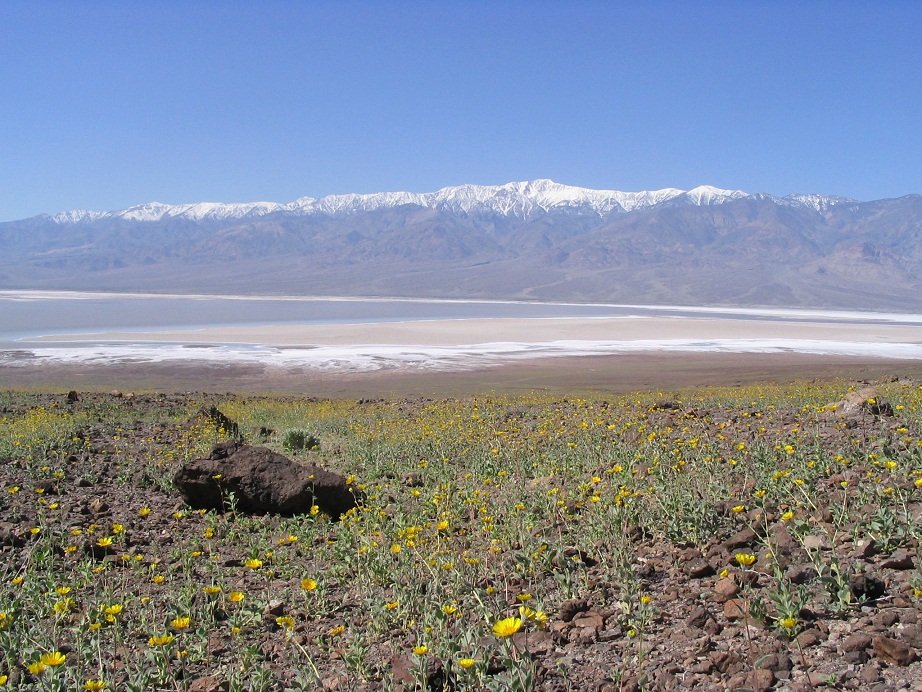
Telescope Peak is the highest point of the Panamint Mountains that form the west boundary of Death Valley. From the summit, one can view down to the nation's lowest point of elevation in Death Valley, at -282 feet, then turn around and view the coterminous United States highpoint at Mount Whitney, elevation 14,495 feet. The summit of Telescope Peak is 11,049 feet. For me, this would be my first time at such high elevations and my first big peak ever.
I have visited Death Valley many times, the first time back in 1977 as a kid, then about once every three months during my college days in Riverside (1990-1992). The Panamints rise high above the valley's basin, a two-mile vertical escarpment on a scale too big to convey in pictures, much less words. The range blocks any storms or clouds that may move through, leaving Death Valley cloudless and sunny, and "assisting" in its famously hot temperatures. I hatched a plan with my college roommate, Vic, to drive there and hike this big peak. He was interested, so we set out one August afternoon for the journey.
We drove through the desert, passing through the towns of Kramer Junction, Red Mountain and Trona, where we stopped for supplies and enjoyed the sulphurous stench. Following US-395 into Inyo County, we continued northbound to where the highway drops a few hundred feet into the Panamint Valley, with the Panamint Mountains rising to the east. Already, the scale was unbelievable. We then followed side roads to Wildrose Road then up to Mahogany Flat at 8,000 feet elevation. We camped here at the campground, the only ones here that night. Thunderstorms had built off to the far-east, but above us it was still and calm.
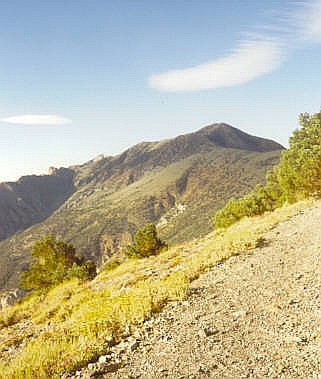
Early the next morning, we started the hike. The trail traverses a long way up the east-facing slopes of the range, with unobstructed views down 8,000 vertical feet into Death Valley. This initial segment went on for a couple miles, and with lenient grades, I made good time. Vic and I would space out about 100 feet apart, but we stopped often to catch a breath. In time, the trail angles onto the rounded highlands of the range, passing through sparse stands of bristlecone and meadows of low grass and clumpy shrubs. It was a superb day, and at our elevation, the temperatures were very comfortable.
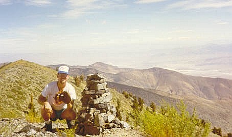
For most of the latter half of the hike, the peak is in view but often far away and sometimes hidden by foreground hills. The trail was always easy to follow and delight to hike. We kept at our system, and as we inched closer to the top, I began to get a little summit fever. I knew Vic was fine as he was always in sight behind me. The last few hundred feet was up open talus slopes with occasional gnarled bristlecones and not much else. I achieved the summit close to noon, a 4-hour ascent for me. Vic was about 10 minutes behind me. My first big peak ever! I was thrilled and a little surprised how well I had done.
The top is a hump of rock, with amazing views in all directions. We stayed up here for about 45 minutes. The climb had been a resounding success. We ate lunch and rested, then when it felt right, we got out our baseball mitts (of course we had brought them along. Who doesn't?) and a cloth faux-baseball stamped "Incrediball" on its side. We had found it laying in one of the intramural rec yards at U.C. Riverside. So we played catch, but we were afraid of overthrowing the ball... which is exactly what we did. Poor Incrediball got thrown so that it bounded down one of the slopes to who-knows-where. My educated guess is that it rolled to the bottom of the mountains and was picked up by someone else, to start another chapter in its amazing journey through the cosmos.
The hike down went well, and we were back to Vic's truck within 3 hours, an overall hike of nearly 8 hours, including the breaks. We packed up the gear and drove down, deciding to go through Death Valley itself on the way home. It was extraordinarily hot when we rolled into Furnace Creek, well over 120 degrees. We cleaned up at the campground showers, then drove from there into Baker along Interstate-15, where we got a post-hike meal. From there, we drove on back to Riverside.
For a first-timer such as myself, this peak was a perfect introductory hike. It was long but not too long, got me really high up but not too high up, and was a good tread all the way up. I was definitely hooked. However, I was also definitely poor and busy with graduate school, so any more big climbs would have to wait another year.
For more Death Valley photos, see Death Valley, 2005.
|
|