The Mountains of California
• www.surgent.net
|
| Tehachapi Mountain |
• Tehachapi Mountains • Tehachapi Mountain Park (part) • Kern County |
|
Date: May 30, 2009
• Elevation: 7,960 feet
• Prominence: 800 feet
• Distance: 4.4 miles
• Time: 3 hours
• Gain: 2,000 feet
• Conditions: Cloudy, spells of rain, and hot
California
•
Main
•
PB
Tehachapi Mountain would be my last of four peaks planned on a 4-peak, 2-day swing through Southern California, including the driving from Arizona. Earlier today I was successful on Piute Mountain, and from there, drove 45 miles out of the hinterlands back onto highway CA-58, the main arterial between Bakersfield and the high desert, passing through the interesting town of Tehachapi along the way.
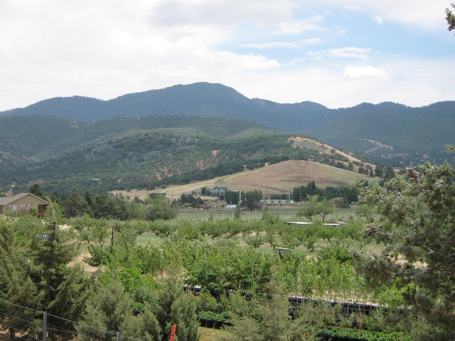
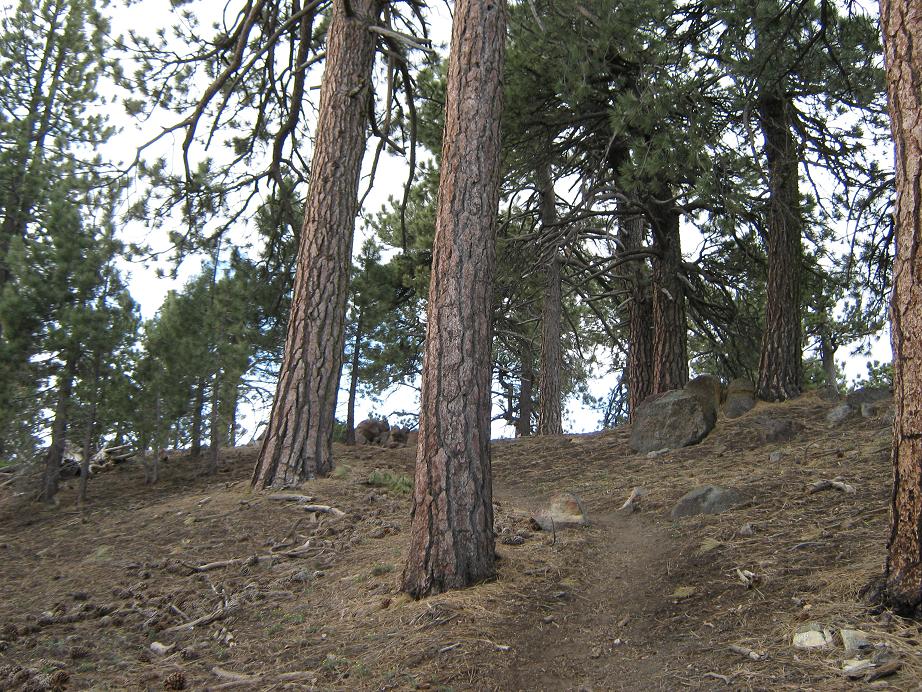
Tehachapi (the city) is the main population center in its namesake Tehachapi Mountains, which run in a southwest-northeast line, separating the lower San Joaquin Valley to the west from the high deserts to the east. The Tehachapis are mostly broad and rounded in shape, with a heavy coat of pine forest for nearly its entire breadth. Since the highest point in the Tehachapis is a shade below 8,000 feet, the crest is not high enough to be above treeline. The lower slopes are covered in low grasses and dotted with oaks and other trees and brush.
There is some confusion as to which summit is the highest in the range. On the topographical map, Tehachapi Mountain has no spot elevation but is within a 7,960-foot contour (40-foot intervals) so it could be anywhere between 7,960 to 7,999 feet. The Double Mountains, located one mile south, both have spot elevations of 7,981 feet (although other visitors note some discrepancy between the two summits of the Doubles). One of these peaks, Tehachapi or the Doubles, is the range highpoint. The consensus seems to be in favor of the Doubles. Tehachapi Mountain has a nice combination of road and trails to make it an easy day hike. So I opted to hike Tehachapi Mountain, and would decide on what to do about the Doubles later.
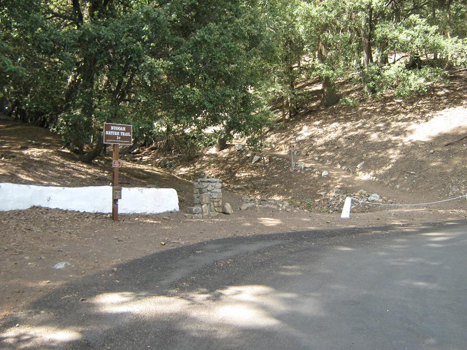
I arrived in Tehachapi around 9:30 a.m. The town is set amid the foothills of the range, a real pretty scene of rolling hills, meadows and forest. It's high enough to get snow in winter and low enough to be warm in summer, but it looks like it is nice all year. From the highway, I went south to Highline Road, then west to Water Canyon Road, following this road in a few miles to the Tehachapi Mountain Park. I parked at a small parking pullout near the Nuooah Trail, suited up, and started hiking at 10 sharp. It was warm with high clouds. Yesterday had been stormy with afternoon thunderstorms so I was aware things might get interesting later on in the afternoon.
I followed the Nuooah Trail (however it is pronounced) up a few yards, past a bench and a small footbridge where it bent left, past a small post fence, and caught a good side trail to my right. This short trail is just an access trail up to a water tank. Beyond the tank, the trail continued up an embankment paralleling a drainage, and in short time, I had reached a major dirt service road.
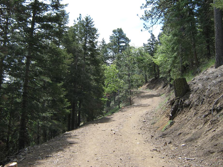
To here, I had hiked one-third of a mile with 250 feet of gain. I went right and walked up this road as it switchbacked right and left and right a number of times, steadily gaining elevation along the way. I met a number of hikers on their way down, all very friendly and willing to give a tourist like me some hints on what to expect higher.
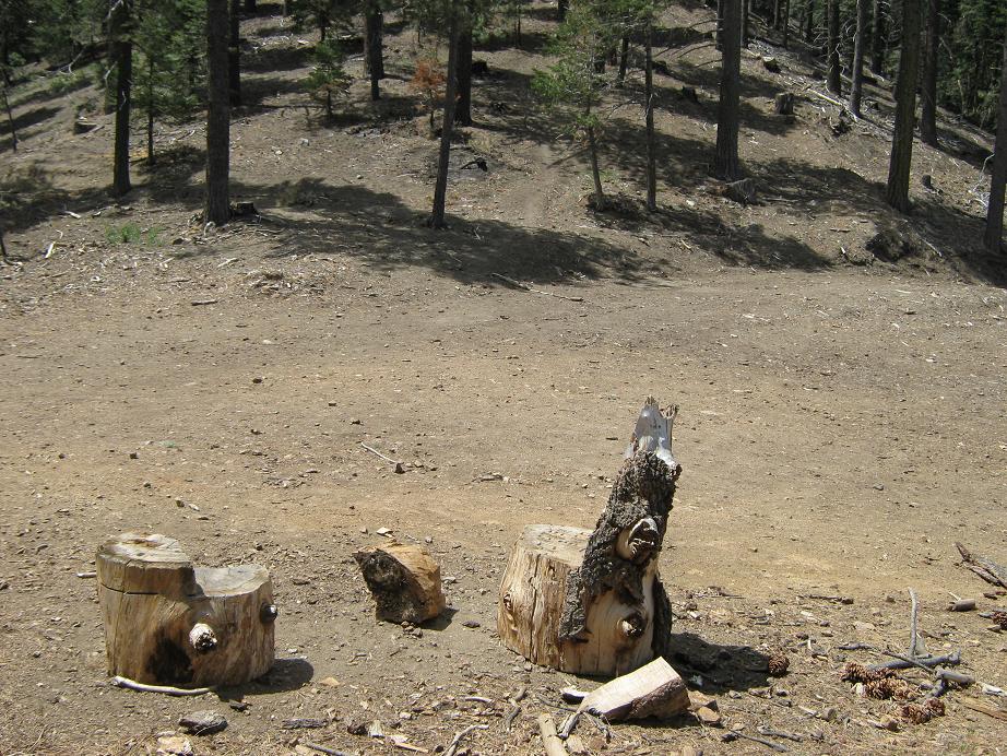
The road portion covers a mile and gains 800 more feet. After about five switchbacks it achieves a pass, emerging from the folds of the canyon and now catching a ridge. Shortly thereafter, it comes to a big clearing where the "Captain's Chairs" can be found: two logs carved out to look like big chairs, sitting in the open. Here I was told I would find the use-trail that would take me to the top.
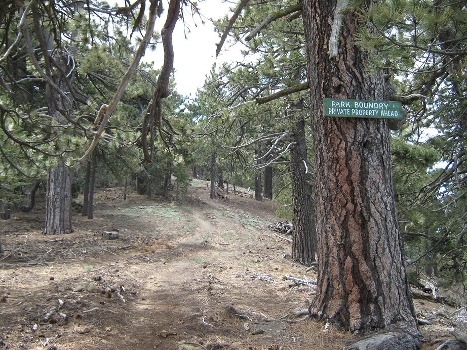
The use-trail runs up the spine of the ridge, well-beaten and obvious, but steep. I was told to not get my hopes up for the "four or five" false summits I'd see. The hiking was tiring but easy. In time I came upon a ridge bump where the slope moderated, passed a "private property" boundary, up another false summit and finally, to the real summit. According to my cell-phone's thing that tells time, it had taken me 1 hour, 45 minutes to hike to the top, covering 2.2 miles one way (going by the Sierra Club's HPS figures) and 2,000 feet of gain.
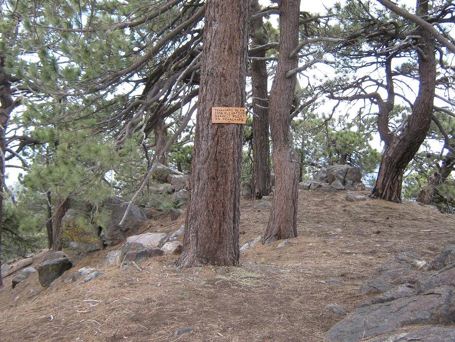
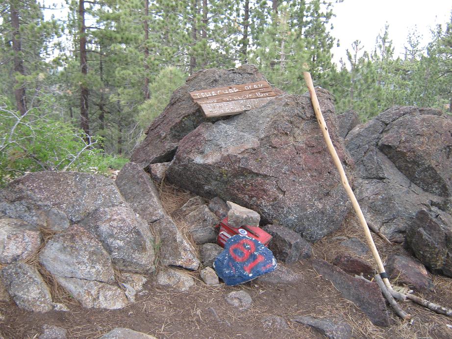
I noted an old sign stating this was the highest point of the Tehachapi Range and a hand-written rejoinder under it saying "Bullshit". Whatever is the highpoint, I sat and relaxed here for a few moments, signed in and rested. I also peered south through the trees at the Double Mountains and their batches of towers. Of higher concern was the lack of sun, as the clouds had closed up and it looked threatening. I decided to get moving back down and leave the Double Mountains for another time, as in if ever.
The hike down went fast, taking just under an hour to exit back to my truck. About 200 feet below the top it started to rain, and it continued to rain for about another 30 minutes, sometimes heavy and even small hail pellets, but no thunder or lightning (yet). Actually, the rain felt nice and I enjoyed it very much. Otherwise, it was warm and sticky. It was sunny above me for the last little way to my truck, humid, uncomfortable and buggy. But the hike had gone well and I got what I came looking for: a workout and a peak.
After exiting the park, I went west along highway CA-202 into the Cummings Valley/Bear Canyon area, a broad valley ringed by mountains, notably Cummings to the south and Bear to the north. This was an old ranch that is slowly being built out with high-end homes and ranchettes. Bear Mountain is a 2,000-foot prominence peak of interest, but it sits on private land (a gated community). If one can get access past the gate, then roads get as high as 800 feet below the top, and from there, dirt roads go the rest of the way. I figured it was worth a try, maybe I'd get lucky. So I drove to the front gate of this planned community, but the guy at the gate told me to get lost. I didn't tell him what I was up to. He did mention I had to be a resident or a guest of a resident to get in. Having no reason to stick around, I got lost as per the man's directive.
It was 3 p.m. when I got back on highway 58, which I followed into Mojave, Barstow and points beyond. I drove east on Interstate-40 to scout peaks for a future trip, plus to enjoy the scenery this way, since I rarely drive I-40 anyway. My plan was to possibly camp in the Havasu area. I drove through Lake Havasu City and still felt good so I drove into Parker, getting low on gas, but I made it into Quartzsite with less than an eighth of a tank left, but at least I was able to maintain my streak of not spending any money in Parker ever again (going on 30 months due to a bogus speeding ticket). However, once I was in Quartzsite I got on the Interstate-10 and drove home, arriving about 9 p.m., a 570-mile day.
The short trip went well and I got good exercise. However, it was nice to be home and back with my wife, and with our new batch of five kittens. I missed them, their little squeaky "mews" and spiky tails and unbelievably sharp claws.
A few weeks later, I emailed the Kern County Surveyor's office and inquired about the elevation of Tehachapi Mountain. They replied that they have never formally measured it, so could not provide me much help. I am siding with those who purport that the Double Mountains are slightly higher. In 2010, I returned to the area intending to climb the Double Mountains, but a freak snow storm blew through that weekend and left everything snowy and muddy for a few days, so I bailed again. I have not returned, and am growing less interested in actually climbing the Doubles. They sit on private property and I just don't feel like driving all that way for two relatively uninteresting peaks surrounded by homes.
|
|