The Mountains of California
www.surgent.net |
| Piute Peak |
• Highpoint: Piute Mountain • Sequoia National Forest • Kern County |
|
Date: May 30, 2009
• Elevation: 8,440 feet
• Prominence: 3,480 feet
• Distance: 1 mile (hike)
• Time: 3 hours and 15 minutes (whole journey)
• Gain: 300 feet
• Conditions: Clear
California
•
Main
•
PB
I was in the Tehachapi area for a couple days, climbing a handful of easy (except those that were difficult) peaks. Yesterday, I had an easy time climbing Frazier Mountain, then a more challenging short hike and scramble up Breckenridge Mountain, outrunning a building thunderstorm.
I stayed last night at a campground in the Lake Isabella area, then awoke before dawn, with two more peaks on the agenda. Normally, Southern California is clear and dry this time of year, but for some reason, the airmass was moist and unsettled. The conditions were right for more storms later today, so I wanted an early start.
My first peak for today was Piute Mountain, which parallels Breckenridge Mountain and shares a lot in common: a big hulking mass of a mountain with narrow roads that get close to the top. Like Breckenridge Mountain, I could expect a lot of slow driving and a short hike. Also like Breckenridge, the highest points were atop rock outcrops.
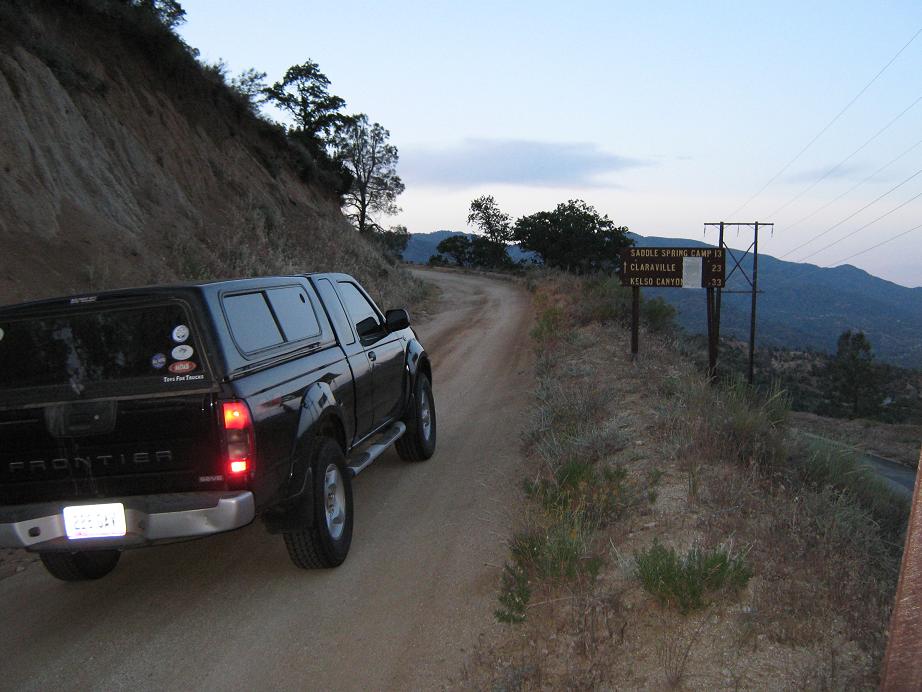
From the Sandy Flat campground, I doubled back into the town of Bodfish, then drove south up the grade to a pass, where a dirt backcountry road veers off to the left (east) from the main road. This is the north branch of the Piute Mountain Road, also known as Sequoia National Forest Road 27-S-02. I was on this road at 5:35 a.m.
The road starts out fine but soon narrows to one car-width wide. The tread was torn up slightly by the ATVers, but the farther I drove in, the smoother the road became. However, it stayed narrow with no shoulder or room for error. I hoped that no one was coming the other way because there literally was no room to pass. Fortunately, no one did.
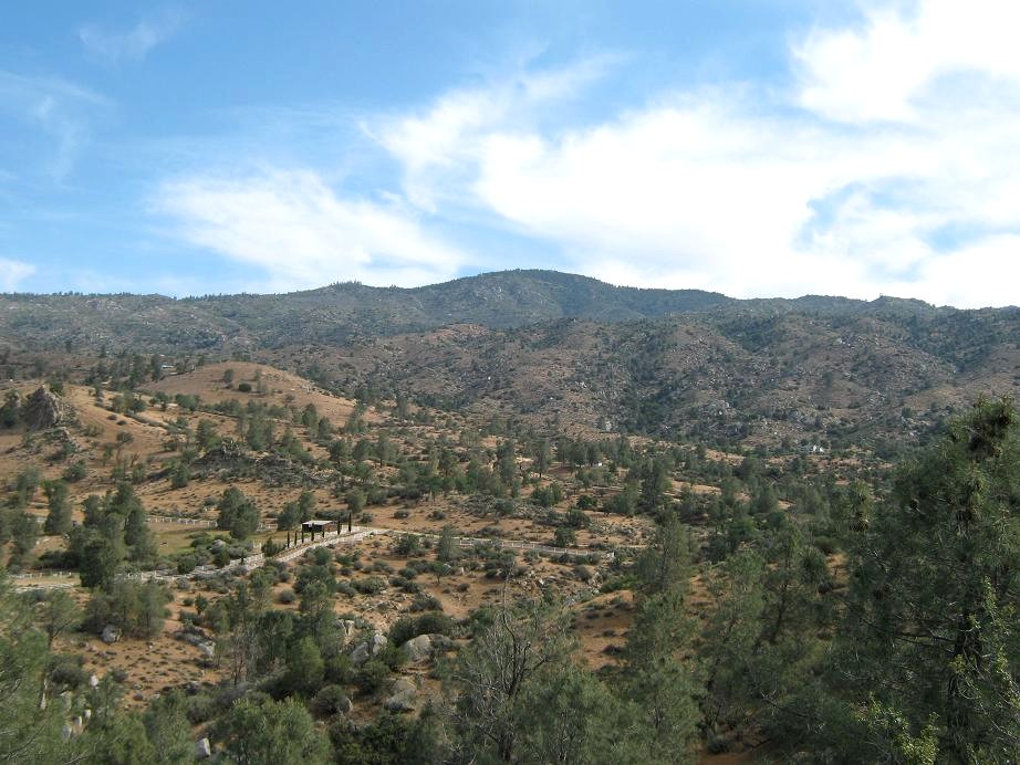
Things improved at the 6-mile mark (small plastic mile markers are placed along this road). The road widened and had a small shoulder. Still, I kept the truck in first gear and never got above 10 m.p.h. At 8.5 miles, I came upon a "town", a collection of vacation homes clustered together on a parcel of private property. The town is apparently named Valley View, said a sign.
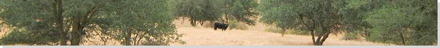
Beyond Valley View, the road's condition improved significantly, now much wider and better graded, so that I was able to zoom through at a whopping 25 m.p.h. By now, I was on the spine of the range, the road mostly level, and in open sections I could make out high peaks, wondering which one was the summit. I knew I was close. I also spooked a bear along the way. He was walking along the road minding his own business, then took off running when he heard my truck.
Finally, the road came to an intersection at 16.0 miles (by my odometer) and 16.7 miles (by the plastic stakes). This is the split for Piute Mountain Road. Going right, the road is marked as 28-S-01 and leads southwest down into Walker Basin, or going left, the road keeps the 27-S-02 designation and leads east down into Claraville and out through Kelso and Jawbone Canyon Roads into the high desert. Both roads are still named Piute Mountain Road on the map, though.
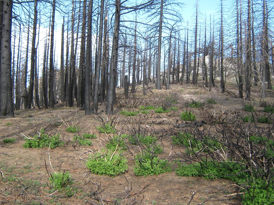
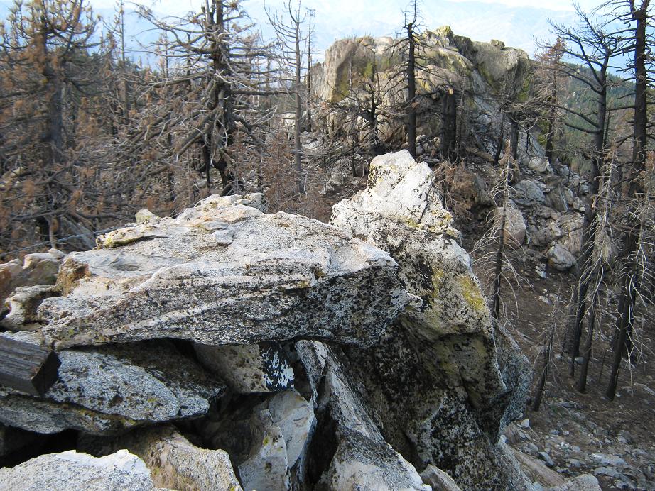
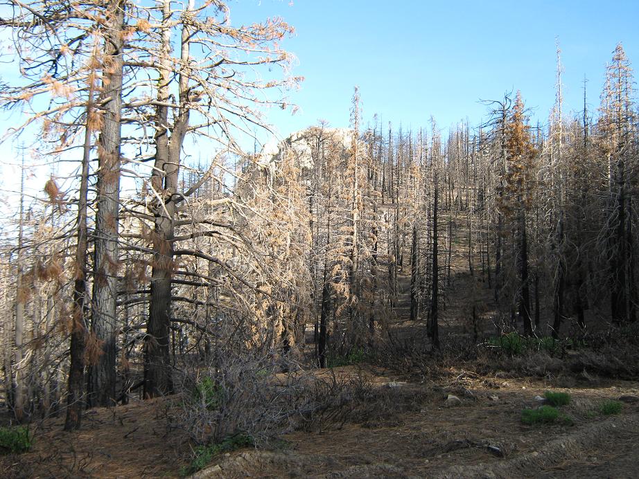
I went right onto 28-S-01 (the sign being knocked over into the brush) and drove about two-thirds of a mile, parking at an open clearing near a rock outcrop at 8,200 feet, due south of the "Piute 8435" summit marked on the map. I arrived at 7 a.m., in pleasant and calm weather. Another truck rumbled up from the Walker side and I had a chat with the driver and passenger, a husband-and-wife team out for a drive and scouting for archery season. They gave me good information about the road they just came up, and they also said they saw a bear, too. The immediate summit region had been hit hard by a recent fire within the last year. However, very little fire damage was seen along the northern road coming in.
According to the map, the summit of Piute Mountain is five distinct contours of 8,400 feet, three clumped close together on the west end of the ridge, one with spot elevation 8,417 feet. The middle summit also features an 8,440-foot contour and two distinct rock outcrops within this contour, while the easternmost region features a spot elevation of 8,435 feet and apparently the site of an old fire lookout. An unmarked road leads north off of 28-S-01 directly across of the rock outcrop where I parked. This road leads all the way up to the 8,435-foot summit, and didn't look too bad.
The hike up this road took all of 10 minutes. At the saddle, I went to the middle rock outcrops first. They are situated on a northeast-southwest line relative to one another, and at first glance the southwest outcrop seems higher and also features a standing stick wedged into a cleft, so I climbed it (easy mid class-3 moves, 10-12 feet of gain). Once on top, looking over to the northeast outcrop showed that one to be higher by about three feet, so I went there, found an easy low class-2 ramp and there I was, the top.
I sighted west to the westernmost summit rock clumps and those rocks were obviously lower. Sighting east to the 8,435-foot summit, it too was obviously lower. Then I descended off the rocks and walked the road to the easternmost summit, looked back and confirmed that the summit is the northeast outcrop of the middle summit. The hike back to my truck went fast and I was gone for 45 minutes total, a round trip hike of about a mile.
Based on what the couple had told me about the southwestern Piute Mountain Road, I decided to go that way even though it is obviously steeper (and shorter) than the Claraville route. All went well, and there were section where the road was pitched at grades over twenty degrees, but no rough stuff to speak of. I dropped a lot of elevation quickly, taking only 8 miles to reach the paved roads in the valleys below, coming out near a town called Twin Oaks. I was out at 8:45 a.m., a total time of three hours and change. The whole experience had gone well and quickly, much better than I had planned, since I really had no idea about the condition of the roads.
From here, I followed these roads through some impressive canyons, eventually coming out to the main highway, CA-58, so that I could get myself into Tehachapi and a tangle with Tehachapi Mountain later this afternoon.
|

|