
The Mountains of California
• www.surgent.net
|
| Brokeoff Mountain |
• Highpoint: Tehama County • Lassen Volcanic National Park • Southern Cascade Mountains |
 Summit from about halfway up
|
Date: July 16, 2004
• Elevation: 9,235 feet
• Prominence: 915 feet
• Distance: 7 miles
• Time: 5 hours
• Gain: 2,000 feet
• Conditions: Clear and dry
California
•
Main
•
PB
Brokeoff Mountain rises above the forested mountains of the Lassen Volcanic National Park in eastern California, a few air-miles south of Lassen Peak. By a fortuitous drawing of the county boundaries way back when, the Tehama-Shasta county line runs north of Brokeoff's summit, putting Brokeoff in Tehama County and giving the flat valley county an utterly gorgeous mountainous highpoint.
We arrived at the park two days earlier after flying in to Reno, and the previous day we hiked up Lassen Peak in beautiful clear and dry conditions. Today was no different, and we got packed up from our campsite and drove about 18 miles to the southern terminous of the park, arriving at a small parking area around 8:30 in the morning.
Many guidebooks and individuals claim that of the two peaks, Brokeoff Mountain's hike is much more enjoyable, with variations of scenery and terrain. Whereas Lassen Peak is pretty much a straight shot up open slopes, Brokeoff's hike spends considerable time amid dense forest, periodic open meadows, and toward the end, an enjoyable transition from forest to sub-alpine zones. There's also the people factor: Lassen Peak is almost always crowded, whereas almost no one by comparison hikes Brokeoff Mountain.
Once properly dressed and situated, we walked across the highway and started up the trail, which enters an alder thicket, and for the first half-mile, zig-zags in and out of the alder and its accompanying stream, which we crossed about three of four times.
Once out of the alder the trail stays north of the creek and gains steadily amid tall pines. About a mile later we crossed the creek at a boggy area and entered into a shielded stretch of the trail that still had remnant snow blocking much of the path. There weren't many tracks and we surmise that we were probably among the first to hike the trail for the season (which likely didn't start until late June). Going up and over or around these snow banks was easy. Occasionally, we encountered ice, but soon we were back out to where the trail had sun and the snowdrifts soon disappeared.
About 2.5 miles in, the trail comes into a meadow where Brokeoff Mountain's blocky mass is directly above us. The trail makes a few switchbacks up onto rockier terrain, with less tree cover. It crests a small notch on the ridge south of the summit. We entered into a region of low tangly brush full of bees out doing their bee business. We walked past them and took an extended break along the trail in an open area. From here the summit is straight above us. While hiking, we heard a muffled "bzz", not sure what it was. βð soon discovered she got a bee in her hiking shorts. How that happened, we don't know. Glad she didn't get stung.
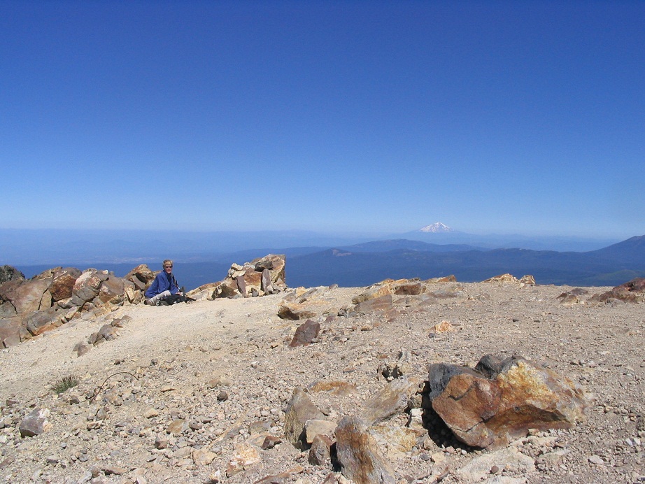
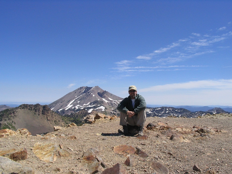
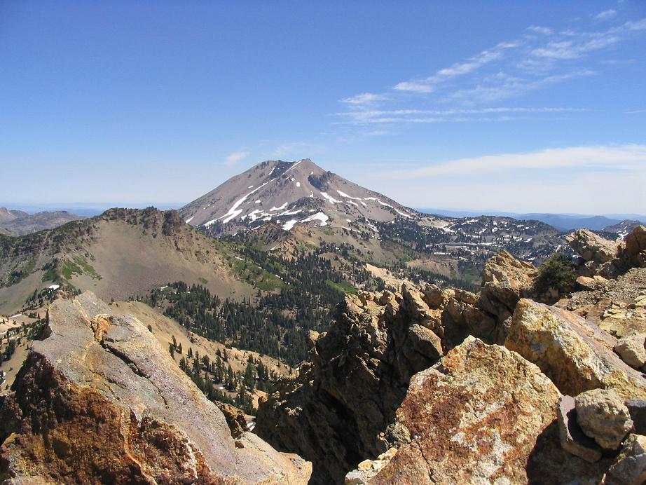
The trail makes two very long switchbacks on the southwest face of the summit before gaining high on the summit ridge, passing a few false peaks and rock pinnacles before curling up to the summit. We arrived at 11 a.m. in spectacular conditions. Lassen Peak was plainly visible to the north, along with all the snowy terrain and pretty glacial lakes. Mount Shasta was visible about 80 miles way to the north. We stayed for about 30 minutes and relaxed in a small shielded area between two rocks on the summit's west edge. We were the first to summit and had not seen anyone at all coming up.
The hike to the top is about 3.5 miles one way with about 2,600 feet of gain. I have to concur with the previous reports, that Brokeoff Mountain is an overall much prettier hike than Lassen. As we descended the top we saw a couple guys coming up, and on our hike out we saw a grand total of 10 people. The hike out went fast and easy. I had been carrying some beater sandals strapped to my pack in case I needed them for crossing the wet areas, and at some point on the descent I realized I was missing one. I had to hike back up a few hundred yards where I found my sandal just laying on the trail. That was our only minor crisis.
We were back to the car by 2 p.m. Unfortunately my boots were now shot. They'd been giving me trouble for awhile with scrunching my toes. Now I had black-toe. We drove down out of the high country, got some drinks in a small town along the highway and had a late lunch at a Mexican food place in downtown Red Bluff. We spent the rest of the day driving 150 miles north to our hotel in Klamath Falls, Oregon, run by Dipesh, the happiest hotelier in the west. The next day we hiked Mount Scott, the highpoint of Crater Lake National Park.
|
|