The Mountains of Oregon
• www.surgent.net
|
| Mount Scott |
• Highpoint: Crater Lake National Park • Cascade Mountains • Klamath County |
|
Date: July 17, 2004
• Elevation: 8,929 feet
• Prominence: 3,008 feet
• Distance: 5 miles
• Time: 3 hours
• Gain: 1,300 feet
• Conditions: Slightly overcast
Main
•
PB
βð and I had spent our last two days at Lassen Volcanic National Park in Calfornia, where we hiked its two big mountains, Lassen Peak and Brokeoff Mountain. Then we drove to Klamath Falls, Oregon, where we stayed a night. Our plan today was to spend the day exploring Crater Lake National Park and its highest peak, Mount Scott.
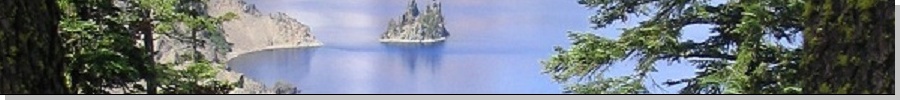
Crater Lake was formed when old Mount Mazama, a huge Cascade volcano, collapsed into itself many thousands of years ago, leaving a depression that eventually filled with water. The lake's surface is about 6,500 feet elevation and is completely surrounded by the remnants of old Mount Mazama. The lake itself is the deepest fresh-water lake in the country, with a maximum depth of about 1,900 feet. The lake is generally circular with a diameter of about 8 miles at its widest. It is also the bluest lake I have ever seen.
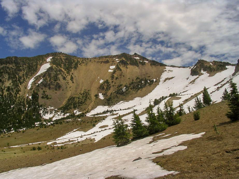
We arrived to the park at 9 a.m. and got ourselves a breakfast at the Llao Lodge on the lake's south rim. This is a popular park and there were many people, lots of traffic (not too nasty, like in Yosemite), and, not surprisingly, lots of motorcyclists touring the park. From here, we followed the East Rim drive about 20 miles, taking us to the east side of the lake and to the foot of Mount Scott. Even in this short drive the difference in vegetation between the lake's east side versus its south and west sides was dramatic: much drier and more sparsely forested than its lusher west and south sides.
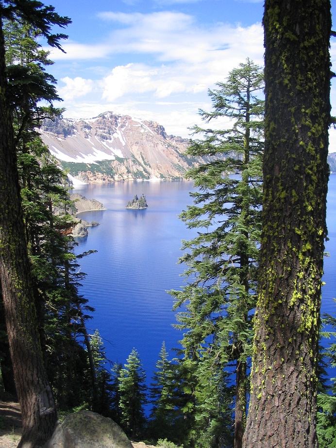
Mount Scott is the only point in the park where you can see the entire lake in one view (e.g. through a camera's viewfinder). At just below 9,000 feet, it is about 2,500 feet above the lake's surface. The hike to the top follows a good trail that gains 1,300 feet in 2.5 miles, and, judging by the number of cars at the trailhead, is extremely popular. In fact, we couldn't find a space to park so we drove an extra quarter-mile and parked at a small picnic area to the north. We suited up and started our hike at 10 a.m. in cool, dry weather, with a few high clouds.
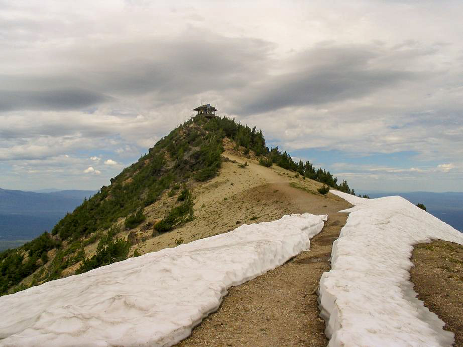
The trail crosses a grassy meadow, then enters into the forest, staying on the peak's south-facing slopes. The gradient was consistent but moderate, and we made good time. About 1.5 miles in, the trail starts up a section of switchbacks that in places was steep, but we made good time and achieved the ridge, from which it was a short walk to the summit. A manned lookout is atop the broad, rocky peak, and there were about a dozen people scattered about.
We found the benchmarks and witnesses in the rocks on the tower's south side, then walked around to the north where we sat and relaxed, taking in the views and enjoying a snack. The one way journey had taken us an hour. We talked with a few people and even saw a guide-dog in training being walked around the top. After about a half-hour, we started down. The trip down went fast and also took just an hour. We were back to our vehicle after 1 p.m. where we rested and changed into drier clothes, and also capturing a wasp inside our car who got mad at us as a result.
We drove around to the west side of the lake to get a few photos, and then drove out, eventually to Bend where we stayed at a Super-8 Hotel. Much to our amusement we arrived on the same day that Bend was hosting its big cage fighting extravaganza, and it all seemed the contenstants and their girlfriends were staying at the Super-8, too. There was also a Porsche fan club contingent staying there, plus a whole bunch of people dressed up in period wear from the 1880s. Needless to say it was a very interesting crowd. Fortunately, everyone behaved and we slept well.
|
|