The Mountains of Arizona
• www.surgent.net
|
| Willow Mountain |
• San Carlos Indian Reservation • Graham County |
|
Date: November 18, 2017
• Elevation: 7,817 feet
• Prominence: 1,357 feet
• Distance: 14 miles
• Time: 6 hours
• Gain: 1,867 feet
• Conditions: Perfect dry and blue Arizona Fall day
I've had my eye on this peak for some time now. It's in a part of the state I've never been to, nor even close to. The peak itself looked simple, there being a road to the top to follow. But I wanted an adventure in visiting a whole part of the state that until now, was terra incognita for me.
Willow Mountain lies in an unnamed range on the east "edge" of the northern highlands of the San Carlos Indian Reservation. The closest I have been to this area is when driving along US-191 between Clifton and Alpine in Greenlee County. This range parallels the high country over in Greenlee County, and is visible from places along the highway (Ironically, not from the highpoints over that way, which tend to be chock full of man-high brush or trees).
I have driven US-70 through the San Carlos Nation many times, always intrigued by the "Point of Pines" sign for Indian Route-8, about five miles east of the main part of San Carlos, the town. Maps show a tiny locale there with that name but evidently, it's not a town, just a place with a name. Those kind of places fascinate me. I had to go there ... some day.
Although I've been interested to hike this peak for awhile now, I didn't actually plan this hike until just a couple days prior. A couple of things were in favor of it: the weather was calm, dry and cloudless throughout the state and there was a lull in the hunting seasons up there. βð was supportive of my last-minute plan and even gave me a nifty compass as a gift, a really nice one!
I left on Friday around noon, arriving in Globe about 2 p.m. to top the tank with gas, get food and drinks, and get a permit for my entrance onto the San Carlos. From Globe, I drove onto the Nation, then took Indian Route-8. Oh boy, a new highway I've never been on. I was already having fun!
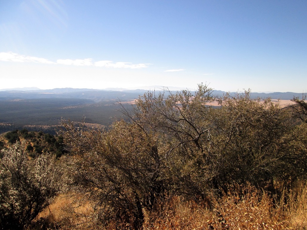
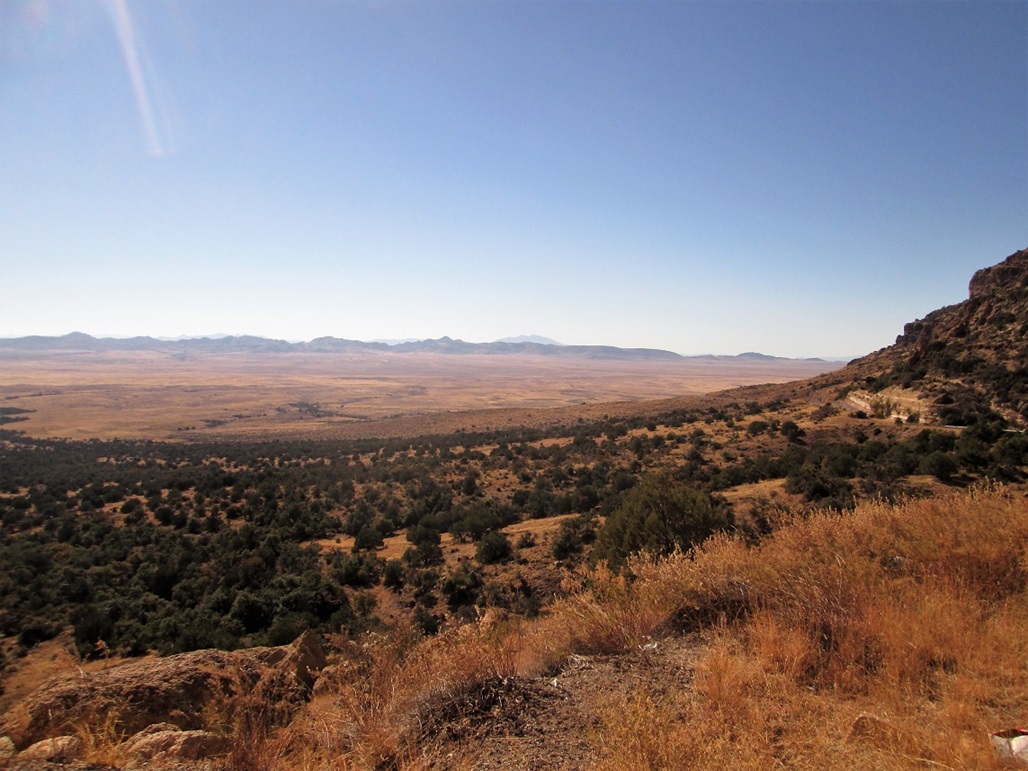
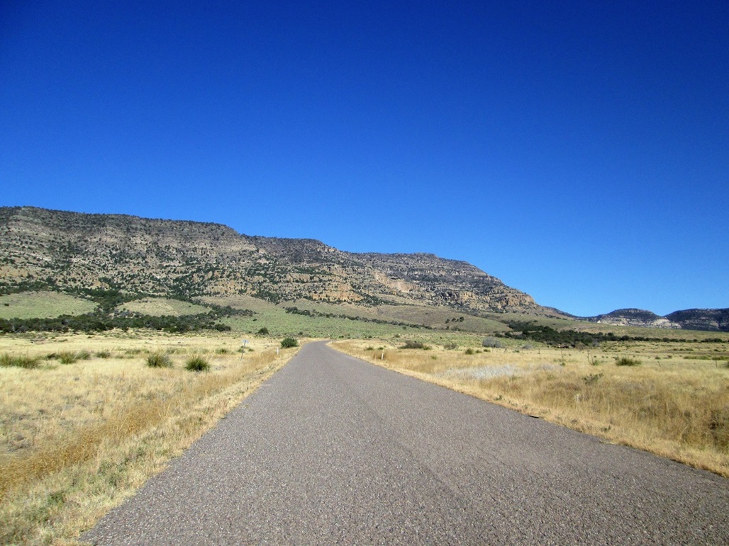
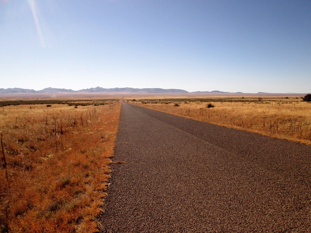
The road trends northeast and bypasses Triplett Peak (so named for its three summits), then passes through some hills to emerge onto a higher bench of land called the Antelope Flats. The country up here, elevations about 4,000 to 4,600 feet, is vast and vacant, with grassy rangeland, and the thousand-foot tall cliffs of the Nantac Rim, the south-facing aspect of the lengthy Natanes Mountains. After a long stretch of straight road, the route then wiggles through more hills, now on the Ash Flat, elevations here in the low 5,000-foot range.
I continued through Ash Flat, coming near to another "named place" I have seen on maps that grabbed my attention, Arsenic Tubs. Any town with that name must be cool. Unfortunately, there is nothing to see. No town, nothing to suggest arsenic or tubs. At best, it may be a ranch name but nothing more. Oh well.
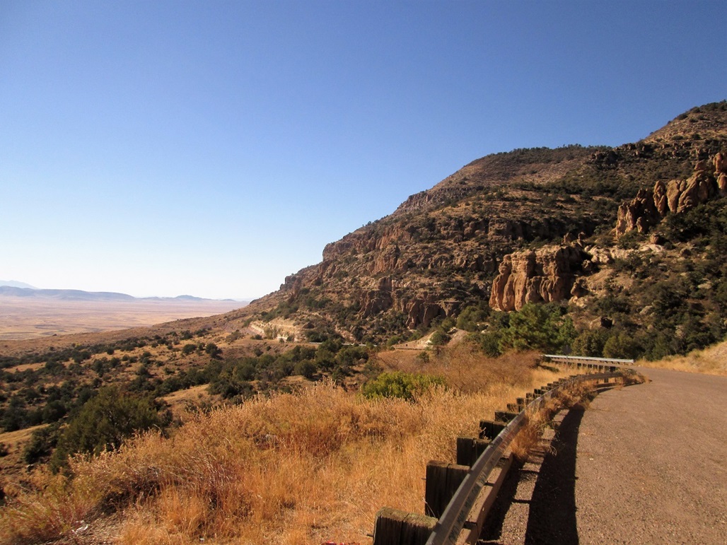
The road then bends left, more northeasterly, gaining steeply (8% grade) toward the Nantac Rim itself. I passes through one of the densest patches of prickly-pear cactus in the state, whole hillsides of the plant. The road weaves below cliffs and bypassing pillars, gaining toward Barlow Pass, elevation 6,644 feet. On the other side, so to speak, is a ponderosa pine forest.
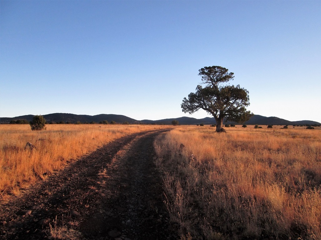
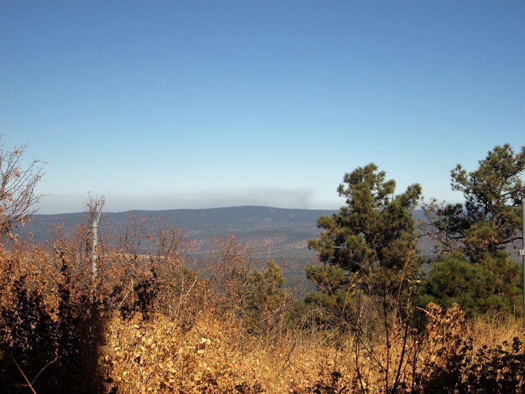
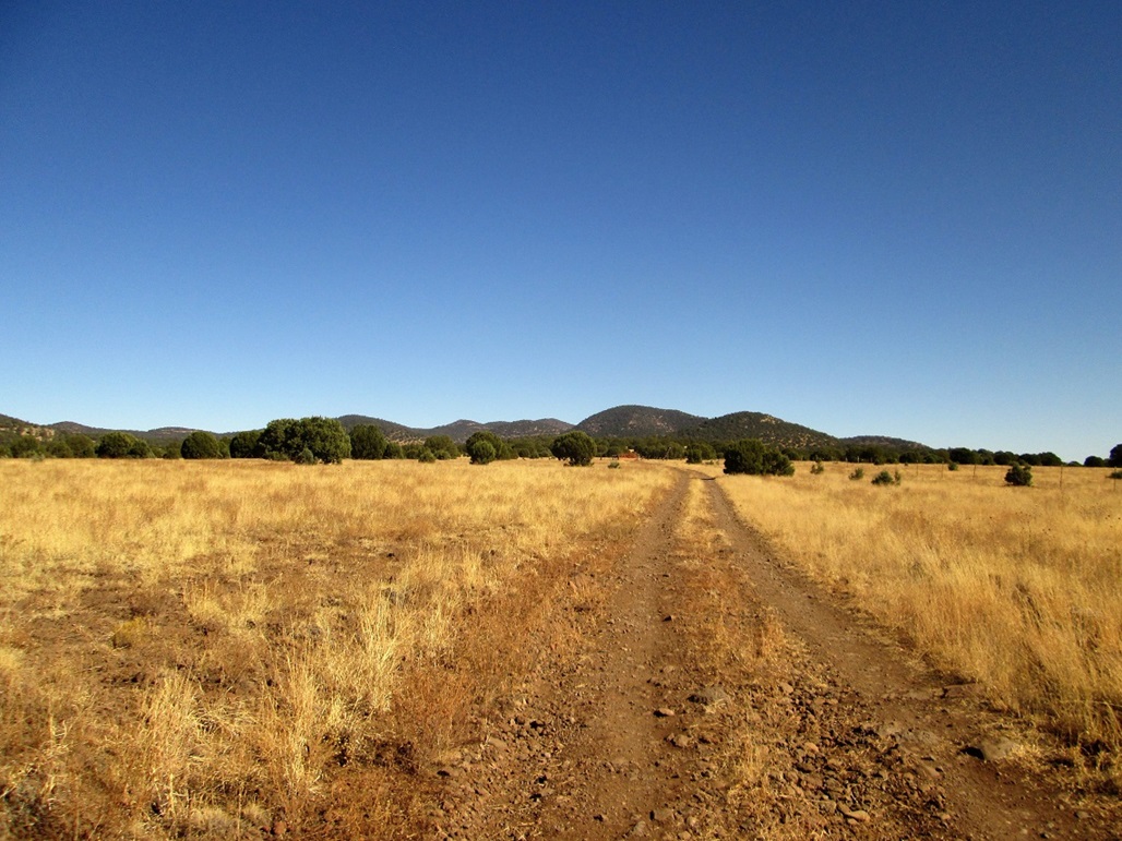
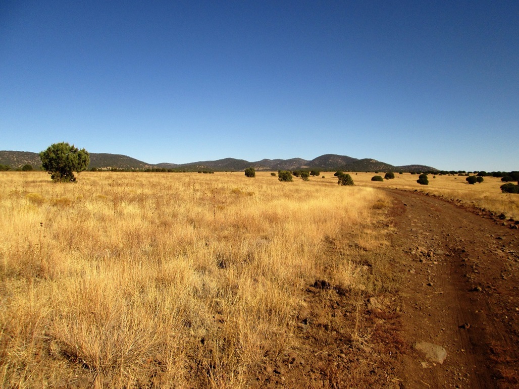
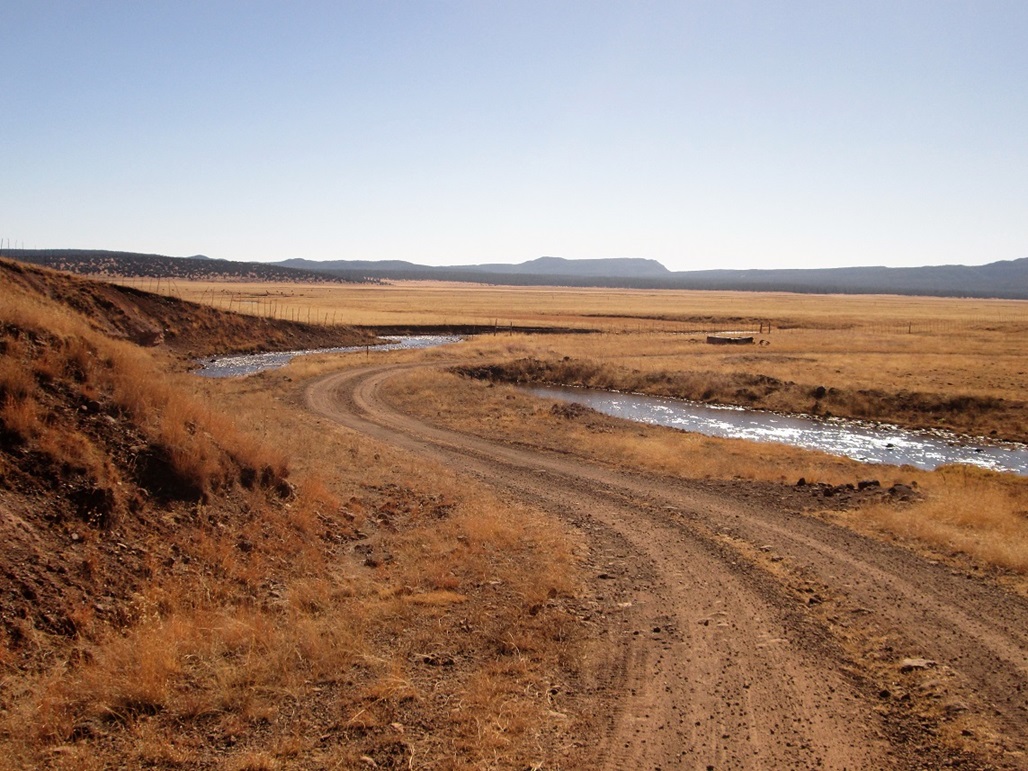
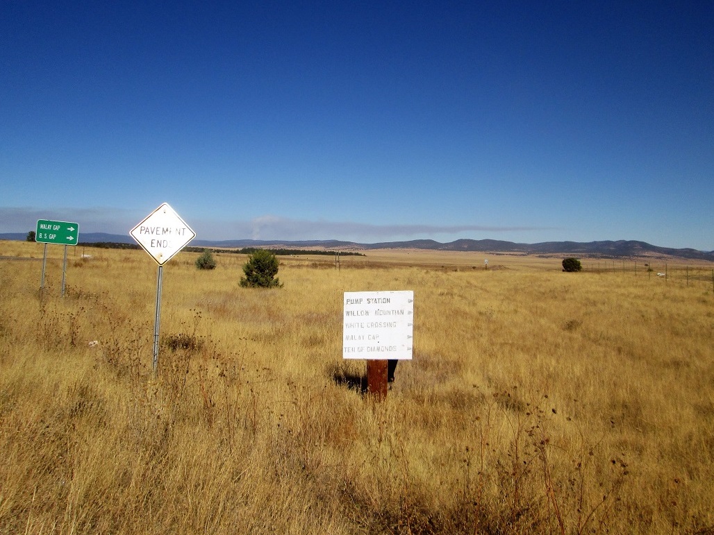
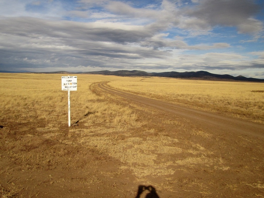
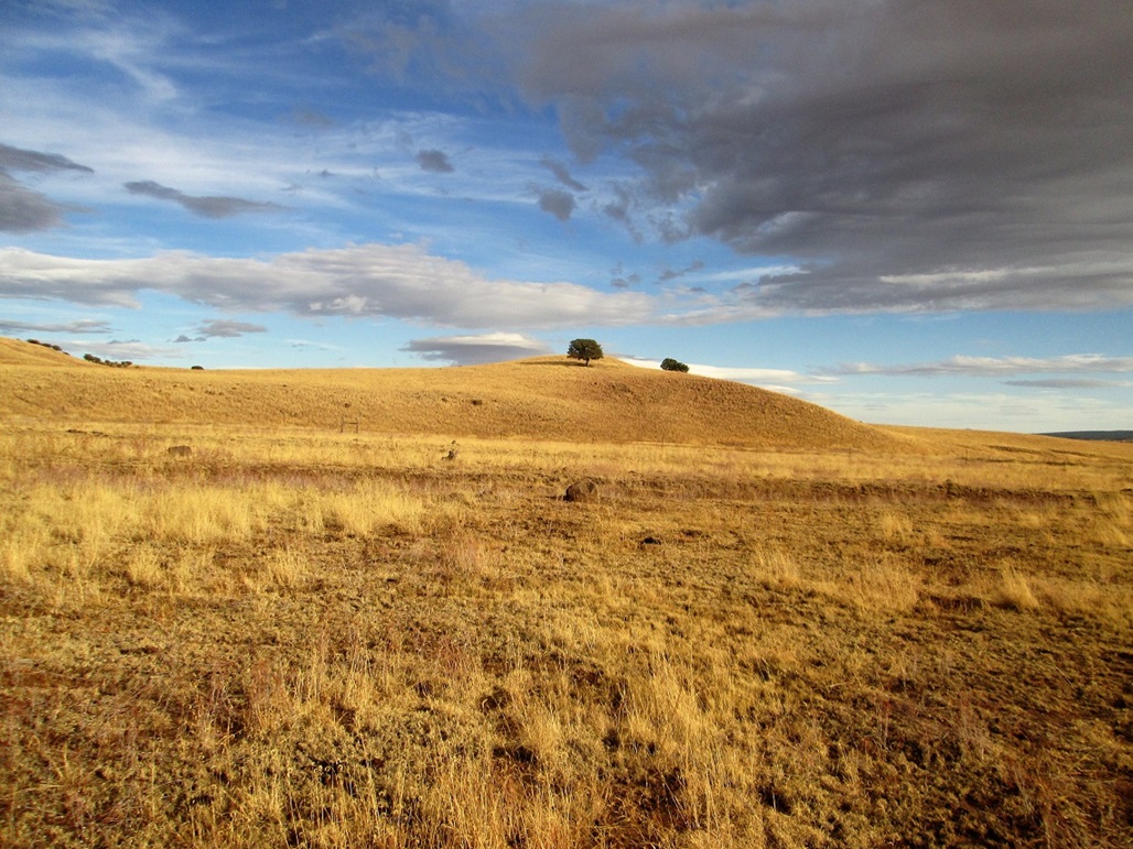
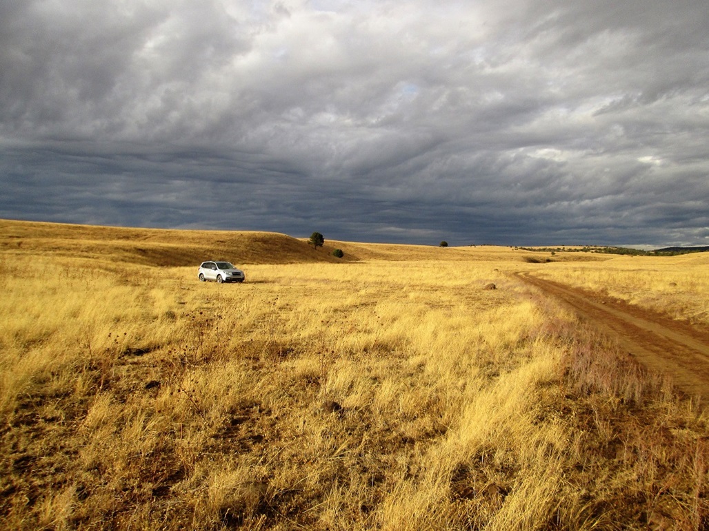
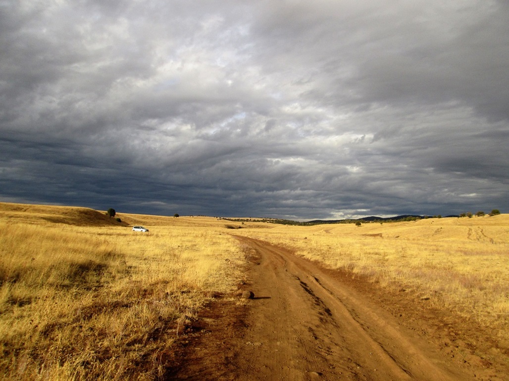
The route then bends north (and apparently changes its number, to IR-5), meeting with another road from the east, now going left (west) toward Point of Pines itself. The place is just a ranger's residence and a couple other residences, plus a camping area nearby. It sits at the boundary between the heavy pine forest coming off the Natanes Mountains and the open grassy "Big Prairie". I didn't stop here. When the road bends north again, the pavement ends, 50 miles from US-70. My goal, Willow Mountain, was visible to the northeast, in what looked like low forest-covered hills. I eased onto what the online maps call SC-2000. There are no numbers on any of the roads out here, but there is a sign for "B.S. Tank and Malay Gap" here, plus a hand-painted sign mentioning "Willow Mt". I followed Road 2000 northeast, carefully matching the bends and junctions with my maps. In a couple miles, it crossed a cattle grate near a corral, then bent north one more time. Here, I continued straight (northeast), now on SC-2010. Road 2000 was wide and well-graded, while Road 2010 was a two-track with grass growing in its center, but fortunately, flat with minimal rocks. I drove slowly, coming to the ford of Willow Creek. It's a small concrete bridge, and easy to cross. I drove up the other side and continued onward. I got about another 1.2 mile past the ford, near a small hill called Hill 6003. The road gains up this small bluff and unfortunately, was eroded badly. I was able to get partway up, but had to get out and move rocks and carefully balance the wheels along the side and the high-center. I got to a flat spot, saw a big gully that was a show-stopper for my vehicle, and decided to go no farther. I made a 9-point u-turn, and eased back down, pulling off onto a flat grassless patch of land near another small bluff. This would be my camping area. I pulled in and inspected the area. It was about 4 p.m., the weather cloudy and cool with a stiff breeze. The clouds were thick but not puffy, no chance of developing into thunderheads. All they did was blot out the sun. Later as the sun was setting, I had direct sunlight on the ground, below the darker clouds. I got a few images illustrating this neat effect. I encamped in the vehicle, reading stories on my Kindle, walking the area, trying to keep warm. Once dark, the clouds dissipated and there was no moon, thus, a very starry night. I could see the usual constellations like Orion, Cassiopeia, the Pleiades cluster, and a couple planets. I had never overnighted in this vehicle until now so had to learn how best to stretch out in it. I tried the back with the seats laid flat, that didn't work. I tried the back set itself, that didn't work. I ended up in the passenger seat, seat all the way back, which worked well. It was cold enough to leave a frost on the truck the next morning.
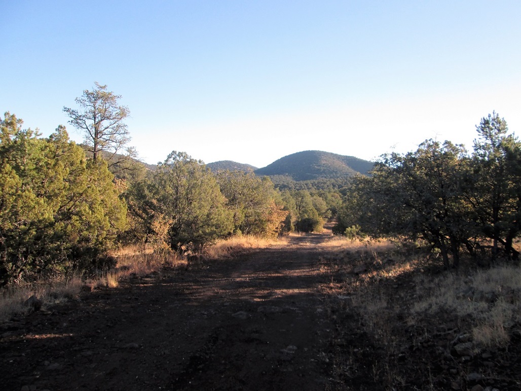
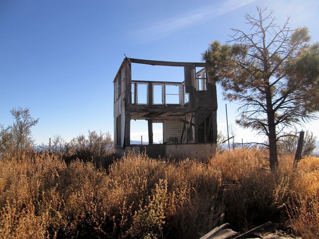
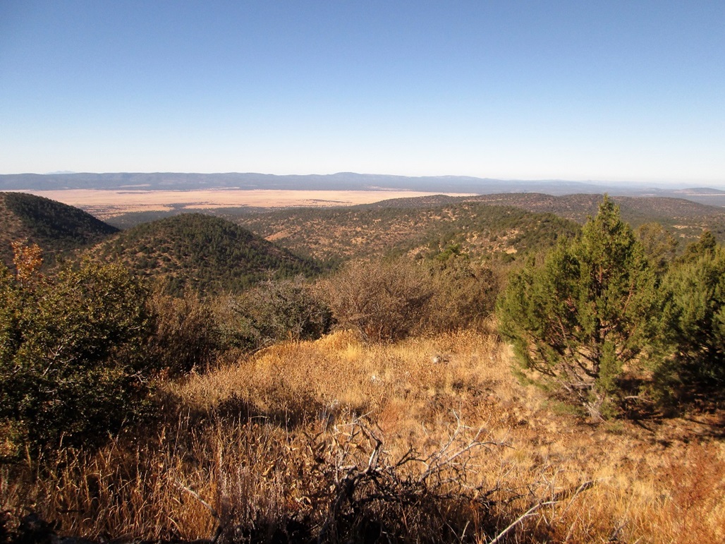
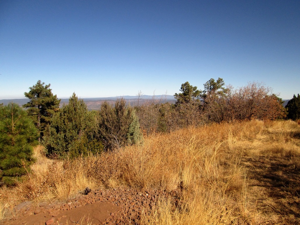
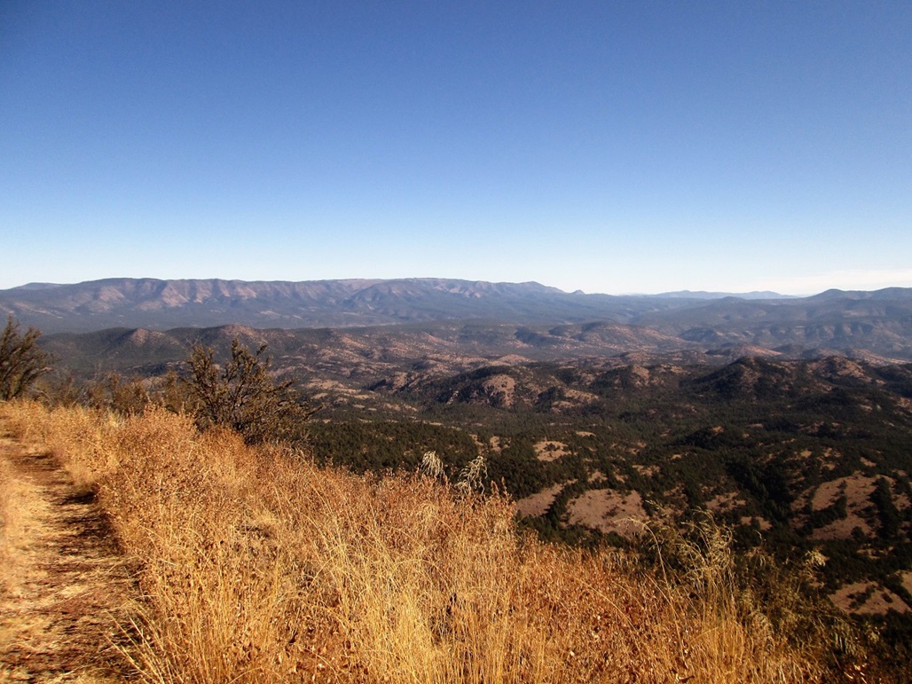
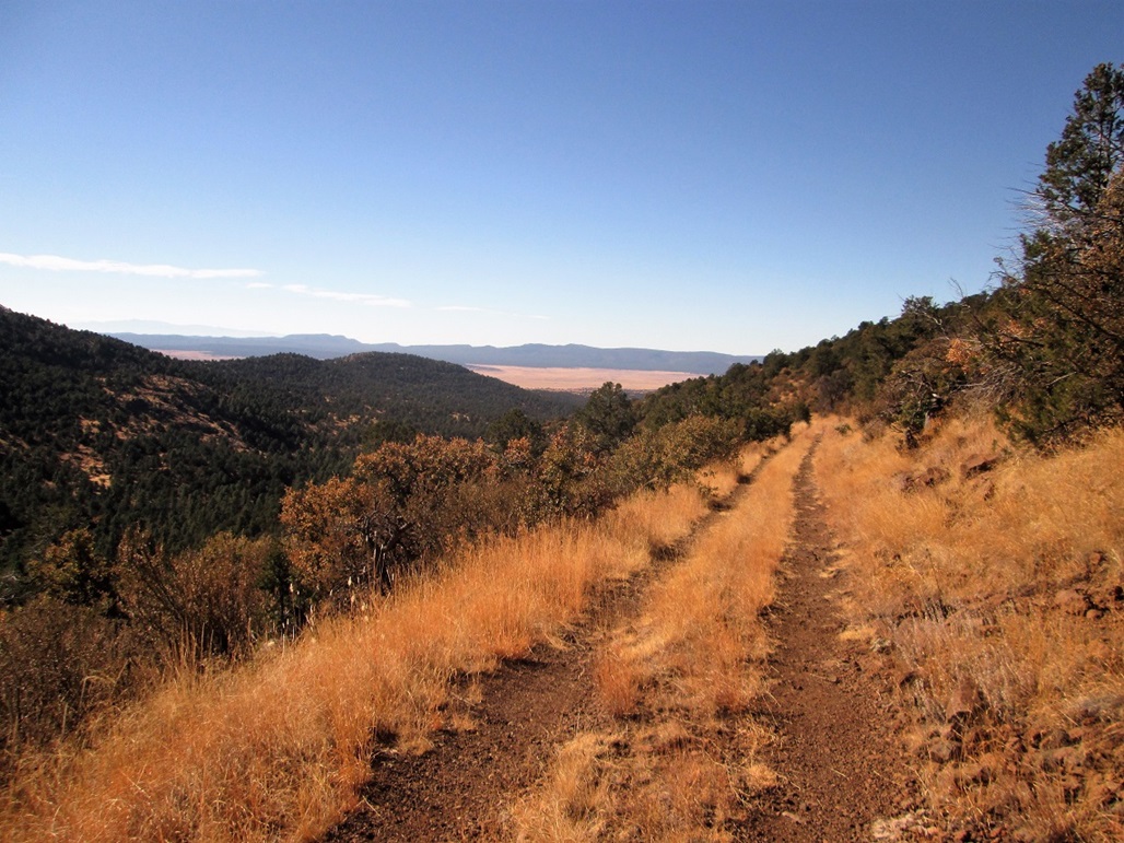
I let the sun rise a little before moving. During the dawn, I got my stuff arranged, things put away, and started hiking at 6:59 a.m.. My GPS said the summit was 6.6 miles away. The road is essentially a straight shot to the top, just a couple switchbacks at the very end, so I reckoned the one-way distance would be 7 miles, with less than 2,000 feet of gain. Still in the shadowy dawn, I walked up that section of road that foiled my car. I was soon above it, where (of course), the road was much, much better. Now on a long straightaway, the sun began to rise and warm things up. The land here was mostly grass with sparse piñon and juniper. The uphill grade was so lenient I barely noticed it. I just walked and walked, making great time. About 2.5 miles in, I came to a gate and a cattle grate at a fence line. The gate itself was just leaning within the grate, barely vertical. To open it, I had to untie a rope, then lift the damn thing out of the grate enough to squirm past it. Past that, I was now in thicker forest, with more piñon and juniper as well as smaller pines. The road then drops about 60 feet toward the Willow Mountain Tank. I found a stump to sit on for my first break. I had been hiking 90 minutes and was pleased to learn I had covered 4 miles (3.9 said the GPS). The summit was just 2.7 miles away. I shed some layers as it was warming up. The area was lovely, with small hills, forested but not too thickly. I spent about 10 minutes here. A "better" road goes north, but the road I wanted bent right and up the only really bad section of road, with bigger rocks and erosion that would stop most smaller vehicles. Past that, the road is a narrow shelf road, paralleling a long canyon aiming for the peak itself. For long stretches, Peak 7593, which sits just west of Willow Mountain, is visible, to where I assumed it may be the actual peak. It was not, so I decided to name it "False Willow". Along the way I spooked some big beast in the canyon below me, about 50 feet down. It moved at first, so I stopped and clapped. Then it moved again, and I took a couple steps. I caught a glimpse of it, a big brown-colored beast. I could not make out what it was, but it ran off. By the way it ran, it probably was an elk (i.e., it ran away with a steady quick cadence). Maybe it was a brown bear. I didn't see much bear scat though, but I did see lots of elk and deer scat. Whatever it was, it ran away, which was good. The trail then comes to a saddle at 7,300 feet, where I took another break. Then it wends left, now on north-facing slopes. The forest here was mainly gambel oak, the road covered about 6 inches in their leaves. Finally, the road came to a bend at the range crest itself, then switchbacked a couple times. At 10:03 a.m., I was on the summit. I was most curious about the lookout tower. It was still there, looking more like an old two-story residence than a lookout tower. It was completely thrashed, wood planks strewn everywhere. I did not dare climb its stairs. Even being in the first floor was kind of spooky. I was actually concerned about hantavirus, which is common in these parts. I sat at the concrete stoop for a break, then walked around the perimeter, looking for a benchmark (there was none) or a cairn or log book. I found nothing. People get here, mainly hunters I surmise. There was a small amount of garbage but not too much. I spent time shooting images of the surrounding scenery. To the north was Mount Baldy, plus a smoke plume! It looked to be a pretty big fire, I am guessing on the adjacent Fort Apache Nation. I spent fifteen minutes up top, happy to be here, happy to have made it in just 3 hours. Not bad for an old slow guy. The hike down went well, going about the same pace as I had coming up. I was back to the tank area after 75 minutes, where I stopped again for a break. The whole area was just gorgeous, and I was enjoying it very much. The closest human was probably 15 miles away. The hike out to the car took 90 minutes, and I was back to the car at 1:03 p.m., a six-hour, four-minute journey, covering 14 miles. I was happy to see my car still there. I did not expect trouble, but I really did not want to be stuck here either. I spent about 30 minutes just relaxing in a camp chair, not in any hurry to get moving. Eventually, I got everything packed and pushed off. On the drive out, I took more photos, plus inspected the Point of Pines roads for a future visit. There was a herd of horses in one area, they watched me as I drove by. As I drove back to US-70, I stopped often for more photographs. Once on US-70, I drove straight home, with a lunch break at a Subway in Globe. There are a couple other interesting peaks in the area I would like to hike, so I'll be back. As usual, I have no idea when. The camping area at Point of Pines looked like nothing special, but there are other roads one can drive on and bush camp. There won't be hordes of people to make noise. I saw not a soul on my hike, and perhaps a half-dozen cars total on my drive in and out.
The University of Arizona ran a Field School in Point of Pines from 1946 to 1960, where archaeology students could get hands-on experience excavating sites in the region. Dr. Emil Haury was the program leader, and he wrote a book on it, Point of Pines, Arizona, A History of the University of Arizona Archaeology Field School (1989, University of Arizona Press). This lengthy passage details what he and his co-hort, Ted, saw as they first entered the region and established the camp in 1946: Ted and I each had a small umbrella tent erected on our chosen spot, the flaps opening east to give us an unbroken view of a vast soft landscape to distant mountains. Nantack Ridge, also known as Natanes Mountains, lay to the south. Its northern slope was fairly gentle and heavily timbered, whereas the south face presented an awesome escarpment that dropped from the summit at 7,000 feet down to 5,000 feet to a large rich grassland known as Ash Flat that merged with the Gila Mountains farther to the south. We were told of cliff ruins in the scarp face, but they were more accessible from the south or Ash Flat. Off to the Southeast, behind a low ridge known as Rocky Point, was Morenci and its vast copper mine, but no vestiges of it or even smoke from the smelter were visible to us. Directly east, some 20 miles, was flat-topped Rose Peak, along the sides of which clung State Route 666, known as the Coronado Trail. It gradually ascended to the high Blue Ridge through Aspen and fir forests to Alpine and beyond. Between us and the Blues, the Willow Mountains poked their way skyward, the top of which sported a plainly-visible fire lookout. Immediately to the south lay a smallish cone-shaped mountain whose profile reminded me of the pyramids of Mexico. Beyond the Willows was no-man's land and out of reach for us, but from our map we learned of places with enchanting names like Malay Gap, Shanghai Springs, Monkey Springs, Lobo Basin, Dry Prong and BS Gap. Ten miles or so to the north, invisible to us, Black River ran in a 200-foot deep canyon carved into an impressively thick basaltic lava flow. Rounded Maverick Mountain, Poker Mountain and West Poker Mountain were just north of the Black River on the Fort Apache Indian Reservation, and beyond were the White Mountains, among the highest in Arizona, the result of long-past, large scale volcanic activity. Barely visible to the Northwest was Saw Tooth Mountain, and westerly, our view was blocked by low hills and a heavy growth of trees. He also details the challenges of getting to that area in 1946, before paved roads ventured there. They followed a track up and over the Natanes Range to the west, coming to Point of Pines from that direction, saying it took 4 hours to cover 75 miles, including one blow-out. The region is apparently very rich in old Indian village ruins from about the 12th Century onward. |


|