
The Mountains of Arizona
• www.surgent.net
|
| Towers Mountain |
• Bradshaw Mountains • Prescott National Forest • Yavapai County |
|
Date: June 5, 2005
• Elevation: 7,628 feet
• Prominence: 1,948 feet
• Distance: Drive-up
• Time: 3 hours (whole journey)
• Gain: none
• Conditions: Sunny
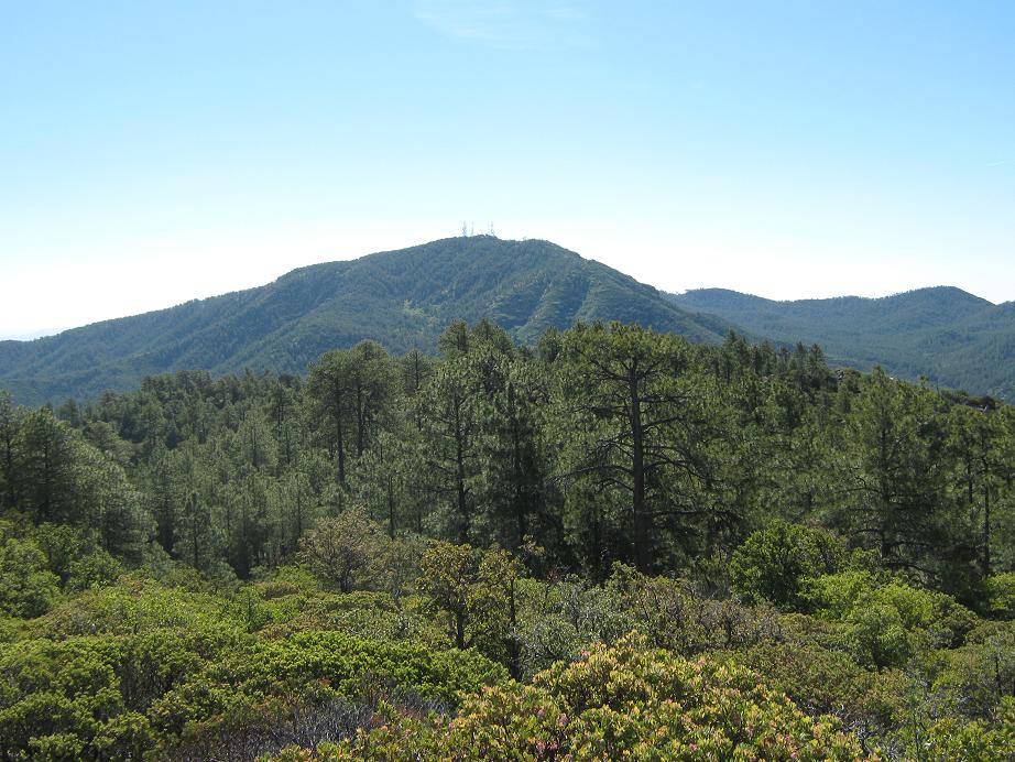
Towers Mountain is the highest peak in the southern Bradshaw Mountains, overlooking the town of Crown King. Its height and prominence (over 1,900 feet) make it an ideal location for a forest-service lookout. The heavily-forested peak is crossed by numerous roads and a couple of trails.
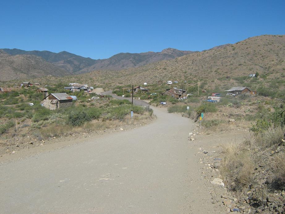
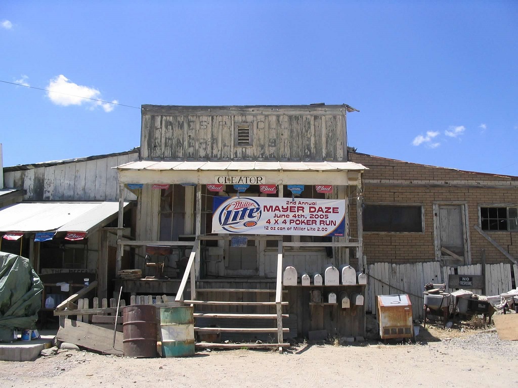
The real treat is the town of Crown King itself, an old mining town founded in the 1870s that survives today as a tiny hamlet of about 100 full-time residents, with homes scattered around the tiny town center. Crown King is reached by a 26-mile dirt road off if Interstate-17 (Bumble Bee Exit). The road is paved for the first mile, the graded dirt thereafter. It passes through the old stage stop town of Bumble Bee after 5 miles, the "living ghost town" of Cleator after 14 miles, then up long switchbacks that formerly held a railroad, built to bring down the gold and silver ore mined from the Crown King mines. For us, this visit would be our second together. We'd be staying at one of the small bed-&-breakfast places in town, celebrating my 38th birthday.
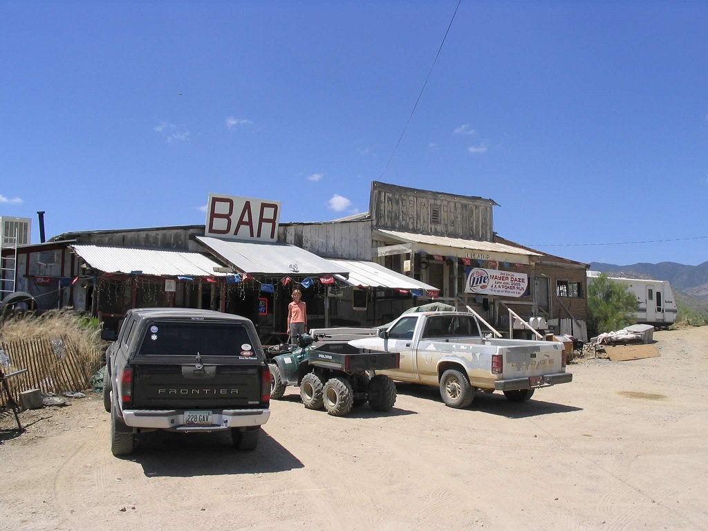
The drive is kind of tedious, but scenic. The road gets washboarded quickly with the amount of traffic it receives. Going at a moderate pace and including stops along the way, it's about a 90-minute drive into Crown King from the highway, the last mile an especially impressive road-cut right into the sheer rocky walls overlooking a steep canyon. Then you enter a hanging valley and Crown King, which is on the right. The downtown is tiny but has a famous General Store, a few bars, a couple restaurants, a small schoolhouse and other buildings used by the small "work force" of Crown King.
Everything is scaled down here, naturally, and people do double duty. At the main restaurant in town, our waiter regretted to inform us that our cook, also one of the town's EMTs, had been called away on a medical call and that there would be a slight delay in getting our meal. We didn't mind, and rolled with the punches. Crown King also features one of the smallest parades in the world. We've never been there during the parade, unfortunately.
On this visit, we didn't do a whole lot of hiking, but we did a lot of driving and exploring. We spent most of one day driving to the Horsethief Basin and reservoir and walking around the area. There are many other little roads and pullouts with historical markers explaining what went on back in the olden days.
As for Towers Mountain, we opted to drive the road instead of a hike. From the Crown King side, the only option is the road, and hiking it would be a many-hour endeavor along forest road. We thought a drive would be more fun. The road up to the top started in "East Crown King", in the suburbs slightly east of the business district. We guessed and found a road that steeply wiggled up the side of the mountain, past numerous homes. Eventually the road makes a couple long switchbacks, crests a pass, then runs along the back-side, coming to the top, which is covered in stately ponderosa pine. The lookout was manned today, so we stayed below and took in the views.
For the drive down, we followed a spur road (FR-520) that drops steeply down the peak's south and west faces. The road was about two notches less in quality than the one we’d driven up, and very steep. Going down it was easy, but coming up it looked like it would be a real chore. But it was fun, and after a couple miles of bumping and bashing, we came out to the Senator Highway (FR-52), about five road miles northwest of Crown King. So we followed the road back into town.
|

|