The Mountains of Arizona
• www.surgent.net
|
| Peak 2329 • Sasco Townsite |
• Samaniego Hills • Arizona State Trust Land • Pinal County |
|
Date: April 29, 2025
• Elevation: 2,329 feet
• Prominence: 449 feet
• Distance: 7 miles
• Time: 2 hours, 40 minutes
• Gain: 530 feet
• Conditions: Sunny and warm, some cloudiness
Arizona
•
Main
•
PB
•
LoJ
•
Lidar
•
Mine information
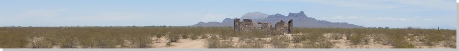
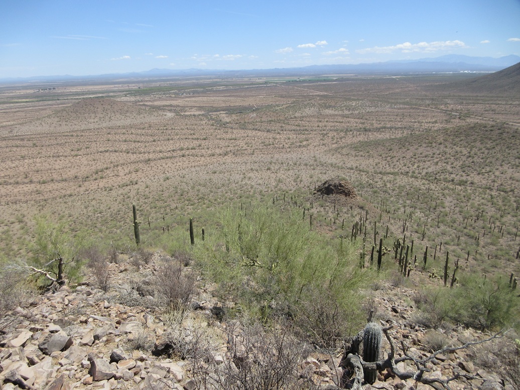
This peak is one of the mounds in the Samaniego Hills, about 35 miles northwest of Tucson, and about 10 miles west of Interstate-10. It is easily seen from the highway: looking west at about the Red Rock exit, Cerro Prieto is the obvious nearest big peak. Then Peak 2329 rises to the viewer's right, a lower trapezoidal-shaped hill.
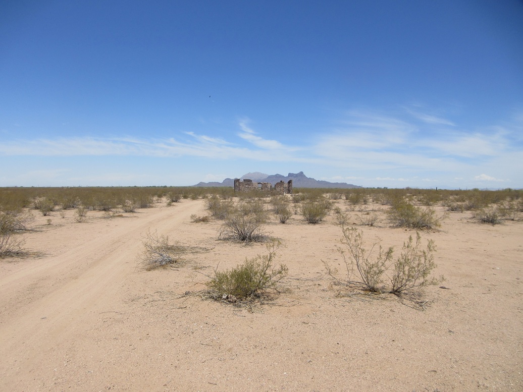
The peak is near the location of the old Sasco townsite, which functioned in the 1910s-1920s. It is an acronym of the Southern Arizona Smelter Company. It was a company town to support the smelter, which "smelted" the ore coming in from the surrounding mines, the Silverbell mine being the closest and largest. The town had a population in the low thousands at its height, and was a fully-functional town with homes, schools, shops, saloons (of course), hotels and so on. When ore prices fell in the 1930s, the smelter shut down, the people left, and almost the entire town disappeared. Just a few concrete structures and foundations remain, plus remnants of old roads. Much of it is on private land these days.
I was on my Tuesday drive to Tempe, and it was expected to be a warm day, but not too warm, highs about 82° in the deserts. I left Bisbee about 8 a.m. and had no real hiking plans this time, intending on just driving straight through to Tempe. I stopped for gas in Marana, and while driving north on the interstate, decided at the last moment to take the Red Rock exit.
I drove through the housing development, then continued southwest on Sasco Road, the peaks rising in the near distance. Sasco Road actually runs right below the peaks, but a significant barrier usually stops me short of the peaks: the Santa Cruz River flows over the road at a point marked "Los Robles" on the map. There is no bridge here.
The flow is variable. I have been here once when the channel was dry. The other times I've been here, the water is about 18 inches deep at its deepest, spanning about 40 feet. There is a secondary channel about a half mile west that can also have a flow. I was hoping the flow today would be low or none at all. But no such luck. The road was blocked by the river, and I did not feel it wise to chance my car through it.
I still wasn't committed to hiking anything at the moment. It was 10:30 a.m. and pleasant, temperature for now about 75°. I had absolutely nothing in Tempe that demanded I be there quickly. Thus, I decided to hike it now. This was a case where I tried not to overthink it.
I got dressed, but carried my shoes and socks and walked to the water in my cheap Target sandals. I took them off and walked through the water barefoot, the water about up to my knee. It was warm and the mud underneath was soft, warm and mushy. There was also mossy growth that added to the gross feeling. On the other side, I sat down, dried off my feet, then put on my socks and shoes.
I should mention that I crossed at a narrower point, and that I also stepped on more rocks. There are rocks in the channel. Thus, trying to "power" through the crossing in a vehicle might mean running into one such rock. This crossing should be done slowly in a vehicle with very good clearance. The flow itself is never very strong, so being pushed to the side is not a concern.
Now I had a long road walk ahead of me. I had no map and had only an image saved on my phone, but navigation was not a concern as I could see the peak the entire way. I walked quickly along the road until I was southeast of the peak. The best lines seemed to be directly east of the peak, or even northeast. Later, using an online mapper site, I walked 2.5 miles, which surprised me.
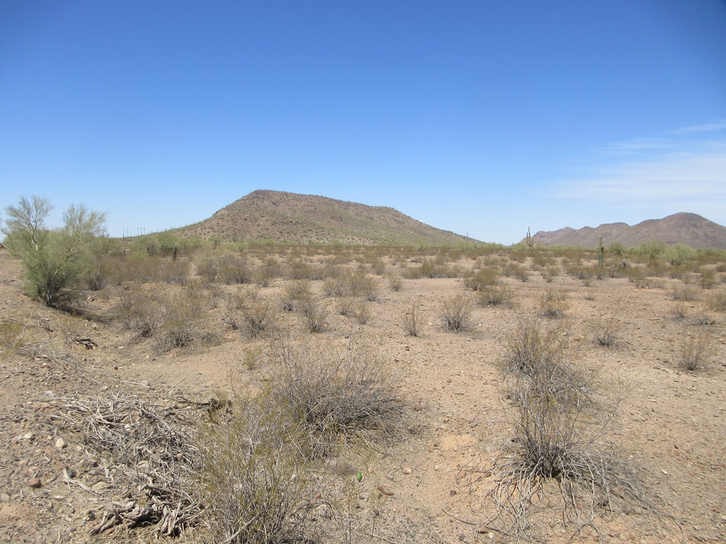
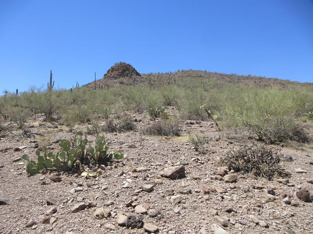
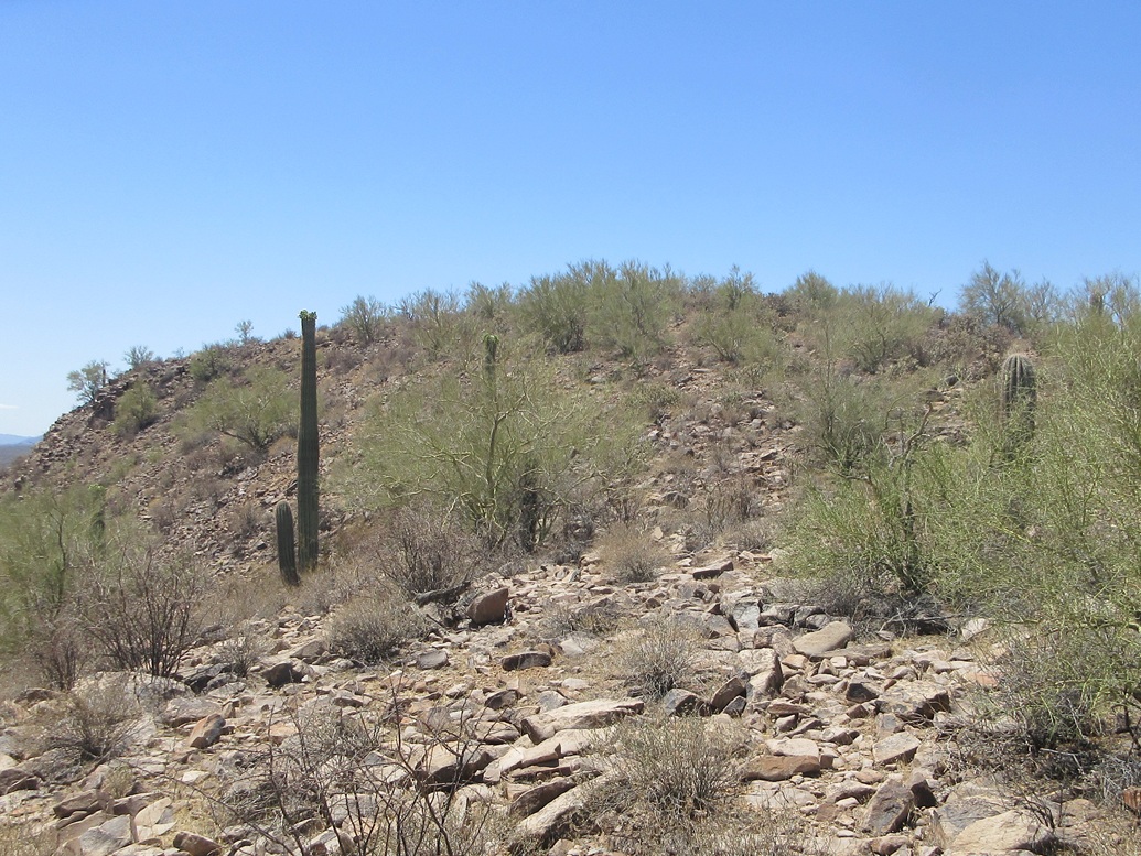
I exited the road and onto the desert flats, which were open with spaced creosote plants, some low cactus, very little grass, and open lanes. Larger saguaro and palo verde were here too, but not as abundant down low. I aimed for the peak's east slopes, with a rounded rocky outcop about midway up the east slope as my first goal.
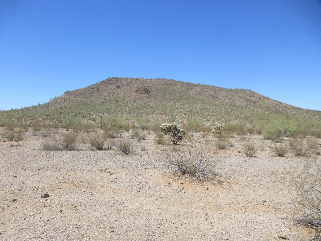
Now on the slopes, the grade steepened and the ground became rockier and more brushy, now with much more cactus including cholla. Lanes came and went and I had to zig-zag a few times to bypass brush thickets. The rocks were looser but the grade, for now, was moderate, so I made good time. I aimed for the "pimple" rock outcrop, and bypassed it going right.
The grade stayed this way until the last hundred feet, where it steepened slightly, now more rockier. The rocks heaped a little and laid back, forming not-quite-cliffs that were easy to step onto and over. I just had to mind the looseness. Then that was all — I was on top the peak.
The highest point is toward the south end of the ridge, about 30 feet higher from where I stood. The slope up top was very gentle and the brush was light, making it easy to walk the final few yards to the highpoint.
The summit is gently rounded and rocky, but nothing sticking up. I found a cairn but no register, and no benchmarks or other signs of previous visitors. It had taken me about 90 minutes to get here, the off-trail portion covering another mile, but with an overall elevation differential of just over 500 feet. It was warm but tolerable, just a few bees out and about.
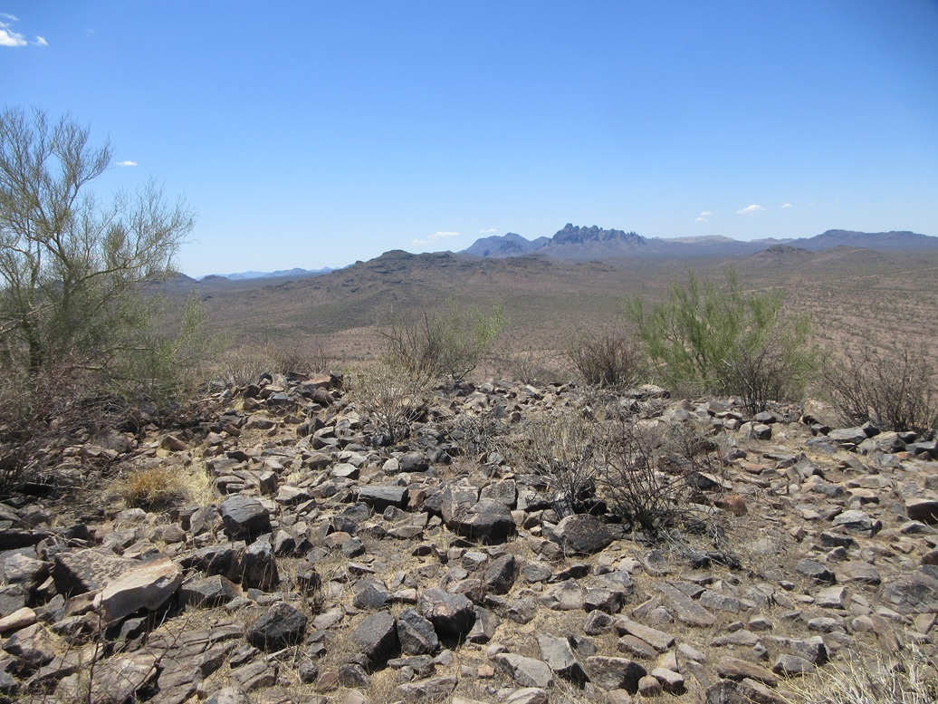
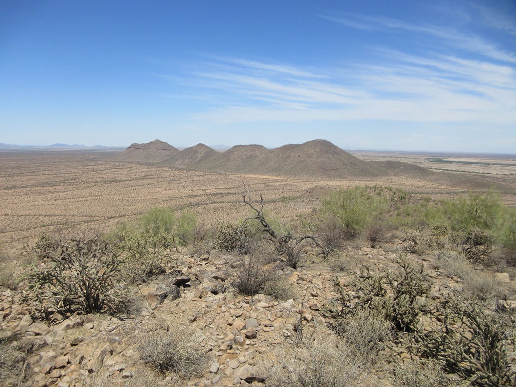
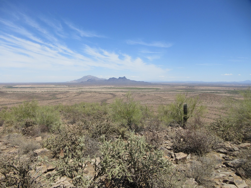
Views were good, there being a little dusty haze in the air. I saw the usual peaks from these hills: Newman and Picacho to the northeast, more hills to the north, Ragged Top and Silverbell to the south, and lots of lower peaks looking west.
I did not spend long up top. I was happy to be here for what was an impromptu hike. I had some distance to cover going out, so I got busy walking. The hike down went well, and I was soon back to the road.
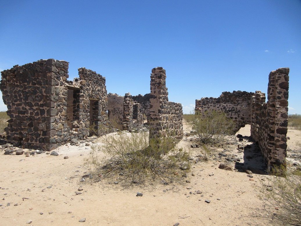
I wanted to check out some of the Sasco ruins. One side road was gated with warnings about trespassing, being watched, this means you, and so forth. So I skipped that part. However, I was most curious about a lone stone structure a little to the east, no gates or anything blocking access.
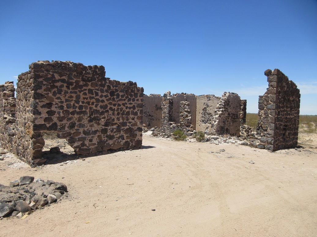
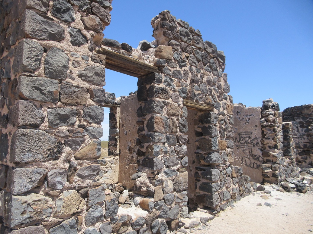
I walked to it and took a close look. I had no idea what it was, but its was substantial. It was made of local stone mortared together. Obviously, it dates from the Sasco era.
Later, I looked it up and it was the Hotel Rockland. The Wikipedia site includes a photo of it from when it was functional. I was impressed by its size. These days, it's just walls in ruin, piles of stone, grafitti, but surprisingly, not much trash. This must have been a fine hotel back in its day. It looked like the interior rooms had very high ceilings, like 12-15 feet high. That and the very thick stone walls would have helped keep things cool during the hot summers (and falls and springs). I will even wager that there was a grand piano there, and they served oysters. That seems to be what classy places in 1910-1920s did back then. The rest of the hike was just a matter of walking out the final miles and recrossing the icky gooey mushy poop-like muddy water then cleaning it off back at my car. I was back at 1 p.m., a two-hour, thirty-minute round trip. It was warmer now, about 85° and I got a little sunburn, but I was happy to tag this peak. There are many more peaks like this back here, but crossing the ford on Sasco Road is simply not an option for me in the Forester. However, there is a backway to here via Marana and the Ironwood National Monument. But that backway is about a 35-mile detour for which I did not have the time today. Taking this backway means I could have driven right up to the base of the peak. I'll return going this alternative way when I have a full day. |


|