The Mountains of Arizona
• www.surgent.net
|
| Salome Peak |
• Highpoint: Granite Wash Mountains • Bureau of Land Management • La Paz County |
|
Date: March 10, 2019
• Elevation: 3,991 feet
• Prominence: 1,231 feet
• Distance: 9 miles
• Time: 6 hours
• Gain: 1,770 feet
• Conditions: Cool and sunny, then cloudier
• Teammate: Matthias Stender
Arizona
•
Main
•
AZ P1K
•
PB
•
LoJ
•
USGS BM Datasheet
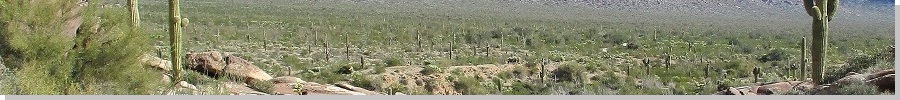
Matthias and I teamed to climb Salome Peak, the highest point of the Granite Wash Mountains in Western Arizona. It was kind of a last-minute plan as some other plans fell through and then we decided to just team as a pair and go bag a peak while the weather was still cool.
Salome Peak rises about six miles northwest of the small community of Salome, along US-60 about 80 miles west of Phoenix. According to the Salome Chamber of Commerce, the peak’s original name was Indian Peak. The town of Salome was established in 1904 and named after the wife of one of the town’s founders, and presumably the peak was renamed not long thereafter. The name comes from the Greek and is pronounced "Sa-loam".
Matthias and I met at 6 a.m. at the Wal-Mart near Dysart Road and Interstate-10 in Goodyear, west of Phoenix. I then drove us to Salome via the Salome Highway, arriving a little after 7 a.m.. The day was clear and sunny but cold, in the high 30s going by my car’s thing that tells temperature. We then spent the better part of an hour getting close to the base of the peak.
In Salome, We went west a little bit on US-60 to Center Street on the right (north), then north on Center about a third of a mile to Hall Street. We went left (west) on Hall for a half-mile to Indian Springs Road on the right. I turned north onto Indian Springs and followed this road (now hardpack dirt) for 1.5 miles to an un-named junction (what would be 68˝ Avenue going by the grid road-naming nomenclature out here). I drove us westbound on this road for a mile to where the road essentially ends near some homesteads and open desert.
At the end of this road, there is a track that goes northwest, so I followed it for about a quarter-mile, but it was not the one we wanted apparently, so I backed out. We wanted what the maps call "Tank Pass Road", which goes northwest to Tank Pass (the pass that separates the Granite Wash and Harcuvar Mountain ranges) and bypasses Salome Peak on the way. This road is about a mile north of the track we were on.
So we backtracked on Road 68˝ to Tank Pass Road, which was a little too sandy for my comfort level. I preferred that other track we had been on earlier, so I drove us back that way (where we met one of the homeowners in his car; he was friendly). We did not know where this track went, but in the worst case, we could park, note our position with a GPS, then hike cross country and catch Tank Pass Road somewhere along the way.
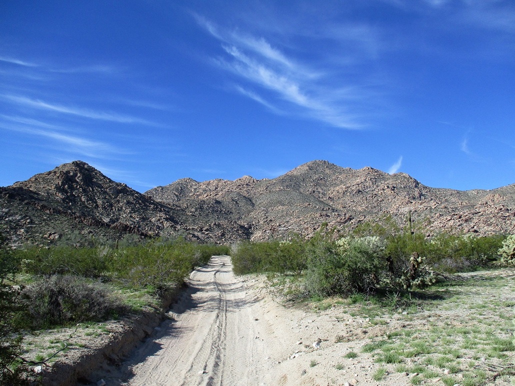
It turns out that this track was in great shape. It was narrow and weaved through the scrubby desert brush for 1.3 miles. There were some easy arroyo crossings, the sand was never soft, and there were no rocky segments. This track then came to a set of powerlines and the accompanying powerline road, which goes northeast-southwest. We went right on this road for about a half mile, then caught Tank Pass Road, which we followed to the northwest. (Note: there are no signs out here; all this was done by map reading with GPS and odometer watching.)
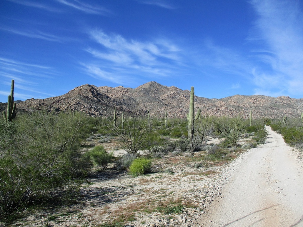
I drove up Tank Pass Road in the moderate sand. My Subaru handled it well, but it was a narrow road with two-foot berms on both sides with no room to bail if necessary. I decided the first chance I had to park, I would take it, so I did, parking along a small track (shown on the topo map) that goes west from this road. We were just a couple miles from the peak well within walking distance. It was about 8:20 when we finally started walking. We were at elevation 2,220 feet.
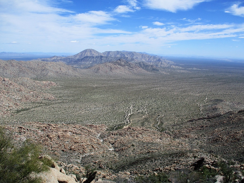
We walked Tank Pass Road, noting that the road’s condition improved a lot. So do I walk back to get the car? I decided not to. We just walked up this road, then took the spur road that goes west into a jumble of large rocks directly below Salome Peak. We covered about 2.5 miles to where the spur ended, gaining about 450 feet. The gradient was so consistent it did not feel like we had hiked uphill at all.
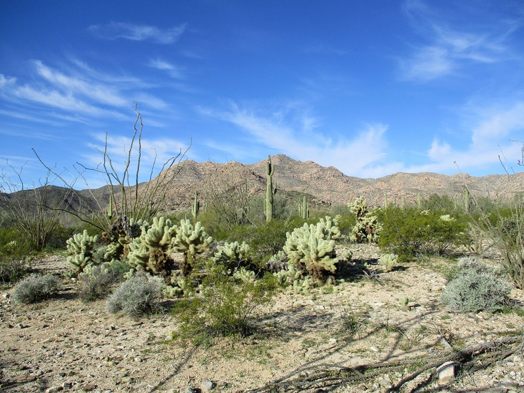
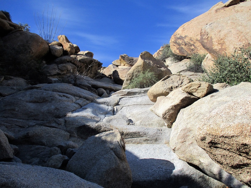
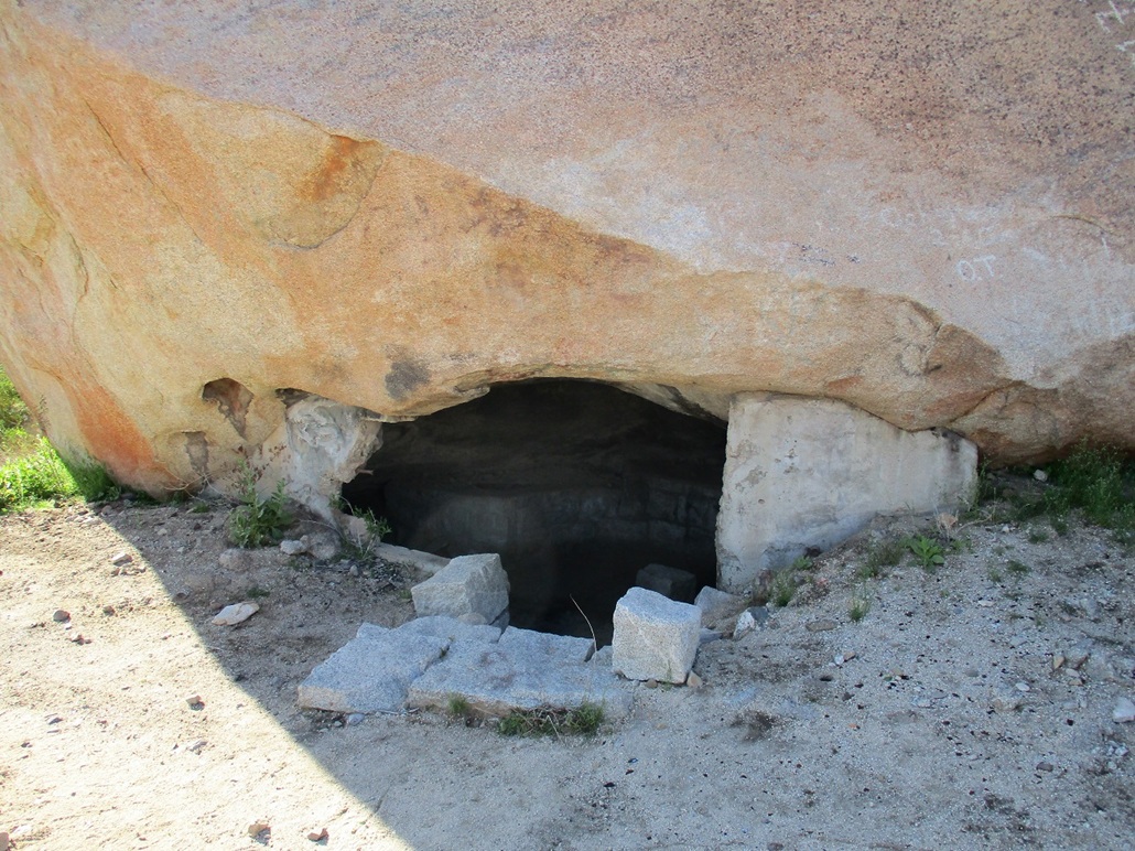
The road spur ends in a small sheltered cove with enormous granitic boulders piled on top of one another, forming voids of varying sizes. There is one such "room" that was augmented with concrete steps and walls that looked like a little jail cell (maybe it was, maybe it wasn’t). I was unaware of its existence until now. We spent a few moments checking out these big rocks before actually starting the climb.
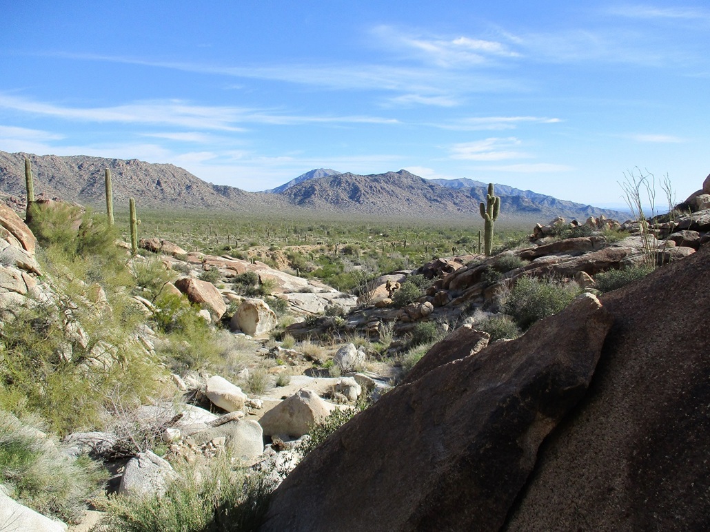
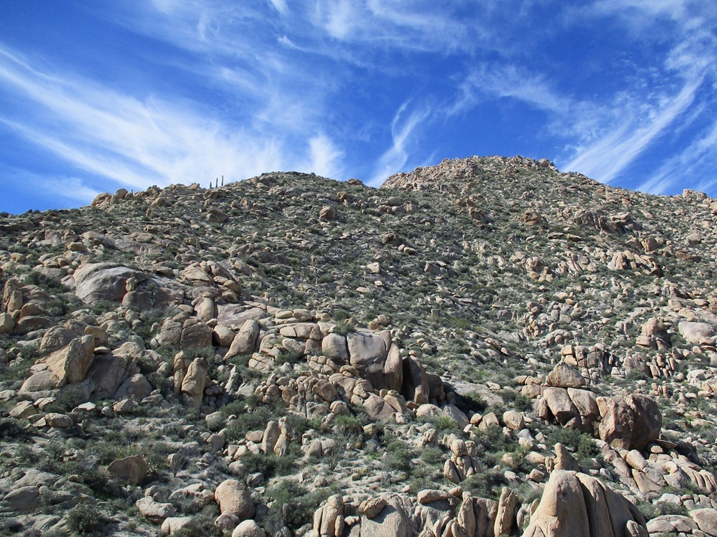
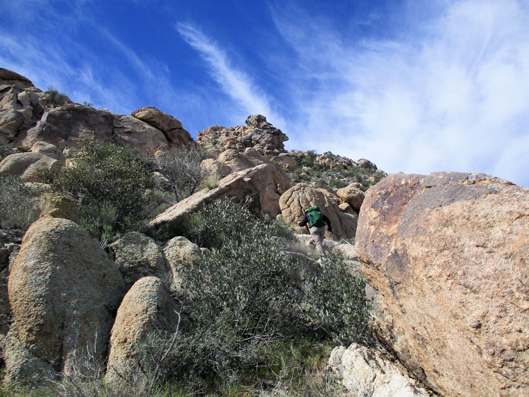
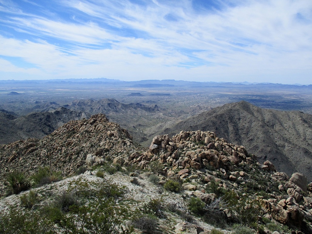
From a distance, Salome Peak is very rocky, with a few brushy slopes interspersed. We could see a way up, but we would have to zig-zag through the rocks. From the base, we angled left and dropped into a drainage, then climbed up this drainage, gaining about 200 feet. This involved a lot of scampering up dryfalls up to about 8 feet in height, but there were always handholds and ledges that made upclimbing easy and fun.
We then came into an opening where it was clear we needed to bail out of the drainage onto the slopes. We found a sloping rock that worked well, then climbed more slopes until coming out onto a higher bench where we had a view of the summit above us. I built some cairns at strategic locations so that we could descend back into the drainage easier on our descent, without having to guess. This was one area where being off route by just a few feet could be problematic.
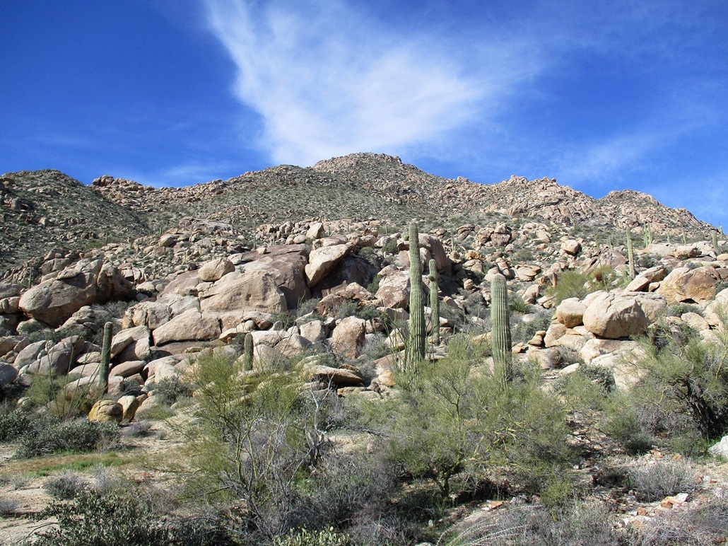
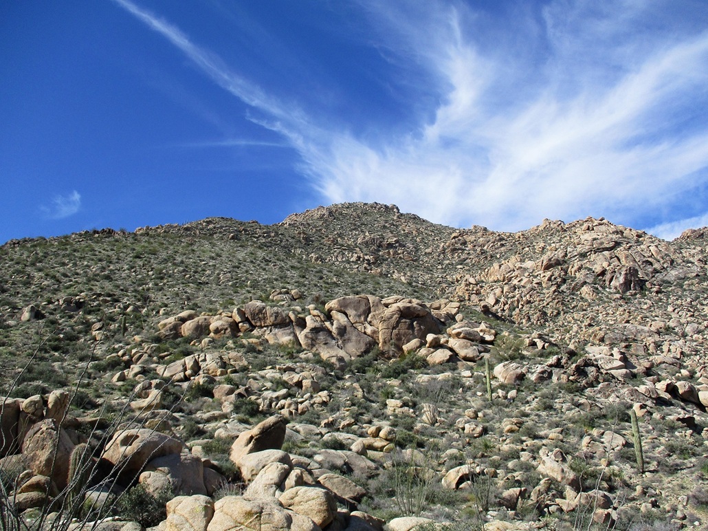
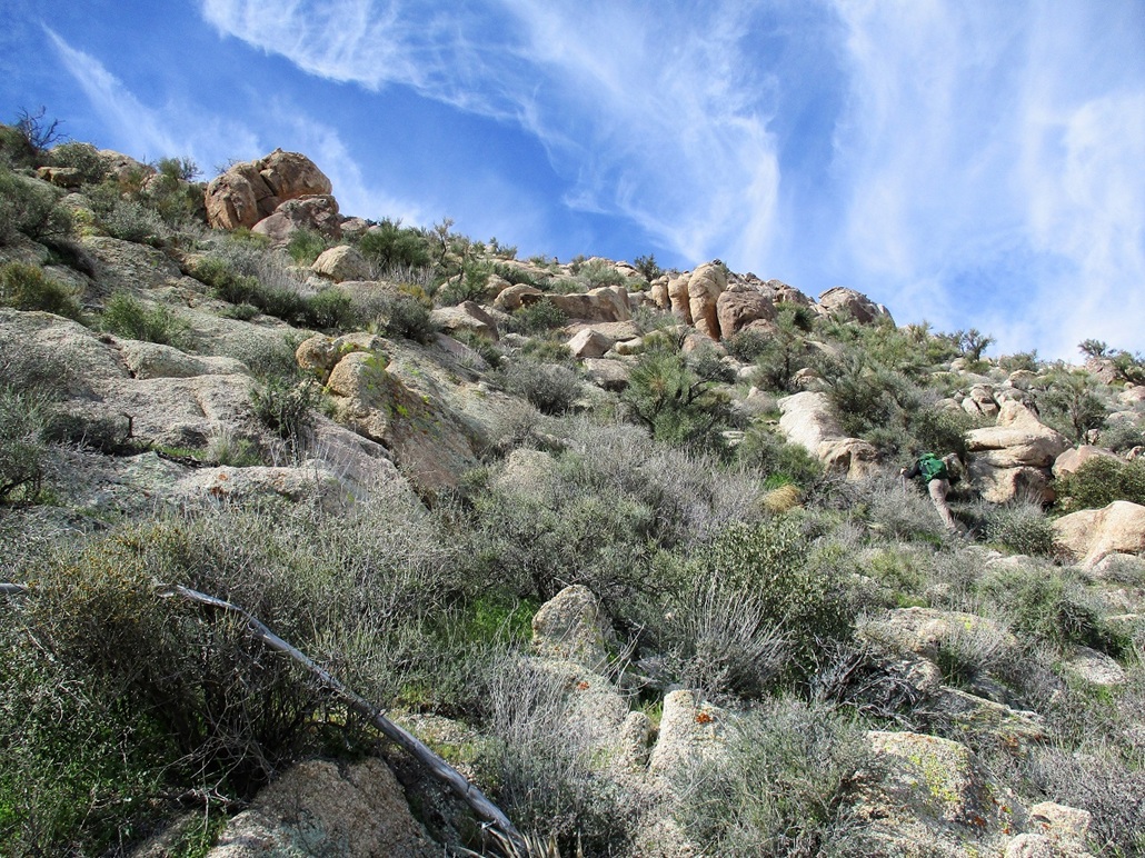
We walked up gentle slopes, walking around the rock piles along the way. We were then on a broad slope that went straight up toward a small knob, elevation 3,380 feet, about a 400-foot ascent. This part went well. It was steep, but the slopes were vegetated, but not overly brushy, and with solid footing. At this knob, we took a break. We still had about 600 vertical feet to go. We could see the slopes would be steeper and much more rocky.
From our rest stop, we walked slightly downhill toward a rock band with an obvious opening through it. We traversed through this opening, hopping from one large rock to another. At one point, one of my bottles of Bai fell out of an exterior pocket of my pack and into a void below. There was no way I was going to retrieve it. Fortunately, the day was still cool and pleasant and I had enough water in my pack.
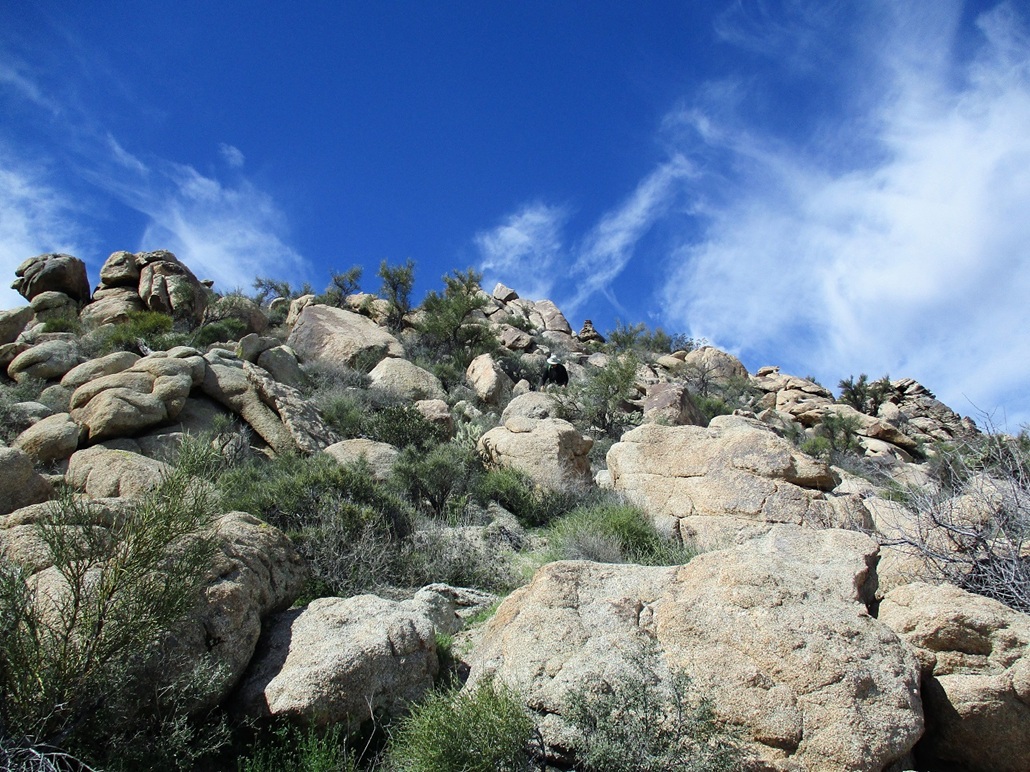
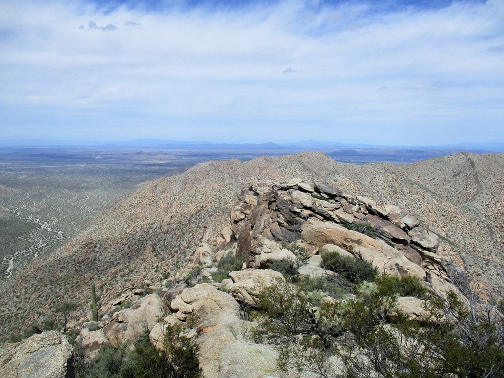
Past this rock band, we started climbing straight up another slope, aiming for a small promontory a little to the left of the summit. We walked up lanes as we found them. Here, the slopes were more gravelly and loose, and the rocks were not always firmly in place. We carefully walked up and angling to the right, now aiming for a dramatic rock outcrop with an overhang that looked like a bird’s beak. We could even see the summit cairn way up on the highest skyline, still a couple hundred feet to go.
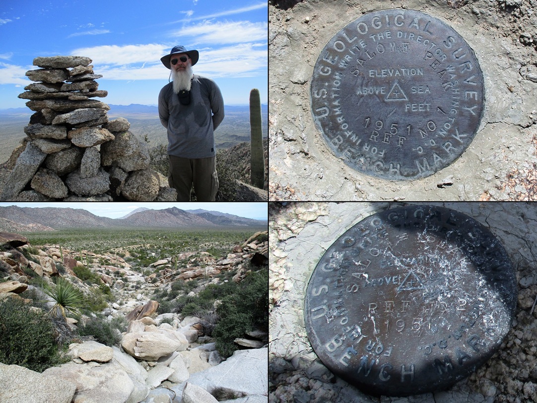
The remainder of the climb was just a matter of finding ways up through the rocks and slopes, trying not to kick things loose or get too caught up in the brush. It went well, and we were on top of Salome Peak at 11:20 a.m., slightly under three hours after starting. From the end of the road to here, we had gained about 1,200 feet in a little over a mile.
The top is marked by a huge cairn about six feet high. We took photos of the surrounding terrain. Harcuvar Peak stood close by across the valley to the northeast. Other notable peaks we could see were Harquahala, Smith, Harquar, Black Mesa, Signal, Whipple (in California), Crossman, the Hualapai Range, Planet and Buckskin. We spent about 30 minutes up here.
The only downside is we could not sign into the summit log. The log held names going back 30 years. A couple guys were up here earlier in the week, but usually, the peak sees one group or person a year, sometimes no one. The pen was out of ink and the pencil had no lead. I was able to scratch in "Scott Surg" on one sheet. Poor Matthias could not sign in, so he does not get credit for climbing the peak. The next visitors should bring along something to write with.
We found two benchmarks, both being reference markers. The apparent actual benchmark may be under the large rock cairn. A rock outcrop about 40 feet away was about as high as the summit. Matthias went over to it, but it wasn’t as high, maybe a foot or two lower. It was breezy up here and a little chilly, so we started down soon.
For the downclimb, we could usually see ways down easier, plus follow our own bootprints and places where rocks had slid downhill. In this way, we roughly followed our "exact" line down. It was more a concern to descend into the lower drainage at the proper places, and those little cairns helped. We took apart the cairns when we exited. We then scampered down the dryfalls and back into the open. By now, there were some people here, having driven in on their ATVs. They were here just to check out the rocks and the little room mentioned earlier. No one was going to the summit.
Some websites say this little room was a temporary jail, mainly because it looks like one, but the Salome website says it’s not. The area here has some archaeological significance. I don’t know what the story is, but I hope to come back someday to explore a little more. Unfortunately, the little room has been slightly defaced with names and dates written in spraypaint, which always baffles me. How do people just happen to have spraypaint with them? Is there a certain demographic that carries spraypaint with them out of habit? I have never had random spraypaint with me or in my vehicle. Otherwise, I suppose I would tag things.
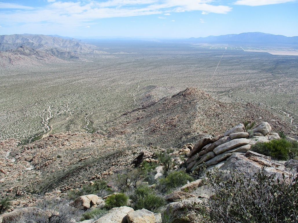
We then walked the 2.5 miles back to my car, arriving at 2:30, a six-hour round trip covering about 9 miles. For the drive out, I decided to follow our exact route we had taken coming in, since it was a known route, plus I could track miles on the odometer more closely. We were back to Salome soon, then back to Dysart Road about an hour later. I dropped of Matthias here and said our goodbyes. I hit a lot of traffic, as there was a race at Phoenix International Raceway today, and everyone was leaving about now. The interstate was clogged all the way into Phoenix. I arrived home about 4:45 p.m..
Neither of us had any idea what to expect before we started our hike, but I think we both agreed this was an especially pretty hike. There were enough rocks to make it interesting but not so many to block us unnecessarily. The slopes were steep but not impossible, and the views were always fantastic. It was also not too long: there were no unexpected false summits to climb over, or bothersome ridgelines to walk. We could see the whole route pretty much the entire way. While I won’t likely climb this peak again, I enjoyed it a lot and do hope to come back to explore the lower rocks some day.
The Roads: I drove a 2017 Subaru Forester which has good clearance and all-wheel drive (note: not the same as four-wheel drive). The AWD handles sand well as I have discovered. The roads in and around Salome and the farm fields were paved or good hard-pack. The track at the west end of 68˝ Avenue was also in good shape. Tank Pass Road was a little sandier, possibly due to being used more often. We saw about four ATVs and a couple Jeeps. The power-line road was also in good shape, if a little bumpy. In dry conditions, it appears any high-clearance vehicle would be sufficient. In wet conditions, the sand could get sticky and there could be big puddles.
I do not know the condition of Tank Pass Road past the turn-off to Salome Peak. Looking at the satellite images, there are other ways to access Tank Pass Road, and I still am not clear where the powerline road leads to, in either direction. Nevertheless, it is always wise to have a shovel or other means to extract oneself, and 4-wheel drive could be useful to have. I would not recommend smaller passenger vehicles on these roads.
|

|