The Mountains of Arizona
• www.surgent.net
|
| O'Leary Peak & O'Leary Lookout |
• San Francisco Volcanic Field • Coconino National Forest • Coconino County |
|
Date: September 15, 2007
• Elevation: 8,938 feet
• Prominence: 1,778 feet
• Distance: 10 miles
• Time: 5 hours and 30 minutes
• Gain: 2,100 feet
• Conditions: Slightly cloudy with breezes
Arizona
•
Main
•
AZ P1K
•
PB
•
Interactive map
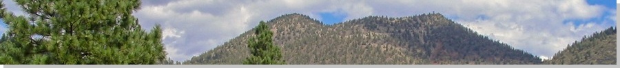
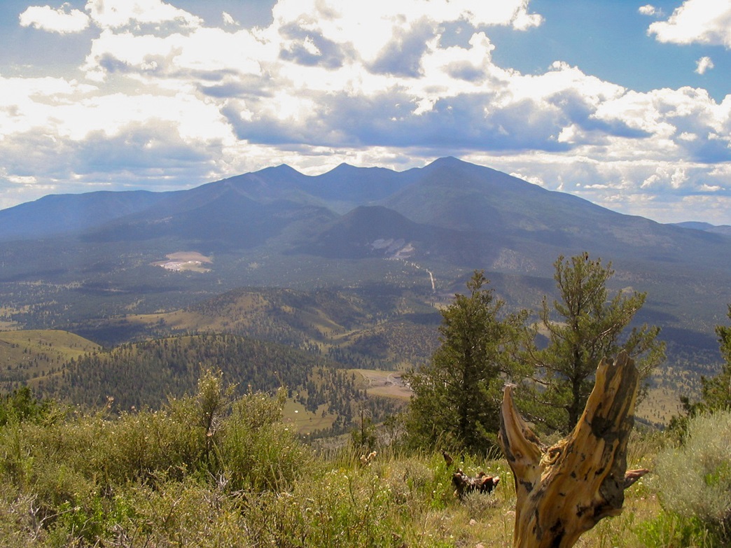
O'Leary Peak rises north of Flagstaff along US-89, a couple of miles east from the highway. It has a double summit, the western one being highest, the eastern one hosting a lookout tower. It is a highly-prominent peak with easy access and a road for a trail, yet far enough from the city so that crowds are minimal. Hikers coming to Flagstaff with a peak on their minds gravitate toward Humphreys Peak, while locals looking for a workout choose Mount Elden.
We left home friday afternoon, planning a weekend in Flagstaff to enjoy the pleasant temperatures and a respite from work and the heat in the deserts. The drive north went well, arriving into town at dusk. We got a hotel and settled in. The plan was to awake early and hike the peak on Saturday, then spend the rest of the day watching baseball and eating diner food. From the hotel, we followed US-89 through downtown (and traffic) for about 15 miles to the Sunset Crater Volcano National Monument turn-off. We went right (east) on the secondary road, then left (north) toward the O'Leary Group Camping Area, about a quarter-mile farther, coming to a gate and parking lot.
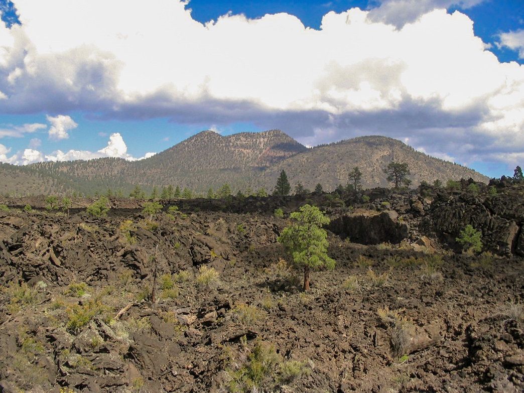
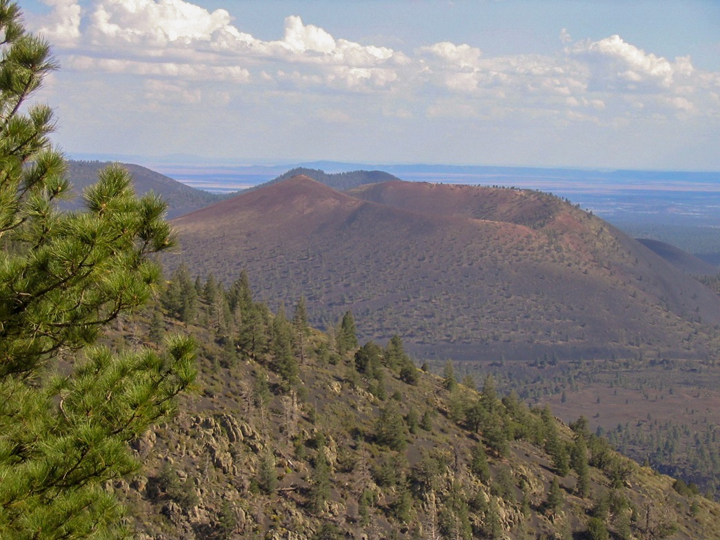
The Sunset Crater Volcano is one of Arizona's most interesting geological features: a cinder-cone volcano that erupted in roughly the year 1065, recent enough so that the native peoples still have oral histories that reflect this event. The Sunset eruption started along a fault, then collected into one main cone, which spat cinders and lava over a wide area. A bolus of basaltic lava breached the cone and formed a flow on both sides of the volcano, forming what is today called the Bonito Lava Flow. Meanwhile, the volcano ejected gajillions of little cinder rocks, which collected over the area and coated many of the already-established mountains and hills with cinders, each about the size of a kibble of cat food.
O'Leary is one such peak, predating Sunset Volcano, but now covered over by the cinders. The cinders themselves are little pumice stones, rough to the touch, and very light. Most are colored black or gray but some have a brown or red tint, creating interesting mosaics on the hillsides. The forest has been able to re-establish itself on the cinder slopes, but there still exist many areas that are essentially cinder deserts. When laying on level ground, the cinders form a soft bedding of rock, which makes for easy hiking. On a steeper slope, they are dreadfully loose and difficult to ascend.
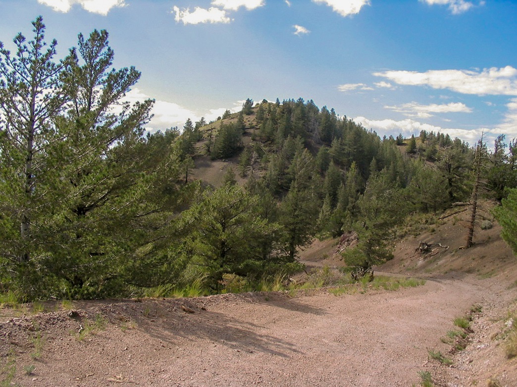
Sunset Crater Volcano National Monument covers about six square miles, mostly centered around the main volcanic cone, which rises a thousand feet above the terrain. O'Leary Peak is about three miles northwest of the Sunset Crater Volcano. A road switchbacks up to the summit, servicing the lookout tower. The route to the top of O'Leary Peak follows this road, which is smoothed over with the countless cinders. A long section of the road fronts the western extent of the Bonito Lava Flow.
The small parking lot holds about 8 vehicles. When we arrived, all spaces were filled and another half dozen cars were backed up, parked along the shoulder. We found a spot out of the way and got ready. Had O'Leary suddenly become popular? It was a beautiful Saturday morning so I figured that might explain some of the crowd. As we were getting our shoes on, some guy emerged back from his hike, and explained this was all part of a big hiking club. There was one other team of two women who arrived when we did. Other than us and the two ladies, all the other cars evidently were all that one group. We chatted with the guy for a few minutes for information on the route. It was about 10:30 when we started our hike.
From the gate, we followed the road east then north, and dropped about 40 feet elevation. Within minutes, we were walking alongside the western extent of the Bonito Lava Flow. The flow here is about 20 feet thick, a snarl of black rock and peculiar formations. It's mostly barren but a few trees and shrubs have found places to put down roots. Being the funny guy I am, I commented how fortunate it was that the flow stopped just short of the road.
We made good time for the first mile and a half, which is mostly level. The forty-foot elevation drop is offset by a slow and easy gain up the south slope of O'Leary Peak, following the road. We took a break after 45 minutes. By now, we had left the lava flow behind, although we were still walking in the cinders. From here to the top was five or six long switchbacks.
However, as we hiked up the road, the gradient was slight enough and the cinder footing soft enough so that she was feeling good to go. We stopped for another break about a quarter-mile short of the aforementioned saddle, at which time a lady rumbled down in her truck. She was a lookout worker, up helping the regular O'Leary lookout man move out for the season. We had a friendly conversation with her. She was amazed anyone would want to hike the road. We were enjoying ourselves and having a good break. The weather was getting interesting, with a dry front moving through the region, bring clouds and a stiff wind.
We pushed on until it felt right again to take another break. At the saddle, the road is gated, but it was easy to get by it and to continue our walk. The road became steeper here as well, and much more tight with the cliffs. A lot of erosion was taking place along the outer edge of the road, and in a few places, we crossed rock slides of varying size. We also noted, interestingly, a sudden and dramatic change in the nature of the rock. We lost the cinders and came upon regular hardpack dirt and rock, presumably O'Leary Peak's "real" underlying rock.
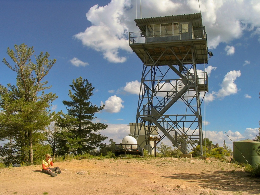
We took another break at one of the last bends in the road, then worked our way to the top saddle, connecting the summit with the lookout tower to the east with the actual highpoint to the west. The summit with the lookout is 8,916 feet, while the highpoint is 22 feet higher, at 8,938 feet. From the saddle, the highpoint is about 160 feet higher. I dropped the pack and said I would run up to the highpoint, then come down and walk up to the lookout to meet βð there.
My little side journey up the slopes was short but tiring. We were back in cinder land, so the short uphill would be a real battle. For every three steps I went up, I lost two, and sometimes three, sliding back down. A few trees and brush patches helped. I followed faint tracks and arrived on top in 10 minutes, figuring my legs actually climbed 300 feet counting all the back-sliding. The top was weedy, marked by a cairn and tree branch. I signed in and snapped a few photographs. I could see βð slowly making her way to the lookout summit.
The descent went fast since the sliding effect was now in my favor, although I got plenty of cinders in my boots. I put on the pack and walked up to the lookout tower. βð was relaxing on bare rock, enjoying the wind. We stayed there about 15 minutes. The one-way hike had taken us 3 hours including rest stops.
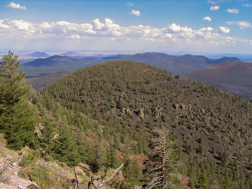
The hike down went quick, with excellent views of Humphreys, Mount Elden, the Sunset Crater Volcano and the eerie landscape of the Bonito Flow. We took breaks and went slow, exiting about 4 p.m. We showered at the hotel and ate at the Galaxy Diner, where we've eaten before many times. We were even treated to a dance-instruction class going on while there. The next day, we drove back to the Monument and went to the visitor's center, plus a drive and very short hikes onto the lava for photographs. Then, back home.
A few months later we received an email from Ms. Kathy Wood, one of the co-founders of the Irish Arizona Project, who happened upon our page and noted the peak was named for 19th-century mountain man and guide Daniel O'Leary. Below is a small biography of Mr. O'Leary, courtesy Ms. Wood:
Born around 1843 in Ireland, "somewhere on the green banks of the Shannen [sic]." ... A letter from Hardyville, AZ, dated September 29, 1867, and published in the Daily Arizona Miner in Prescott discusses the army of the Colorado battling the Hualapai Indians: "Our worthy townsmen, Geo. Spear and Dan O'Leary go as guides; better and more thorough mountaineers than Kit Carson ever was or will be." ... Served as guide, interpreter, and mountain man for military and other endeavors ... O'Leary Pass and O'Leary Peak are named for him.
Ms. Wood and her co-founder of the Irish Arizona Project, Janice Ryan Bryson, wrote a book about the Irish In Arizona, published by Arcadia Publishing. No photograph of Daniel O'Leary exists, so they asked if they could use our photograph of his eponymous mountain, to which we gladly agreed. It's the photo at left, second down in the sidebar. Sadly, Ms. Wood passed away soon after the book was completed. I never met her, but learning of her passing was sad. We wish the best to her family as well as continued success to the Irish Arizona Project and for her and Ms. Bryson's book.
|


|