The Mountains of Arizona
• www.surgent.net
|
| Maple Peak |
• Highpoint: Sierra Aguilada • Apache-Sitgreaves National Forest • Greenlee County |
|
Date: May 13, 2006
• Elevation: 8,294 feet
• Prominence: 2,370 feet
• Distance: 14 miles
• Time: 8 hours and 20 minutes
• Gain: 2,600 feet
• Conditions: Clear and very warm
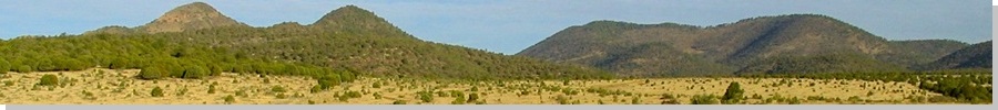
Maple Peak is an isolated mountain in eastern Arizona, with the best access coming in from New Mexico. It's either a stand-alone peak, or the highest point of the Sierra Aguilada, depending on which map you may be reading. Its remoteness keeps visitation to just a few people a year. The current topographical map does not show a trail, and the thought of a long bushwhack to claim it was not appealing. However, the rangers in the Apache National Forest assured me there is a trail to the top. With that, I made this peak a primary goal for our short May trip to the region.
We left our home the day before and drove through Globe and Safford, entering New Mexico and driving through Glenwood and into Alma, where we took a series of decent forest roads into the highlands toward a place called Smoothing Iron Camp. The drive covered 280 miles and went without mishap. We found a nice camping spot in a glade of trees at Smoothing Iron Camp, which is a single residence. Apparently, the land here is split between the Gila National Forest and private inholdings. The residence sat within one such inholding. We arrived around 6 in the evening, and were about a quarter-mile from the residence.
We set up camp and sat around, and not long later, a father and son came riding up on their horses. They live at the residence. They had no objection to us camping where we were, saying they get hunters here often. When we told them of our plans, the father warned us about the wolf and bear population up in the canyons we'd be hiking, and asked if I had a "peestole". I said I did. Meanwhile, The son, about age 7, amused himself by roping various things, including me, with his lariat. They were friendly and soon were on their way.
From Smoothing Iron Camp, the presumed plan was to drive a chunky dirt road another couple miles to a gate on the Arizona-New Mexico border, then hike from there along old road and a trail in Snare Canyon about 2.5 miles to a ridge, then from there, hike north along meandering trail to the summit. It looked like a logistically easy hike, about 10 miles round trip and about 1,800 feet of gain. I daresay I may have felt a little too confident.
The night was pleasant, highlighted by a full moon. We awoke at 6 a.m., but B. felt rotten. We sat for an hour, but ultimately βð decided against the hike and offered to stay back at camp. I felt bad that she would not join me, but appreciative she would let me go in solo. However, the new plan came with a price. First, it made sense to leave the truck with βð at Smoothing Iron Camp, since it was such a pretty locale with plenty of trees. This meant I would need to walk the road to the state line, adding a couple miles each way. Suddenly, my 10-mile hike had ballooned to 14 miles. Secondly, I didn't get started until 8 a.m. The day was going to be warm. Although it was pleasant now, there was no chill to the air. Nevertheless, I packed a lot of water, some food, my peestole (a Rossi Arms .44-calibre 5-shooter revolver), and started the hike.
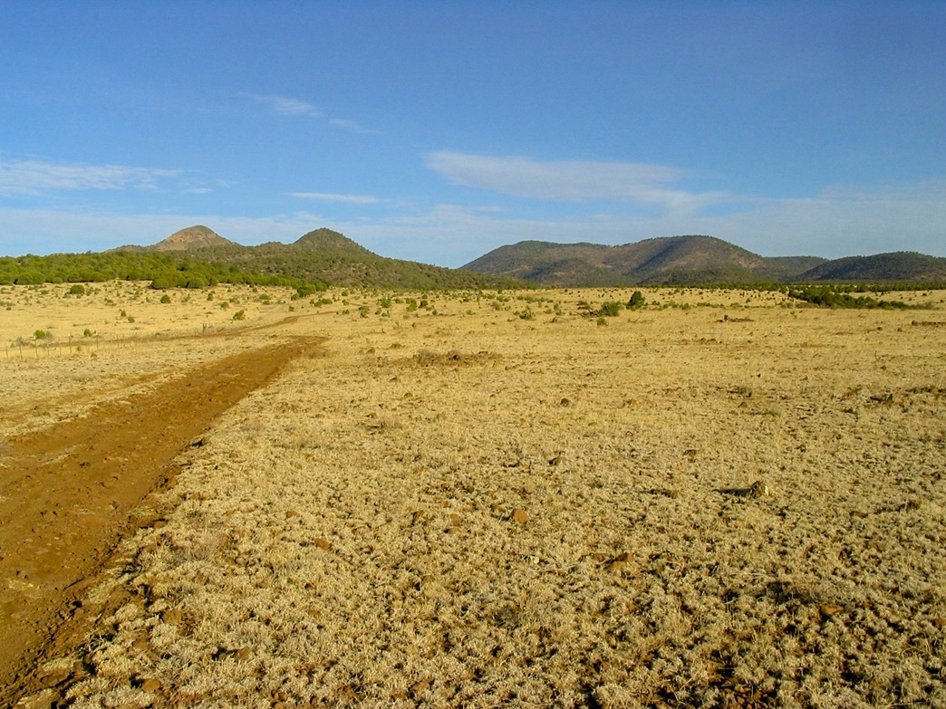
The hike to the fence line went quickly, and some cattle were milling there but moved aside as I came up. Past the gate, I walked the remaining road another half-mile to a wide cleared area with fire rings. It looked like an ad-hoc camp used by hunters. So far, so good. But here, I lost any sense of the trail. I tried some paths but they'd run a hundred feet, then peter out. The map showed me about 200 feet above Snare Canyon, but no path to get there. I tried a few things but nothing seemed right. Finally, I bashed through a drainage into Snare Canyon, hoping for the best. It worked, and I found a good foot-path here. I was back on track, but my futzing around up there had cost me about a half-hour, and had put me behind schedule.
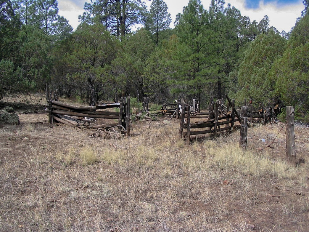
I walked up Snare Canyon, passing a couple corrals and meadows. Soon, the canyon started to close in, and rounding one bend, I spooked a black bear who was wallowing in a spring about 300 feet ahead of me. He bolted for the woods when he heard me, which was good, for him and for me. I was spooked, but didn't want one bear encounter to drive me from my hike. One bear, I can go with that. Two bears, then yes, I'd turn around. But to hedge my bets, I loaded my gun and holstered it to my belt. As I walked up the canyon, I clapped, shouted, banged sticks and made as much noise as I could. I saw no more bears, but moving slow as I did put me even more behind my schedule.
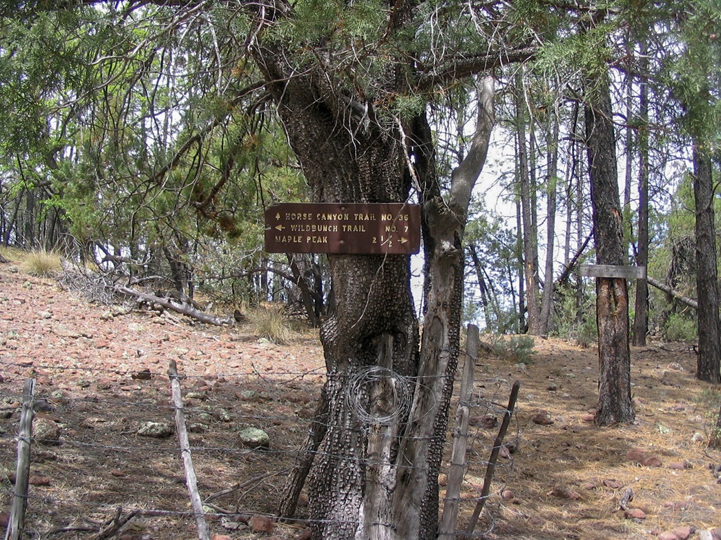
The remainder of the walk to the saddle above Snare Canyon went fine. The canyon opens up again and the trail grows faint. The final approach to the saddle was along very gentle gradients, and I arrived here soon enough, having covered 4.5 miles with about 1,000 feet of gain. A sign pointed the way to Maple Peak, still 2.5 miles distant. I didn't take much of a break, and kept moving.
The hike now trended north along an old, faint rubbly trail hewn into the grassy and brushy hillsides of the Maple Peak massif. The trail made long switchbacks and grew faint in places, causing me to get off route a couple times. I tried to keep a good pace, and soon, I had gained about 500 feet to put me in some more wooded sections with shade. I was on the east end of the summit ridge, and for all intents and purposes, the trail ended in a glade of large ponderosa.
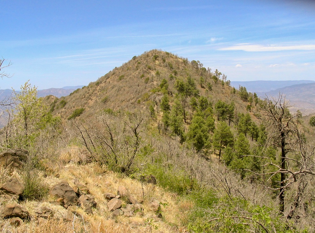
I angled sharply uphill and found pink surveyor's ribbons tied to tree branches. Most of the time, I traveled up-slope by my own reckoning, achieving the ridge, with Maple Peak still hidden from view. Next, I followed scant paths through woody downfall, brush, rocks and crud, coming to a highpoint along the ridge, where, for the first time, I had a view of Maple Peak, a conical summit, covered in brush, about a quarter-mile away. I had to descend a small saddle then ascend the opposite side to achieve the summit, which I did about 1 p.m.. The log held just a handful of names, all of which I recognized as friends and acquaintances, averaging out to about one or two visits a year. The views here weren't that great and the whole place was kind of a let-down. It was hot, and I needed to be moving back. I didn't stick around much at all. Once I signed in, I basically turned around and started the walk out.
The hike back to the saddle above Snare Canyon took an hour, and I was feeling reasonably energetic, so I kept moving. It was now 2 p.m., and that's what time I had told βð I would be back by. Clearly, that wasn't going to happen. She knows me well enough to automatically add an hour to whatever time I tell her. Still, I did not want to waste time or scare her, so I kept moving, keeping as quick a pace as possible.
Unfortunately, I had to slow my pace one I entered into the narrow parts of Snare Canyon, so as not to spook a bear. I took this stretch slowly, made noise and moved carefully. In time, I had emerged from this narrow section. I passed those corrals I had seen coming up, and sensed I was near where I had dropped into the canyon earlier in the day. I got a little lucky, finding a path here that led uphill back to that gate on the state line. It was about 3:30 p.m. and it was hot, into the mid-90s.
From the gate, I still had two miles to walk. I was beat and worn down by the heat, trying to move as fast as I could under the conditions. I arrived back to camp about 4:30 p.m., then saw βð, who had been pacing the area, trying to find highspots from which to view the trail to see if she could see me. She was very concerned and upset, but not angry. I told her what had happened, and felt terrible about scaring her as I did.
She had told me that when an hour had passed, she got concerned enough that she actually hiked to the state-line gate, then back to camp and to that residence, but no one was in. All she could do was wait and hope. When I came back, I plopped into a camp chair and drank a gatorade, plus more water. I was very dehydrated, and needed about a half hour to recuperate. She certainly had a right to be concerned. We packed up camp and found a hotel for the night in Reserve, New Mexico.
The hike was not difficult, but it was long and I had a few delays that put me off schedule. The day was quite hot, too, and ultimately, I did not have an enjoyable day. It was a chore to hike this peak to tick it off my list. I'm glad I did it, so I don't have to come back, but the other factors were enough to make the day less than ideal. Others have hiked this peak using different routes or in nicer conditions. Basically: don't do what I did.
|

|