The Mountains of Arizona
• www.surgent.net
|
| Madera Peak |
• Pinal Mountains • Tonto National Forest • Gila County |
|
Date: July 10, 2019
• Elevation: 6,647 feet
• Prominence: 407 feet
• Distance: 5.5 miles
• Time: 3 hours and 45 minutes
• Gain: 2,500 feet
• Conditions: Clear with blue skies, warm temperatures
Arizona
•
Main
•
PB
•
LoJ
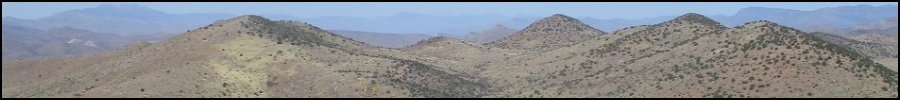
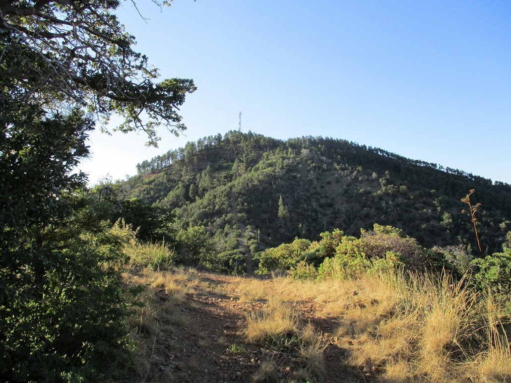
Madera Peak is the north-most peak of the Pinal Peak massif, essentially a bump along the long northwest-trending ridge that comes off of Pinal Peak. A communications tower stands atop a slightly-lower subpeak and is visible from below along US-60 in Miami. This tower can be accessed via a decent dirt road from the Pinal Peak side, or from a steep and eroded track from far down below on its north side.
I wanted a hike after not doing one for a month. It is very hot in the deserts right now, so a desert peak is out of the question. I did not want to drive two hours to the high country either. This peak, with a summit at 6,647 feet and a trailhead at about 4,500 feet, promised to have moderate temperatures. Furthermore, I would be following a road the entire way, meaning no cross-country bush-whacking necessary. I did not want to be dealing with snakes, either.
To increase my chances for success, I also planned to be hiking as close to dawn as possible, when the air temperatures would be mild for at least a couple of hours. I awoke at 2:30 a.m.and was on the road by 3:30 a.m., traveling east from Scottsdale via US-60, arriving into Miami a little over an hour later. Miami is the small "suburb" west of Globe, home to old-time buildings and the massive open-pit copper mine, which lies north of the town. Madera Peak lies south.
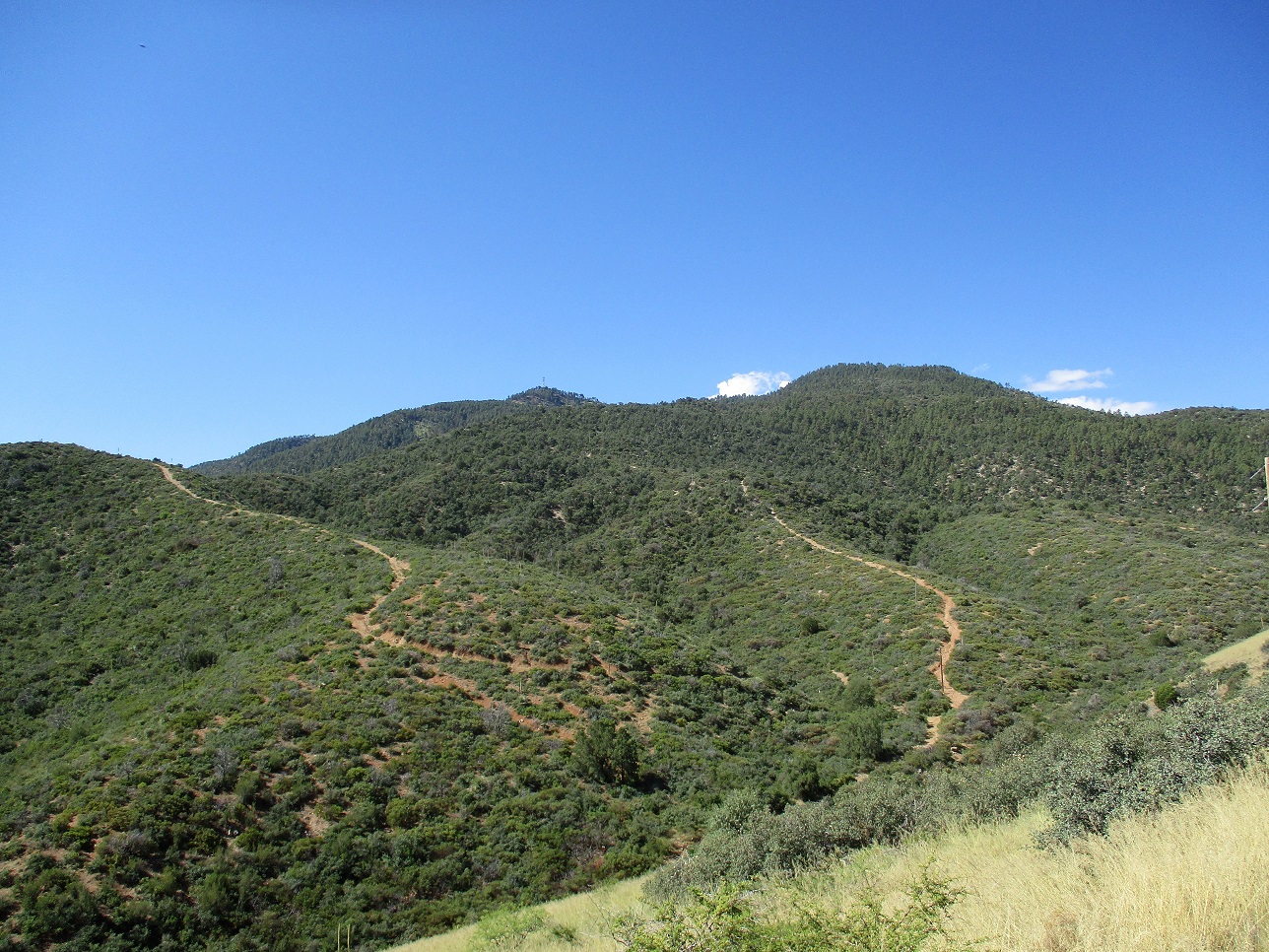
The trailhead is near the Warnica Springs Campground, run by the Tonto National Forest. I had a detailed street map of Miami, following Adonis Road south, then up hills and a couple turns to Cherry Ridge Road. Pavement ends a little farther up. It was still dark so I drove slowly. I went right at one unsigned junction, then stayed straight at another junction, a left going to "Jones Ranch".
By now, I was on Forest Road 906. The road is good, but narrow. I drove at 15 m.p.h. and at 5 a.m. exactly, came to the trailhead, where old Forest Road 580 splits from FR-906. There is a Warnica Springs Campground sign here, but the actual campground is still a short ways ahead. I backed into a clearing below a hill, elevation 4,520 feet. From US-60 to here, I covered about 8 miles and gained about 1,200 feet. In dry conditions, this road is passable by all vehicles, but I would not recommend to bring a large trailer up here. I had with me a trip report of the hike from the Hike Arizona website, so I knew what I was in for.
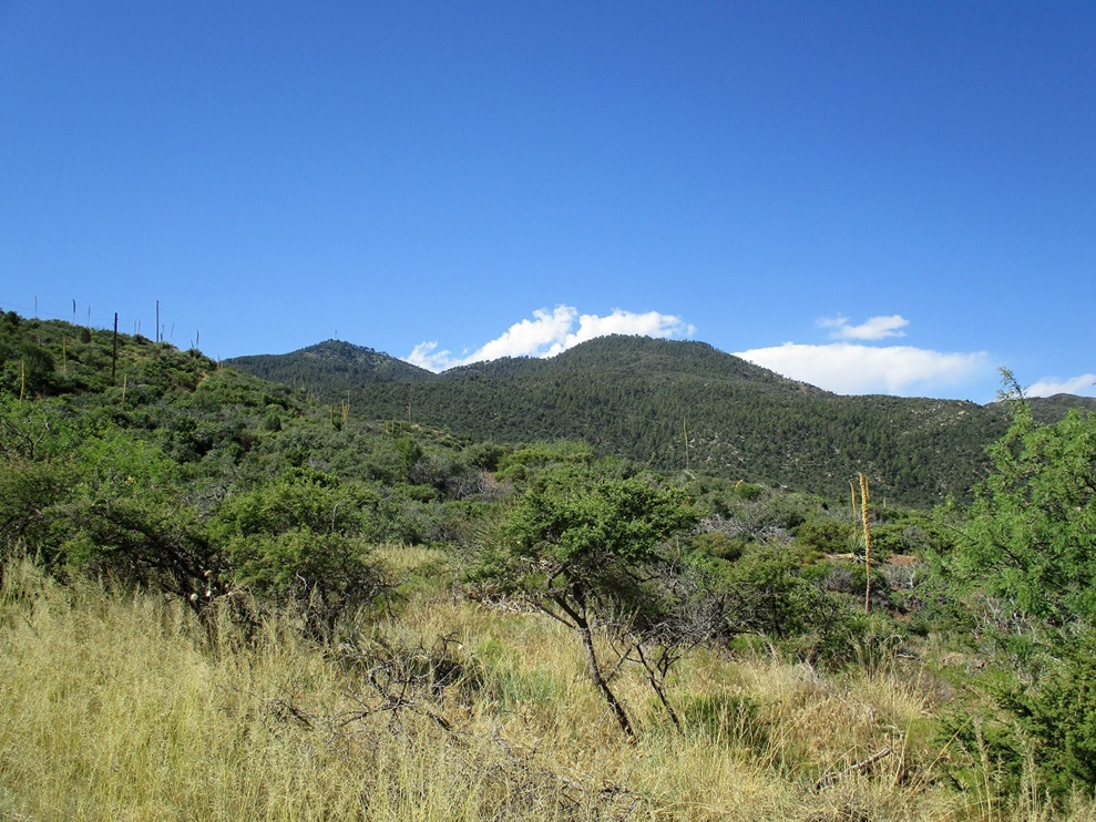
I got my boots on and my pack together and started walking at 5:15 a.m.. My car's temperature gauge said the outside temperature was 73 degrees, which was a little warmer than I was hoping for. The sun was still below the east horizon, lighting the sky in beautiful orange and lavender colors. I was traveling very light: I had 3.5 liters of liquids including two frozen waters, my trekking poles, my hat and camera. I wore just a pair of shorts, stuffing my shirt into the pack. Even after 5 minutes of hiking, I was sweating. While it was cool outside, there was no chill. Forecast highs for Globe today was 105 degrees, and 112 down in the deserts.
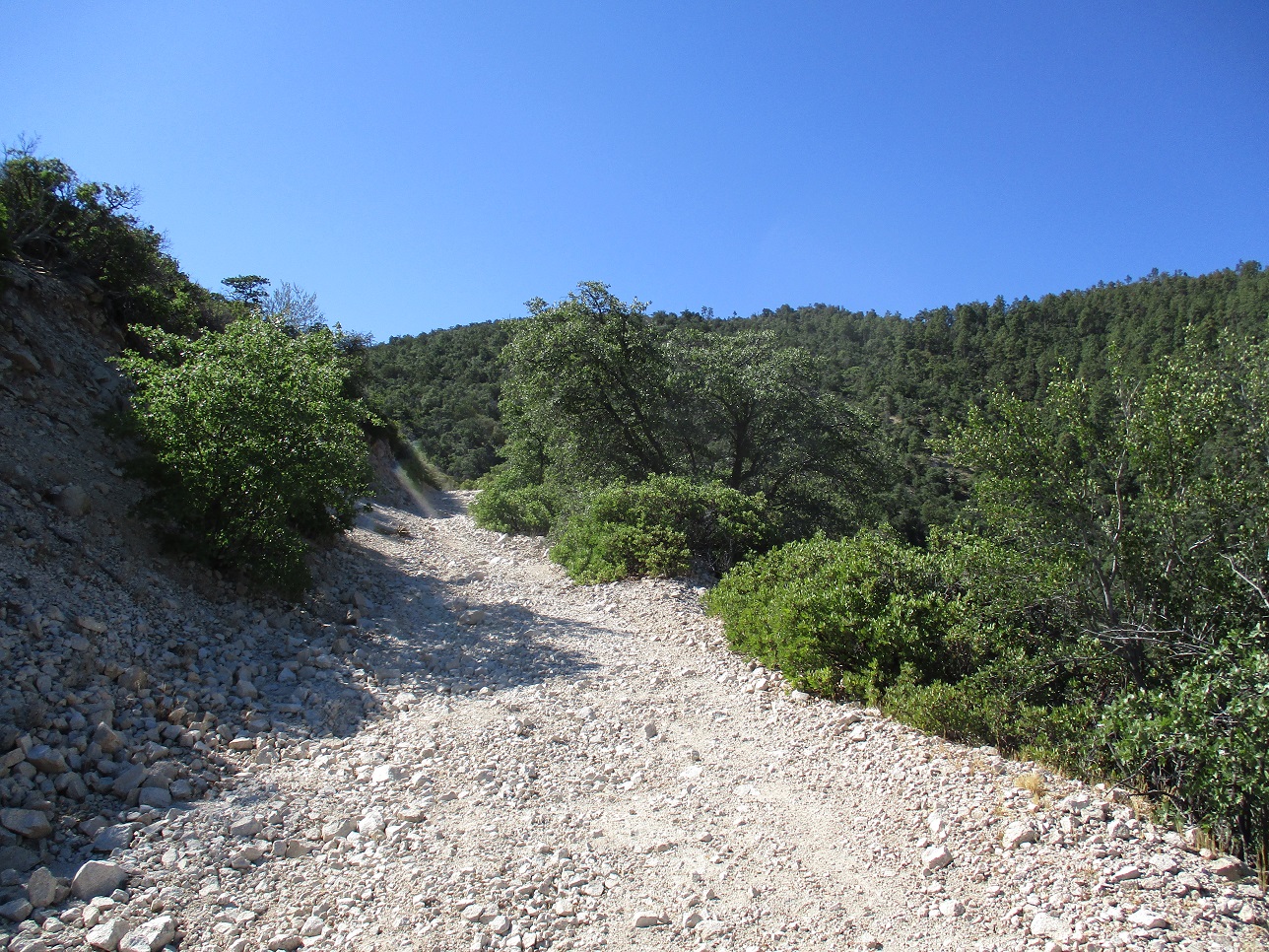
I started up old FR-580. It was rubbly but wide, with ruts and erosion channels of various sizes and depths. Not many people drive it but some do. A quarter-mile in, I came to a split and stayed left. The road then wanders through the thick scrub, always a bit steep and occasionally very steep. It meets some power lines that service the tower up above. At times, the road would parallel these towers and other times wander away from it. There was no trick to this. I moved fast and took advantage of the unrisen sun to put in a few hundred feet of vertical gain. Once the sun rose, I could feel its warmth, but then, I caught a break: it was then occluded by a bank of clouds far to the east. This would give me about another half-hour of shade.
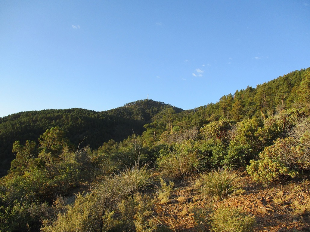
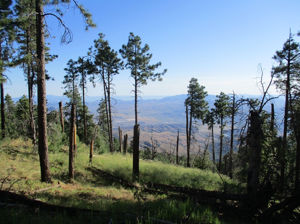
A little over a mile in, I had gained about a thousand feet. The flora transitioned into woodier manzanita and some small trees. The road grew more eroded by degrees to where I would think it unwise to bring up a vehicle this far. At about the 5,500-foot level, the road then starts a very steep push, nearly straight up, a 700-foot gain that ends at the high ridge above, with a small hill, elevation 6,239 feet, the first destination. Madera Peak and the communication tower peak were visible too.
By now, the sun was out and it was warming up, but higher up, it was still "kind of" cool. The bigger trees started at about the 5,800-foot level, offering plenty of shade. This steep segment went slowly but was not difficult. I kept moving until I found a nice place to sit in a shaded spot for my first break, elevation about 6,000 feet. To here I had been hiking about 90 minutes and had gained just under 1,500 feet.
Resuming my hike, I marched up to the first hill along this ridge, elevation just over 6,200 feet. There is a 70-foot drop, then another easy incline to top out on Hill 6,239. Up ahead was the communication tower and the hump of Madera Peak behind it. But first, I had to drop a hundred feet to about 6,140 feet, then tackle the last 500 vertical feet to the top.
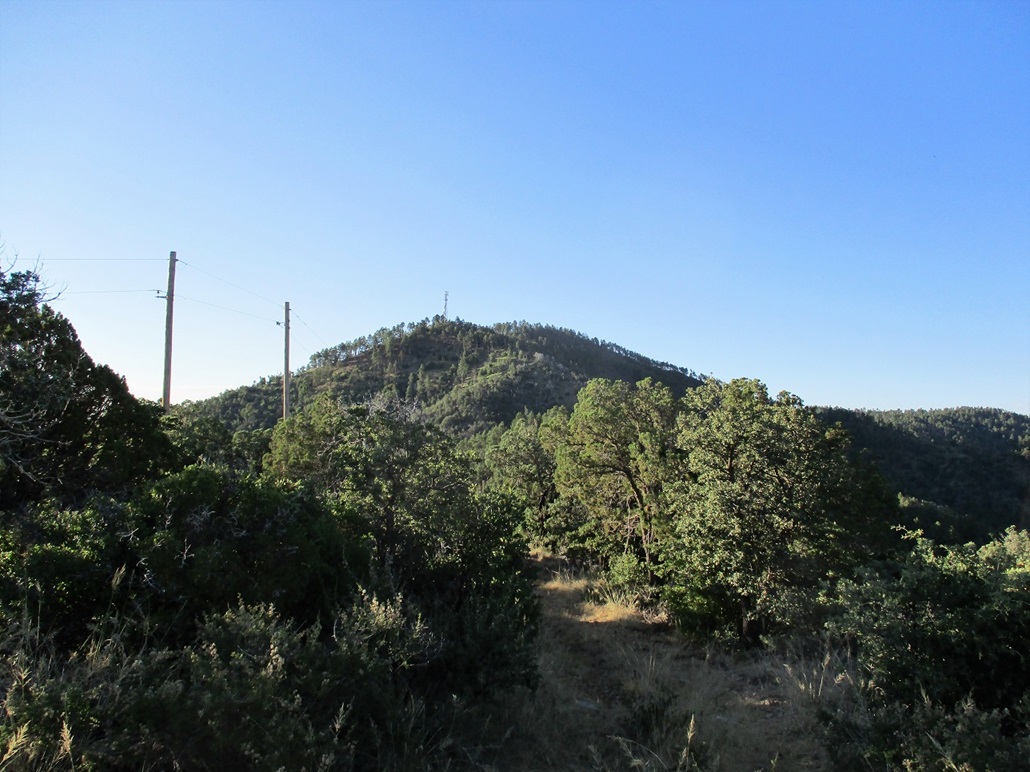
This segment was absurdly steep. This entailed a 500-foot gain in about a quarter-mile. Doing the math, that's pushing a 40% gradient. The road just went straight up and was covered in loose gravel. I was able to lean into the slope and grunt up it but more than once my feet came out from under me, or I slid back a couple feet. Hiking alongside the road in the forest did not seem better, as it was equally steep and somewhat thick with branches and other barriers.
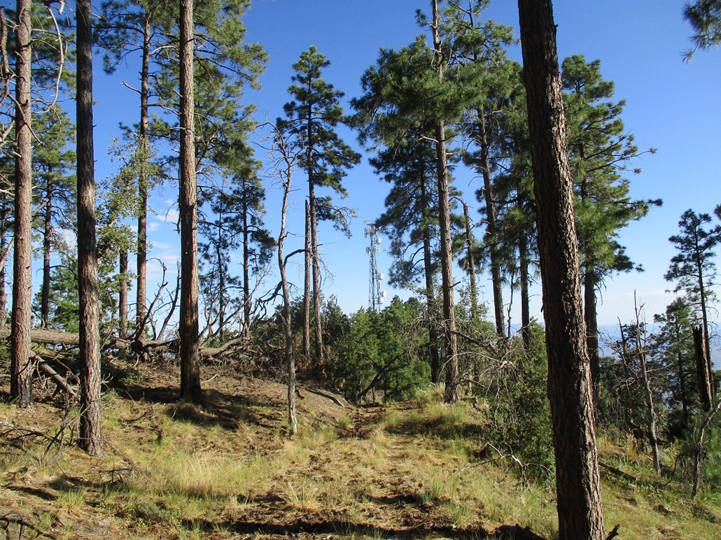
This road then makes a soft turn right, then one last turn left. By now, it should not be rightfully called a road any more. One segment was essentially a small cliff, where the underlying rock was exposed, forming steps and ledges. Getting up really wasn't a challenge, but I would not ever bring a vehicle to this part. No way. Anyway, past this, I was soon to the communication tower, then past it and to the summit, arriving there at 7:05 a.m..
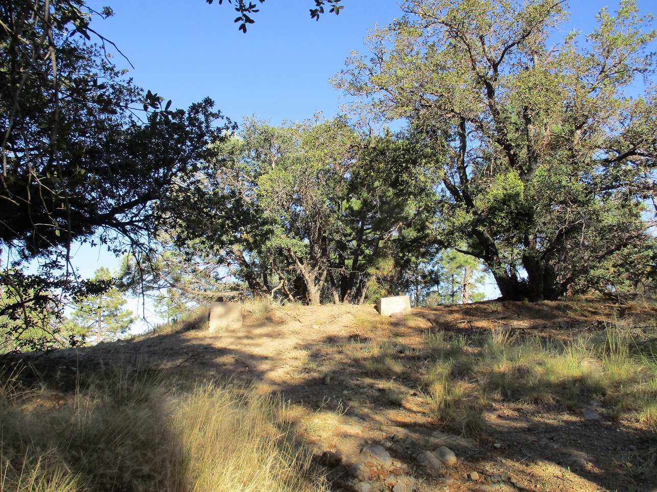
The top once held a lookout tower but today, only some concrete footings remain. It was kind of broad and non-descript. There was a fire ring nearby, but no register anywhere. I took a small break to drink and have a snack, but did not stay long. Up here, it was pleasant, temperature about 65 degrees. However, I knew it would be warming fast down below.
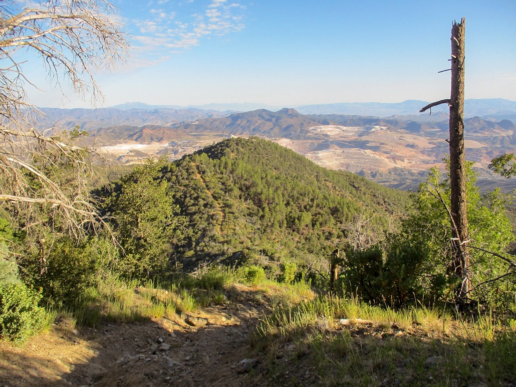
As I hiked down, there were some spots with fantastic views down below, some looking east and some north, plus a few views of Pinal Peak to the south. My first challenge was to scoot down the thing once called a road. It was really steep, but I went slowly and stayed mainly within whatever erosion ditches I could find. I challenged myself not to fall, but I came close many times, suddenly "skiing" on that small scree.
I was able to scoot down that steep potion, then up and over the two hills. I then stopped at the same spot I had coming up for another break. My intention was to hike out the rest in one push. This I did, just moving carefully down the steep segments and enjoying the views. I was in no hurry and kept a casual pace. I did not see much wildlife but did scare a couple deer, plus passed by one bush humming with bees. I saw no snakes.
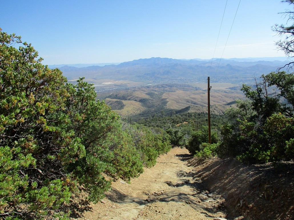
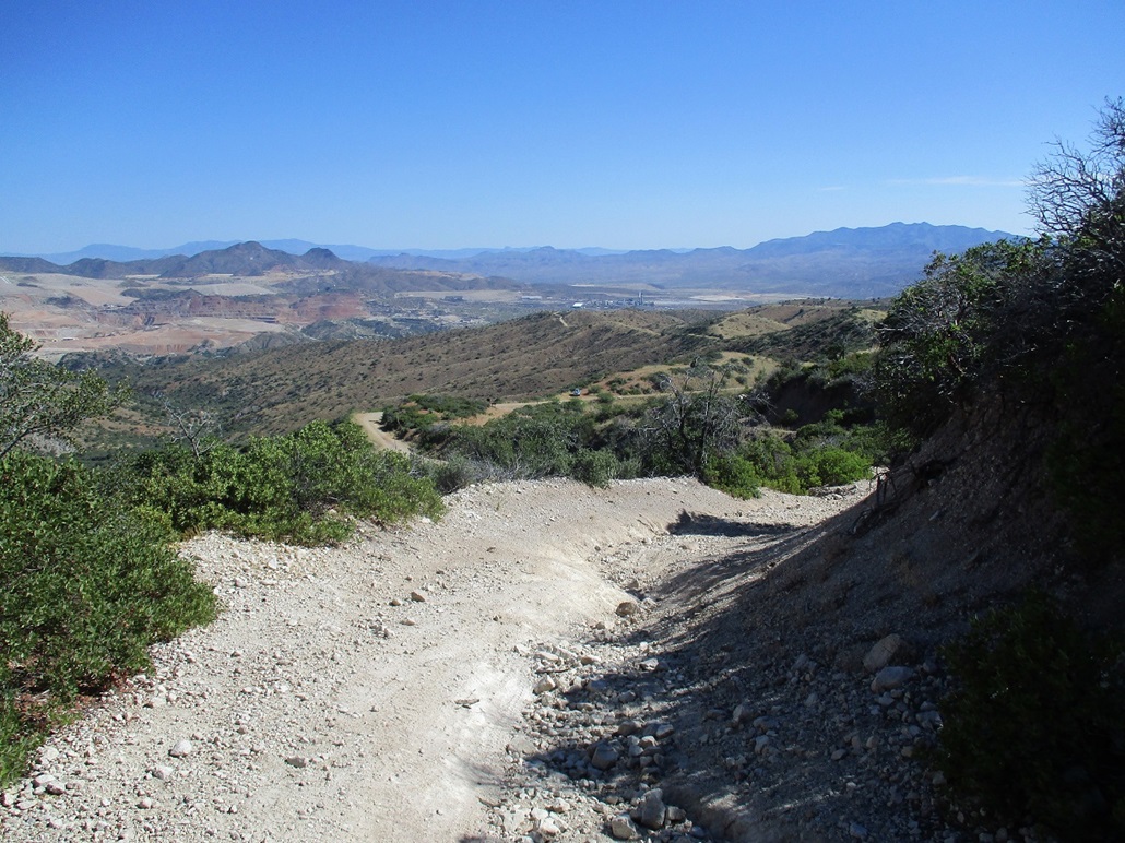
I was back to my car at 9:05 a.m., by now very warm. I changed into dry clothes and got situated for the drive out. My car's gauge said it was 94 degrees outside now. I slowly drove down the road into Miami, but stopped for photographs and to admire the views down into Miami and the big pit mine across the way. Whatever your opinions may be of such mines, they are impressive to view. Once in Miami, I stopped for cold drinks and texted my wife, then just drove straight home, arriving a little before 11 a.m..
I enjoyed the hike but needed to take advantage of any bit of leverage I could. Starting at dawn was wise, and that cloud bank was helpful to keep the sun from blasting me for a little while. I went through all my liquids and could have used another liter. I was happy to get in some vigorous exercise and get out of the desert for a half day. That being said, I would recommend to hike this route when things are more sedate, e.g. in mid-Fall or Spring, or winter if things are dry. It's a steep hike wih nice views.
|


|