The Mountains of Arizona
• www.surgent.net
|
| Peak 4236 |
• Saguaro National Park • Tucson Mountains • Pima County |
|
Date: April 22, 2025
• Elevation: 4,236 feet
• Prominence: 356 feet
• Distance: 5.4 miles
• Time: 2 hours, 10 minutes
• Gain: 1,460 feet
• Conditions: Warm, clear and pleasant
Arizona
•
Main
•
PB
•
LoJ
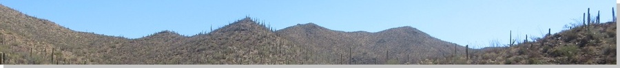
This peak lies south of Wasson Peak in the Tucson Mountains within Saguaro National Park. It rises south of the King Canyon & Sweetwater Trail junctions, which meet at the high saddle below both peaks. A trail to the north takes one to Wasson Peak's summit. There is no trail to this peak's top, but the off-trail hiking is short and not difficult.
Today being a Tuesday, I was on my way to Tempe. The weather was warm but nice, highs in the deserts only in the high 80s, with sunny and clear skies and very low humidity. With an early start, I could take advantage of the morning coolness and be down before things started to get too warm.
I left Bsibee a little after 6 a.m. and was in Tucson about 90 minutes later. I followed Speedway Road west, up and over Gates Pass, then down into the open desert, following the main roads northwest toward the Arizona-Sonora Desert Museum. The King Canyon Trailhead is across the road, barely outside the National Park boundaries. I pulled into a space at 8 a.m. and got myself properly packed and attired. I started hiking at 8:10 a.m., sunny and a little warm, 75°, but with some shade for now as the sun was still low in the east.
The King Canyon Trail has two branches, the lower one staying within King Canyon itself, and the upper one following an old road, paralelling the canyon. My last (and only) time here was in 2006, when my wife and I climbed Wasson Peak. I recall we stayed low at first on the hike in, then scampered up to the road, and on the hike out, stayed low the whole way. For this hike, I chose to stay high.
The road was wide and pitched at a lenient grade. It was rocky, but a smoother hiker's path had naturally developed within the roadbed, and I followed that. I passed a couple early on but did not see anyone else for this segment. The trail then drops about 60 feet, meeting the lower trail near the Mam-a-Gah picnic area. This was 0.9 miles in, said the signs.
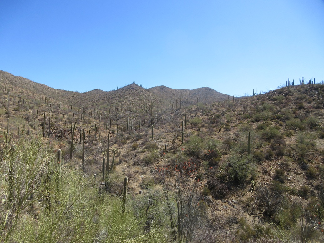
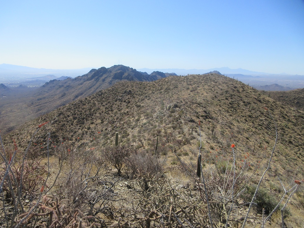
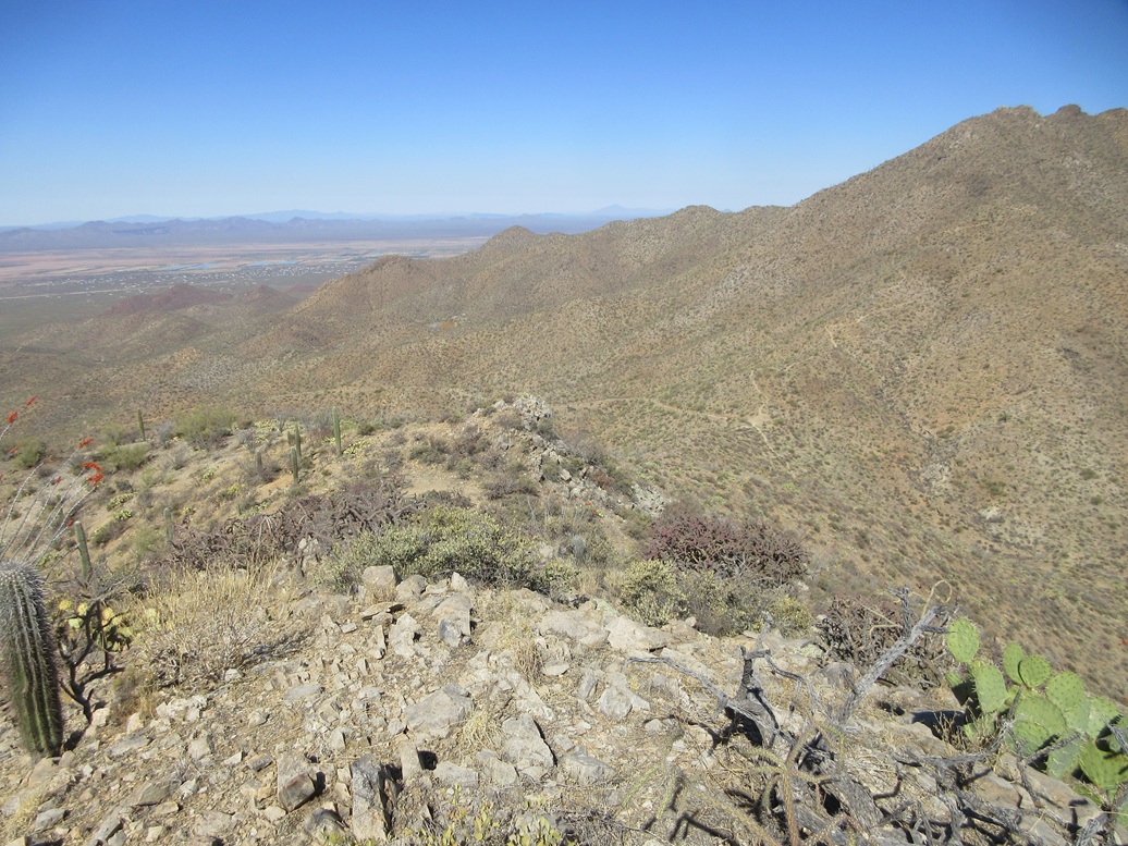
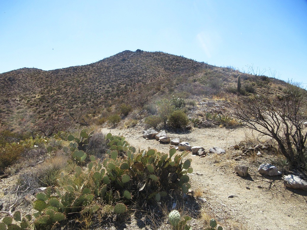
I stayed on the trail as it aimed up the sandy canyon bed, but shortly, it angled right and up a steeper segment with rocks forming into steps. The trail here is now a proper trail, just a few feet wide but nicely maintained. I encountered one hiker on this portion. The high saddle was up ahead, and Peak 4236 visible to the right ... and, of course, much bigger Wasson Peak visible to the left.
I arrived at the saddle, 2.3 miles from the trailhead going by the signs. There were a couple groups here, one just getting started up the trail to Wasson Peak, and another couple having a rest on the sitting rocks. Me, I followed a blocked-off trail going south until I was out of sight. I was wearing shorts for the trail hike, but wanted privacy to put on my hiking pants for the off-trail segment.
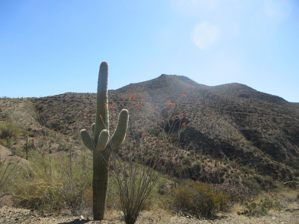
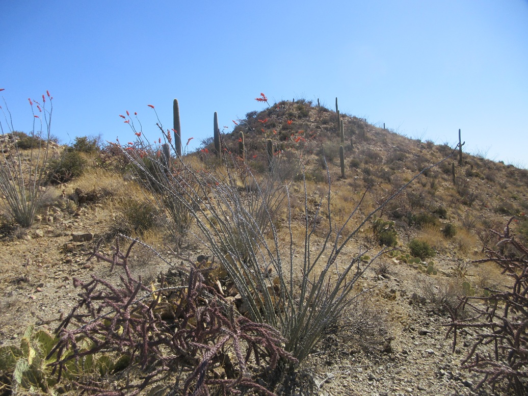
The off-trail portion runs about 0.4 mile to the summit. I found a slope and scampered up it. The brush was light and spread out, and almost no grass to block views of the ground. It was warm enough for rattlers to be out and I wanted to keep an eye out for them.
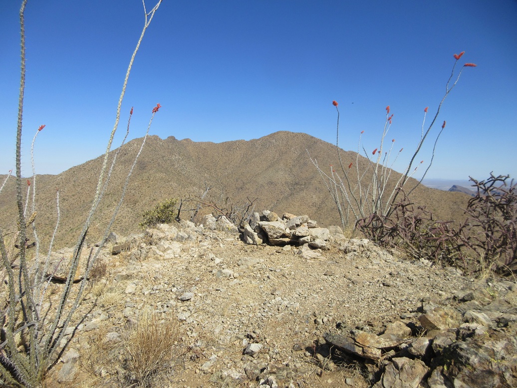
I followed lanes as I found them, going steeply uphill toward a rock outcrop, then passing it on its right, with the main summit rising just behind it. I was on top the peak at 9:20 a.m., a 1-hour and 10-minute ascent hike covering about 2.7 miles. I had gained over 1,400 feet and the air temperature was cooler. When a breeze would pick up, it felt refreshing.
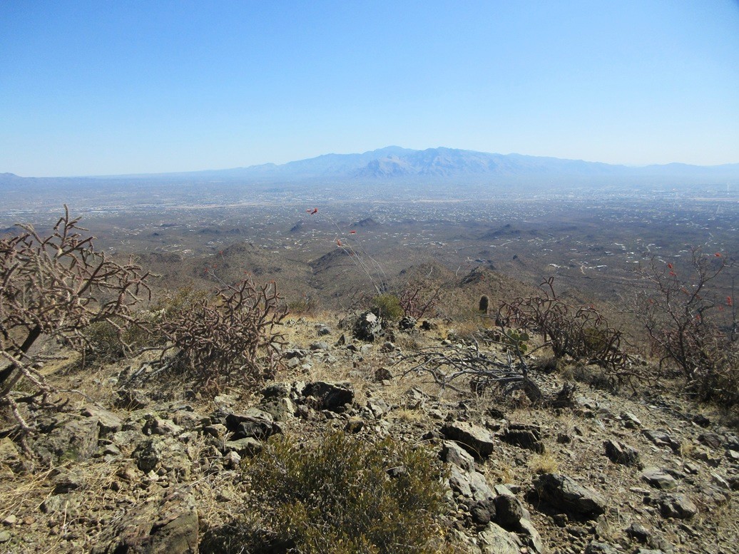
The top has a rock pile and the remnants of a register within it, now just scattered pieces of plastic and business cards. I did not bother to sign in. I took some photos, and spent just a minute looking around. I was happy to make the top and enjoyed the fine views, especially that of Wasson Peak.
I hiked down the slope back to the saddle. At this moment, it was just me, so I changed back into hiking shorts here, plus had a proper five-minute sit-down break and something to eat and drink.
The hike down went very well, with lenient grades, a well-tended trail and gravity assisting me. I encountered more hikers coming up. At one point, a rock rolled from under me and I stumbled backwards into a bush, just as a couple of hikers were coming up. I then got up, raised my arms and made like I meant to do that. The lady said it was good there wasn't a cactus hidden in the bush. I agreed, and also said it was good there wasn't a snake coiled up there either. The guy then wished me a safe trip. Ha ha. I deserved that.
Once on the trail/road south of the Mam-a-Gah picnic area, there were many more people heading up, a group about every five minutes. Most looked like they were not going very far, probably to Mam-a-Gah and no farther. It was warming now. I was back to my car at 10:25 a.m., a slightly-faster hike out. By now, the lot was full. I changed into driving clothes and my car's temperature gauge side it was in the mid 80s now.
I took the scenic route back to Interstate-10, continuing northwest to Sandario Road, then following that north many miles into the Marana area, catching the interstate at the Marana interchange. The rest of the drive into Tempe went well. It was a windy day and there was a general pall of dust in the air.
This hike marks an end to an interesting year in which I commuted once a week between Bisbee and Tempe for my job. Upon moving to Bisbee in late 2023, I preferred an all online schedule but knew that wasn't likely to happen, so I was willing to accept some in-person classes at ASU's main campus. I figured I would make each trip there and back into an adventure.
I don't mind teaching in person. It's still fun to interact with the students, which is hard to do with an online class. Depending on weather, I would usually camp somewhere Tuesday nights and find somewhere to hike for that Wednesday. In a sense, Wednesdays were my weekend. I still had some online classes and I found that they are busiest on Saturday and Sunday, because that's when they have time to engage. I deliberately set up my schedule to keep Wednesdays open. I'd also use Wednesdays to handle things in the big city such as doctor visits, taking the car in, and doing shopping for things not easily available in Bisbee.
By my count, I was able to climb 127 new peaks in Arizona during this period, from early September 2024 to now. I tried to "clean up" all the undone peaks in and around Phoenix I had skipped while living there. This is where I am at this stage of my life, I may as well make the best of it. I'm probably going to repeat this scenario for the following school year, then I'll see what happens after that.
|


|