
The Mountains of Arizona
• www.surgent.net
|
| Kentuck Mountain |
• Tonto National Forest • Verde River Valley • Maricopa County |
|
Date: October 27, 2019
• Elevation: 5,013 feet
• Prominence: 623 feet
• Distance: 5 miles
• Time: 4 hours, 10 minutes
• Gain: 1,620 feet
• Conditions: Chilly at first, then very warm later on. Clear skies and still conditions
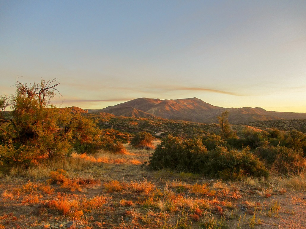
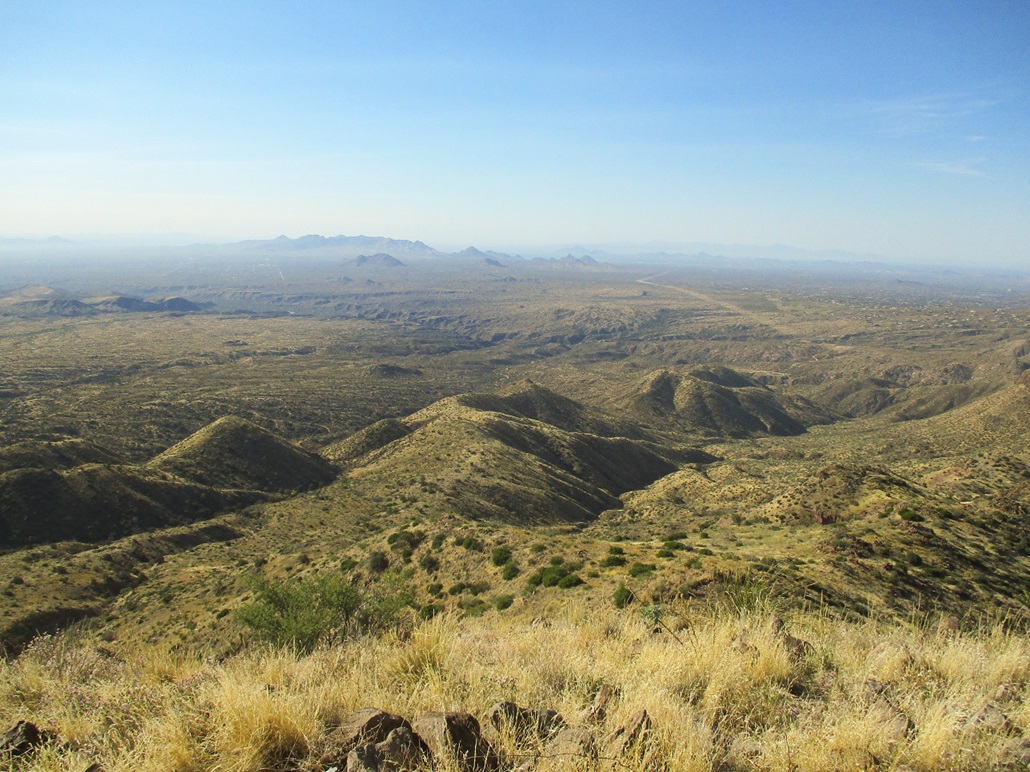
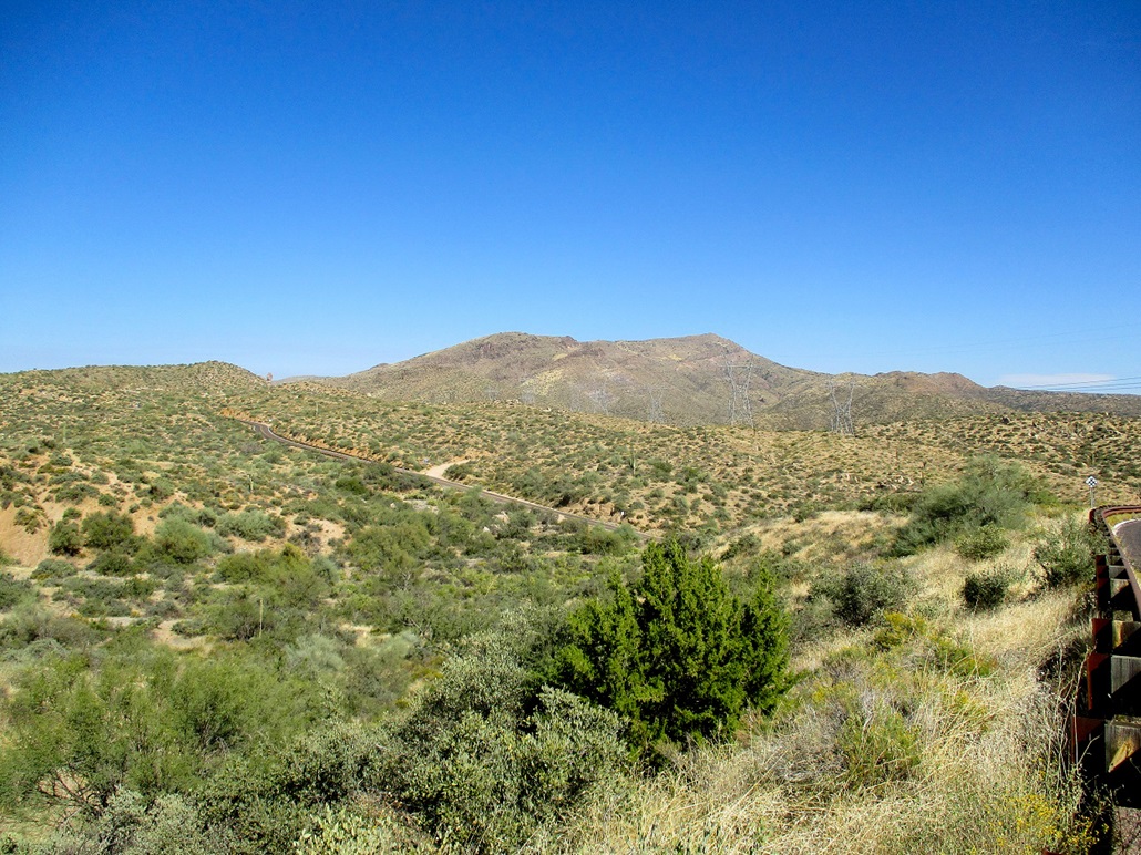
Kentuck Mountain is one of many summits along a ridge west of the Verde River, easily accessible via Tonto National Forest Road 24. I've been hiking the various summits up here for a year now, but not for a few months due to the heat, which has finally abated for the season. I was back again for more "FR-24" peakbagging.
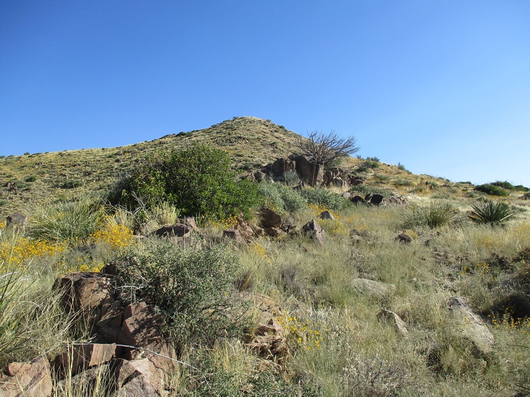
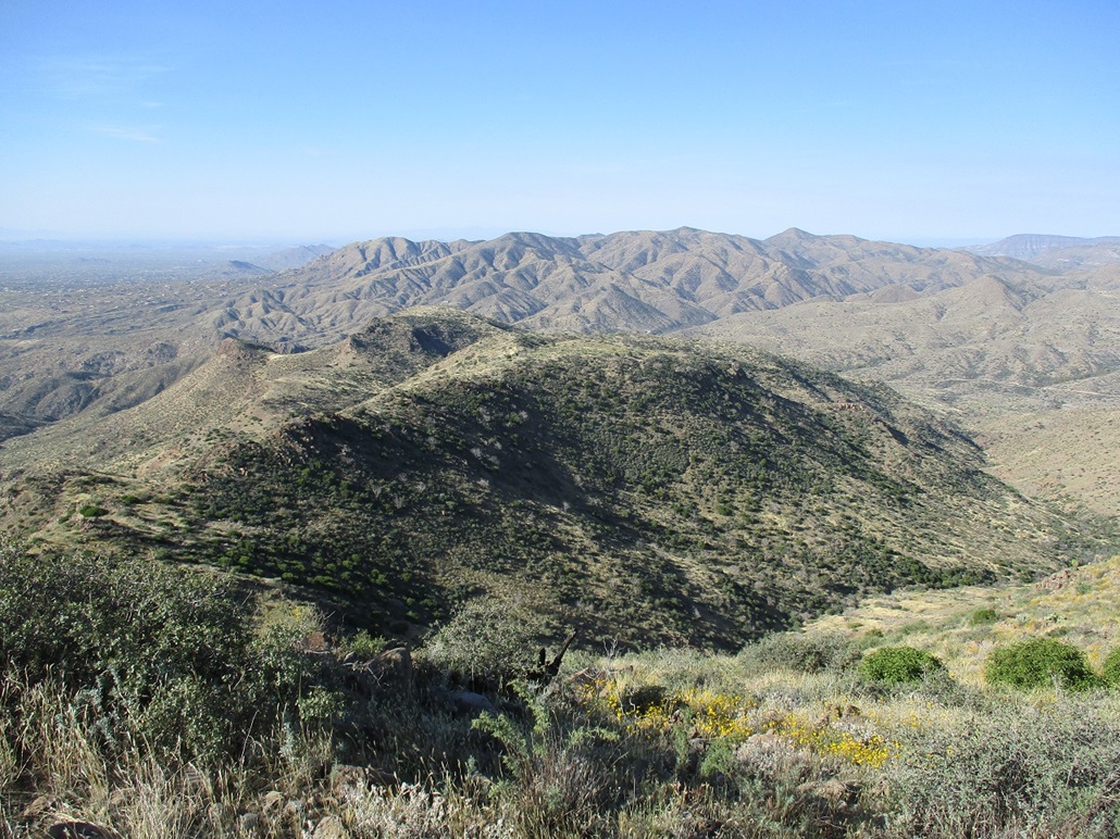
The mountain has an attractive skewed profile, long ridges dropping gently down its west slopes, and abrupt, steeper slopes to its south and east. It does not get climbed often but is not a difficult climb. There was a well-written report on HikeArizona, which I used as my general beta. The natural approach is from the west via FR-24, taking advantage of the gentle west-trending slopes. There is no trail, but the slopes are open and navigation should not be a problem.
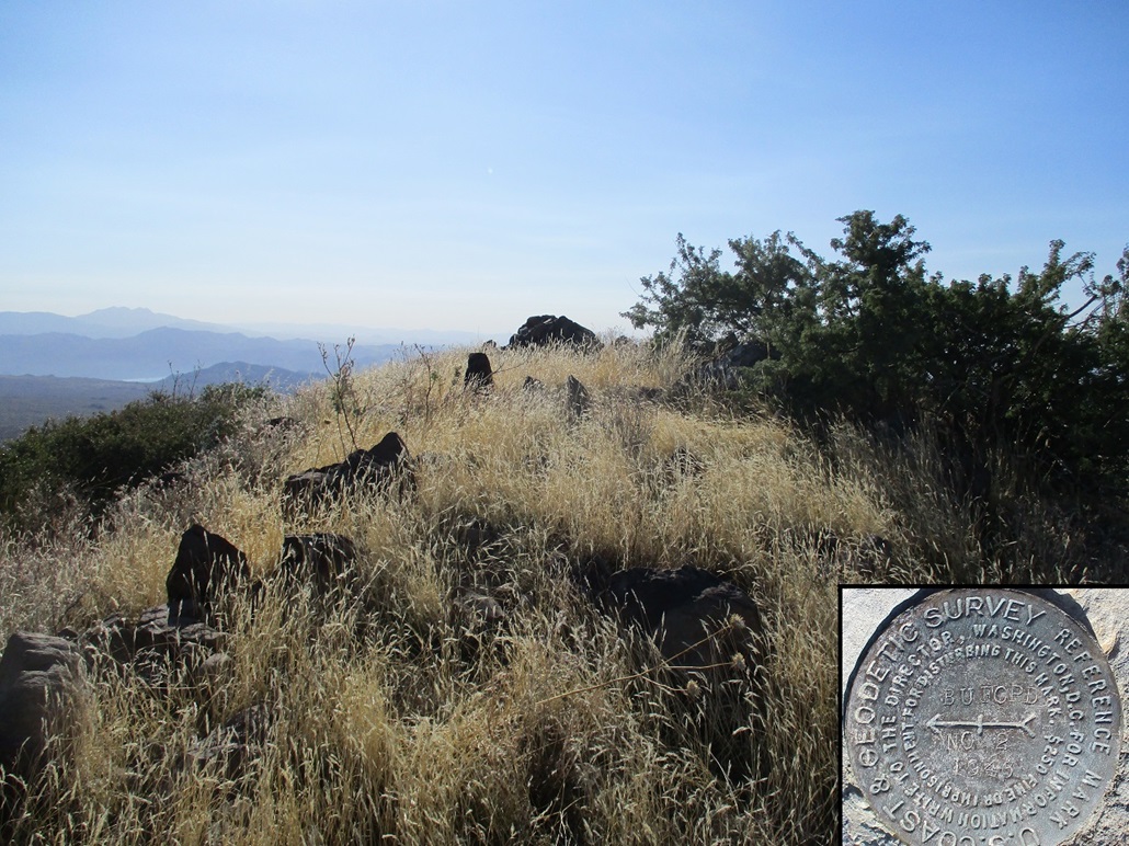
The mountain's name results from some confusion as to what mountain was called what, whether officially or informally, and how that confusion back then may have resulted in how the peaks are named today. It involves Kentuck Mountain, and Humboldt Mountain to the north (the one with the FAA radome on its summit). To muddy matters, a third name, Buford, enters into the mix. A benchmark that once was affixed atop Kentuck Mountain was stamped "Buford", suggesting that today's Kentuck Mountain was once known as Buford Mountain.
However, the description in Will Barnes' Arizona Place Names suggests that "old timers" referred to Humboldt Mountain as Mount Buford. He describes the peak as the one being four miles east of the Ashdale Ranger Station, which is still in existence. Thus, this reference would have to be to current-day Humboldt Mountain.
Somehow, the name "Buford" got attached to current-day Kentuck Mountain. That, I cannot explain and Barnes does not explain that either. The USGS humped up to the top of Kentuck Mountain about 80 years ago to affix a benchmark named Buford, which may have been simply an error, someone misunderstanding what peak was "Buford" and what one was "Kentuck".
In any case, the name for the mountain did not stick, and it is known as Kentuck Mountain today, and Humboldt Mountain is known by that name, and the name Buford simply has vanished into history. The name "Kentuck" was a nickname of Marcus Herring, who was a miner and moved around a lot in Arizona's early territory days and may have lived in the area for a time (Barnes is vague here). The name "Buford" is a derivative of "Beauford", for Clay Beauford. He was a soldier for the Confederate side in the Civil War (as a teenager), then a Sergeant in the U. S. Army. He came to Arizona in 1870 and was a well-respected lawman, as a Chief of Police and later as a legislator in the territorial government.
I wanted to be hiking as early as possible, so I left home at 6 a.m. on a Sunday and drove north through Cave Creek, with no traffic to slow me. I was in the general "trailhead" area by 7 a.m.. There is a small community of cabin homes (called Camp Creek) in a narrow draw paralleling FR-24. I parked in a pullout about a half-mile north of the cabins. It really did not matter where I started. Any route I chose would eventually have to converge to one of the two principal ridges that leads to the top.
I started walking at 7:15 a.m., the temperature in the low 40s. The sun was up by now but still low behind the peaks, so I had shade for another two hours. The day was clear and calm, with light winds at worst.
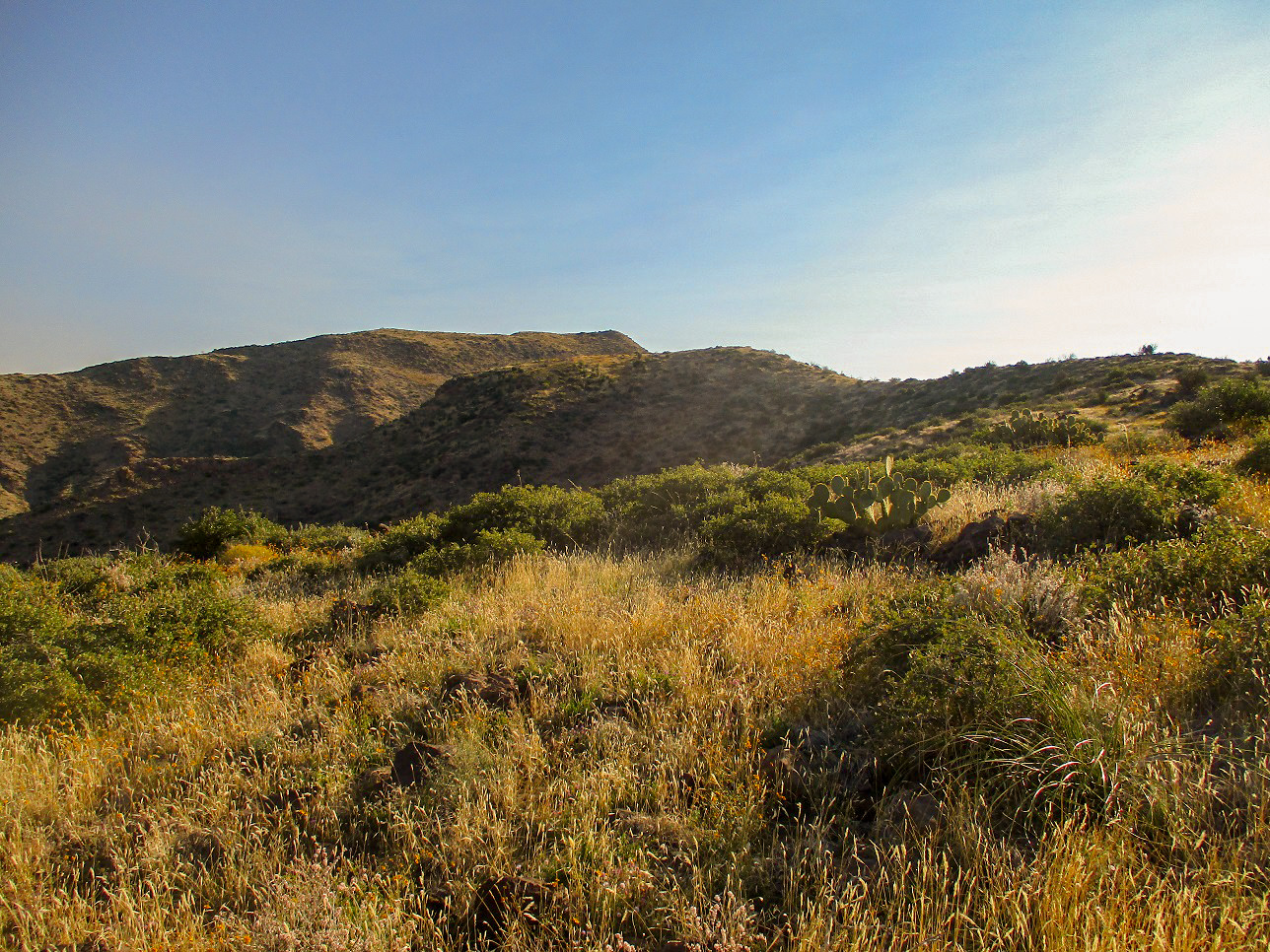
I walked the road south until I found a spot to drop into Camp Creek (about a 40-foot drop). I then poked my way south along the creek, aiming for the toe of one of the long ridges. I ascended out of the creek bed and onto a sloping bench of brush, cactus and low trees. I walked generally up, and soon came to an old road (now part of the Maricopa Trail) that parallels a set of power lines that run across the base of the mountains.
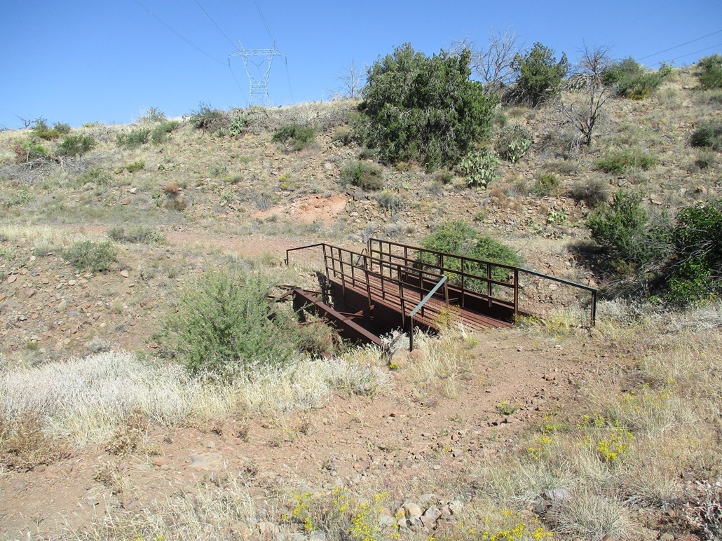
In studying the satellite imagery, I wanted to be on a slope south of an odd footbridge of some sort, as best as I could tell from the satellite image. I hiked to it, and it was a bridge built of I-beams and struts that may have at one time been wide enough for a vehicle but today is only wide enough for people (and maybe horses). The bridge spans a narrow slot canyon just a few feet wide but about 25 feet down. Once south of the bridge, I hiked until the road reached its apex, at which time I started directly uphill.
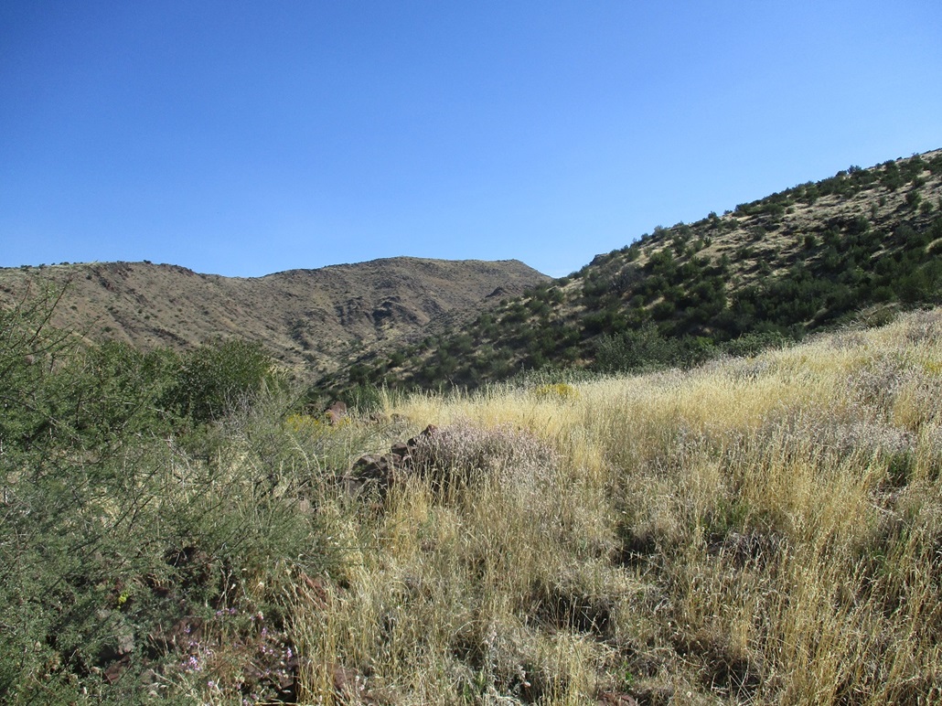
I was intending to take the southerly of the two main west ridge of the peak. I was on the correct slope but for the moment could not see the top. Ahead of me was a gently-inclined slope, then a steeper segment above it. I made good time and tried to follow open lanes through the low brush. The grass was about shin high and the rocks turned everywhere I stepped, so I had to move slow.
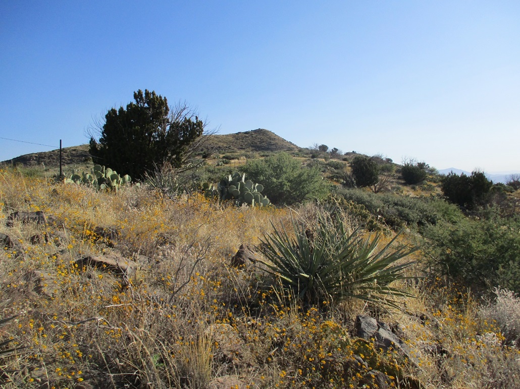
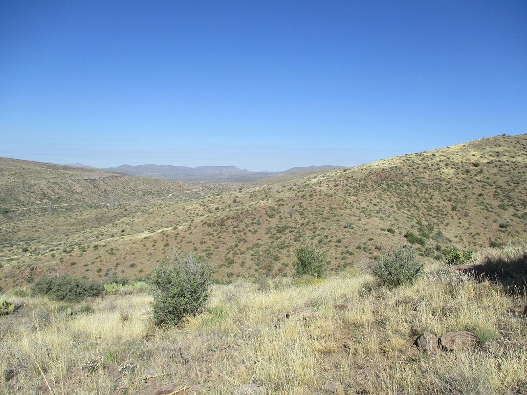
However, there was no challenge to this route, and I kept a steady pace. On the steeper slope I followed game paths, some very well defined. In time, I was above the steeper slopes and now on a longer, less steep ridgeline where I could now see the summit up ahead, about a mile away. I had gained about 800 feet on a mile and a half. I took a break on a convenient sitting rock near a lone tree.
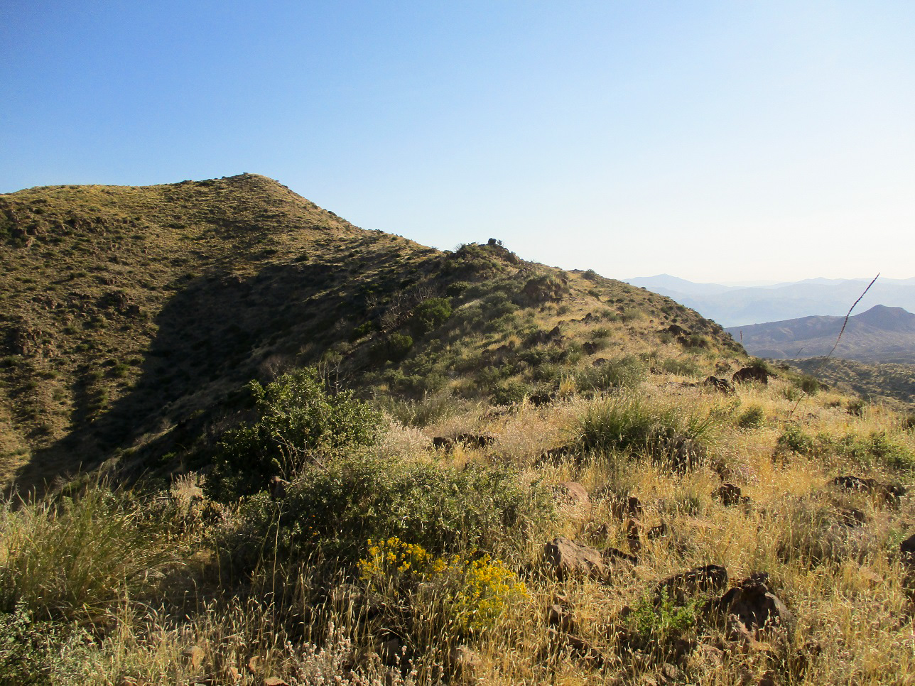
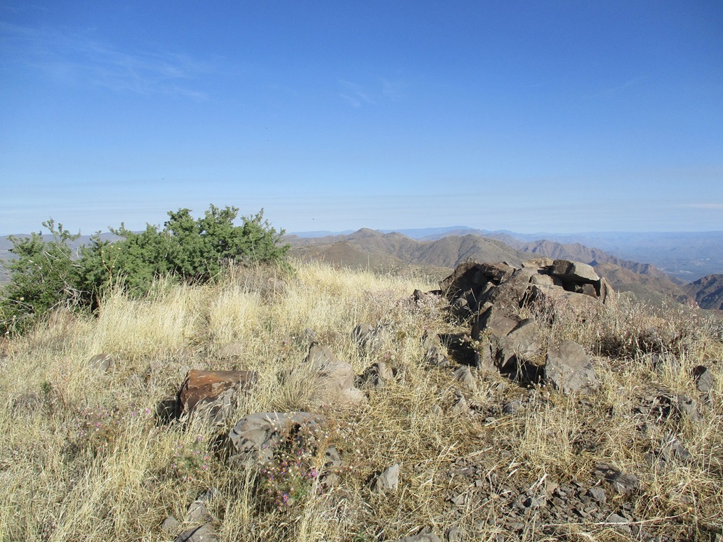
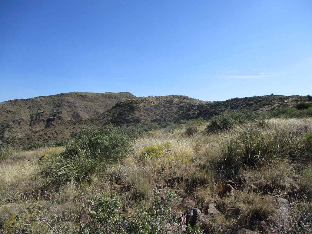
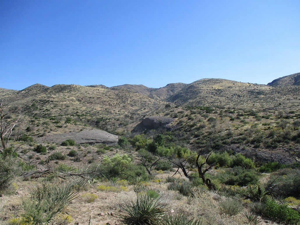
Now on the ridge, I was surprised to see a barbed-wire fence running along its spine. This fence was minorly a nuisance since I had to cross it a couple times to avoid unwanted brush or steep slopes. At about the 4,700-foot level, I came to the first of about four rock outcrops. These were easy to bypass or clamber over, but they also took time to manage due to the usual way rocks like to pile up. I was past the rocks and on the last saddle below the top. From here, I encountered the only steep part of the hike, the final 150 feet to the summit. However, it went well and I was on top.
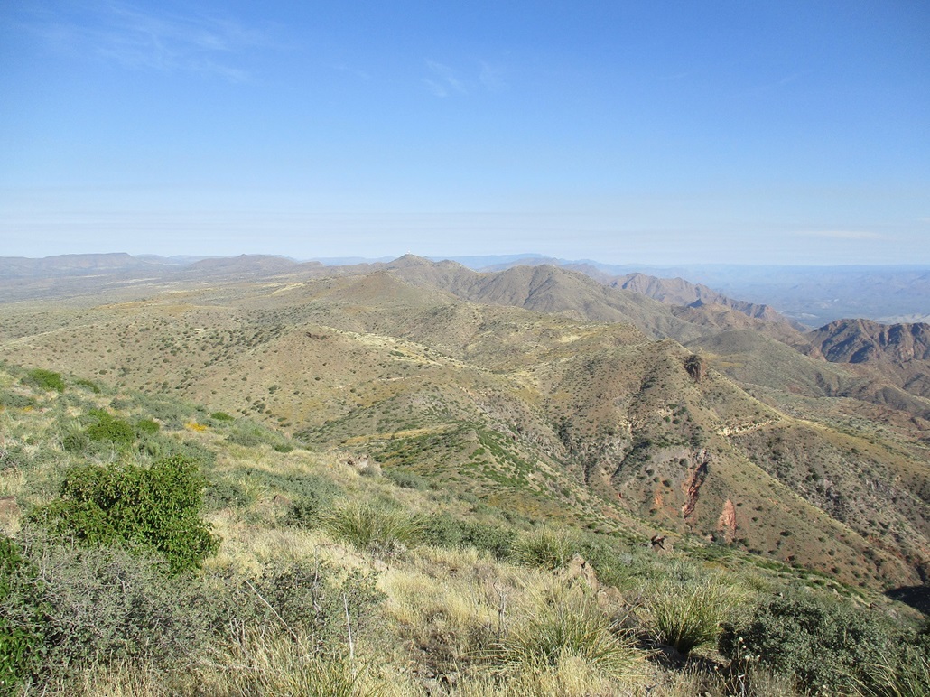
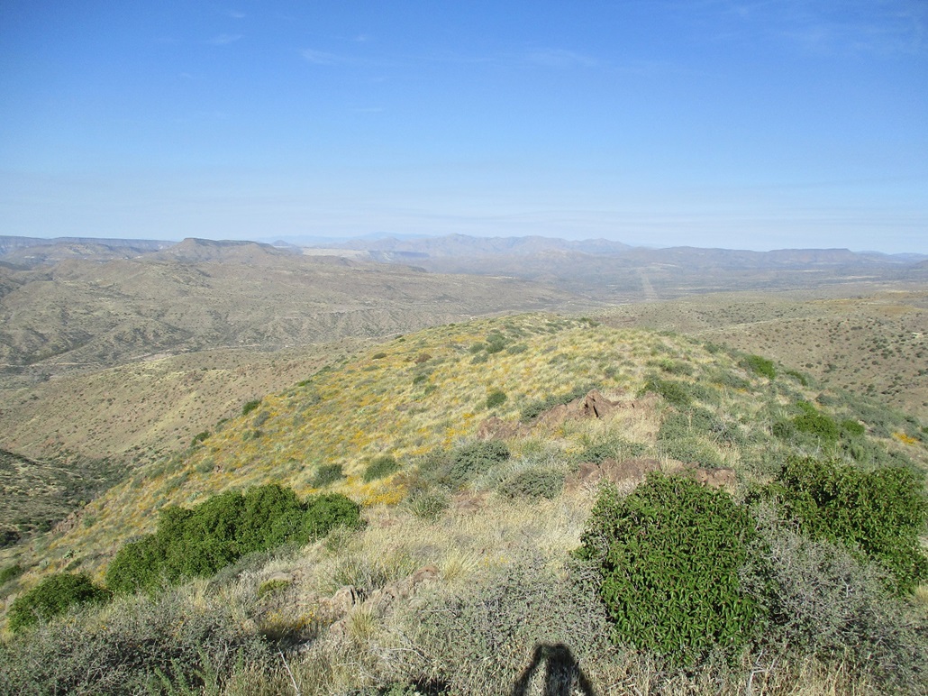
The summit has a rockpile on it but I could not locate a sign-in register. I looked for the Buford benchmark but could only find one of its witness markers. I spent a few moments taking images of the surrounding views, and a five-minute rest break, where a single bee buzzed me. The day was turning out to be a beautiful one ... and warming up, too. After starting in the low 40s, the temperature up here was pushing 70 degrees. It had taken me 2 hours and 15 minutes for the one-way hike.
I spent about fifteen minutes up top, enjoying the beautiful views around me, but up here, the steady breeze started to chill me, so I started down, retracing my route. The rock outcrops went better and I crossed that pesky barbed-wire fence a few times. I could not move fast because every rock wanted to roll out from under me. The grass was higher in places and in the warmth, I suddenly was concerned about snakes.
While I wasn't moving fast, I was moving consistently and was soon down off the steep sloes and back to the powerline access road. I stopped again at the footbridge to inspect it, then worked my way down and up through the Camp Creek draw back to my car. I returned at 11:30, roughly a two-hour egress. The hike had gone well with no mishaps, not even a scratch. There was one stretch where I heard buzzing, so I hustled through that part quickly. Otherwise, the hike was a delight and I enjoyed it very much. The day was warmer overall --- in the mid 80s back in town.
After a brief rest at the car, I drove north on FR-24 a few miles to scout other roads for future hikes. There were a lot of people driving the road and camping off to the sides, but it was never too busy. I really enjoy this region and will be returning for more peaks to bag and rocks to step on and bees to avoid.
|

|