
The Mountains of Arizona
• www.surgent.net
|
| Black Mesa • Kayenta Point |
• Highpoint: Black Mesa Complex • Navajo Indian Reservation • Highpoint: Navajo County |
|
Dates: (1) June 4, 2000; (2) May 30, 2004
• Elevation: 8,168 feet
• Prominence: 1,808 feet
• Distance: 13 miles
• Time: 7 hours
• Gain: 168 feet (net), nearly 1,000 feet gross
• Conditions: Sunny and warm both times
• Teammates: Andy Bates and K.A. in 2000; βð, Bill Jacobs, Barb Lilley and Gord MacLeod in 2004
Arizona
•
Main
•
AZ P1K
•
PB • LoJ
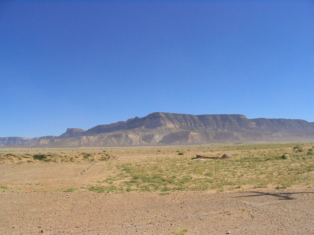
Black Mesa is a mesa complex covering hundreds of square miles in the Navajo and Hopi Nations of northern Arizona. The highest point of Navajo County is a spot elevation of 8,168 feet located about one mile east of Kayenta Benchmark (8,120 feet) on Black Mesa's northern rim. The highpoint does not have an official name, although for purposes here, I informally call the whole north promontory "Kayenta Point".
Getting to the highpoint is challenging, as there are about a half-dozen possible routes, all involving remote dirt roads, possibly locked gates, cliffs, canyons, and potentially long hikes. The "traditional" route comes in from the southwest, near Lolamai Point on the mesa's north rim, about five miles from the highpoint. This route involves a lot of hiking, but the road access seems to be the most stable. I have used this route on both my ascents, in 2000 with K.A. and Andy Bates, and again in 2004 with my wife along with Bill Jacobs, Barb Lilley and Gord MacLeod.
First Visit, June 2000: K.A. and I agreed to team for a hike to Black Mesa's highpoint, both of us close to finishing the Arizona County Highpoints (I was down to my last two). Andy Martin of Tucson was aware of our plans and introduced us to Andy Bates, also of Tucson, who was down to just this one highpoint to finish the Arizona list. Neither of us had met Andy before. We were glad to have him along.
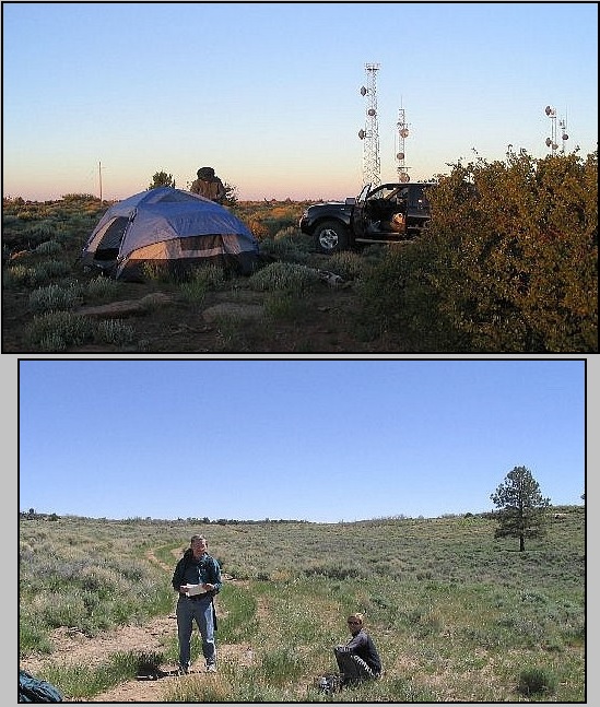
We left Phoenix Saturday afternoon (June 3rd), planning to camp at Lolamai Point, then make the long hike (and long drive back home) all on Sunday. K.A. was driving us in his brand new Isuzu SUV. We arrived to Lolamai Point in late afternoon and set up "camp" in an open area. The ground is rocky and covered in a thick mat of grass and cactus. Andy and I would be sleeping in the open, K.A. in his vehicle.
K.A. provided the entertainment, leaking fuel from his camp stove onto a depression on a rock, then lighting it all anyway, creating a foot-high blob of flame for a few seconds, all of this less than a foot from his vehicle.
We had discussed and agreed upon a dawn start (5 a.m.) due to the day's expected heat, the long distances, and my need to be back in Phoenix at a reasonable time. Andy and I were up and ready, but the third member of our party refused to get up, and we did not get started until almost 7 a.m..
We walked east along an old track and following a fence line for a mile and a half, passing a corral then entering into the low scrubby forest. When the fence and tracks ceased, we followed an eastern bearing and always kept the north rim of the mesa within sight. This brought us to Yellow Water Canyon, the first of four canyon crossings we would encounter.
This one was the steepest and brushiest. It was about a 150-foot drop, but very brushy with small cliffs and slopes with poor footing. It was short but tiring. There were three more canyons to cross, each smaller than the last, and not as taxing. We were making decent time.
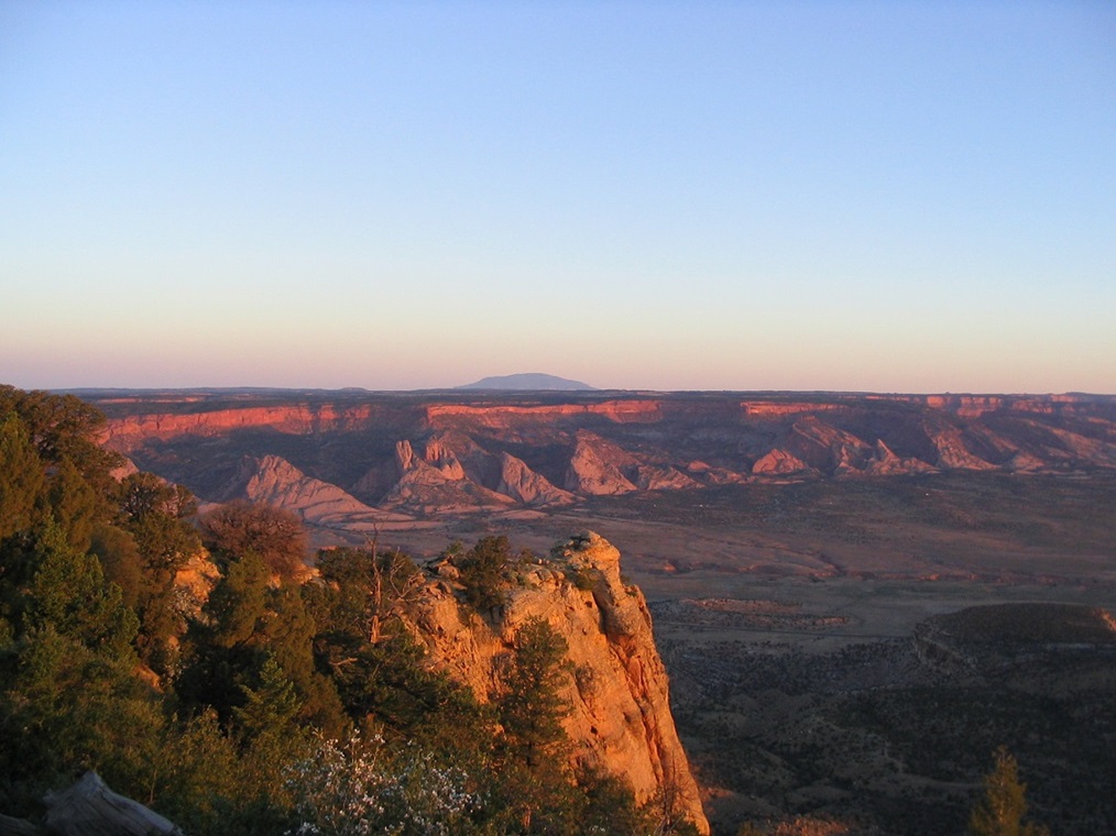
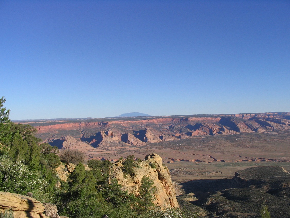
After the last canyon, we came upon a track, and followed it. It led to a substantial road we were not expecting. It came up from the south, from where we had no idea. We followed it north, then east, passing a gate and a meadow. We were now on the main promontory with Kayenta Benchmark to the west and the highpoint to the east. The road went all the way to the north rim, where we could see the towers at Lolamai to the west and the spires of Monument Valley to the northeast.
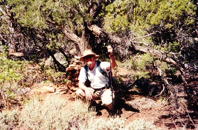
To get to the highpoint, we followed a narrow track east into the trees, then another few hundred yards through the trees until we came out to the rim again. This section of the rim faced east, so we knew we were close. Now it was just a matter of hiking through the trees south a few paces until we found the rock cairn at the presumed highpoint, which we did about 10 a.m. To here, we'd covered about 6.5 miles in about 3 hours.
We stayed for 45 minutes as we congratulated Andy on completing Arizona's county highpoints. After lunch and photos, we started back for the car. Andy and K.A. went west to visit the Kayenta benchmark while I went south along the road, hiking all the way out by myself. I retraced my route, lagging in the heat toward the end. I was back to K.A.'s car at 1:30 p.m., and K.A. and Andy arrived about 20 minutes later. We left the area at 2 p.m., stopped for lunch in Flagstaff, then back to Phoenix, arriving that evening.
I was happy to succeed on this hike, but not in good spirits aftewards. Andy was a great partner, easy-going and smart. K.A. was a walking disaster area. His driving was atrocious, passing trucks on double-yellows on blind curves, a tendency to straddle lane markers while he decided what to do, never using blinkers, and so on.
When he admitted how tired he was after the hike, I offered to drive us back to Flagstaff, which he accepted. For me, it was a way to govern my own existential fate. After Flagstaff, he drove us into Phoenix, doing his usual thing of straddling lane lines, never signalling, often driving well below the speed limit and tapping the brake incessantly. I've never been in a car that got honked at so many times, yet he seemed entirely oblivious to it all. How this guy hadn't yet gotten into a major accident or killed himself is beyond me.
I had hiked with him a few times in late 1999 and started to sense that this guy was dangerous. I only agreed to go with him on this hike because I really wanted to hike this peak, plus having a third person along helped defray tension. I was already frazzled because of his driving to the highpoint, and his (deliberate) wasting of time putting us two hours behind schedule had put me in an unaccommodating mood, to put it kindly.
Upon starting his car, I was surprised and alarmed to see we had less than a quarter tank of gas! I drove us back to the main highway, and knew we had enough to get to Tuba City to fill up, but K.A. strongly resisted getting gas in Tuba City, preferring a place in Flagstaff where it was "cheaper". I did not agree with this, but knew there were some gas stations along the stretch between Tuba City and Flagstaff, about a hundred miles away.
In Cameron, about halfway, we were below 1/8th of a tank. I suggested again to get some gas and K.A. again very strongly resisted. I capitulated once again. I knew there were a couple more places along the way. That little yellow "low on gas" light was on by now and I'll be damned if we get stranded on a highway because we ran out of gas. This would be a bridge too far for me.
When on the outskirts of town, I pulled in and got a couple gallons of gas, maybe $5 worth, and K.A. threw a fit, yelling at me, almost crying, because he wanted to wait for a place in Flagstaff where it was cheaper. When I told him this was on me, he suddenly calmed. At this point, he took over driving.
He pulled into a station that was cheaper. It was an old-style station with one island and two pumps, and people would just cram their car into line, no one being orderly. It took almost a half hour to get to a pump, all to save 5 cents per gallon. I pointed out that at about 15 gallons, we saved 75 cents, and if it was worth using up more than that idling. He gripped the steering wheel, hunched forward and stared straight, ignoring me. I didn't care. I needed to unload.
The three-hour drive back into Phoenix, with K.A. behind the wheel, was torture. I resolved never to hike with him again, or have any dealings with him unless there was no other option (e.g. being part of a larger crowd where I could keep my distance). I do not have good memories of this hike, merely chalking it up as a "necessary" hike for a larger goal.
Second Visit, May 2004: I planned another trip up to Black Mesa with my wife. We'd deliberately put this one off due to my lack of enthusiasm about this particular hike. I put out an offer for others to join us and in time, we had a group of five: us two, and Bill Jacobs, Barb Lilley and Gordon MacLeod. I had "known" Bill through the county highpoint web-group but had never met him until this weekend. Barb and Gord are well-known throughout the western United States for their thousands of ascents and their familiar log-books they place at the summits. Barb was one of the first women ever to reach the summit of Denali in the 1960s.
We planned this highpoint over Memorial Day weekend. We drove up to Flagstaff two nights before and spent yesterday (the 29th) hiking and exploring the Sunset Crater and Wupatki National Monuments outside of Flagstaff. Today, we drove toward Black Mesa, following the roads to Lolomai Point. At this turnoff, we met up with Gord and Barb, who were there waiting for us. Together, we convoyed along the dirt road to Lolomai Point, arriving at 3 p.m. in cool breezy weather. We set up our tent, with no help from the steady breeze and occasional gusts. We visited with Gord and Barb, then as darkness set in, we all got busy getting some sleep.
The next morning, Bill rolled in 6:30 a.m. to join us. Bill's a veteran county highpointer and brand new to Arizona, so he was interested in joining us for this hike, and it was good to meet him in person after 5 years of only knowing him through emails. The five of us convoyed back about a mile and started our hike at a gate near Fir Springs. The gate was unlocked, but a hanging lock on it made us skittish about driving in, so we parked outside and started our hike in at 7:30 a.m.
We walked up a road not shown on the map, and then met up with the route I took back in 2000. There really is no other option that avoids the four significant canyons that cleave the mesa. We all crossed Yellow Water Canyon, then took a break at the next canyonhead. Yesterday's wind was now replaced by perfect conditions: cloudless skies, no breeze, temperatures in the 70s, and dry. We all hiked in a loose clump, people pairing off to chat, but generally Bill, my wife and I were the quicker of the five, while Barb and Gord weren't far behind. When we got to the major road about 4 miles in, we took another break.
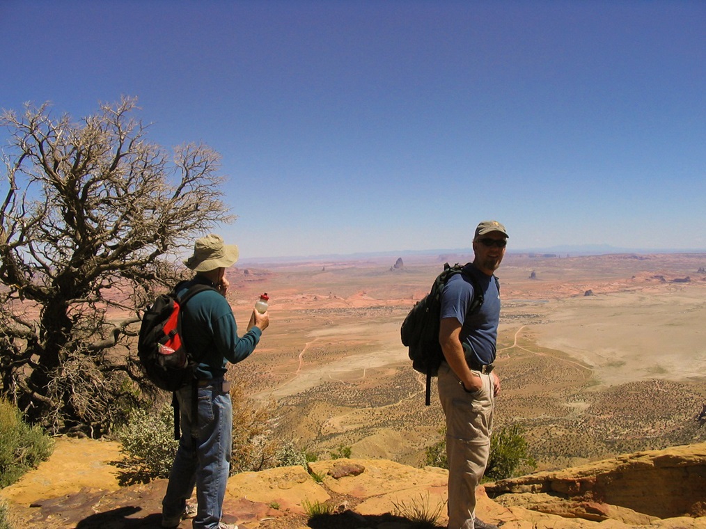
From here, we took off way ahead of everyone, but soon Bill caught up. We took another break in the meadow close to the highpoint to let Barb and Gord catch up, then all made our way to the highpoint. Finding the cairn was a bit tricky, so the three of us split up and I found it, then called everyone over. We arrived about 11:30 a.m. and took an hour-long lunch break, enjoying the scenery. The views over the rim's edge were amazing, including Monument Valley and mountain ranges in Utah and Colorado.
The hike out went quick. We egressed about 3 p.m. to our cars. Barb and Gord were planning on camping another night on the mesa so they took their time. Bill got moving pretty fast, while my wife and I rested then got moving to our hotel in Chinle, where we visited Canyon de Chelly the next day before driving back home. Everything had gone smoothly and I thank Barb, Gord and Bill for joining us on the hike.
For me, this was a sweet return trip. I had way more fun and an overall rewarding experience than I did in 2000. Of the Arizona county highpoints that I repeated, perhaps none were more "fun" the second time around than this one. It removed the bad vibes and memories I had from 2000, and completely made me reconsider the inherent value of this hike. Yes it's long and tedious, but it's fun and unique and very few people get this way.
|

|