
The Mountains of Arizona
www.surgent.net |
|
Hilltop Lookout • Peak 5132 • Peak 4517 Today I would be exploring the mountains in the northern San Carlos Indian Reservation, with an old fire lookout called Hilltop Lookout as the primary destination. These mountains rise about 25 miles north of US-70, the main highway through the reservation, and south of the Salt River. The main variable was the road itself. Roads on the San Carlos are often not maintained and require 4-wheel drive, but the road that leads up into the hills seems to be kept up as it eventually leads to the Black River Crossing, one of very few ways to cross the rivers that mark the north boundary of the reservation (the Black is a major tributary to the Salt). Assuming I could get my car to the "trailhead", the actual hike would not be difficult nor very long. So I tacked on a couple more peaks to do as bonus peaks on the drive out. Only a few people have logged ascents of Hilltop Lookout, and for these other two peaks, only one had a logged ascent. It's not that these are difficult peaks. It's just that no one comes here. The San Carlos is like the Uzbekistan of Arizona. Remote and hard to get to. After my class last night, I got some groceries and drove east through Superior to camp at the Oak Flat Campground above town. I took the same spot as I have the other three times I've camped here. It had been warm, in the high 80s down low, but now higher and nearing 9 p.m., the temperatures had fallen into the 60s, and would drop into the low 40s by tomorrow morning. I had a meal in the front seat and then vegged a little before getting my sleeping arrangement set up. Too lazy to set up my cot, I slept in the front passenger seat, but it was not a good night of sleep. I could not get comfortable. Some nearby campers had a small yippy dog that barked much of the night. It's human mom would tell it to shut the f up, what the f is it barking at, and so on. I could hear this all clearly. I was up at dawn, 5 a.m., and with no reason to stick around and some driving to do, I hit the road, passing through Globe and another 20 miles into the San Carlos, aiming for the main town, Peridot. Today would be the first time I have ever driven off the main highway into the town itself. The weather was cool for now but with clear skies, calm conditions and low humidity. It was looking to be a fine day. A few days earlier, I had secured a permit to be on the San Carlos lands. They can be found here. It's not the easiest site to use and can be confusing, and first-time users may need to phone in first to get set up. Once you're in their system, then it's slightly less confusing to get a permit. But the fact that the San Carlos allows for people to explore their lands with a permit is noteworthy. Not all Indian Reservations allow this.
Date: April 23, 2025
• Elevation: 6,628 feet
• Prominence: 418 feet
• Distance: 5 miles
• Time: 90 minutes
• Gain: 810 feet (gross)
• Conditions: Sunny, clear and pleasant
Arizona
•
Main
•
PB
•
LoJ
•
USGS Datasheet
I reset my odometer as I exited US-70 onto BIA-170. Going north, it is about 4 miles to the town of San Carlos, with homes along the road almost the entire way. In San Carlos, I went right at the first intersection and stayed on this road as it passed under a bluff. At 5.8 miles, I went right onto BIA-10, the main road that heads north into the hills.
The road crosses a bridge spanning Sevenmile Wash, then angles north, losing pavement about a quarter mile later. The next five or six miles is a steady incline upwards along a sloping mesa, the road here being wide and in good shape, a little rubbly in spots. I was able to drive 40 miles per hour with no difficulties.
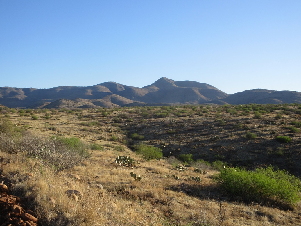
The road then enters into the lowest foothills and becomes narrower and slightly steeper. It swings east and passes below Peak 4517, then eventually angles north again, continuing upward. Hilltop Lookout's hill can be seen, a gently-rounded hump with a pointier peak, Peak 6238, to the right. Although Peak 6238 looks significantly higher, the two peaks differ by just 10 feet in elevation. The road drops into Cassadore Spring and fords a creek, the water just a few inches deep.
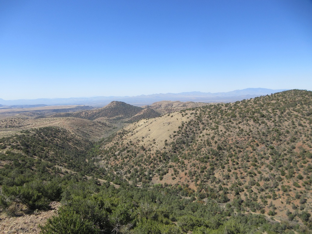
Another five miles or so, the road meets another "major" road at Bear Canyon Junction, now entering into a canyon, with Peak 5132 to the left (west). Now the road starts to gain elevation in earnest.
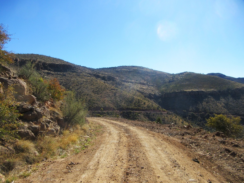
The remaining five miles (approximately) of the road is cut into the southern slopes of the peaks, with tall cliffs above. The gradient gets steep, the road narrows and in spots, it was a little haggard with erosion. I nudged the Subaru carefully, generally no faster than 10 miles per hour, going in and out of the road with the folds of the slopes.
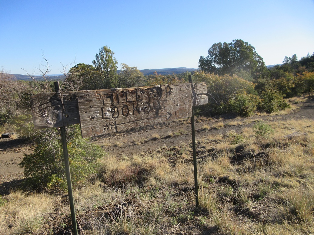
Finally, the road crests the lip of the range and enters into high-elevation forest. I parked less than a mile later, when I came upon a very old wooden sign pointing to Hilltop Lookout. According to my odometer, I had driven 24.5 miles. I was at approximately 6,140 feet elevation, about 3,600 feet higher than where the original road left US-70. It had taken me a little over an hour to get here, and frankly, this was about 90% of the challenge of the climb.
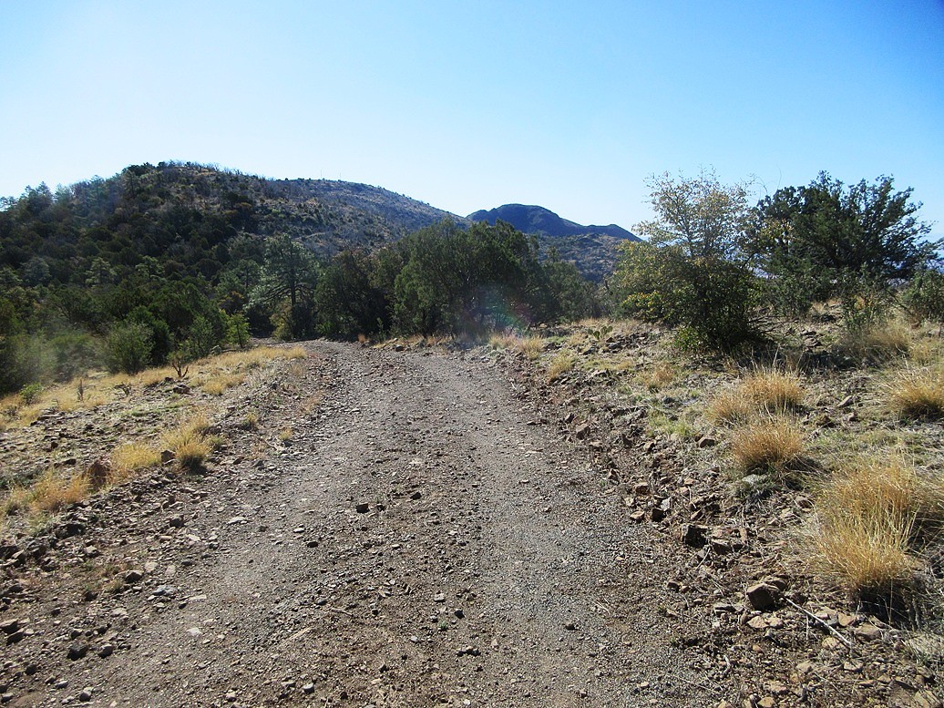
Up higher, it was sunny and pleasantly cool, temperatures in the high 50s. I got dressed and my pack arranged, and started walking at 8:15 a.m.. I'd be following a secondary access road to the summit, this road not marked on any map.
The road hike went extremely well. It was a pretty good road, and most stock 4-wheel drive vehicles should be okay on it. It gains some elevation, then drops about 140 feet to a lowpoint before going upward again. In about a half hour, I had covered a couple miles to where this secondary road meets the main road. It was another half mile of easy walking to get to the top of the peak.
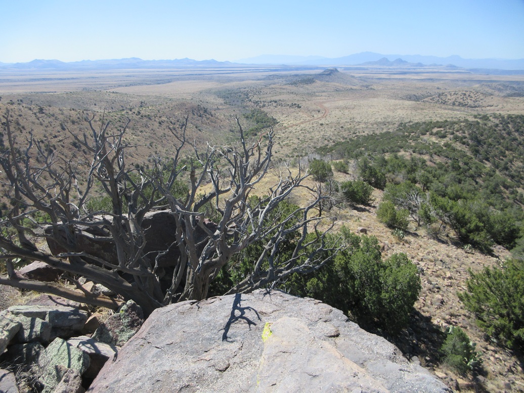
The top is open and flat, with a couple of modern towers rising above the old decrepit lookout shack, all this enclosed in fencing with razor wire along the top. There is no tall forest lookout tower here. This lookout was just a small hut with a porch. Even from down low, it offered good views of the surrounding forests and hills.
I walked the perimeter of the fence. The benchmark is probably on a rock underneath the hut, so locating it was not going to happen. The highest point were some rocks beside the road, probably pushed up by the road grader decades ago. These rocks rose about 6 feet above the ground and offered a perch to take some images.
I spent just a few minutes up top, mainly looking around at the views and hoping to randomly find a register or benchmark. The return hike went fast, and I was surprised to complete the hike in just 90 minutes. I was back to my car at 9:45 a.m.. As expected, the hike itself was not difficult and went quickly.
Back at my car, I could hear a vehicle coming up the hill. A work truck with two occupants passed by. I waved but they did not wave back. I got into my car and started down. As soon as I started to drop off the lip, I see another work truck, fully laden with tools, rumbling up. I pulled to the side and let him pass. I gave a finger-wave but got nothing in response. These were white guys, probably contractors. Where they were going, I don't know.
The drive down the steep shelf roads went slow and I was grateful there were no more trucks coming up, as some sections of this road were quite narrow. Peak 5132 was about five miles down the road. It would be my second peak of the morning.
Elevation: 5,132 feet
• Prominence: 312 feet
• Distance: 2 miles
• Gain: 544 feet
• Time: 45 minutes
• Conditions: Still very lovely
PB
•
LoJ
I parked back at the Bear Canyon Junction, off the main road. Just then, a couple more work trucks came rumbing upward. I am very curious what big project is going on up in the hills. I'll probably never know.
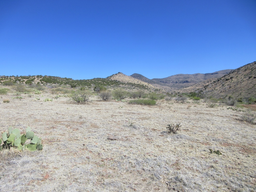
I was about a mile southeast of the peak, intending to follow its long and gentle southern ridge to the top. I walked across a cattle grate and started up the slopes. At first, everything was trampled down to nothing, or mowed to a half-inch high, by the cattle. The higher I got, the grassier it became.
The hiking was easy, following lanes through the grass and rocks, and weaving through stands of piñon and juniper. I was soon to the higher saddle and the final slope to the top.
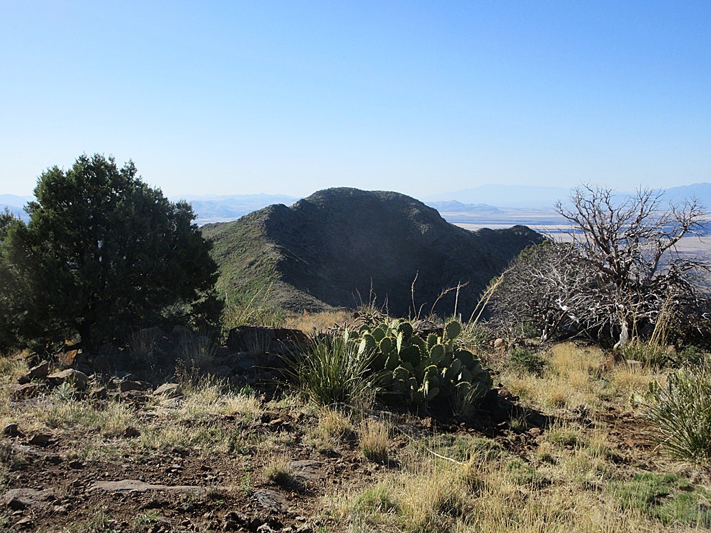
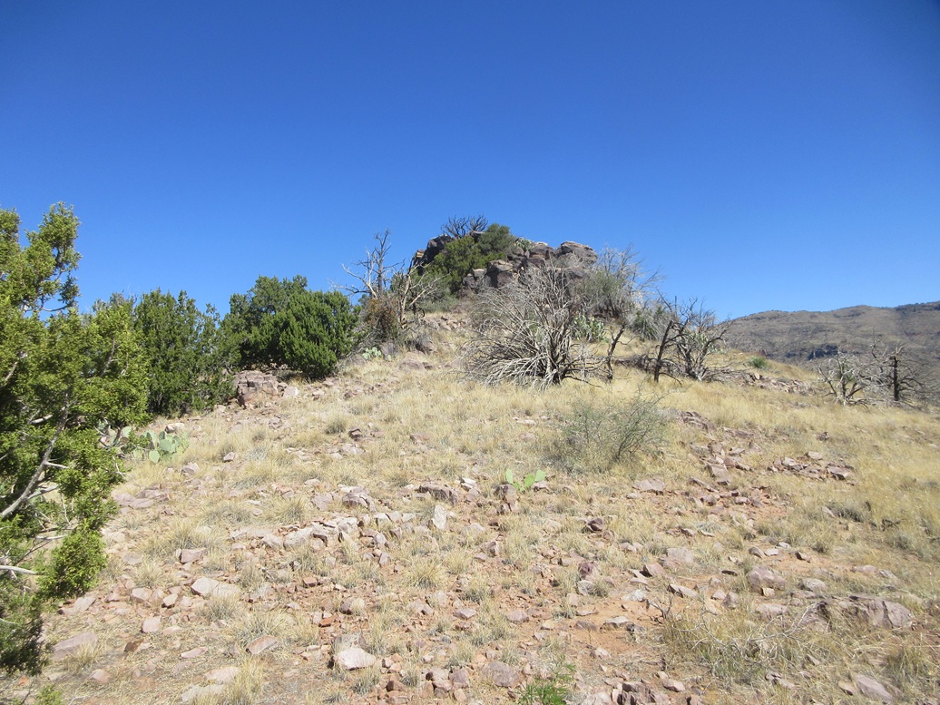
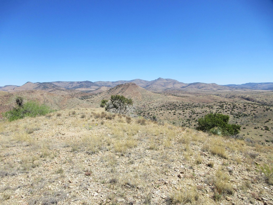
From a distance, it is clear there is a big rocky cliff surrounding the top, and as I got closer, could see it better, hoping there would be a way up. The rocks rose about 30 feet above the ground.
Once at the rocks, I found a chute through two large blocks. This chute was a chaos of big rocks, but they heaped in such a way to where I could walk on them as big steps, needing hands in a few spots for balance and hoisting myself upward. Warmer now, I kept an eye out for snakes tucked in between the big rocks.
I got up this first chute, then walked along a ledge of more big rocks to a small cliff. I was able to walk on the rocks, only one maneuver requiring hands and some thinking. Once above this little barrier, the top rocks were nearby, about another eight feet higher. The one-way hike had taken me just about 20 minutes.
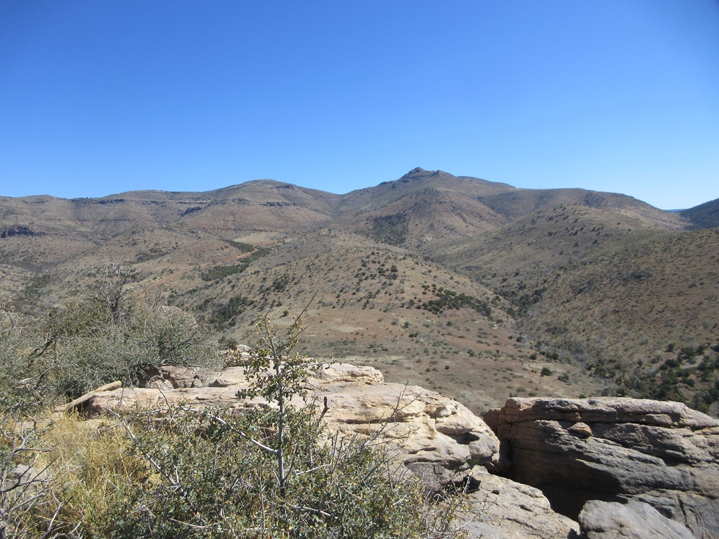
The views were very good, being on an elevated perch. I had a better view of the higher mountains from where I had just been, plus some nice long distance views looking south, the land dominated by giant mesas cut by canyons. I found no cairn nor register and noted that only one other person, Bob Packard, had logged an ascent of this peak thirteen years ago.
I retraced my route down the rocks and then walked out the slopes back to my car, cutting a little more down than over as I walked out. The outbound hike took just twenty minutes as well, and I was gone for about 45 minutes total.
This peak was enjoyable and certainly easy to get to, and any climber should be fine on these rocks. This peak's remoteness will likely keep visitors down to the barest minimum.
Elevation: 4,517 feet
• Prominence: 357 feet
• Distance: 0.8 miles
• Gain: 420 feet
• Time: 45 minutes
• Conditions: Sunny and warm
PB
•
LoJ
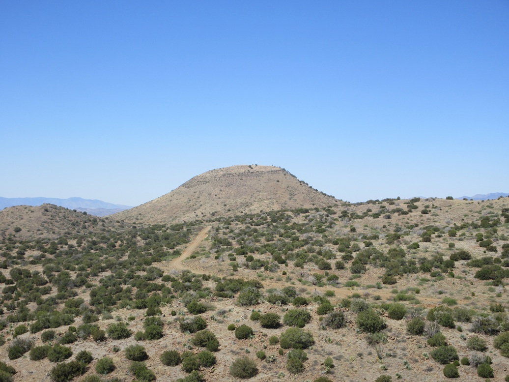
I drove another five miles down the road, approaching Peak 4517. It stands out, being a trapezoidal-shaped peak with steep sides, with a flattish top surrounded by a thin band of cliffs.
I parked to the south of the peak, in a clearing where some unused construction equipment sits: a corrugated drain pipe, and some big tubing spools. I backed in, about a hundred feet off the road.
Since I was south of the peak, I figured I would bust up the peak's south slope. Eyeballing the peak as I walked to it, its east and west slopes looked about the same.
I walked up a steep road embankment, then up some easy slopes, then onto the steep stuff almost immediately. At first, it was steep but tolerable. The rocks generally stayed put and the plants and grass were spaced out, forming easy lanes.
Looking up, the cliff band here was not as vertical as in other places. It was more a series of rocky heaps and tiers, with rubbly slopes in between. Here, the slope steepened to about as steep as it could before things would just slide off the mountain.
I moved very slowly and carefully through here, using the rocks for stability. There was no scrambling necessary; I just made sure I had good footing and gently moved upward. I only had about 50 feet of this anyway.
At the top lip of the rocks, the slope leans back, near a dead saguaro which would serve as a waypoint for when I returned. The remaining climb was up much more friendly slope, with blooming ocotillos adding color. Then, suddenly, I was on top. The summit comes fast.
The top is bare, with good views in all directions. This peak has no previous ascents logged at Lists of John nor at Peakbagger (I added its page after the fact). So this was a "LoJ FA" for me. However, there was a simple cairn at the top, so someone has been here before. For a peak so close to a road, that should not be surprising.
I did not stick around long. This was my third peak of the day and I was ready to get down and get going. The hike down went well. I followed my general route down and somehow stayed upright all the way down. I was back to my car quickly, a 45-minute round trip.
I was very pleased with this morning's efforts, and happy to tag all three peaks on my agenda. I most enjoyed being so far back from civilization, in the outback of Arizona.
The drive out went well. So well that when I was back on pavement, my tire pressure light turned on. I drove to a gas station nearby and checked each tire. Sure enough, the right rear was low, but not bad, just 10 psi lower than normal, and no obvious puncture. I filled it, and drove into Globe for a lunch at that same Mexican place I've been to three weeks in a row now.
When the highway (US-60) opened up again, I got in line with everyone else and drove back into Phoenix. It was warm, but not hot, temperature about 90°. I had a cheap hotel reserved and looked forward to a shower, a bed, and the Kings-Oilers on the television.
Lidar data for the San Carlos does not exist at the refined 1-meter scale. Only one peak, Peak 5312, is "borderline", but its lower saddle contours pinch in close together suggesting that the peak is almost certainly a ranked summit. The 1/3 arcsecond data suggests a prominence of about 320 feet, for what it is worth.
The road (BIA-10) was a decent road, and given the number of work trucks I saw, it is maintained. However, it has its narrow and rocky parts, and higher up, some erosion ruts and steep grades. In dry conditions, 4-wheel drive is not necessary. Reasonable high clearance would be. I would not recommend a sedan or any low-slung vehicle on these roads. In wet weather, I would not even attempt them.
I once again appreciate that the San Carlos allow access through their permit system. No one checked for mine today, but they're inexpensive and I want that peace of mind. Only a few areas of the reservation are off limits. Most of the rest is ostensibly accessible, but some areas are so remote with no road access, they might not see a human for years at a time.
My tire did have a slow leak. I was able to get into Phoenix fine. but the next day the light came on. I found a tire place nearby and they patched it, affirming that it did had a puncture in it, no doubt from a rock or something from that road.
|


|