The Mountains of Arizona
• www.surgent.net
|
| Guthrie Peak |
• Black Hills • Northern Peloncillo Mountains • Greenlee County |
|
Date: October 29, 2005
• Elevation: 6,571 feet
• Prominence: 2,391 feet
• Distance: 5 miles
• Time: 4 hours
• Gain: 1,200 feet
• Conditions: Clear, dry and nice
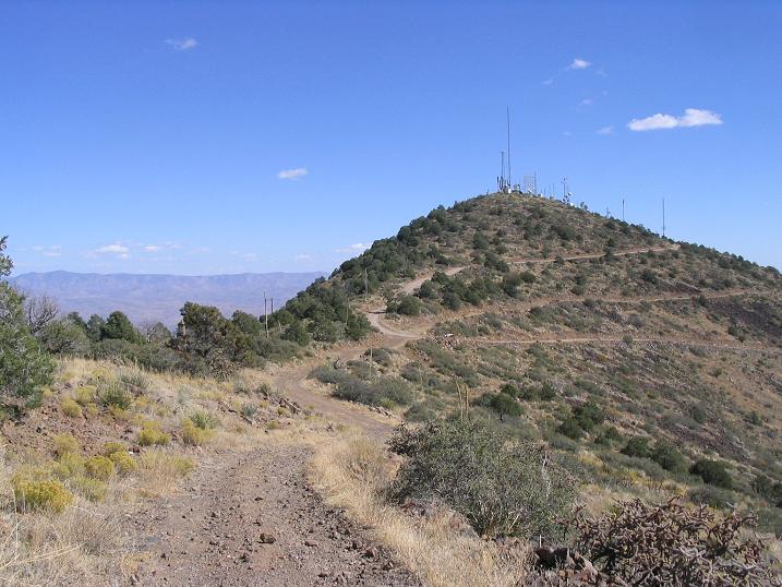
Guthrie Peak is the highest point of the Black Hills, the northern extension of the Peloncillo Mountains in eastern Arizona. The peak is visible along highway US-191 between Safford and Clifton, rising over 2,000 feet above the highway and featuring communications towers. After having driven by this peak a number of times, we made plans to hike it this weekend as part of a getaway to the hot springs around Safford.
Getting to the top is no challenge. A rough track veers off the Black Hills Backcountry Byway and leads all the way to the top. This was an opportunity to explore this "Byway", which was the original road connecting Clifton and Safford before US-191 was built. We drove to Safford the day before and camped the night at the Essence of Tranquility Hot Springs south of Safford. We enjoyed a great Mexican meal at the Casa Mañana restaurant at the junction of US-191 and US-70, downtown Safford.
We left the campground at 7 the next morning and drove 20 miles east of town and north along US-191 into the Black Hills. We then left the highway where the south end of the Byway began, and started rumbling up that road. It was dirt but well tended. However, larger RVs might find it difficult, as we noticed one guy having trouble handling the turns. After about a dozen miles, we parked near where the aforementioned side road leaves for the summit. This is near a large red-and-white tower. We were at 5,380 feet elevation.
The road to the top is rough and narrow, so we had no desire to drive it. After taking some time to get ready, we began the slow walk up this road. βð had been experiencing pain in her ankles and knees, so she was testing her abaility to hike after a long time off. In the worst case, I could go down and get the truck to come and get her.
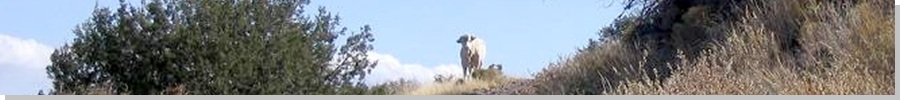
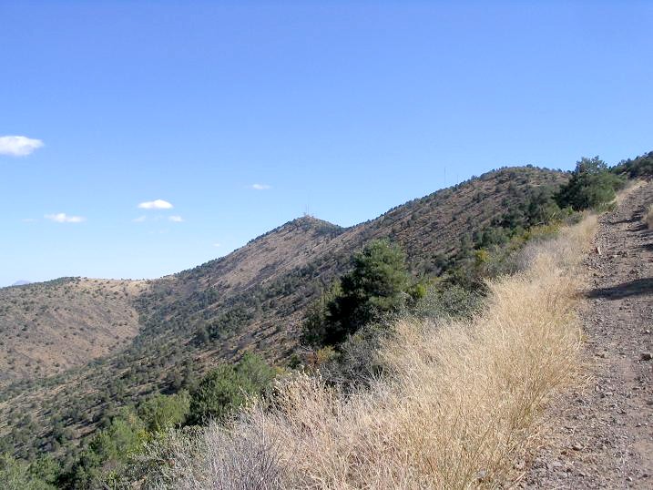
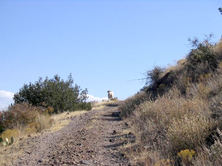
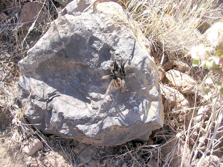
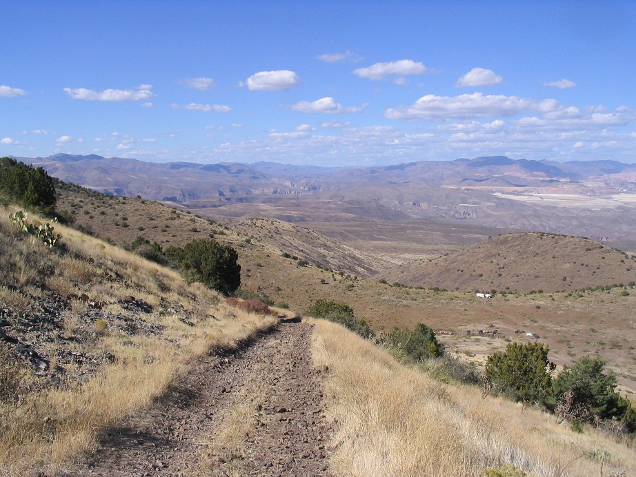
The hike up this road went well, and we were treated to some interesting wildlife. We saw a tarantula walking along a rock on the side of the road. There was also a lone white steer standing in the road, staring us down. We passed him without upsetting him. After a short while, we had topped out onto the main range crest. We took a break here to admire the views down into the Gila River box canyons below. The day was superb, with sunny, clear conditions.
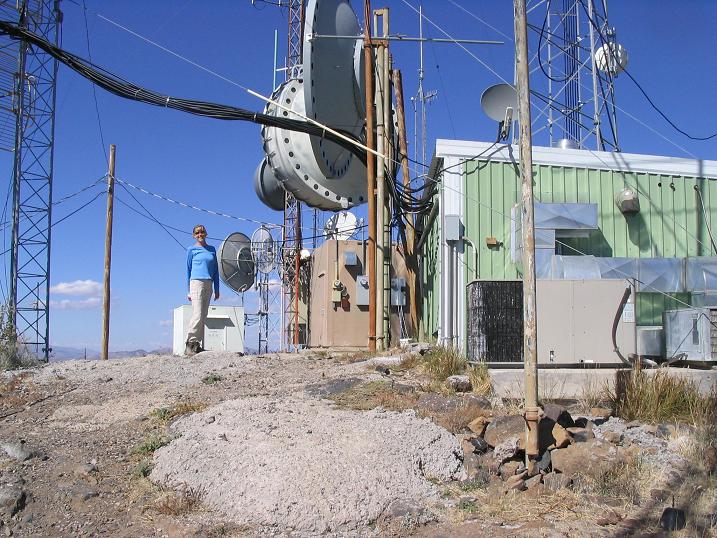
From here to the top, the road was more level, and even dropped in a few places. We just walked the road until it dropped one last time, then met with a better road that leads to the top. This better road comes in from US-191, but is gated at the highway. We were on the summit after two hours of easy hiking. Not surprisingly, the top was chock full of buildings and towers. Some workers were there, a couple guys tethered onto one tower about 80 feet above us. They did not mind our presence. We even saw another tarantula!
We took time to rest and check out the views, which were exceptional. Surrounding us were numerous mountain ranges, deserts and river valleys. We could see the huge mining works north near Clifton and Morenci. The day was so nice, there was no reason to hurry back down. But after about 30 minutes, we started the return hike.
The hike down went smoothly, going carefully on the rubbly rocks. We took a couple of breaks and arrived back at the truck in about 90 minutes, for a total time of 4 hours including breaks. Down below was a corral with a lot of cattle penned in and various cowboys working them and others getting them on to some transport trailers. The cattle mooed up a ruckus and could be heard from where we were.
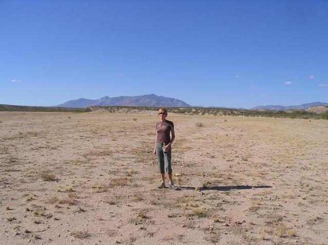
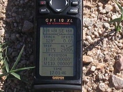
Our drive out went well and we were back in Safford by 4 p.m., relaxing back at our campground and a couple dips in the hot springs to soothe our muscles. We rewarded ourselves with another meal at Casa Mañana that evening. This was a straightforward and easy hike but a good one to get back into the swing of things. The next day we drove home and visited a confluence, the one at North 33, West 110. Then, on home.
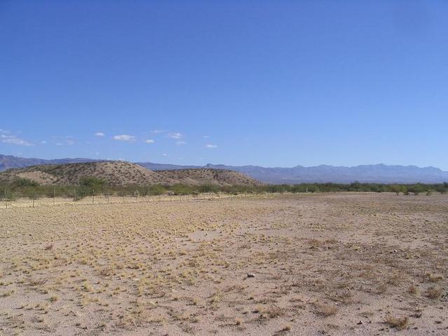
This confluence is about 20 miles west of Safford, about 4 miles south of Fort Thomas. Getting to it means following a few marginal dirt roads, then a walk across desert scrub and through arroyos to a cleared area, a big fenced pasture. It wasn't too interesting, but we got good views of the big peaks around us.
|


|