
The Mountains of Arizona
• www.surgent.net
|
| Black Top Mesa |
• Superstition Mountains • Superstition Wilderness Area • Tonto National Forest • Pinal County |
|
Date: January 8, 2020
• Elevation: 3,354 feet
• Prominence: 554 feet
• Distance: 11.5 miles
• Time: 6 hours
• Gain: 1,950 feet
• Conditions: Magnificent
Black Top Mesa is one of many peaks and formations in the backcountry of the Superstition Mountains. The whole range grew from ancient volcanism, with millions of years of erosion resulting in eroded tuff towers, cliffs and convolunted canyons. It is stunning country, now protected as wilderness, with miles of good trails and a number of let-in points. One could hike this land their whole life and still see something new every outing.
So I really have no excuse for almost never visiting the Supes. I just don't come here that often. When I first moved to Arizona in 1992, I explored the lower trails in Lost Dutchman State Park a couple times, and took friends who were visiting there if they wanted a hike. I've also hiked the trail from Peralta Trailhead in the south, the one that leads to the saddle overlooking Weavers Needle. I've hiked that trail about a half dozen times. I've tagged a few high summits but those have been one-offs. I never have developed a strong affinity for the range.
I was a member of the Central Arizona Mountain Rescue Team (Maricopa Sheriff's) from 1997-2004, and we had a lot of calls to the Supes. That was one of our primary rescue areas. Given the abundance of trails and the number of people who hike back there, lost hikers and injuries are common. We seemed to go to the Supes about once a month.
My first real rescue, where I was a fully-certified field technician, was to a guy who had busted his ankle just below the Flatiron. I was one of the first to show up. As a result, me and one other guy were helicoptered in to help the hiker. The helicopter then went down and ferried two more of our team up. A couple other hikers were there helping the man. I was fully involved: doing vitals, assessing his situation, deciding how to secure his ankle and him. We were able to load him into a helicopter, and they flew him down to an ambulance. We just hiked down the trail back to our cars. That was a real thrill for me.
Maybe I just burned out on the Supes with all the times we were going there on rescues. Whatever the case, whenever I get it into my head to go hike somewhere, I tend to ignore the Supes, which I know is bad. It's like having a National Park's worth of trails and scenery and I just ignore it.
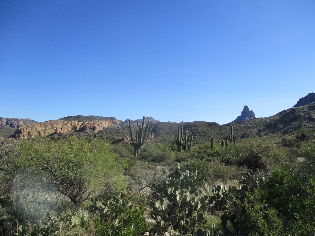
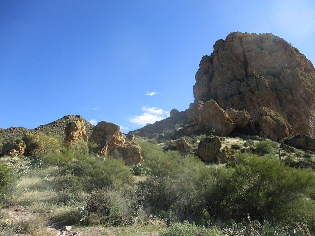
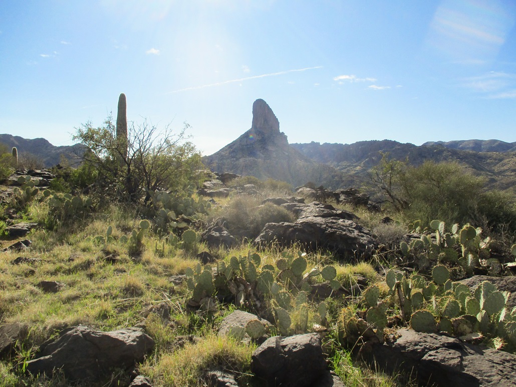
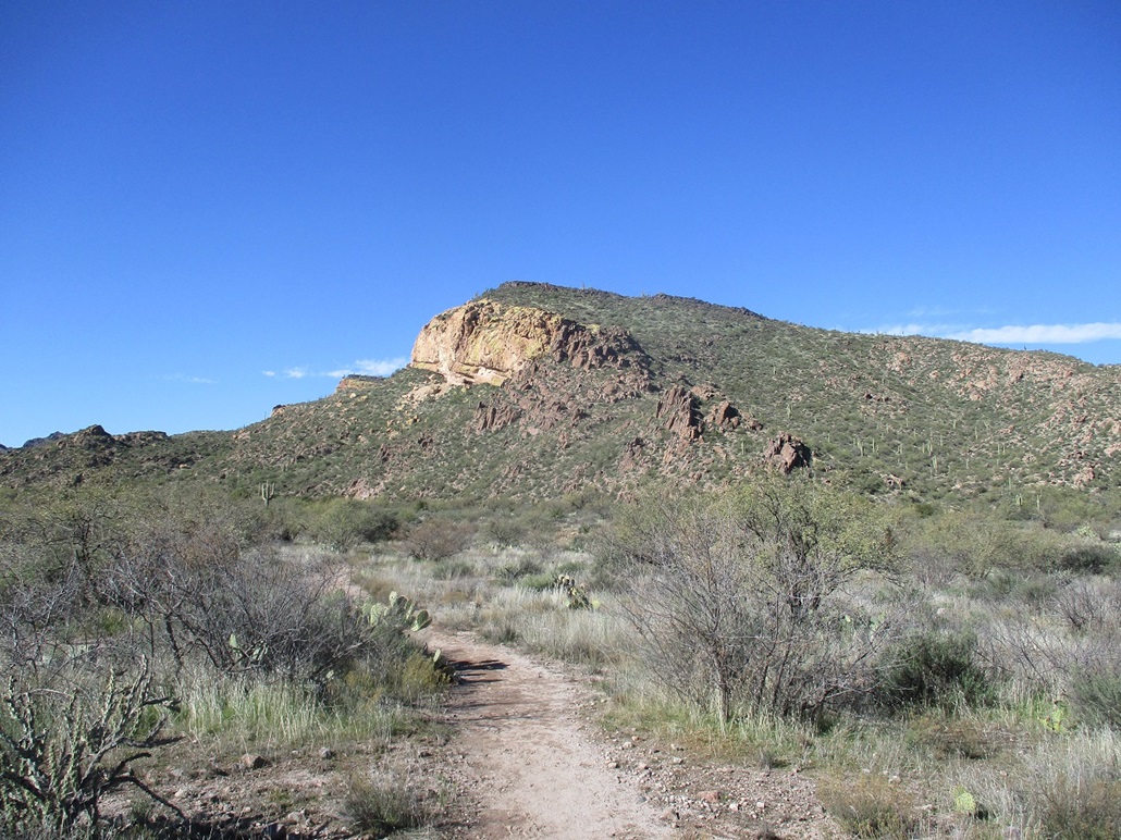
So when I read a short but informative trip report from someone who'd hike Black Top Mesa, I immediately was interested and set up plans to hike it. The mountain itself is a loaf-shaped mass, with tuff cliffs on its south, west and north faces, and a caprock layer of black basalt lava rock, which presumably inspires the peak's name. It is roughly centered in the part north of the main Superstition massif, with access from the First Water Trailhead. I was drawn to the idea of a fairly long hike (almost 12 miles round trip), which would give me a good dose of exposure to the inner canyons and hills of this area.
I know it gets crowded here so I picked a weekday, when crowds would be mitigated, and left home before dawn to arrive about when the sun would be rising. I rolled in to the First Water Trailhead about 7:20 a.m., the day clear but very cold for now, about 33 degrees (F). There were a few vehicles here already, possibly belonging to some overnighters somewhere in the backcountry. I suited up, locked the car, and started walking almost exactly at 7:30, sharp.
I followed the Lost Dutchman Trail (#104), dropping about 60 feet in about 0.4 mile. It comes to a junction with the Second Water Trail (#236), which goes left. I angled right, staying on the Lost Dutchman Trail. I walked slowly, the sky light but the sun still hidden by the mountains. It was very cold and my hands hurt.
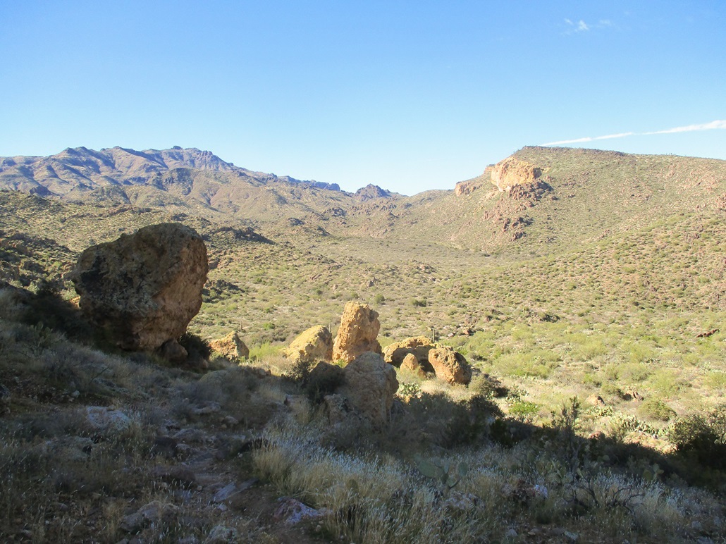
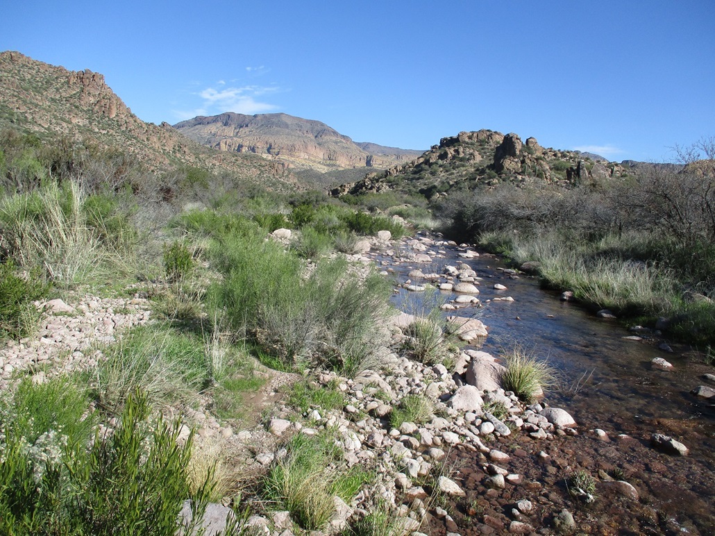
The trail heads southeast and parallels the First Water Creek, which today was flowing well. The trail stayed generally on the west bank, but small hills soon forced the trail to cross the creek, which it would over a half-dozen times in the next mile. Afterwards, the trail leaves First Water Creek, gains a small ridge, then drops into another creek, this one unnamed on the map, but paralleling First Water Creek (they merge about two miles to the north). I had to cross this creek a couple times, too.
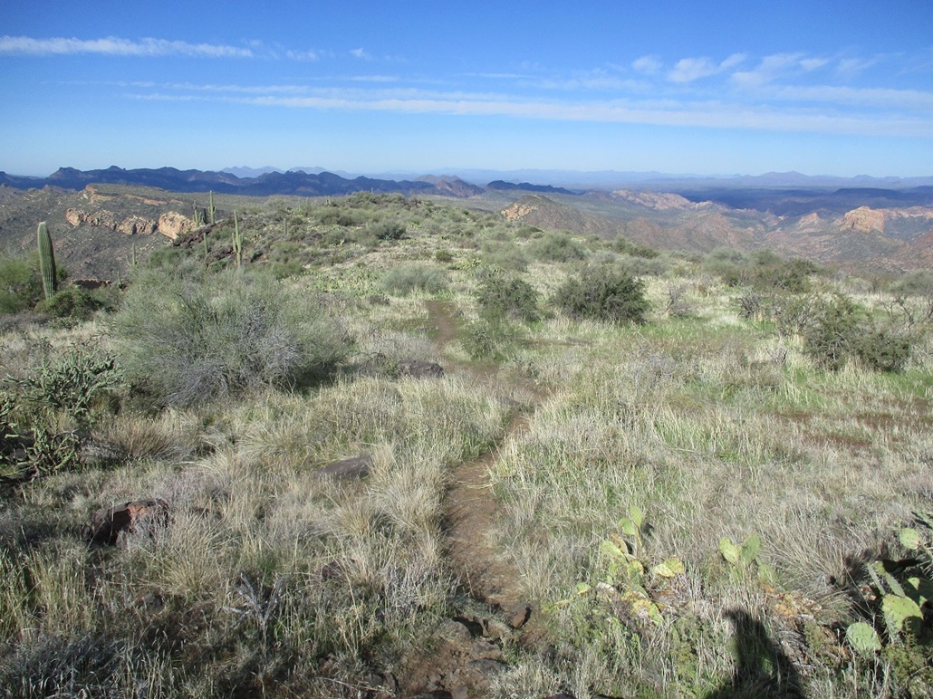
Once past the second creek, the trail bends east and gains toward Parker Pass, elevation 2,630 feet, roughly 2.5 miles from the trailhead and about 400 feet higher. I was making great time, my movement helped by the fine trail. I had not seen anyone yet. The sun was rising by now, lighting the higher peaks, and warming things up a little, to where it was not so biting cold. I took a break at Parker Pass.
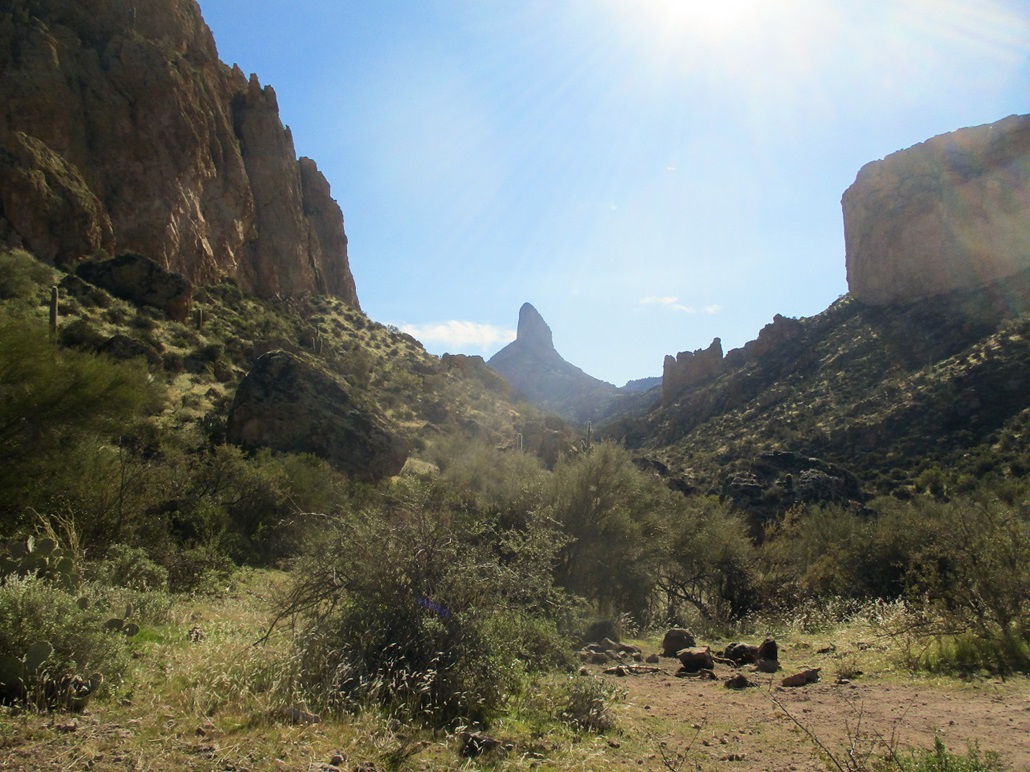
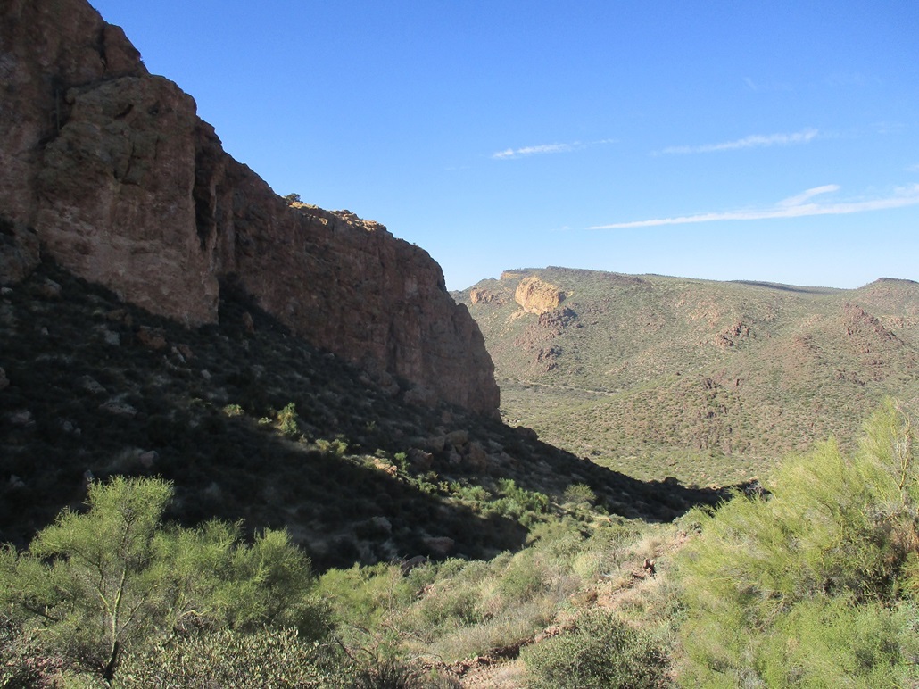
From the pass, the views open up looking east. The distinctive spire of Weavers Needle is visible as one approaches the pass. At the pass, its upper half stands tall. To the left (north) is a yellowish band of cliffs with a dark top --- Black Top Mesa. I was still two miles from its base.
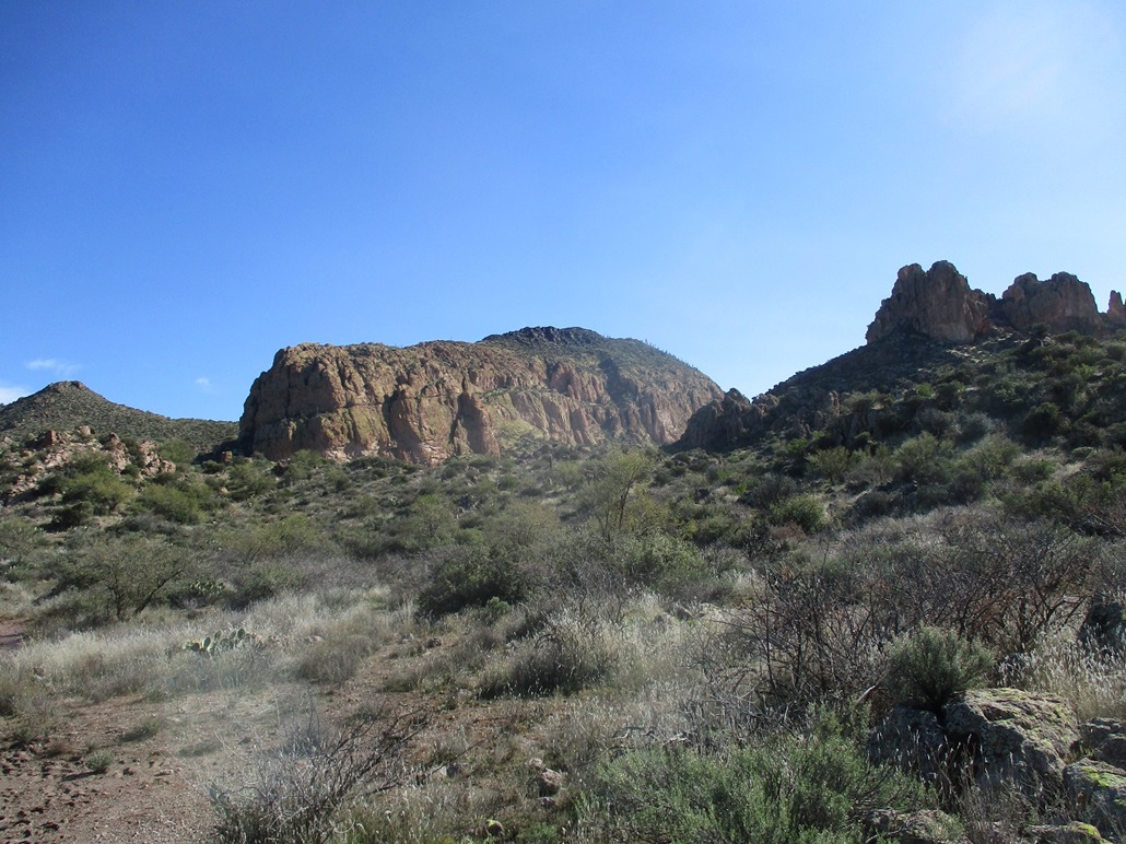
This next segment covered two miles and dropped nearly 400 feet, but the grade was so gentle I barely noticed it. I followed the trail, now stopping more often to admire and enjoy the views. In time, I had dropped downward to bottom out in a flat basin ringed by Black Top Mesa to the east, the fin-summit of Palomino Mountain to the south, Yellow Peak and Boulder Canyon to the north. Here, there are three trail junctions spaced about a quarter-mile apart: Trail 241 (I forget its name), the Boulder Canyon Trail (#103), and the Bull Pass Trail (#129). I wanted Bull Pass.
On Bull Pass Trail, I dropped into a creek (Boulder Canyon Creek, I think), then started up its other side. Then things got steep. After almost 5 miles of gentle inclines the whole way, I finally had some steep grades to handle. However, the trail was in great shape and the grade never too severe, nothing I haven't seen before.
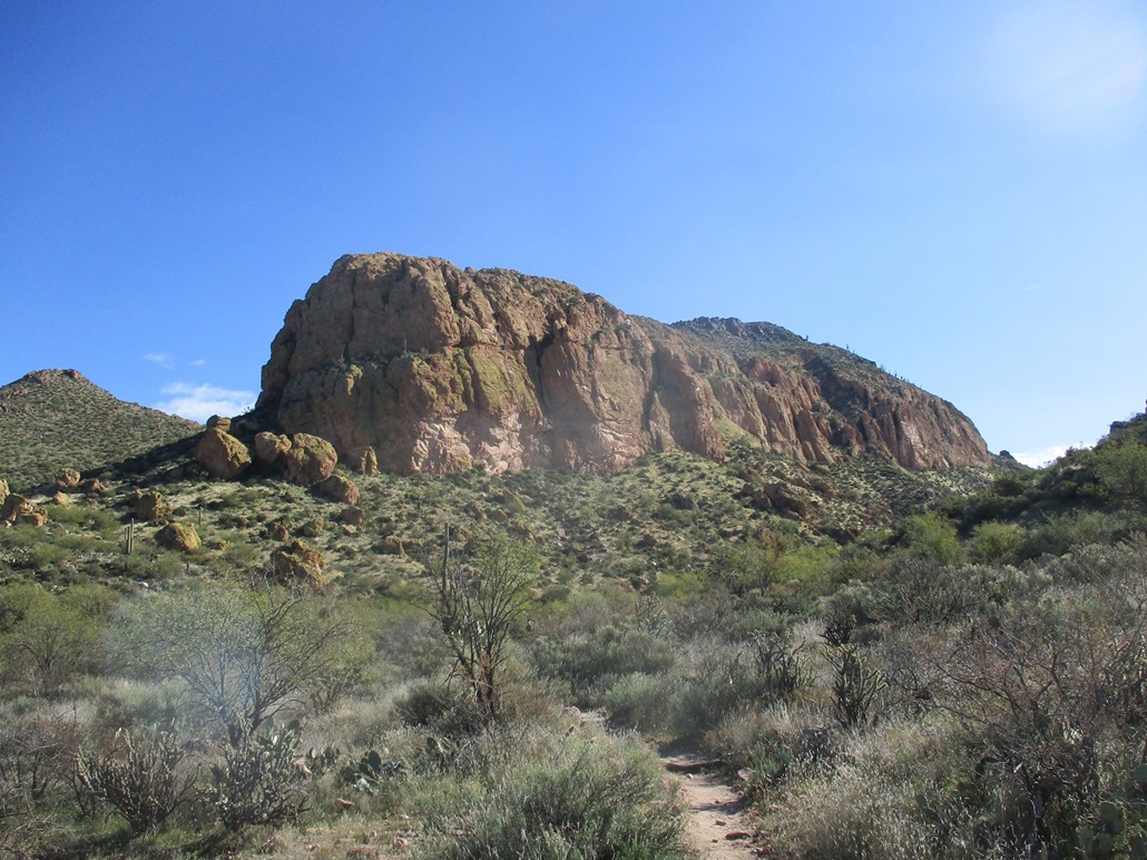
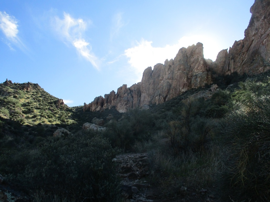
The Bull Pass Trail runs north of the magnificent band of cliffs that form a pallisade around Black Top Mesa. Below the cliffs are a dozen or so massive tuff blocks that fell long ago and have simply stayed put on the slopes, some bigger than a two-story house. I kept to the trail as it gained just under 500 feet to top out at Bull Pass (elevation 2,790 feet). north of Black Top Mesa.
At the pass, there is a lesser trail marked by a cairn that starts steeply upslope, trending more south than east. This trail is not numbered and not on any maps. However, it is used often enough so that it is as obvious and easy to follow as most other trails in the area. I had about 550 vertical feet to gain in a mile, steep but manageable.
As I walked uphill, I would stop and look at ths scenery ... and noticed someone hot on my heels. I had not seen anyone up until now, and there was someone just a couple hundred feet behind me. I stopped yet again to catch my breath, saw this person looking right at me. I raised my pole up to say hi, and this person just turned around and started down. I wonder if he (she?) followed me thinking I was still on Bull Pass Trail. It just meant I'd have the summit to myself.
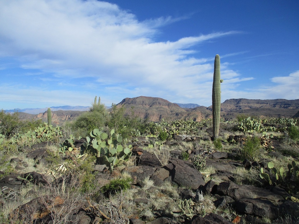
The trail starts to level and aim for a level portion of the ridge north of the highpoint. Here, the black volcanic rocks become much more abundant, brush including prickly-pear cactus growing between the rocks, with a few saguaro to complete the picture. I arrived on the top-most rocks and dropped the pack. It was 10:23 a.m., meaning I had been walking just shy of 3 hours.
The views up here were stunning. Immediately south was Weavers Needle, then all around the grandeur of the Superstitions --- Bluff Springs Mountain, Malapais Mountain, Yellow Peak, the Superstition massif, and peaks far away such as the Four Peaks and the Goldfield Mountains. I took a number of photographs, and I also simply sat and admired the views. It was just me and for fifteen minutes, I did not move a muscle. I stayed up top for a half-hour exactly, starting down at 10:53 a.m.. It was warm enough to take off the leg sweats and hike in shorts for the egress.
As I hiked down, I stopped often for photographs. I had taken almost no images on the hike in as the sun was low to the east and that was the direction I was hiking. I simply could not take a photo of Weavers Needle without the sun glaring it out (unless I waited about 3 hours). I took a whole bunch of images and hoped one or two would turn out well.
I was back to where Bull Pass Trail meets with the Lost Dutchman Trail. I could hear two people talking and it sounded like they were close by, but as I sat for a drink, no one ever showed, although I could plainly hear them. They were fairly loud and I prefered that they either pass me, or stay behind me. When they did not appear after a few minutes, I figured I'd get moving. I hiked back to Parker Pass in one long push, meeting a couple more hikers along the way. I took another break at Parker Pass.
From the pass back to the trailhead took another hour or so, covering a couple miles. I was enjoying the sights I had missed when it was too dark earlier this morning. I was back to the trailhead at 1:30 p.m., a two-hour and thirty-minute (or so) hike out. The round trip had taken almost exactly six hours. By now, the parking lot was full, but no one was around. I rested for a few minutes and changed into more comfortable clothes for the drive home.
I was home in about an hour, just in time to rush onto campus for a meeting. I was beat but not hurting, not feeling thrashed as I sometimes do after a long hike. Although I put on 11.5 miles, most of it was level hiking, and I was able to move well and not have to grunt out every step. I was thrilled how the hike went, and came out a believer, never again to doubt the beauty of the inner Superstition Mountains.
|


|