
The Mountains of Arizona
• www.surgent.net
|
| Asbestos Point |
• Sierra Ancha • Tonto National Forest • Gila County |
|
Date: April 5, 2020
• Elevation: 6,652 feet
• Prominence: 311 feet (confirmed via LIDAR)
• Distance: 7 miles
• Time: 3 hours and 15 minutes
• Gain: 1,970 feet
• Conditions: Just beautiful
Arizona
•
Main
•
PB
•
LoJ
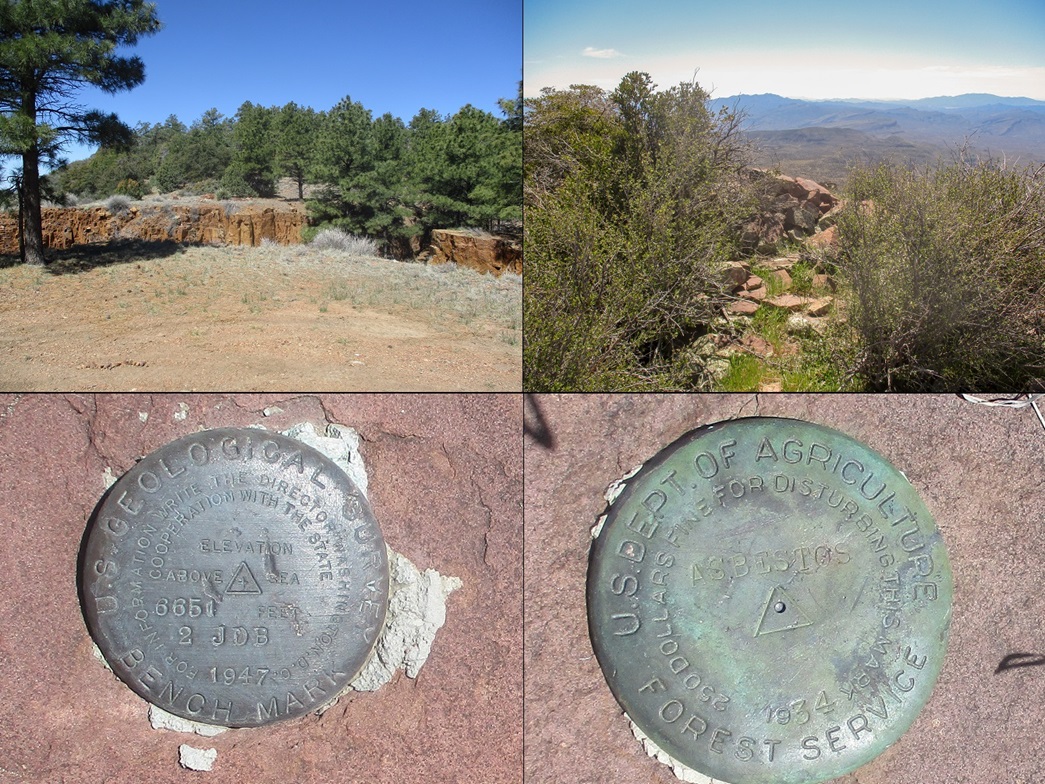
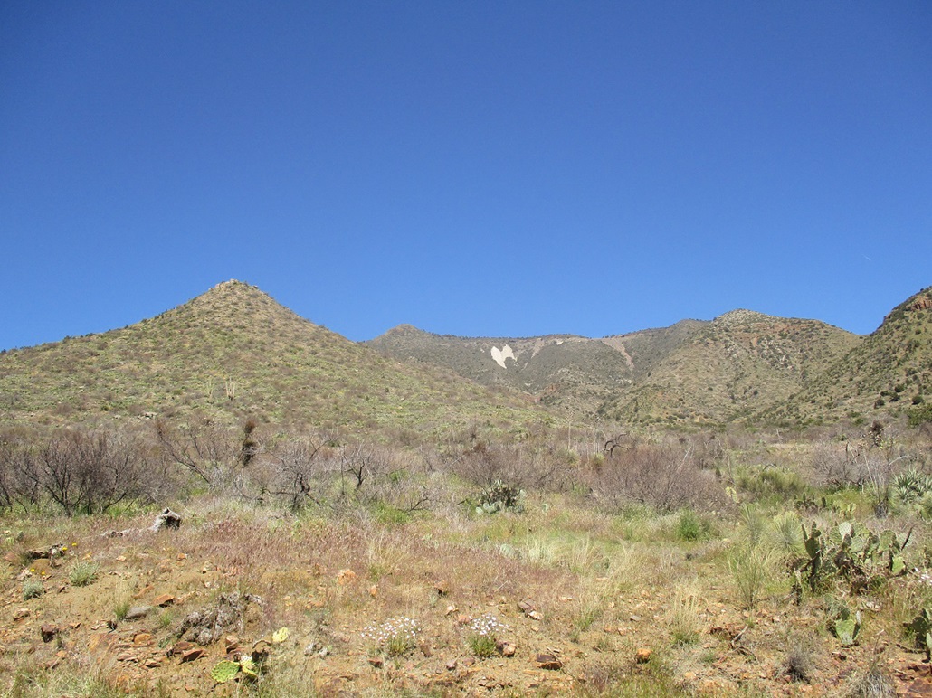
Asbestos Point is a small summit at the tip of a ridge on the southern end of the Sierra Ancha. Below the summit and along the ridge are a series of asbestos mines, which functioned from 1915 to 1927, then on and off through the early 1960s. White-colored rock from the mines was tossed down the slope, forming white "angel wings", which are still visible and from a long distance away. When approachng the Sierra Ancha from the south along state route AZ-288 or driving past it on AZ-188, the angel wings are easily seen. Asbestos Point is the bump to the left.
Asbestos Point itself has just 312 feet of mean prominence, so is not an "impressive" mountain, although, as I would learn, the last hundred feet is no walk in the park. The peak was just a destination, while I was equally curious about these mines and any relics thereof. A rough dirt road leaves AZ-288 and runs a couple steep miles to the high ridge and the old mines. Lesser tracks lead to the base of the peak, and only the last steep uphill slog is off any road.
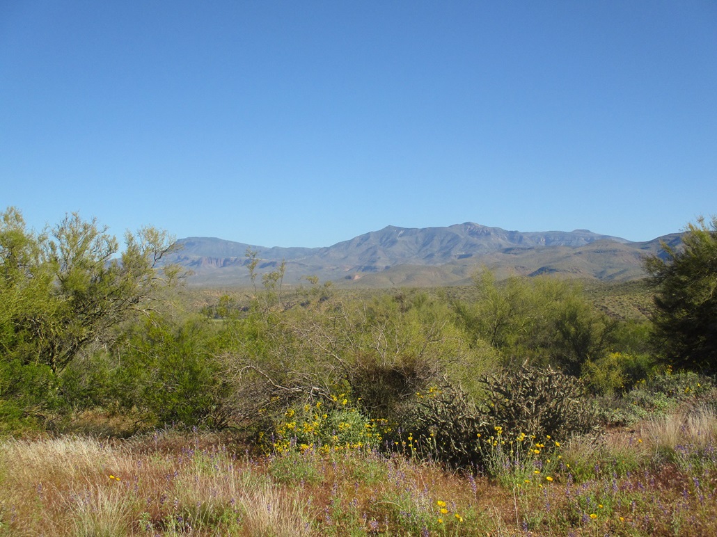
I left home in Payson about 7:30 a.m., drove south along AZ-87, then onto AZ-188 southbound along Lake Roosevelt, then onto AZ-288, the Young Highway, heading north. To the AZ-288 turn-off, I had driven about 60 miles. I drove northbound on AZ-288, across the old truss bridge over the Salt River, then up and up and up into the Sierra Ancha. The big peaks and ridges grew closer, and my destination, Asbestos Point, was plainly visible. It was about 9 a.m. when I was abeam of the mountain.
At this time, a young woman was waving me down. As I slowed, she had a set of jumper cables draped over her. Turns out she and her boyfriend were camping and their car would not start. I was the first car they'd seen in 45 minutes. Anyway, I drove in, parked near their car, and her boyfriend hooked up the cables to his battery. After a few tries, he got his car to start and they were able to leave. I've been in similar predicaments so it was nice to be able to help them out.
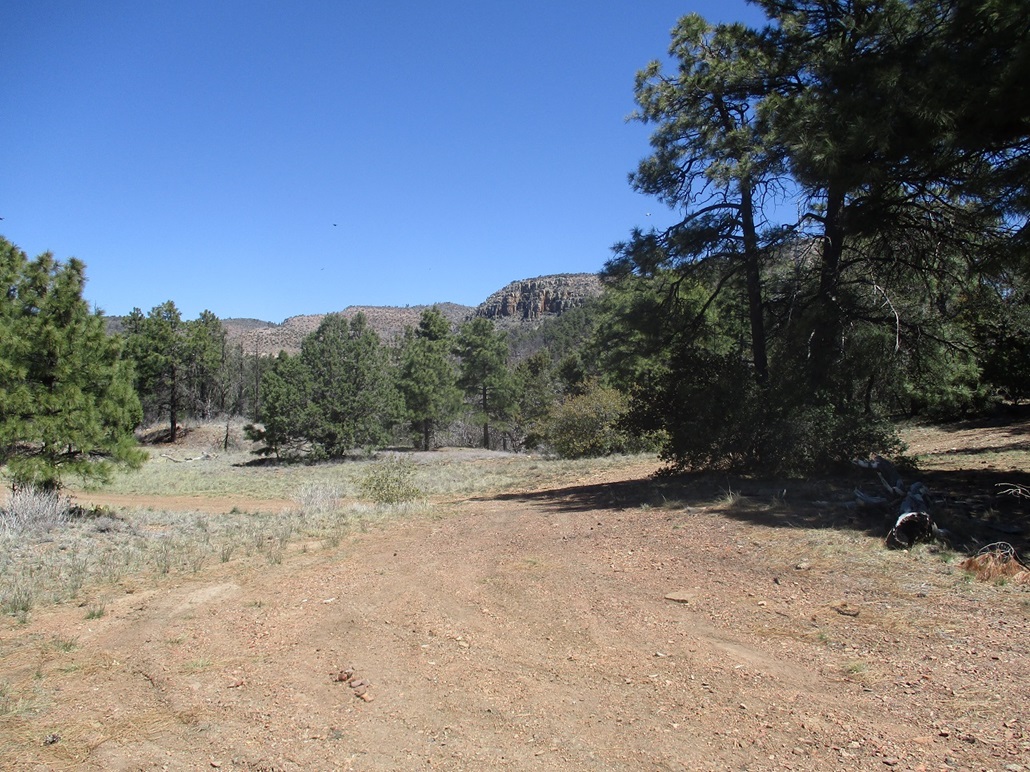
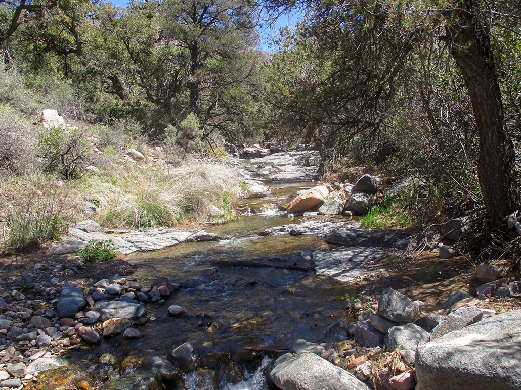
Back on the main road, I was only a mile or two south of the road I wanted, Tonto Forest Road 489. This road heads up Pocket Canyon and to the ridge near Asbestos Point. I drove in just a couple hundred feet on FR-489 and parked in a small pullout near Pocket Creek, which was flowing well. I was at elevation 4,680 feet, the time about 9:30 a.m.. The day was sunny and clear, pleasant and slightly cool at this elevation.
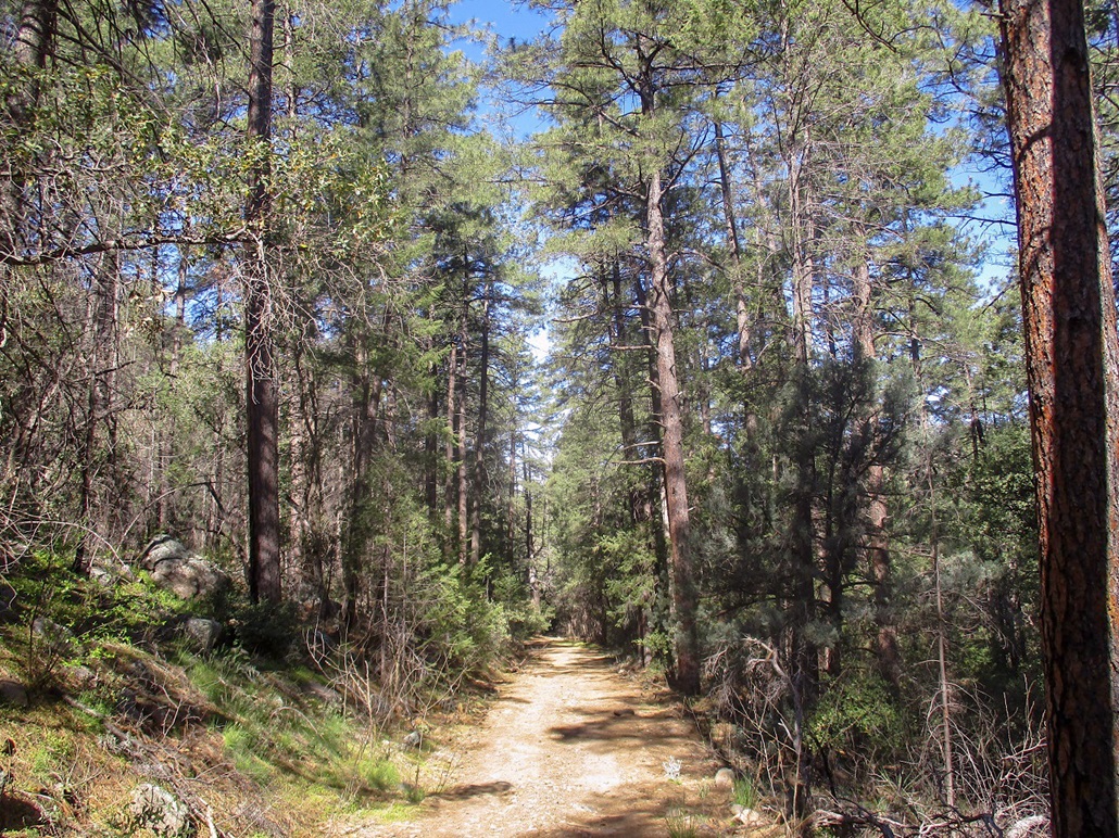
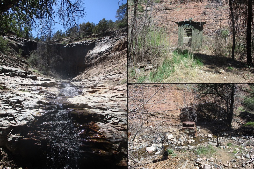
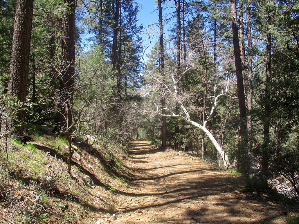
I started hiking within minutes, heading up FR-489. I came upon another family camping in another pullout, then, about twenty minutes later, came upon the second (and last) group, a threesome camped higher. They were near an old shed that sits beside the creek. A thirty-foot waterfall lies across the road from them, and there was also an old vehicle body from the 1930s lying beside the creek. I had covered a little over a mile and gained about 400 feet. The road to here was good for hiking and passable by any high-clearance vehicle when dry.
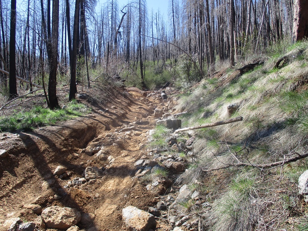
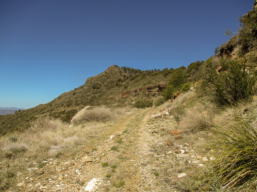
Immediately beyond this last camping spot, the road forks, the right fork heading uphill. The quality dropped about eight notches. Suddenly, the road was covered over in large boulders and had badly-eroded sections forming steep v-channels in the tread. Large trees had fallen onto the road. For walking, it was still a good route, although the steeper grade and loose rocks and gravel made footing a little less secure. Also, the road was muddy. Although our last big rain was over two weeks ago, there are many springs up high which were flowing.
As I walked up the road, I doubted anyone could drive it, but sure enough, there was a fairly fresh set of tire prints, still reasonably well-defined. They were probably here in the past couple of days. But these were beefy prints, and only a tricked-out Jeep or similar, with a capable driver, could get up this mess.
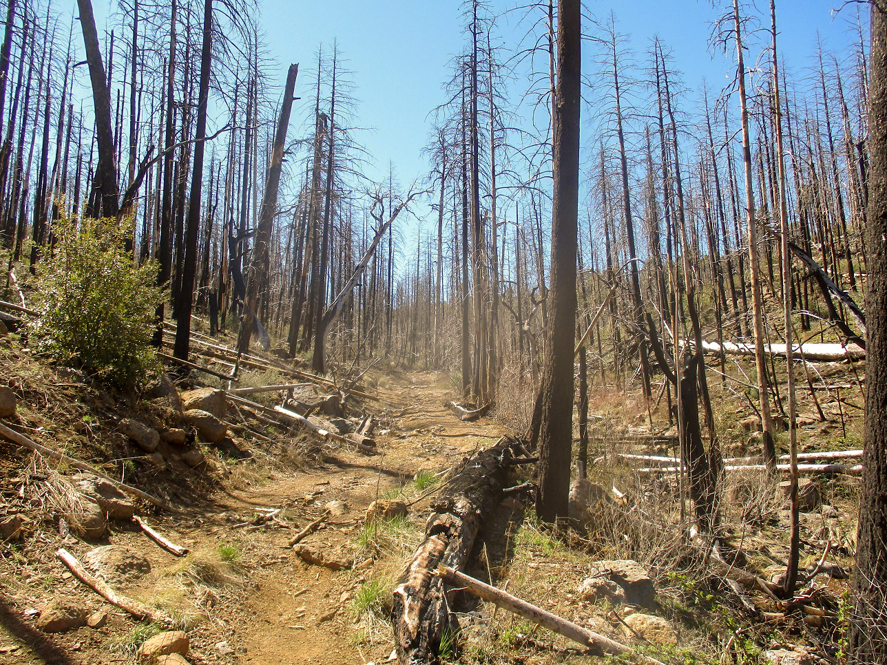
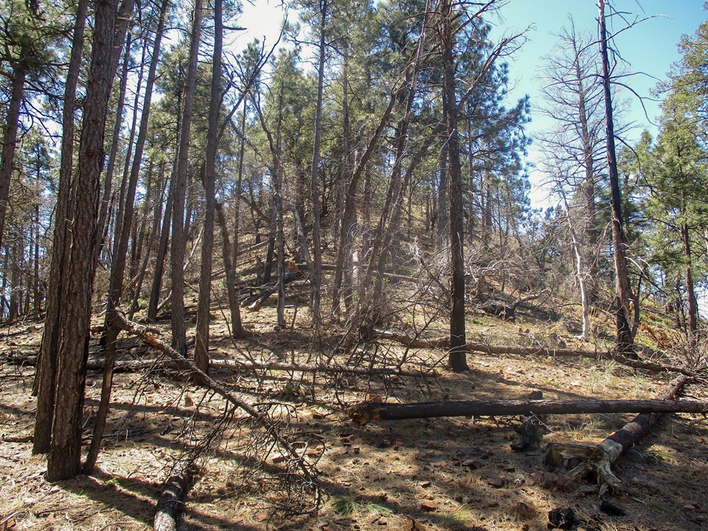
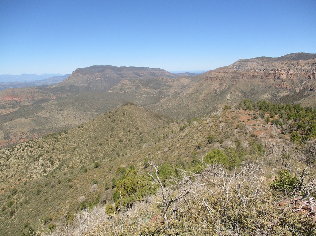
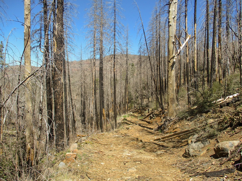
As I hiked higher, the forest changed, from leafier trees down low, to thick ponderosa, to an old burn area of vertical blackened sticks, formerly ponderosa trees. The views were good: I could see the surrounding canyon walls and high ridges easily. The road cuts across the creek near the top, then aims upward and slowly flattens as it gains the high ridge. Up higher, the road was consistently muddy, whole segments one long pile of muddy goop. I had to walk on the berms or hop from rock to rock, whatever it took.
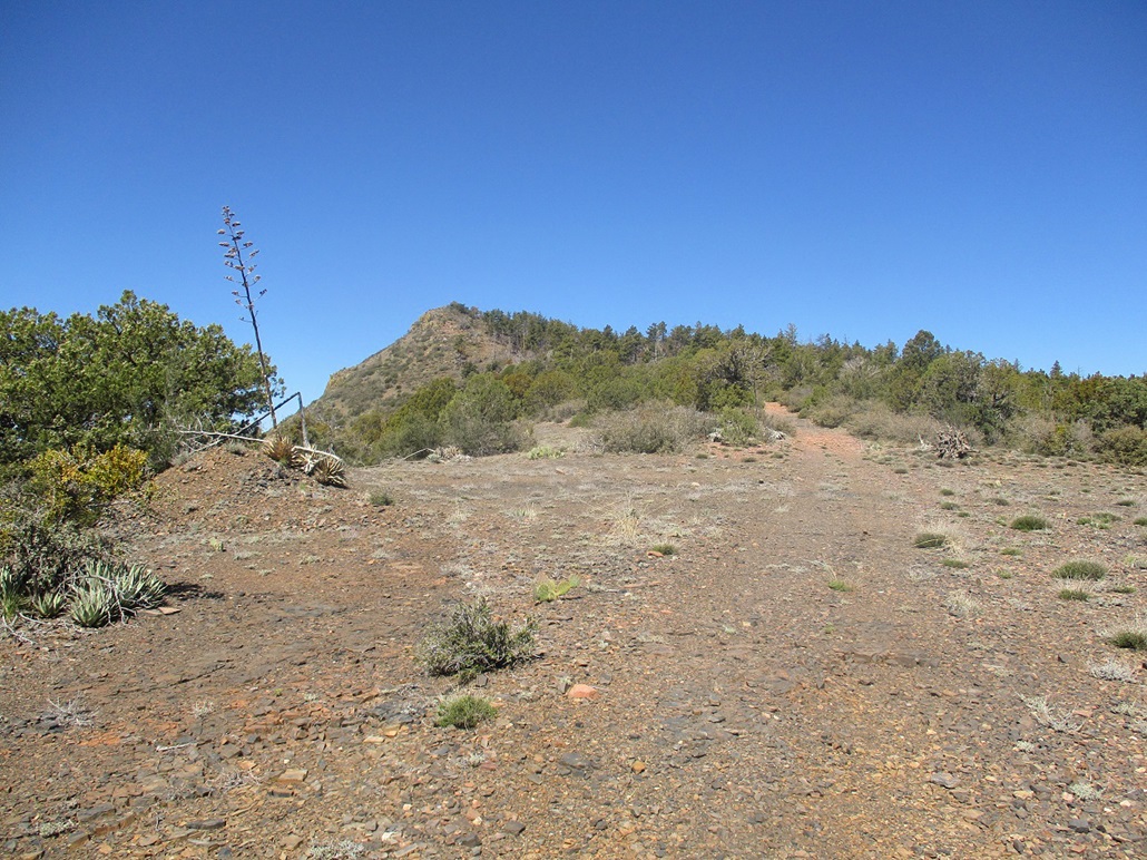
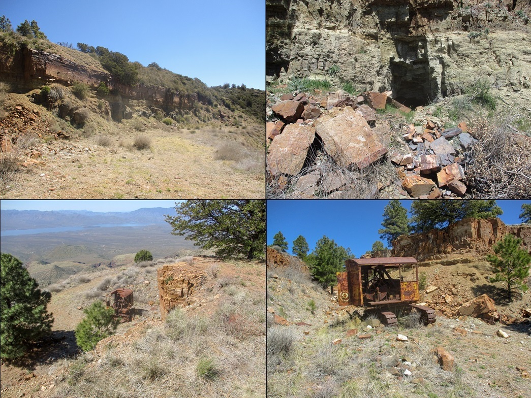
Toward the top, the road makes a hard right, then sweeps upward again to top out on the high ridge, at a saddle between Asbestos Point to the west, and Zimmerman Point to the east. The saddle itself was a lovely flat piece of level ground, with junipers and pines, and plenty of open space. I walked up to the south edge and looked down about 40 feet at an old crane (or similar), a relic from the old mining days. I would inspect it later.
I followed the road westerly as it weaved around a couple of breaks and (natural?) trenches, soon gaining above that into a light forest of juniper and ponderosa. The track was faint, but as long as it went west and uphill, I stayed on it. I came into an open area where I had my first close-up view of the summit, a pointy hump at the far end of the rise. Once back in the forest, I stayed on the track until it reached its own apex. I was north of the summit now. I left the road and walked through the trees to the base of the summit hill.
The hill is steep and abrupt, gaining about 120 feet at about a 40 to 45-degree slope. I looked for a line that looked free of brush or downed trees. I found one more toward the west edge, and slowly grunted up the slope, trying to keep from slipping. I used trees and rocks to stay secure. Soon, I scrambled up the last bit to the small rocky and brushy summit, arriving about 90 minutes afterstarting, a 3.5-mile one-way hike with just under 2,000 feet of gain.
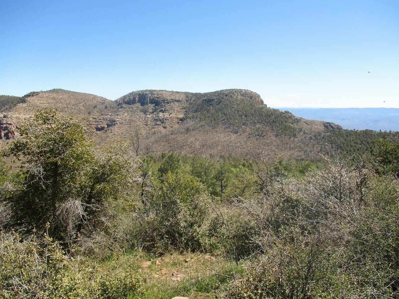
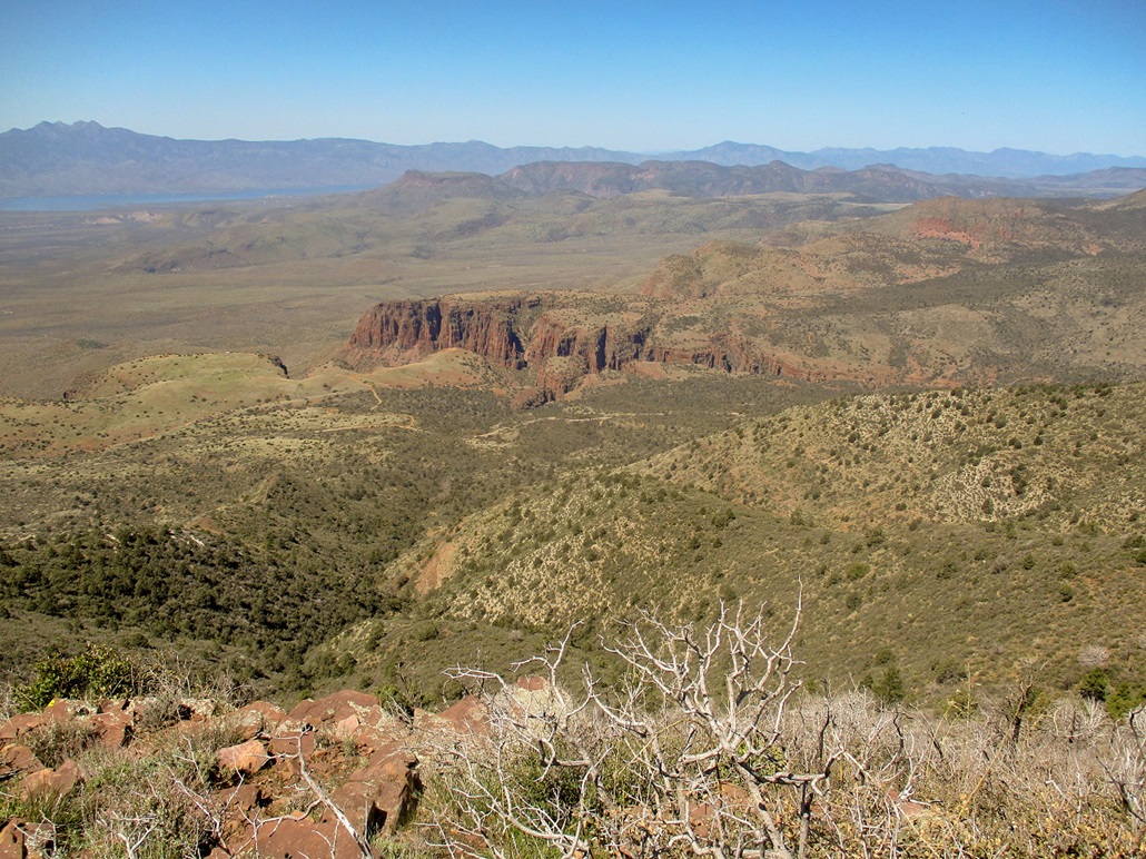
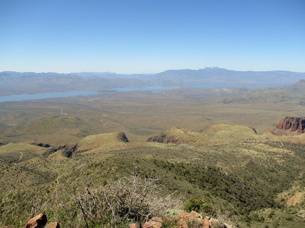
The views were great. There are no foothills when looking south, so it's a long 4,000-foot drop to Lake Roosevelt below. Looking west I had an elevated view of the Salome Creek Canyon. In other directions I had great views of the distant Mazatzal Mountains, Armer Mountain, and peaks to the east such as Rockinstraw Mountain. The summit has two benchmarks, one stamped ASBESTOS from 1934, and another stamped JDB from 1947. I could not find a register, and the insects were out in force, so I did not stay long. I descended carefully down the slope, then walked the track back to the saddle.
I followed the road down a small break and onto a lower road-cut that runs about a half-mile across the highest slopes. Spaced somewhat evenly are mine adits, many still visible and easily accessible. I walked the road a little ways, and scampered up a couple rock piles to peer into the adits. However, I did not go inside. One, there may be asbestos dust still there, two, mines like to cave in without notice, and three, I wasn't really interested in going inside a pitch-black hole. I was content to view them from the outside. I spent about a half hour looking at the adits, and that old crane thing (I have no clue what it is, to be honest). It's probably been here for 60 years, maybe going all the way back to the first mines from 1915. They somehow got that thing up the road back in the day. When operations shut down, it was easier just to leave it where it is.
I hiked down the same way to my car, going faster now with gravity to assist me. The road was gooey with mud or slick with gravel so I went slow, but still made good time, taking an hour to get back to my car. The "higher up" camping people had left by now, the "lower down" group were still there --- their stuff was, at least. I did not see any people. I was back to my car at 11:45 a.m.. I took time to change and then go look at the creek, which was just a few feet away. This would be a great camping spot and I will surely come back. I was slightly concerned my car would not start after possibly draining it of juice when I helped those other people, but it started just fine.
I drove slowly outbound, inspecting some side roads and enjoying the views and the wildflowers. I got back onto AZ-188 heading north. There were a lot of motorcyclists out today, some solo and others in big groups. Traffic was light, but invariably there was always some motorist going 35 m.p.h. on the highway, causing back-ups. I was in no hurry so I tried my best to be patient. I was home a little before 2 p.m..
In keeping with the spirit of social distancing, I kept apart from anyone I met, as they did from me. I saw no one else on the hike, and although there were cars parked in spots in other areas along AZ-288, I did not see many people, certainly no clumps of people smooshed together. However, I will note that dogs apparently do not understand this social distancing. They would come right up to me to either bark at me or sniff me.
|

|