The Mountains of West Texas
www.surgent.net |
| Emory Peak |
• Highpoint: Brewster County • Highpoint: Big Bend National Park • Highpoint: Chisos Mountains |
 Emory Peak as we start the hike
|
Dates: (1) January 1, 2000, (2) December 21, 2005
• Elevation: 7,825 feet
• Prominence: 4,485 feet
• Distance: 9 miles
• Time: 5 hours in 2000, a little longer in 2005
• Gain: 2,500 feet
• Conditions: Fantastic both times
Texas
•
PB
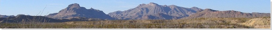
Emory Peak is the centerpiece of Big Bend National Park in West Texas. It sits atop the Chisos Plateau, overlooking a beautiful panoply of mountain ranges, forests, canyons and desert. An excellent trail goes to the base of the summit rocks, and a twenty-foot scramble leads to the top. It is one of the best hikes not only in Texas, but within the United States.
January 2000: As 1999 drew to a close, I wanted to do something unique to celebrate the momentous date in which years starting with 1 ended, and those starting with 2 started. Normally I stay home on new years eves, or stand like a fool smashed against a hundred thousand others at a block party. Instead, I would go to Texas, find a bar somewhere, and drink beer. I had no place in mind. I'd figure that out once I got there. I'd be the proverbial stranger.
As I hashed out this plan, I made Big Bend my main destination. This would be my first visit to this park. I left Arizona on December 30th, and stayed a night in El Paso. The next morning, I climbed Franklin Mountain in El Paso. I was done with the hike by noon, with most of a day to get me somewhere close to Big Bend.
I drove a couple hours east on Interstate-10, then south on US-90 into Marfa. I drove around the downtown area but nothing looked enticing. So I drove another thirty miles to Alpine, which is home to Sul Ross State University. I figured with a school in town, the nightlife may offer more options. I got a room at a hotel, then drove back to town and planted myself in a bar where they had a good Tex-Mex band playing. They had good food and the people were cool. I had fun, and enjoyed the experience. That was where I was when the odometer rolled over.
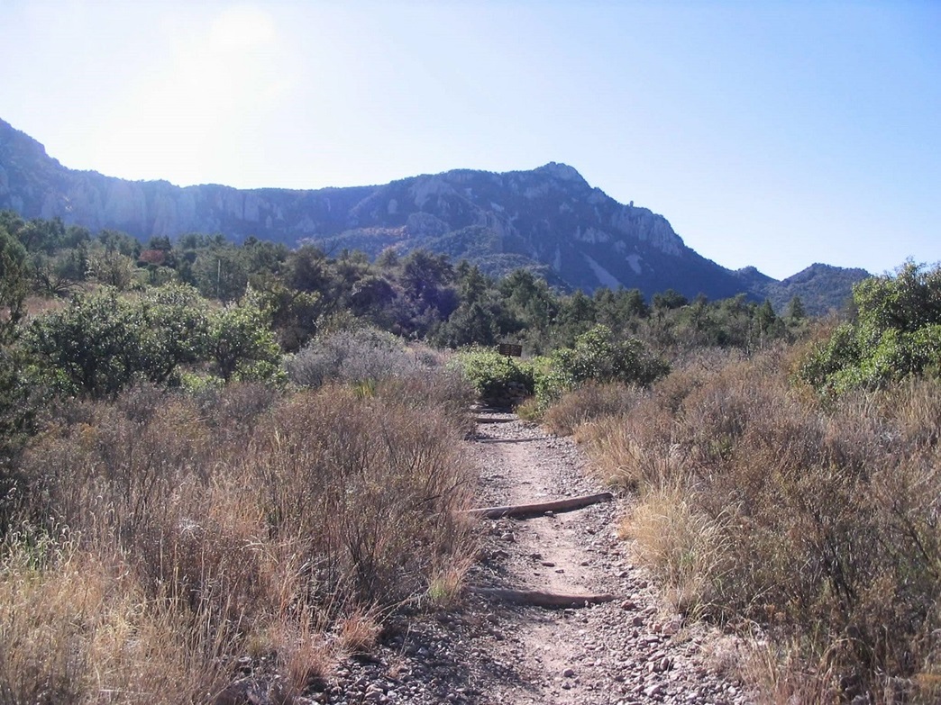
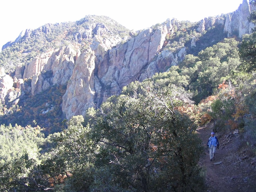
The next morning, I drove south to Big Bend National Park, paid my fee and parked at the Chisos Basin parking lot, arriving at 9 a.m., weather pleasant and a little overcast. I began my hike along the Pinnacle Ridge Trail shortly. This is a fantastic trail, well-maintained and free of loose rocks and other impediments. The trail gains steadily but at an easy grade through meadows and low forest before it switchbacks a few times to gain the main ridge of the Chisos Mountains. To here, I had covered 3.5 miles with 2,000 feet of elevation gain.
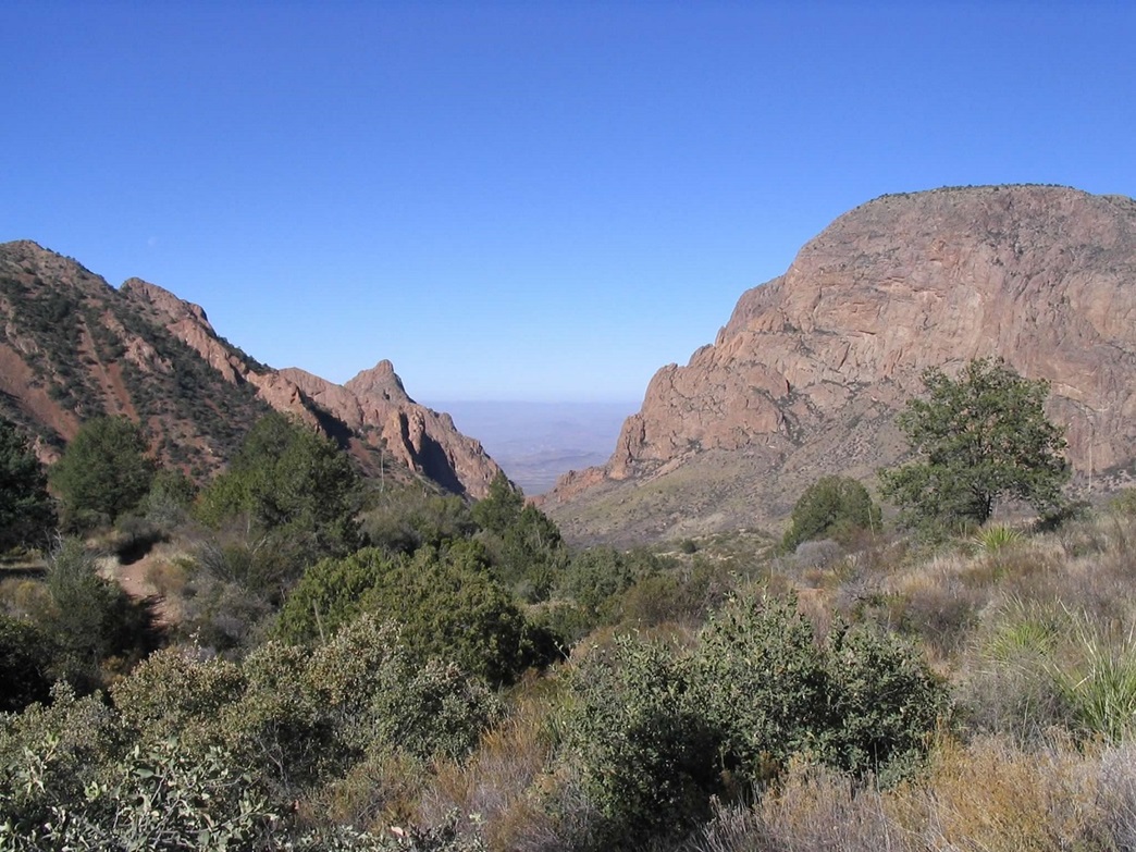
I met with another hiker who was part of a large group, but they were going too slow for him. So we hiked as a duo, and together covered the final mile to the top. The trail drops a little, then branches off toward the summit through pleasant grass meadows. The last hundred feet gets steeper and more brushy, the trail built tightly into the rocks and trees. Finally, it ends at the base of the summit pinnacles.
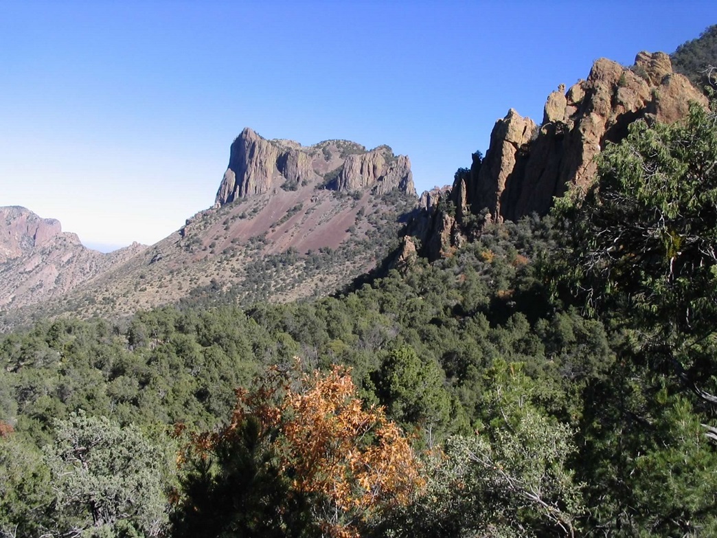
There were about a dozen people milling about, most not interested in scaling the rocks. We looked at the rocks and found a way to shimmy up one 10-foot section, then it was an easier, short series of little ledges to get to the actual top.
We relaxed for 15 minutes, enjoying the amazing views. We started down when a few others started to come up, crowding us out. Down-climbing the rocks went quickly. The hike out went quick, and I bid goodbye to my hiking partner as he stuck around to greet his friends as they slowly made their way to the summit. I was back to my truck at 5 p.m.
I stayed for dinner at the Chisos Basin Lodge. I thought about staying at Big Bend for another day but the weather was variable and I had other plans, so I hit the road. I proceeded north to the town of Marathon ("Mare-uh-thin", accent on the "mare"), passed through a storm, and ended up back in Alpine, staying at the same hotel as I did the previous night. I spent the rest of my trip exploring the flat Permian Basin lands around Midland, Mentone, Winkler and then into New Mexico.
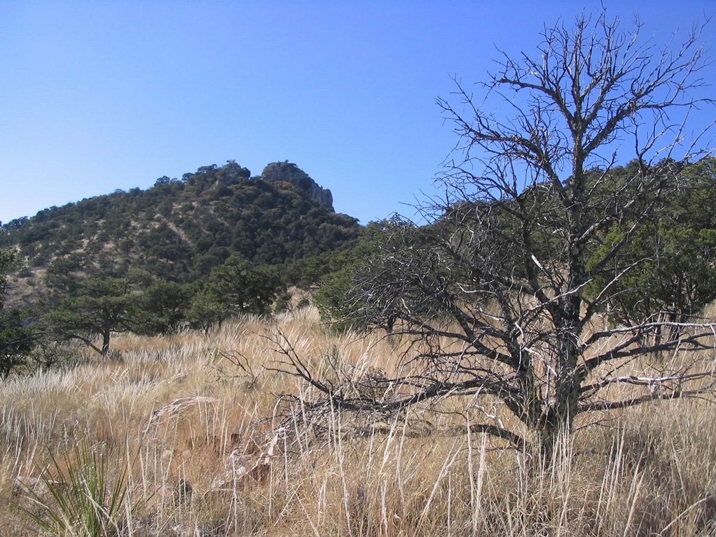
December 2005: For Christmas 2005, βð and I encamped at the Terlingua Ranch, a lonely outpost about 60 miles from the park and about 15 miles off of the main highway, TX-118. This place has cabins, campsites, RV pull-through sites and a cafe. A number of people live scattered about the region, which is outside the National Park boundaries. The "immediate" area covers about 200 square miles, of which we figure 500 people live here permanently. Terlingua Ranch serves as a nexus for the locals, as well as a popular tourist destination for those heading to the Big Bend.
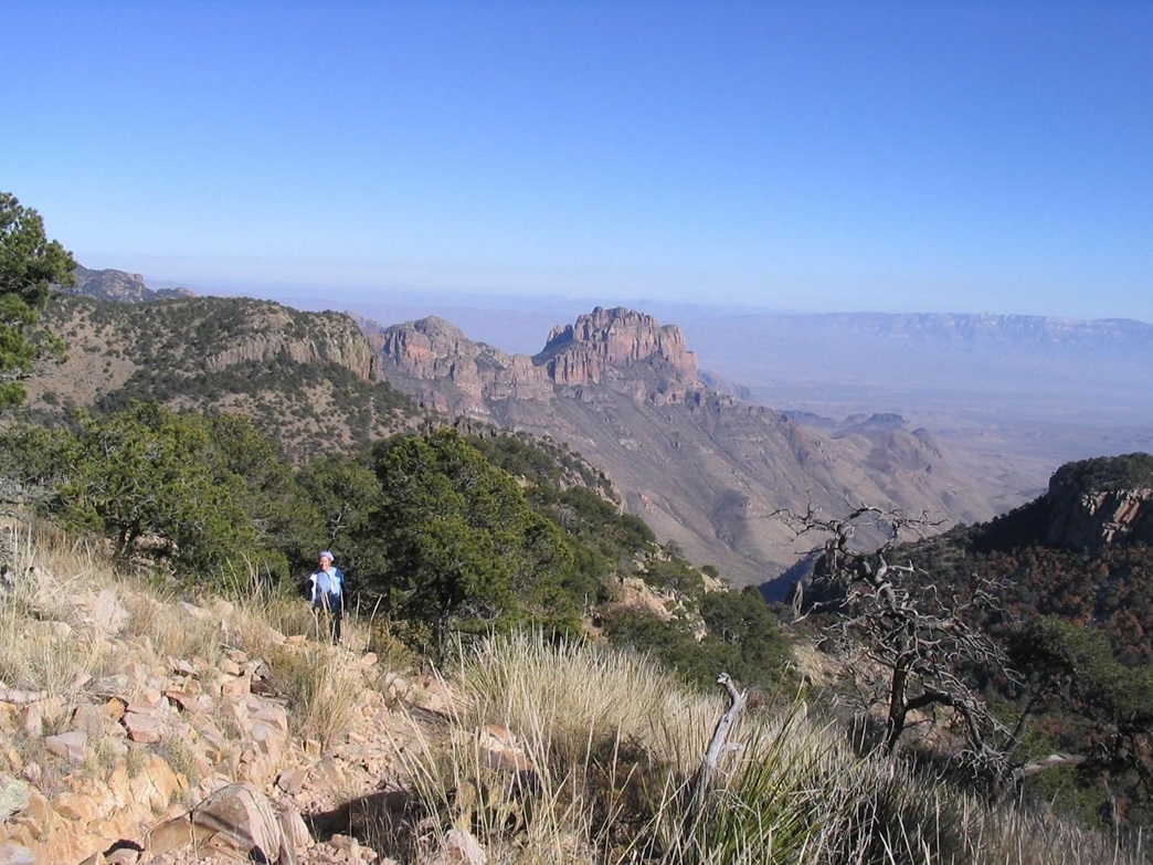
We arrived on the evening of the 18th and spent a couple days relaxing and doing other hikes and explorations before tackling Emory Peak on the 21st. We were at the Chisos Basin trailhead by 10 a.m., where we took time to get ready. We followed the same trail as I took in 2000. Not much difference but some new signs were put up. It's a beautiful trail that is never too steep and always with amazing views looking down. We achieved the ridge in two hours and took an extended break.
βð was hanging in there given her insidious arthritis and its accompanying fatigue and achiness. She psyched herself up for the remaining mile to the top, and we took this section very slowly, taking about 90 minutes to get to the base of the summit rocks. We then scouted for ways up. We found a distinct cleft off to the right (not the same way I went up in 2000) and saw that this looked promising. It's about 10 feet of minorly-exposed scrambling to a safe ledge.
I went up first and turned to guide βð, but she was having real trouble gaining a solid footing or grip. After a couple minutes of trying things out, common sense dictated we don't push our luck. I suggested she not do it, and she asked me then to come down. I was just a few feet from the summit. My head, when I stood, was nearly level with the top, but I chose to skip the final few feet and come back down to be with her as we celebrated a successful hike.
We spent 45 minutes on the ground, while a few others showed up. Interestingly, not one was willing to chance the rocks to the summit, like back in 2000. The hike down went slow as well, and we returned to the truck at 5:20 p.m., as the sun was setting. After changing out of our boots and getting situated, we drove back to our cabin at Terlingua Ranch.
We stayed at Terlingua Ranch a couple more days, highlighted by a cute little fox running around the cabin and the hill above us. We redrove the River Road (FM-170) to Candelaria then spent a couple nights at the Chinati Hot Springs, with Cornpone the bloodhound. And finally, home to Arizona.
|
|