The Mountains of Nevada
• www.surgent.net
|
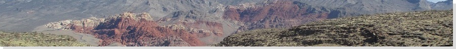
| Ugly Brown Lump • Peak 6080 |
• La Madre Mountain Wilderness • Spring Mountains • Clark County |
|
Date: May 25, 2021
• Elevation: 6,080 feet
• Prominence: 1,160 feet
• Distance: 6 miles
• Time: 4 hours
• Gain: 1,840 feet
• Conditions: Sunny and cool, but warming steadily
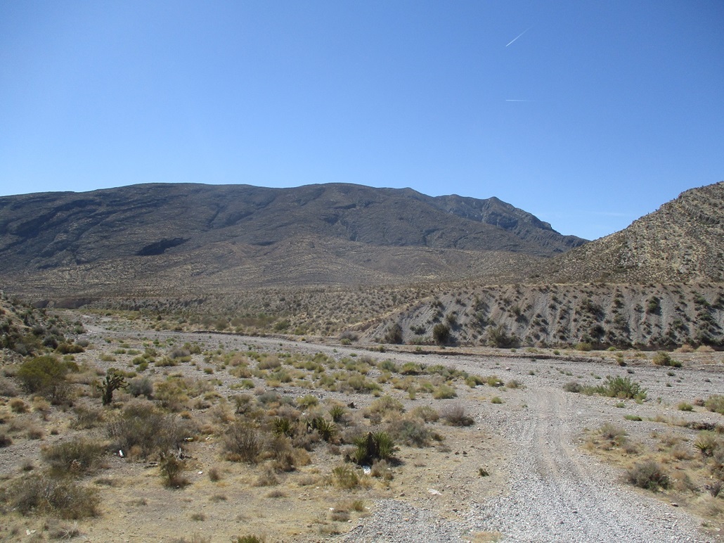
This peak lies south of highway to Mount Charleston, about ten miles west of US-95. I had no idea it existed until last night. I was looking at online maps and saw this peak. It looked straightforward and also high enough in elevation so that the heat of the day would not be as bad as down in the city. The name is apparently one used by local peakbaggers. It's not ugly. It's a decent hill that gets overshadowed by the bigger and sexier peaks like La Madre Mountain and the big peaks up by Charleston.
I was up very early, getting myself onto the 215 Beltway to the northwest part of town, then somehow getting onto US-95. There is a lot of construction here and the detour signage is weak at best. Someday this will be a fancy four-leaf interchange, but for now, it's a jumble of roads, temporary bypasses and work trucks. I went north on US-95 to the highway to Mount Charleston, NV-156. I knew to look for a dirt track past a hill alongside the highway. I found this track, and drove in about a half mile. This put me out of sight of the main highway. The area is used by shooters, but today, there was no one. I parked, still early enough that the sun was still mostly behind the eastern hills and I was in shade.
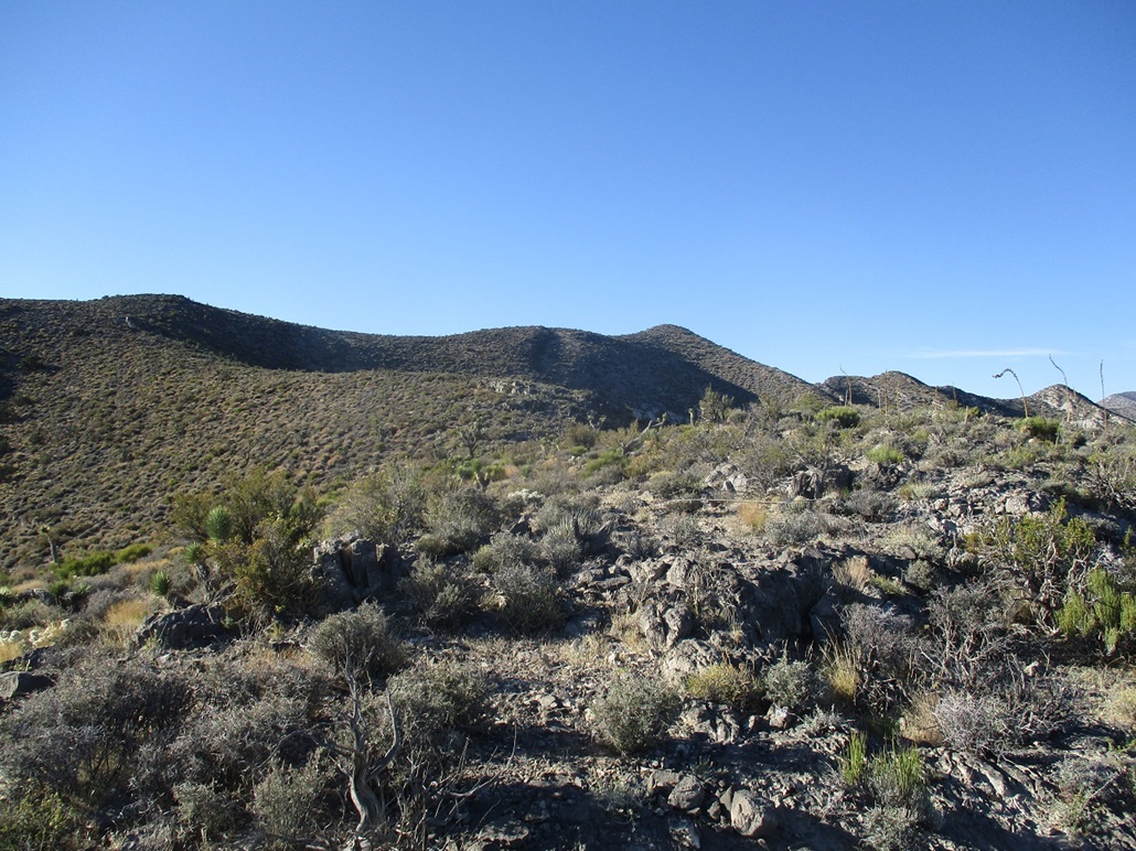
I walked down a track into a broad wash called Harris Springs Canyon, losing about 80 feet over a mile. The sun rose and I could better study the topography of the mountain. The summit is a bump at the south tip of the massif. Cliffs fall away on the east-facing side, while on this side, the slopes rise up over a thousand feet to the crest and to the summit. Eyeballing it all, there did not appear to be any unexpected cliff bands or other surprises. I chose a slope essentially closest to me. It looked friendly so I went for it.
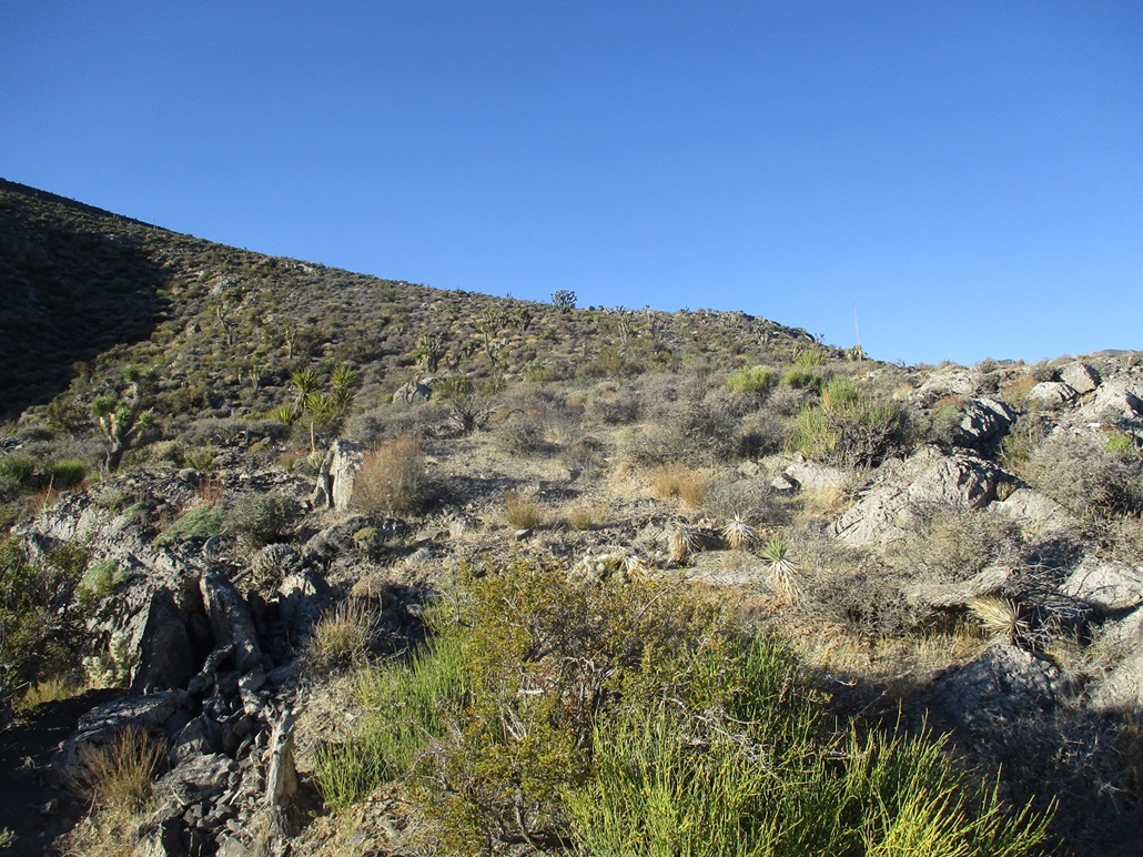
The slope increases incrementally, becoming slightly steep, but never more than that. I gained up this hill, the brush light with open lanes to follow, and continued upward to a rock outcrop up ahead. It became apparent that a better slope was to my left (northish), so I dropped about 25 feet through lumpy talus, then up the other side onto this next ridge. This would be the only scrambling I'd do today and I would rate it as easy Class-2, hands for balance only.
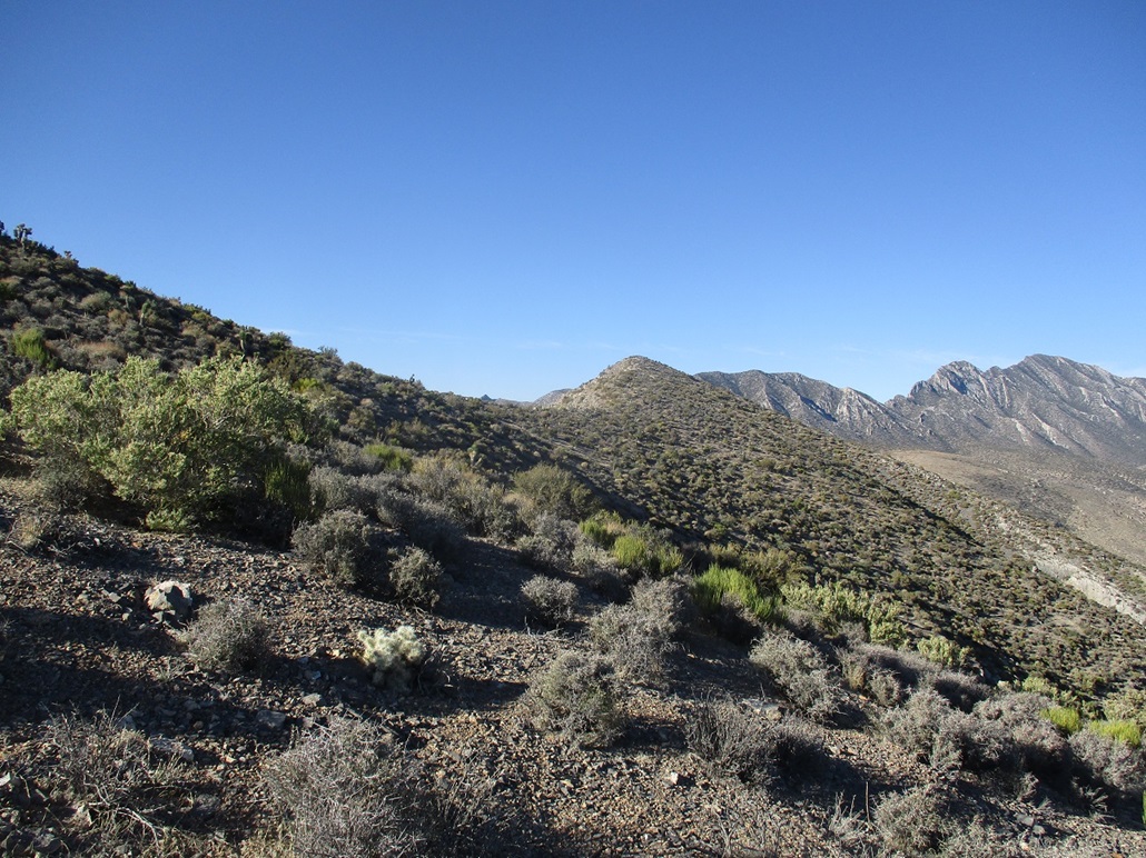
On this new ridge, the underlying rock exposes above the brush for long stretches at a time, much of it limestone with that very rough texture. I was able to walk up these rocks almost like following a sidewalk. Eventually this ended and I was back in the brush and rocks. The way up revealed itself in segments, and after an hour or so, I was high up on the slopes, achieving a lower ridge. The highpoint had been hidden for this whole lower stretch, but now was visible again. I was close to spot elevation 5842 on the topographical map, a gain of about 1,400 feet from the lower canyon.
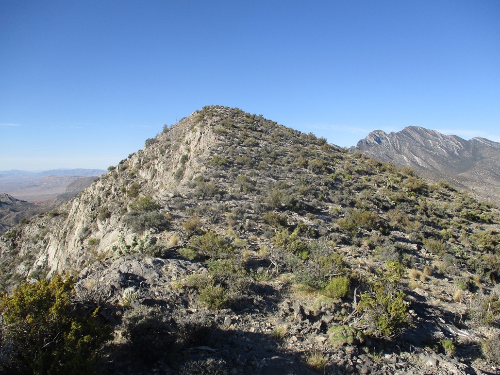
I next aimed for the highest ridge, a little south of spot elevation 6063, bypassing it on its west slopes. I had to go up and down one more easy bump, then up again to the final bump, the summit. The grades and the footing was always secure and there were no loose scrambly sections near the very top, which seems to happen with lots of other peaks.
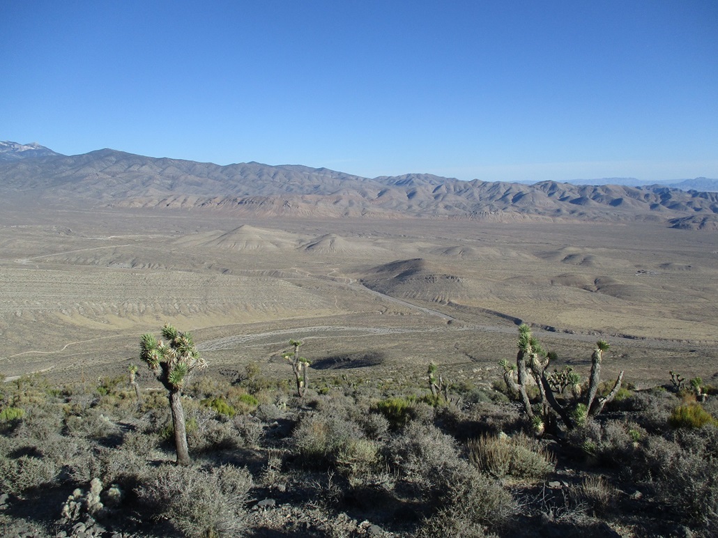
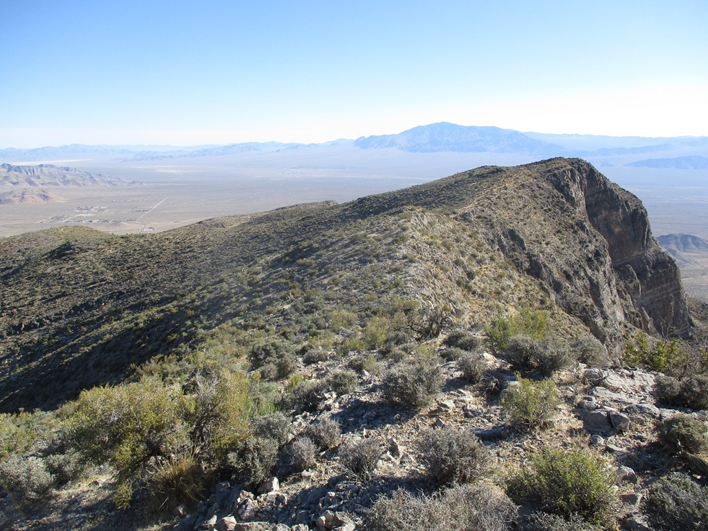
The views up here were outstanding. I had front-row seats of the La Madre Mountains to the southwest, and the massive bulwark of the Spring Mountains and its highest reaches near Mount Charleston. I could also see the cliffs facing south and eest, and the slopes I'd just ascended to the north and west. The sun was still somewhat low in the East so photos that way were not possible. The big Sheep Range rose to the northeast, and I could make out the sprawl of Las Vegas, but not much detail from this distance. I enjoyed this summit and spent more time than usual up here.
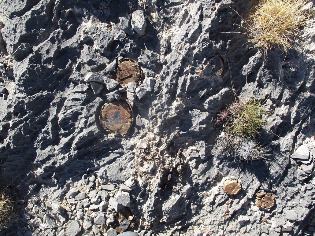
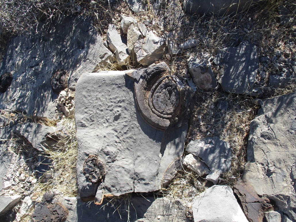
For the hike down, I retraced my route as close as possible. Previous visitors had done loop routes but mentioned that some of these other ridges or canyons can get messy. It was warming, but still pleasant, mid 70s for now. Lower down, I thought I saw what looked like old metal posts in the rock, then I realized these were petrified wood from long-ago trees. I took a couple photos. Those trees probably existed many many millions of years ago, and I bet a dinosaur or two probably ate at its leaves. The hike down took about 90 minutes. It was much warmer now, and the final walk out of the sandy canyon back to my vehicle went slowly. The round trip covered 4 hours and 6 miles with over 1,800 feet of gross gain, a very intense but enjoyable workout. This peak should get a better name, because Ugly Brown Lump really isn't fair. How about Cute Sepia Mound, or something like that.
Driving back to Henderson was an epic. Back to where US-95 meets with the 215 Beltway, it was not clear to me which way to go. It does not mark the detour as southbound or northbound, but just mentioned the next streets that would come up, which is fine if you're a local who knows the streets. In any case, I got on the Beltway and after a couple miles, realized I was heading eastbound toward North Las Vegas and the Las Vegas Speedway. Rather than turn around, I just followed it. I knew it would have to intersect Interstate-15 at some point. Once it did, I backtracked on the interstate south back to where the 215 meets it near the Strip. I know this area well, so I was able to get back to my dad's place easily afterwards. This detour added about 20 miles.
Later, my dad and I went out for prime rib at a local casino restaurant. I felt justified after burning those calories on the hike. For the better part of 25 years, after my folks moved to Henderson, my dad and I would go out for prime rib at a casino in downtown Henderson. It wasn't a big sexy casino, just a locals' casino, but its restaurant always had dependably good food. It was me and my dad's thing, whenever I visited which was just twice a year at most. I love prime rib, but I never ever eat it on my own. I always saved such an occasion for a lunch out with my pop. Then he'd front me twenty dollars like I was a kid, and I would use my advanced degree in mathematics to promptly lose it in the machines. I tended to play the dollar slots. My thinking was that if I hit it big, I'd make out handsomely. If I'm going to win a couple hundred coins, I don't want pennies, I want dollar tokens. The downside is that if I don't win, I would lose that $20 fast. He played the penny machines, the massive ones that have about 20 paylines that don't make an ounce of sense. He'd have about 1200 credits, which sounded awesome but it was just $12. (By the way, the extra paylines don't mean squat. The machines are programmed to pay out in such a way that the overall expectation of winnings - a weighted average - comes out the same as if you were playing a machine with just one payline. Slots have some of the worst expectation of any games of chance anywhere, usually losing about 40 to 50 cents per dollar played. In other words, you lose fast. By comparison, roulette and craps have relatively good expectations, about a couple cents of loss per dollar played. All games of chance pay out so that the house has the positive expectation, which is not a surprise.) Anyway, this meal with my dad would be our last together. He was ailing, and would pass in April 2022. I knew he was in bad shape, but you just never think "this is it". I miss these meals with my dad, and miss my father terribly. He lived a long full life, and died honorably.
|


|