The Mountains of Nevada
• www.surgent.net
|
| Spirit Mountain |
• Highpoint: Newberry Mountains • Lake Mead National Recreation Area • Clark County |
|
Date: January 25, 2014
• Elevation: 5,639 feet
• Prominence: 2,879 feet
• Distance: 4.5 miles
• Time: 4 hours and 45 minutes
• Gain: 2,500 feet
• Conditions: Clear but slightly hazy with high clouds
• Teammates: Scott Peavy, Joe Surgent (base camp manager)
Nevada
•
PB
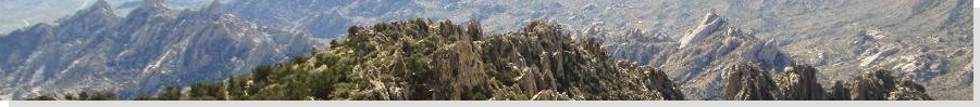
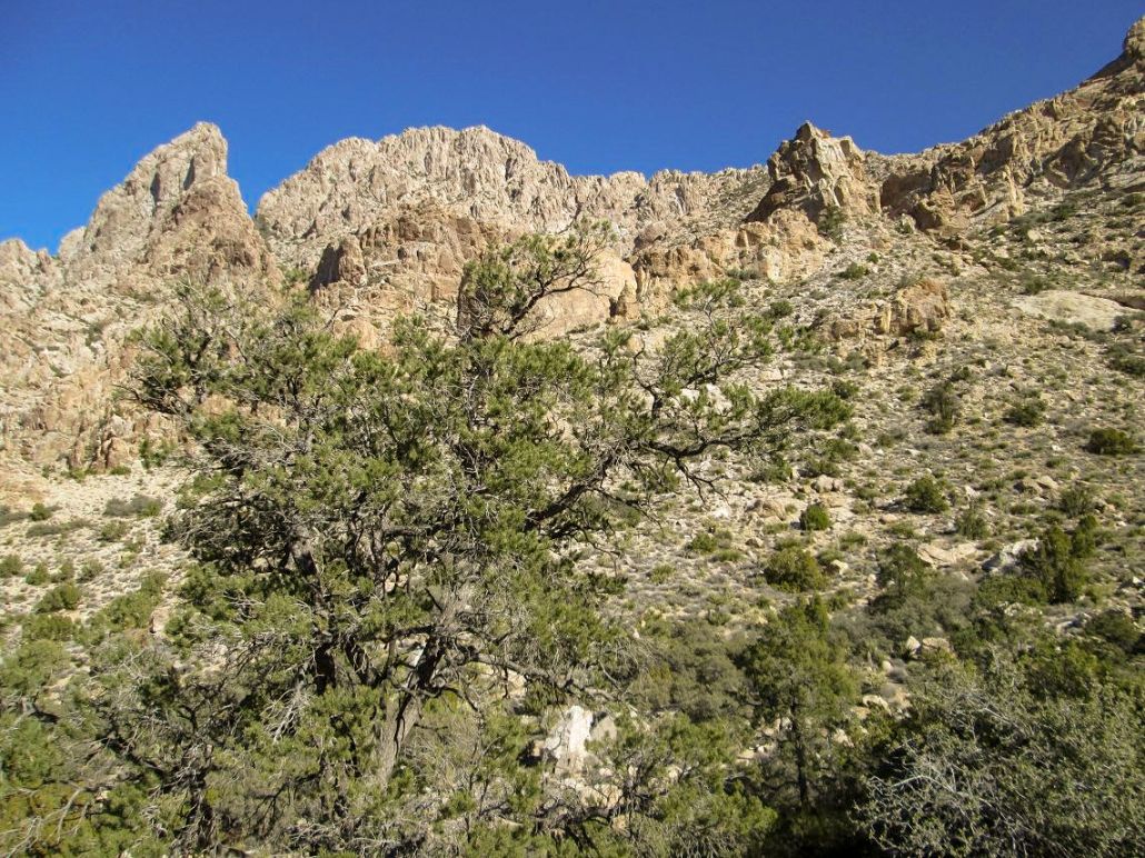
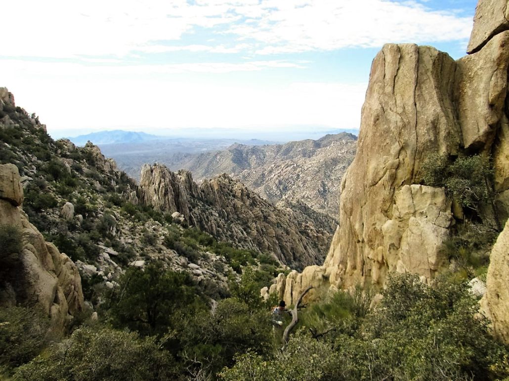
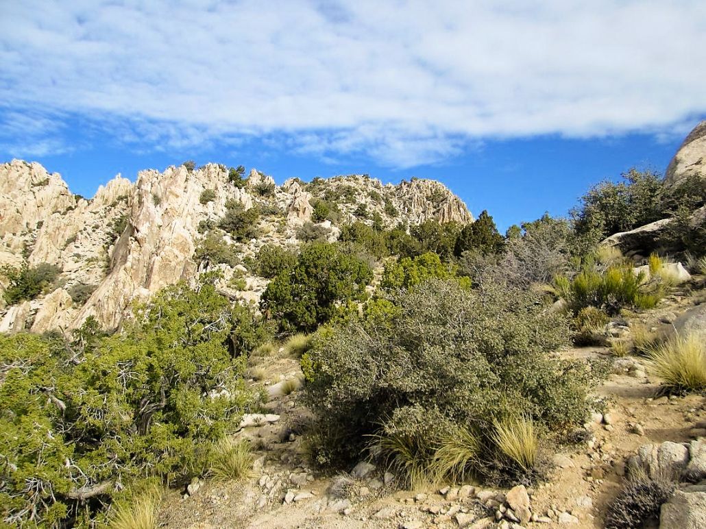
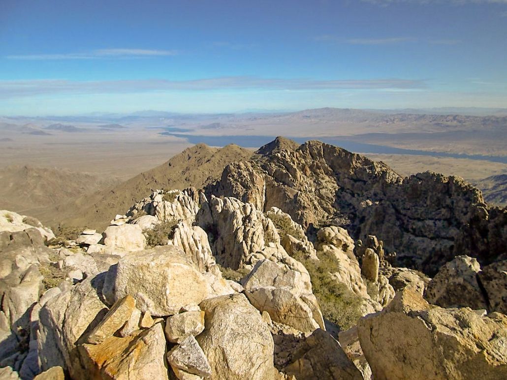
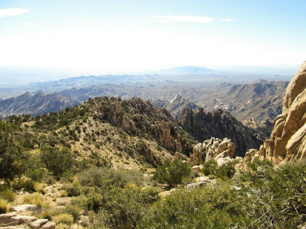
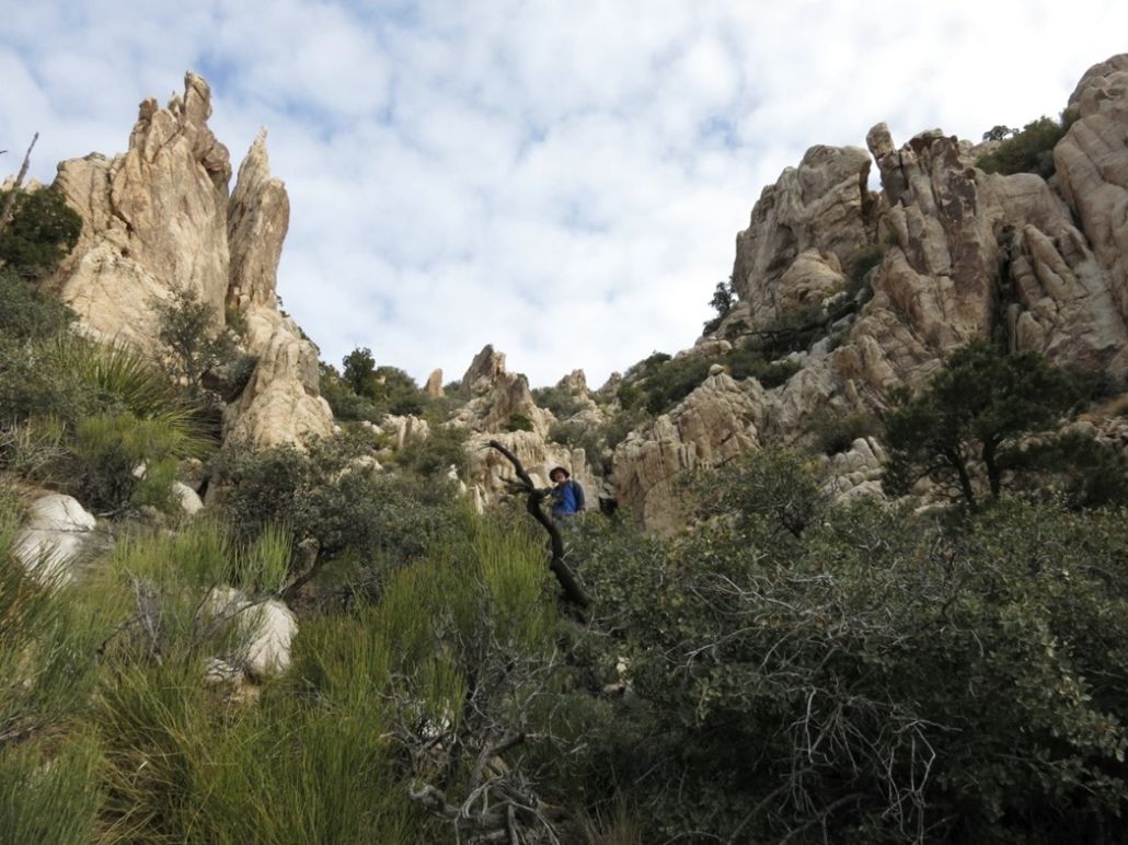
Spirit Mountain is the highest point of the rocky Newberry Mountains, the southernmost significant mountain range in Nevada. The Newberry Mountains sit astride the Colorado River, north of the town of Laughlin. As viewed from Laughlin, the summit is nearly a full mile higher in elevation. The range is extremely rocky, with innumerable spires, but fortunately, a cairned path leads almost to the very top, and at worst, the climbing entails a couple short sections of rock scrambling.
I was here about three years ago to hike it after another climb had to be abandoned, but I had no map and no real sense of what to do, and this did not look like a mountain on which to experiment without good, solid information. I drove in to Christmas Tree Pass and explored the area, but didn't really start a true hike. For Christmas of 2012, my wife and I stayed in Laughlin and I had plans again to try Spirit Mountain, but the weather was cold and windy, even down in Laughlin, so I passed again. This time, I met up with Scott Peavy, and the weather conditions were excellent.
I flew into Las Vegas the night before and stayed the night with my parents, then the next morning, my father drove me to Christmas Tree Pass, where we met Scott Peavy, who had driven all the way here from Phoenix this morning. We parked in some pullouts and got everything in order, starting the hike around 7:45 a.m. �Nevada time� (8:45 a.m. Arizona time). My father was not going to hike. Instead, he was our camp manager, walking the roads, looking for rocks and relaxing in his lawn chair.
Scott and I walked north up an old road, now closed to vehicles. The road bends right then left, gaining about 100 feet below a low band of foothills. We walked to the road's end, then hiked up the hills to a pass, having gained about 200 feet from the cars. At the pass, we had an unimpeded view of Spirit Mountain and all its rocky, spiry glory.
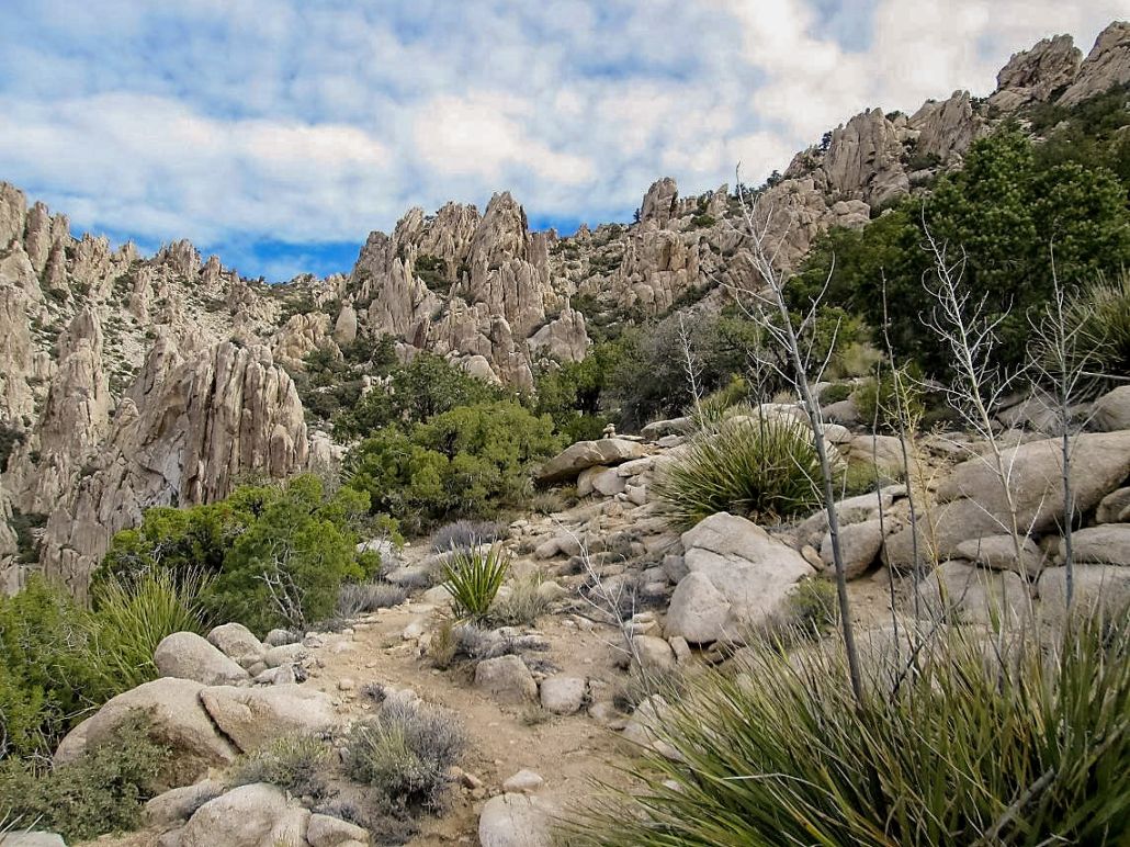
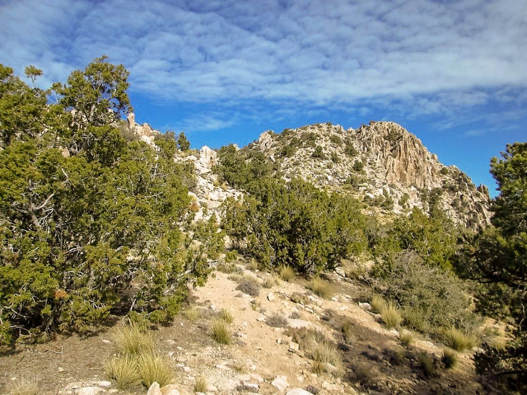
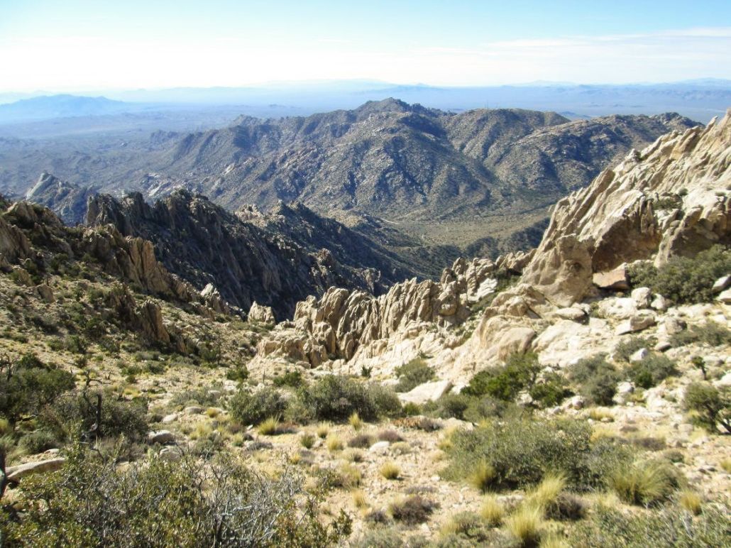
We dropped down about 200 feet, walking up and down some ridges until we found a scant path. This path then became more distinct, becoming the actual path that leads to the top. This path skirts below the slopes, then at some point, meets the rocks that begin the true climb to the top. To here, we had covered about a mile of a lof of up and down hiking, expending a lot of energy and not having gained much at all.
Looking up, there is a squat pillar about 300 vertical feet above, and a steep slope leading to a small saddle to the right of the pillar. We followed the trail up this slope, and within 15 minutes, had arrived onto this saddle, taking a rest here. Looking up again, the summit stood high above us, and more of the same kinds of slopes ahead. However, after this first pillar, we actually dropped a little in elevation. But quickly, we were back to the steep uphill grind.
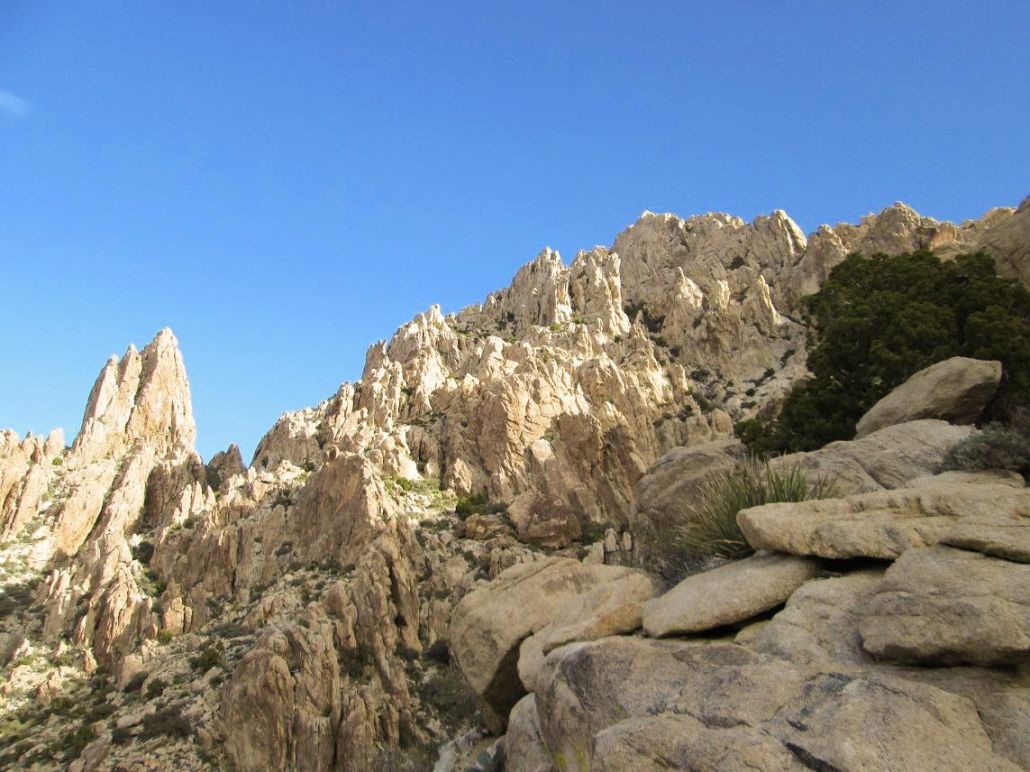
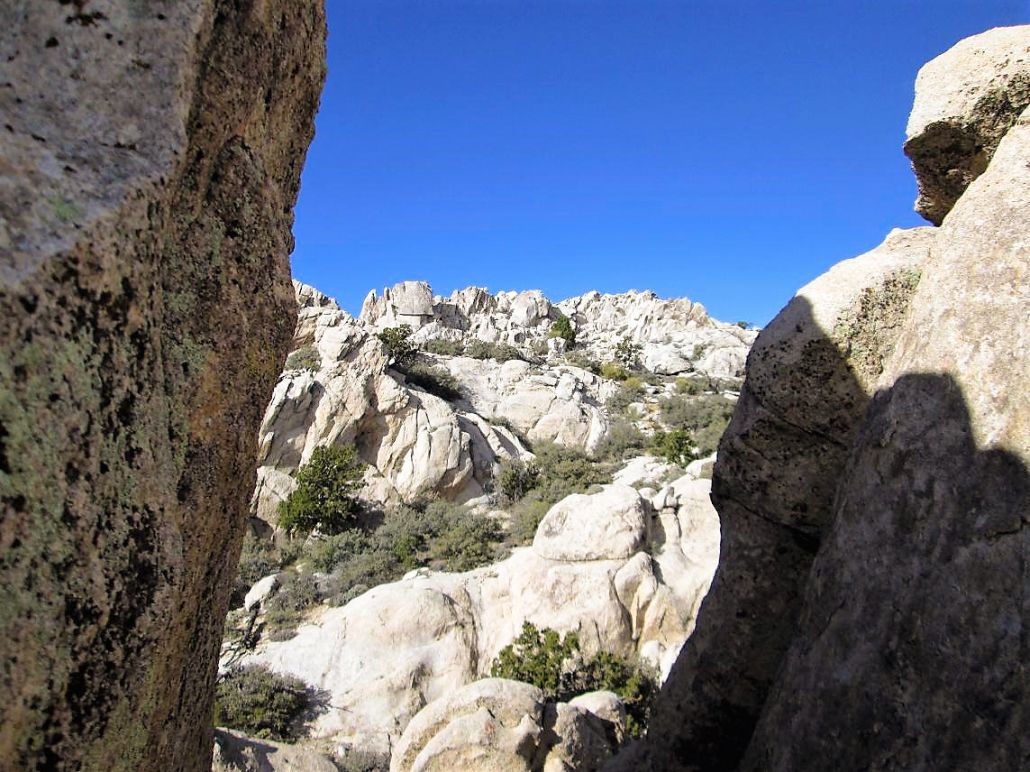
The whole way was cairned, but we often had to stop and study the route for the next cairn as the path would become indistinct, or braid with other paths. And often, the next cairn seemed to be somewhere illogical. But as we climbed to it, the way would become clear again. We surmised who ever put in the route and cairned it must have done so with a lot of trial and error. The paths and cairns helped because otherwise, we would have taken three times as long trying to glean the route on our own.
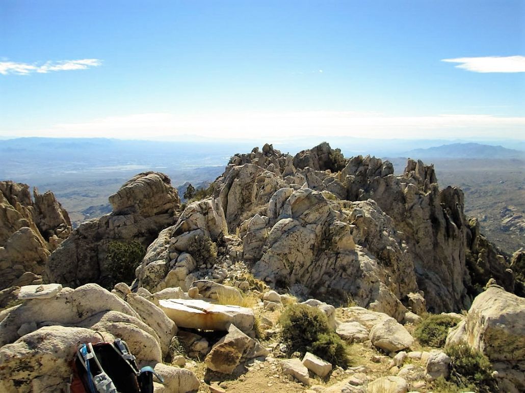
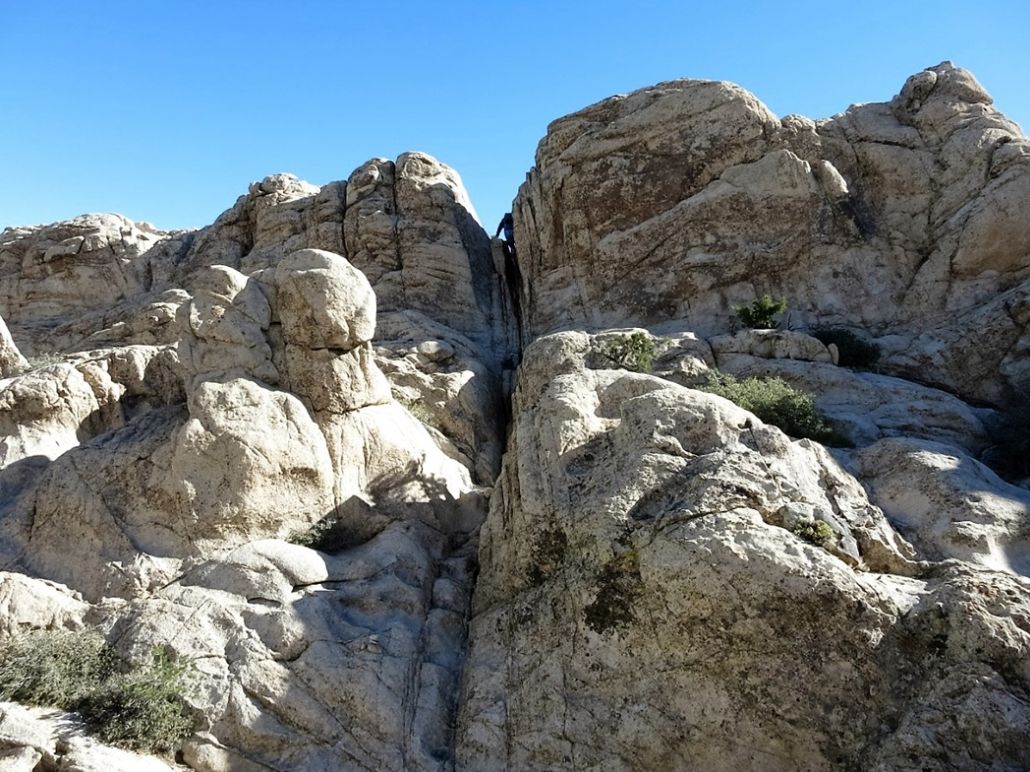
We kept at the task, walking from cairn to cairn, occasionally shimmying up some open rock, and in time, the gradient lessened as we approached the range crest. We arrived onto the crest and took a break. To the north was a false summit, which we first thought might be the real summit, but we knew better. The path continues north up the slope, then bends west through some scrub, ending at the base of a rock wall. The wall featured two or three clefts, through which we could see the true summit not far off.
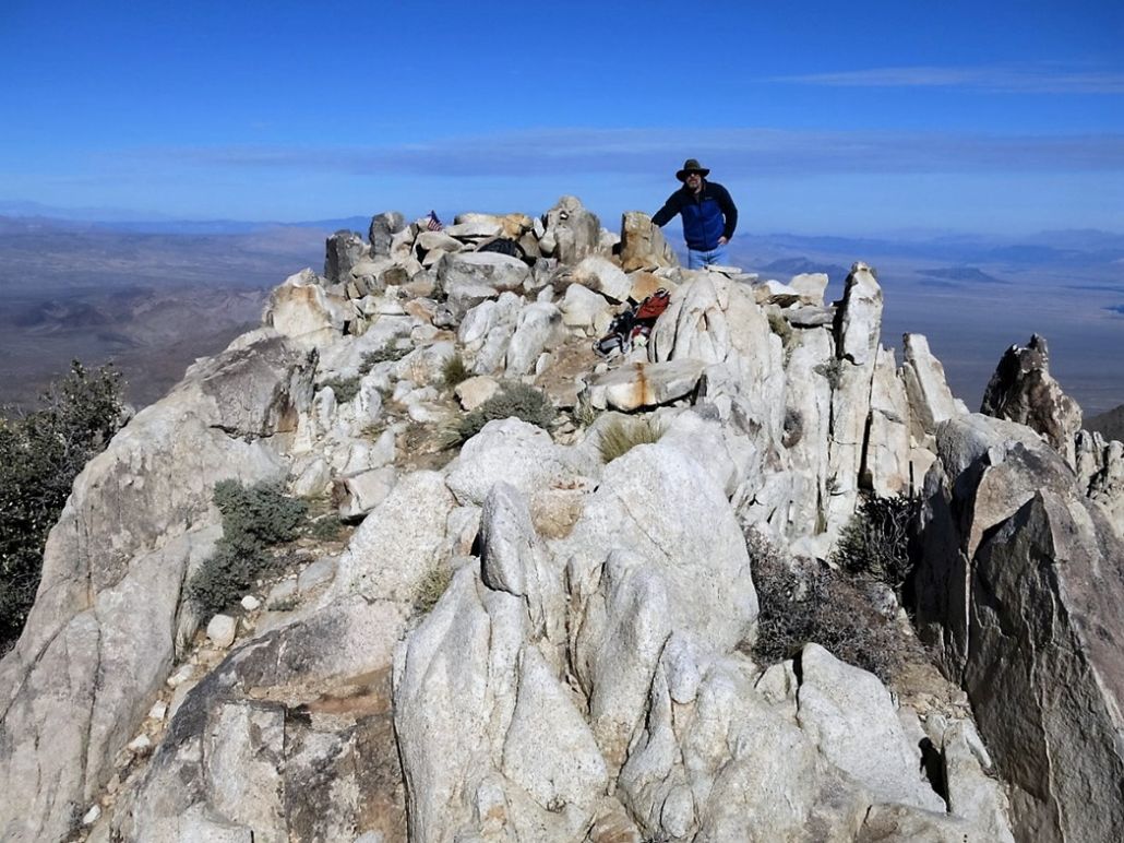
We scampered up one cleft, gaining about five feet, then down the other side, losing about thirty feet and dropping into a bowl of rock. From here to the top, we walked up easy rock slopes and in moments had arrived to the summit. Our one-way hike had taken about two hours and thirty minutes, a reasonable figure given the terrain we had to deal with.
The views were excellent. The day had been partly cloudy, but when we arrived on top, the clouds mostly cleared and gave us much better lighting for photographs. I was using a brand-new camera we had just purchased. Anyway, the views were tremendous in all directions, with the big peaks in Arizona to the east, Nevada to the north and west, and California to the south. The conditions up here were pleasant, temperatures in the 50s with a soft breeze. We stayed up here about 20 minutes.
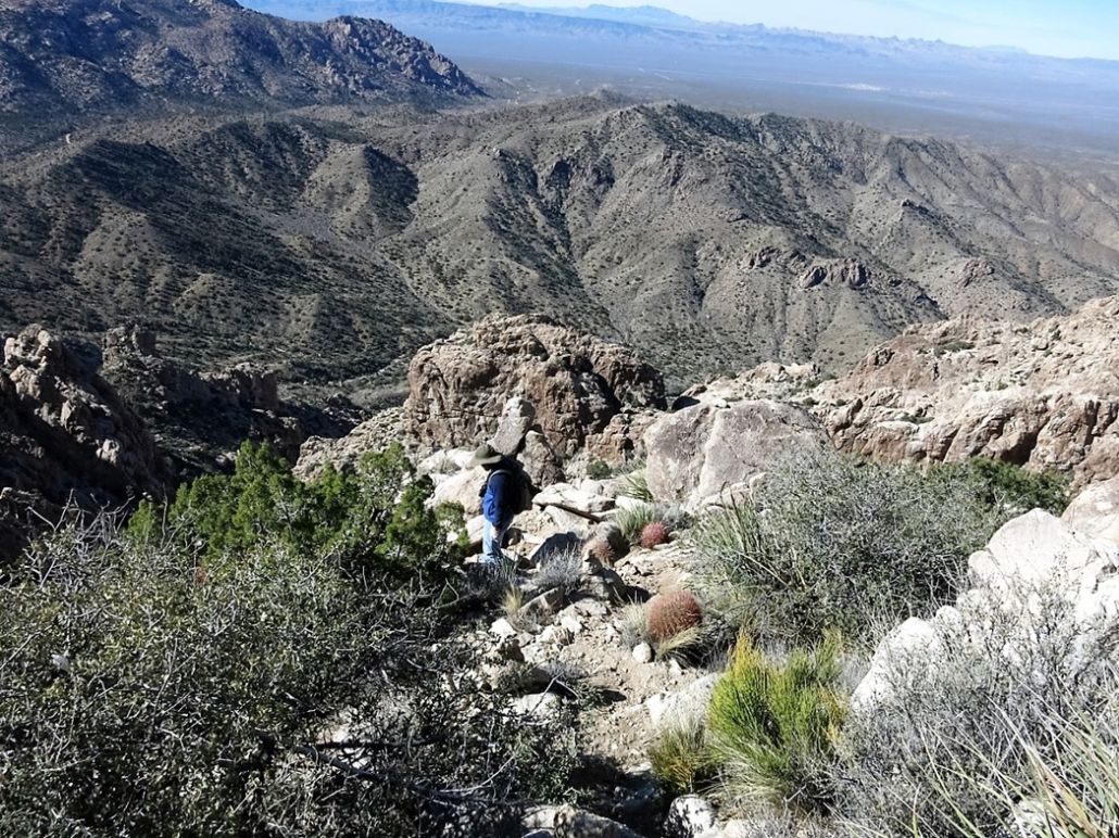
For the hike down, we followed our route as close as possible. On the steep rocky slopes, we had better vantage points to eye the cairns and the paths, but in a few cases we had to search around for the next cairn, concerned we may be following a dead end path. The trail dropped elevation fast, and we were down off the steepest sections in a little over an hour.
We still had to regain about 200 feet to get over that initial band of foothills, which was kind of tiring by now. This presented no challenge, and we were back to the cars a little before noon Nevada time, a two-hour descent and an overall time of just under five hours. My dad was enjoying the sun and just sitting around, so he greeted us as we returned.
We stuck around for a few minutes, changing into more comfortable clothes and talking about the climb. But, Scott had a long drive ahead of him, so we shook hands and went our separate ways. As always, I appreciated his companionship on the climb. My father and I drove back to Henderson, where I showered. Later, we all went out for a buffet meal, to replenish all the calories lost on the hike.
From below, Spirit Mountain can seem to be a very intimidating climb, but the trail and cairns helped tremendously. Other than the need to pay attention and to scramble in a few spots, the actual climb was rather easy, and the views were astounding.
The following day, I would hike Black Mountain in the McCullough Range nearer Las Vegas with my mother.
Click here for Scott Peavy's full set of photos.
|


|