The Mountains of Nevada
• www.surgent.net
|
| Gass Peak |
• Highpoint: Las Vegas Mountains • Desert National Wildlife Refuge • Clark County |
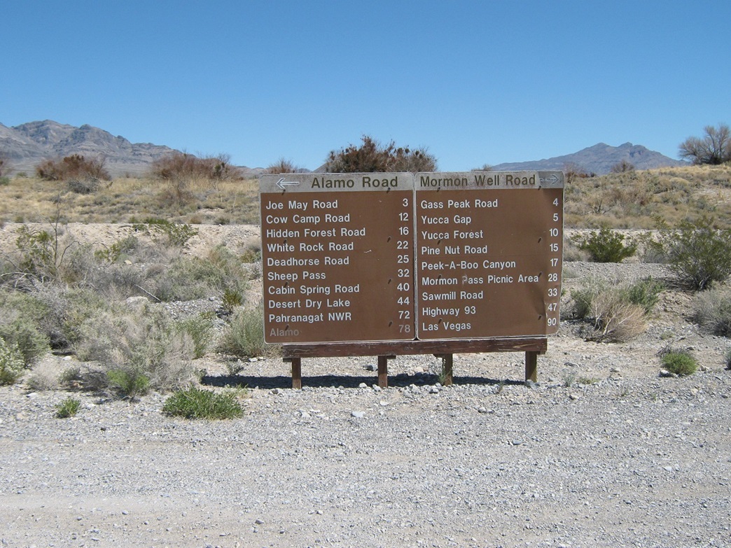 Mileage sign
|
Date: April 5, 2009
• Elevation: 6,943 feet
• Prominence: 2,023 feet
• Distance: 6.4 miles
• Time: 4 hours
• Gain: 2,032 feet
• Conditions: Clear, dry and gorgeous
Nevada
•
PB
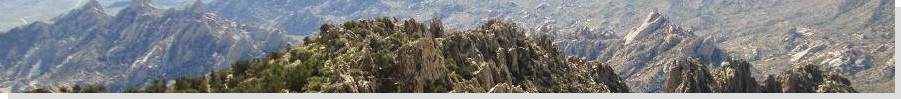
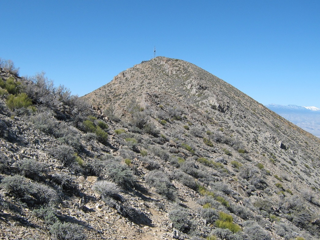
Gass Peak is the highpoint of the Las Vegas Mountains, which lie north of the city and south of the taller and broader Sheep Mountains. It is named for Octavius Decatur Gass, a settler in the region back in the days when grown men were named Octavius. From Las Vegas, you could be excused for not noticing the peak as it blends in well with the Sheep Range that rises behind it.
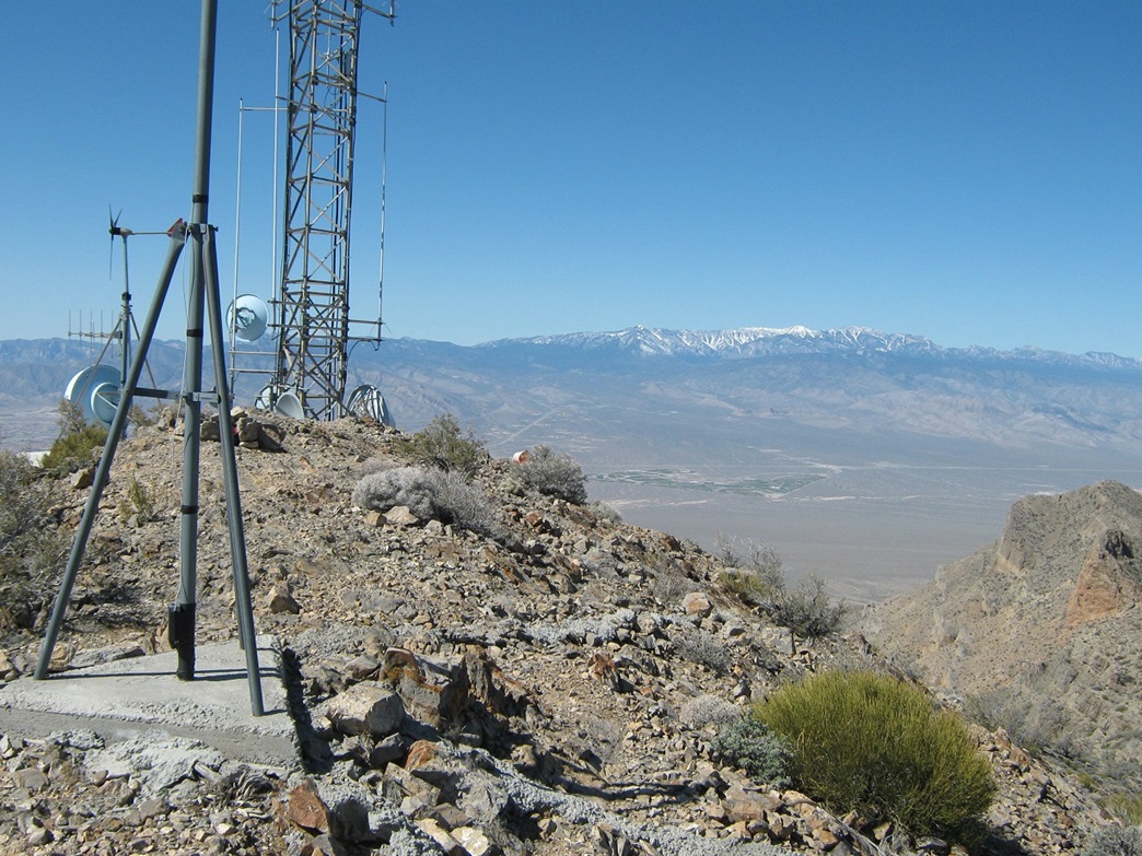
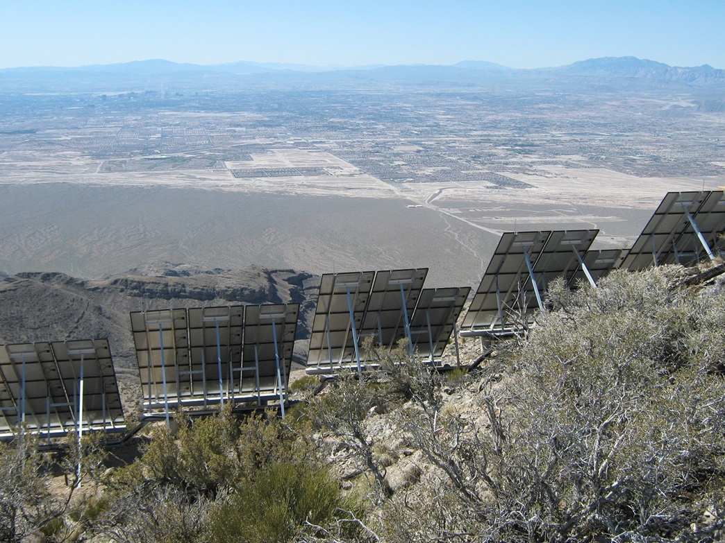
The peak lies within the Desert National Wildlife Refuge, and part of the Nellis Air Force Base borders to the range's south, creating a buffer against the Las Vegas sprawl. There is no maintained trail to the top, but an ATV track, plus a decent use path, lead all the way to the summit. The peak and range are in their natural, wild stage and feature wonderful scenery and views over the deserts and surrounding mountains. Only the top is marred by towers, solar panels and buildings, all to keep America connected.
This would be a perfect time to climb Gass Peak. Its elevation is just below 7,000 feet, so it can get hot in the summer. But it's too low to be socked in by heavy snow, so it should be snow-free in April. Plus, the weather this time of year is usually dry and clear, with pleasant temperatures. I arranged to visit my parents in Henderson this weekend. I drove up from Arizona yesterday, then got an early start today.
I followed US-95 north out of Las Vegas, exiting the highway at Corn Creek Road, a couple miles north of the Paiute Indian Reservation signs. The exit is not a developed highway exit with ramps and bridges. Instead, it's an "at grade" exit that would be very easy to whiz past, unless you were specifically looking for it. I followed Corn Creek Road (dirt and gravel) four miles east to the Desert National Wildlife Range buildings, and signed myself into the register. It was still early but already, a few cars were parked here.
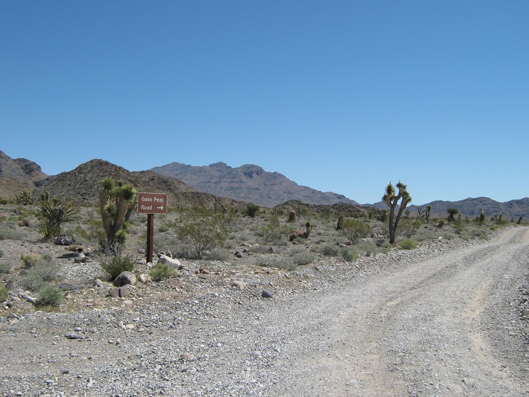
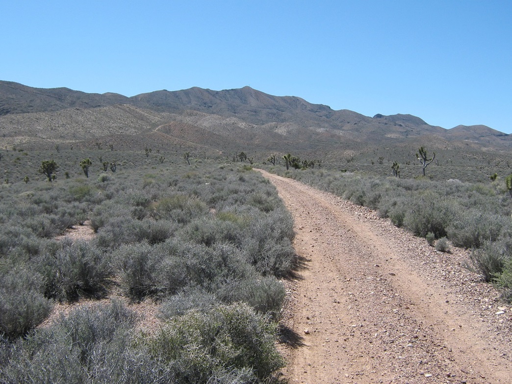
Past the Corn Creek buildings, I turned right (south) onto Alamo Road, then less than a half-mile later, left onto Mormon Well Road for four more miles to yet another junction, with Gass Peak Road. Turning right, I followed Gass Peak Road about eight miles southeast and east through the foothills, steadily grinding my way up the road to the "trailhead", a wide area near a junction with a smaller road that veers sharply south toward the range.
This last road is not shown on the topographical map (it does show up on Google-earth), and is closed to vehicles. The drive in took about an hour from US-95. Only Mormon Well Road was slow-going and rough, while Gass Peak Road was smooth by comparison. All roads would need a high-clearance vehicle, but I did not use 4-wheel drive at any point.
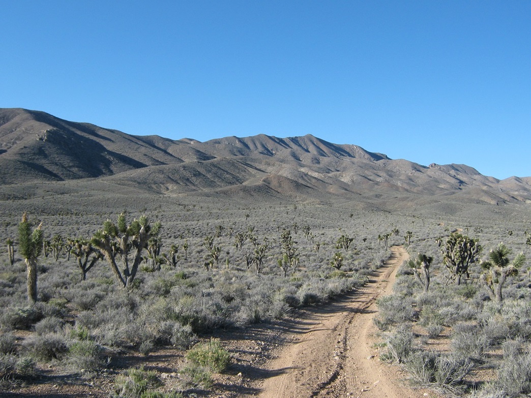
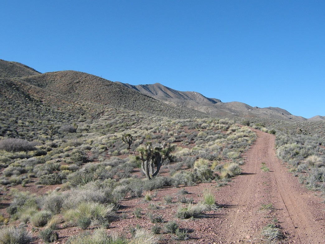
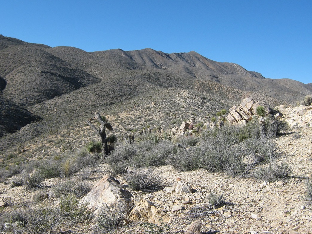
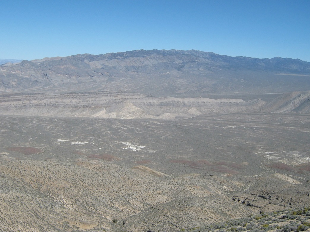
From the parking area, the summit is visible in the distance to the southwest, and essentially so is the whole route. The first third of the hike follows this closed road, which is open to hikers. The remainder of the route is along use-paths and along the high ridges. I was the only person at the trailhead, and the temperatures were cool, about 50 degrees. The day was crystal clear and dry and beautiful. I had million-dollar views of the snowy Spring Mountains and Mount Charleston to the west, and of the Sheep Range to the north. The elevation here is roughly 4,900 feet, high enough to support a healthy grove of joshua trees. I suited up, locked the vehicle and started hiking a little before 8 a.m.
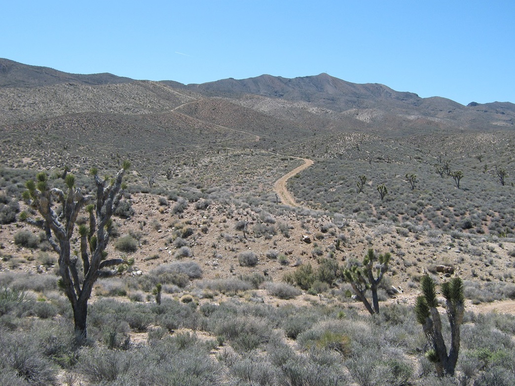
I followed the road south a few hundred yards to a split. I took the right fork, where I could see the road wiggling up ridges to top out on a foothill up ahead. Walking the road went quickly, although the road became quite steep at the end. Then it ends, just like that. I stopped here for a break, at 5,550 feet elevation. It took me 30 minutes to hike here, covering about a mile. I could see my truck down below, all small and stuff.
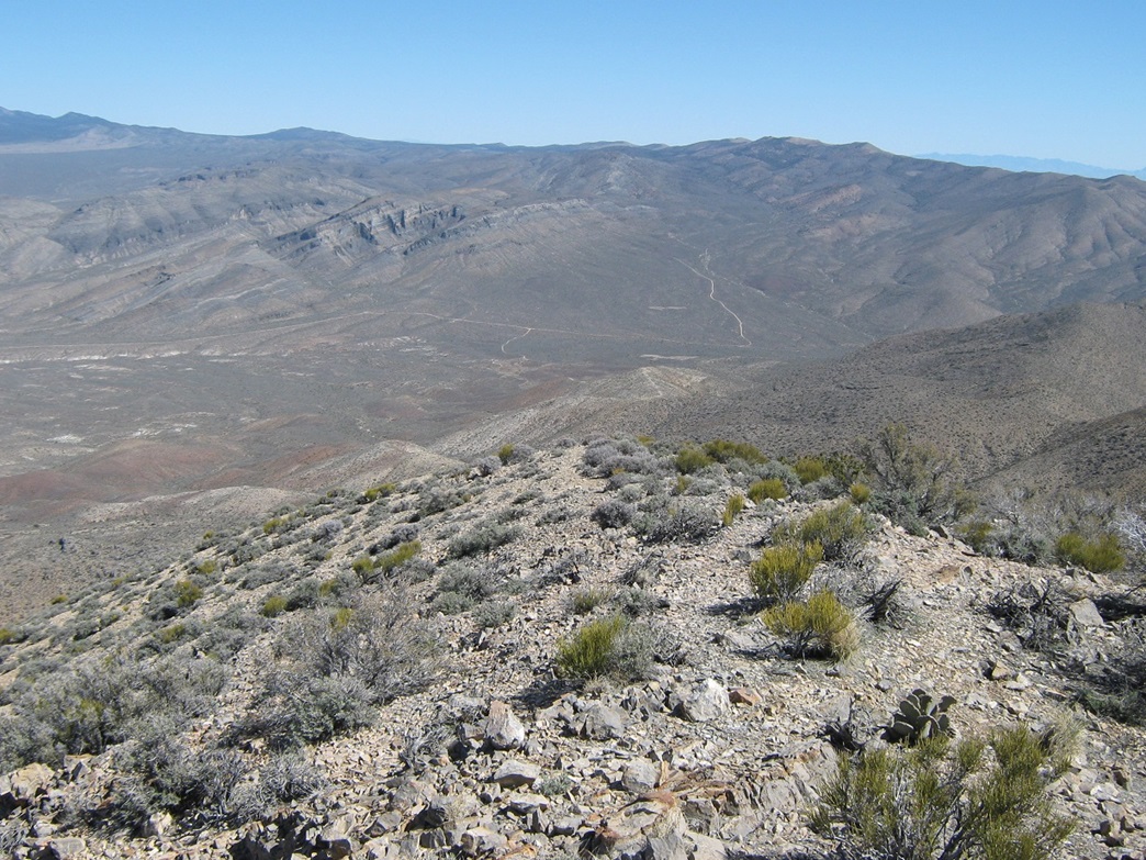
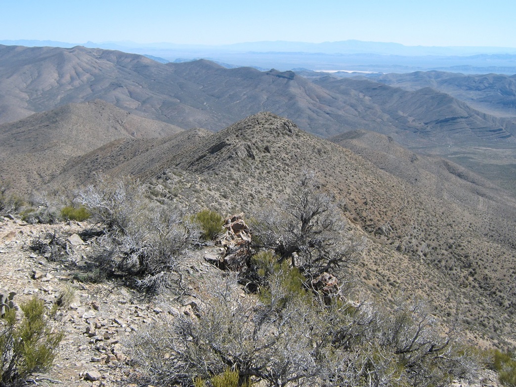
From here, the remainder of the hike follows a series of ridges to the summit. After my break, I started hiking southwest along a ridge ahead of me, following a decent foot-path and making good time. In general terms, the route goes southwest, then bears left up a ridge to top out on the range crest, high enough to look down into Las Vegas. The route reaches a saddle along this range crest, and I took another break here. The summit was another mile away and 700 feet higher. The day was warming up: when it was still I was actually kind of warm, but mostly there was steady breeze that cooled me quickly. The humidity was in the single digits and the nearest cloud was about two states over.
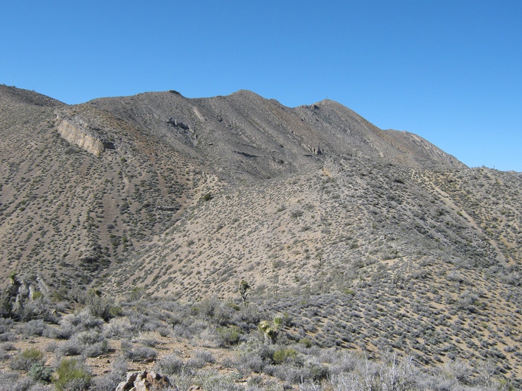
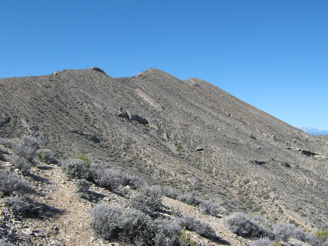
From the crest saddle, the route continues up more hills, but now they are more steep and abrupt, and for the most part the scant trail sidehills these points. I just kept trudging forward and upward, coming to a point where the route was on the main spine of the range, some lower summits now hiding Gass Peak. The path was still solid and easy to follow. It generally stays right (north) below these sub-peaks and gets a little thin and sloppy for a few hundred feet, the only time I had a little bit of concern about what a fall might do to me.
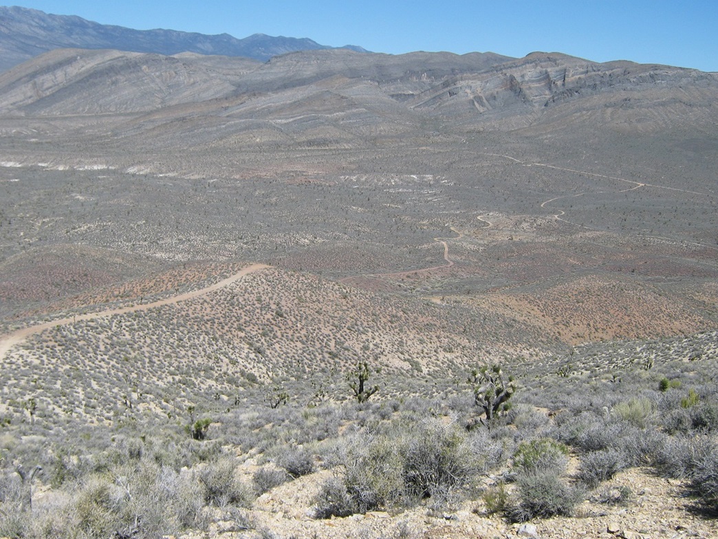
Soon, I arrived to a rock outcrop in the saddle below the summit, its towers and buildings now visible. I carefully picked my way past these obstacles, using the hands as needed, plus my butt when necessary. The final segment was up a steep slope with small rock bands, but it went fast and I was on the summit, the time 10:30 a.m.. I took a victory break amid the towers and solar-panels, and admired the wonderful views in all directions. The view down into Las Vegas was impressive, as were those of the surrounding Spring and Sheep ranges, plus all sorts of other peaks, valleys and desert plains, with horizons in some cases over 100 miles distant. I had not seen another person the entire way up, so I relaxed, having the peak all to myself for the time being.
After sufficient eating, drinking, looking and resting, I started the trek down and made good time, stopping periodically for photographs. I took another break back where the road had topped out on the lower foothill. The walk down the road proved to be the most trouble: its steepness meant I slipped and scooted on its gravelly tread more than I would have liked.
I was back to my truck a shade after noon, a 4-hour hike including breaks. I took time to relax back at my truck, changing into more comfortable clothes before starting the drive out. I stopped at the Refuge headquarters to walk around a bit. The drive to my parents' place took a little over an hour. I felt great, and after a shower and brief rest, celebrated Las Vegas-style: a buffet meal for three (with my ma and pa) at the Fiesta for $25.
Gass Peak was a lovely outing, an easy half-day hike for a fairly major summit, with reasonably easy road access (no passenger vehicles, mind you). The views into Vegas are outstanding, probably better than those from Charleston (too far up) or Potosi (too far away). I had a thoroughly pleasant hike and agree with the consensus that it is a hidden gem amid the giant peaks that surround Gass Peak and hog all the attention.
|
|