The Mountains of New Mexico
www.surgent.net |
 "Alejan" Hill
|
Cerros de Alejandro • Mount Taylor These two county highpoints are located near Grants along Interstate-40, about an hour west of Albuquerque. I drove here over Labor Day weekend of 2000, part of a four-peak swing through western New Mexico.
Date: September 2, 2000
• Elevation: 9,166 feet
• Prominence: 616 feet
• Distance: 4 miles
• Time: 90 minutes
• Gain: 900 feet
• Conditions: Pleasant with some cloudiness
New Mexico
•
PB
The Cerros de Alejandre are a series of volcanic mounds sitting atop Mesa Chivato in western New Mexico. The highest of these plugs, called Benchmark Alejan, or Alejan Hill, is the highest point in McKinley County.
I left Phoenix early this morning and drove to Grants, arriving at 1 p.m. The day was warm and sunny with puffy clouds that could form into thunderstorms, but for now were just being puffy clouds. I followed State Route NM-605 for 24 miles north to San Mateo. Actually, I bypassed San Mateo and took side roads past Lee Ranch and slowly up a steep road (Cibola National Forest Road 456) that led up onto the plateau. The roads were excellent.
After 4 miles on FR-456, it turned into FR-239 at a junction. I stayed on FR-239 at all subsequent junctions. After another seven miles, the road came to a gate and a mailbox. After the gate, the road deteriorated badly, with lots of rocks and ruts for the next six miles. I never got out of first gear the whole way past the gate. I drove to a junction with a dry pond and a corral to the northeast, and a road that went east. This road is supposedly open to the public, but on this day it was closed. I somehow timed my arrival for the second day of elk hunting season. This may have been why they shut the road, to protect against overuse by vehicles. I was close to "Alejan Hill" anyway.
From the parking area, I walked east on the closed road (open to hikers) for a mile, going up and over a soft rise to get past lower foreground hills. I walked southeast cross-country through the scrub toward a prominent and obvious northwest ridge of Alejan Hill. The hill is a mix of open grass, rock outcrops and thickets of brush. I was able to zig and zag up the hill, avoiding the brush, and quickly arrived on top, a rounded hump marked by cairns and old wooden planks.
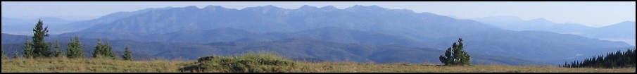
I stayed for 20 minutes and relaxed. Mount Taylor dominated the view to the south, while other distant ranges dotted the horizon. In the immediate vicinity were other hills similar to Alejan, and a couple of old volcanic plugs sticking up from the plateau like big splinters. I then headed down and ended up walking out with a group of four hunters who had walked in earlier but had no luck. The group consisted of two men, a woman and a child of about 7, all in fatigues and carrying impressive archery equipment. They were nice and we chatted as we walked out. My round trip hike took 90 minutes and covered four miles.
Mighty Mount Taylor to the immediate south was next on my agenda, but by the time I drove the road back out to the interstate, it was nearly 5 p.m. so I decided to wait until the next morning, which was a good idea since the weather acted up that evening. I stayed in Grants at an old-timey hotel for $20.
The access to Alejan Hill seems to be unclear, the land here a mix of public and private sections. The road conditions change, too. You may get lucky and drive to the base, or have to park ten miles out. The hilltop is within the Cibola National Forest, but intervening stretches may be private.
Date: September 3, 2000
• Elevation: 11,301 feet
• Prominence: 4,094 feet
• Distance: 7 miles
• Time: 3 hours
• Gain: 2,100 feet
• Conditions: Calm and sunny
PB
Mount Taylor is a big mountain about an hour west of Albuquerque. It rises north of Interstate-40 near Grants and because of its great height and prominence, dominates the views for dozens of miles around. The mountain also serves as one of the four sacred mountains of the Navajo, and the traditional eastern boundary of the Navajo lands. Its Navajo name is Tsoodzil.
From Grants, I followed First Street (state route NM-547) through the center of town, heading north into the foothills. A good forest road, FR-193, runs another five miles to the Gooseberry Trailhead (Trail #77). I arrived at the trailhead at 7 a.m. in fine weather, got situated and started my hike soon thereafter.
The initial portion of the trail was level and forested. It drops into Gooseberry Draw, then up its other side. From here, an old road (the trail) continues up the other side of Gooseberry Draw, running parallel to an old fence, then coming to a gate. Past the gate, the road barges uphill through the last of the forest onto grassy meadows. To here, I had gained a thousand feet and covered 1.5 miles. I took a break here on the grassy slope. Aside from the beaten-up nature of the road, everything else was lovely.
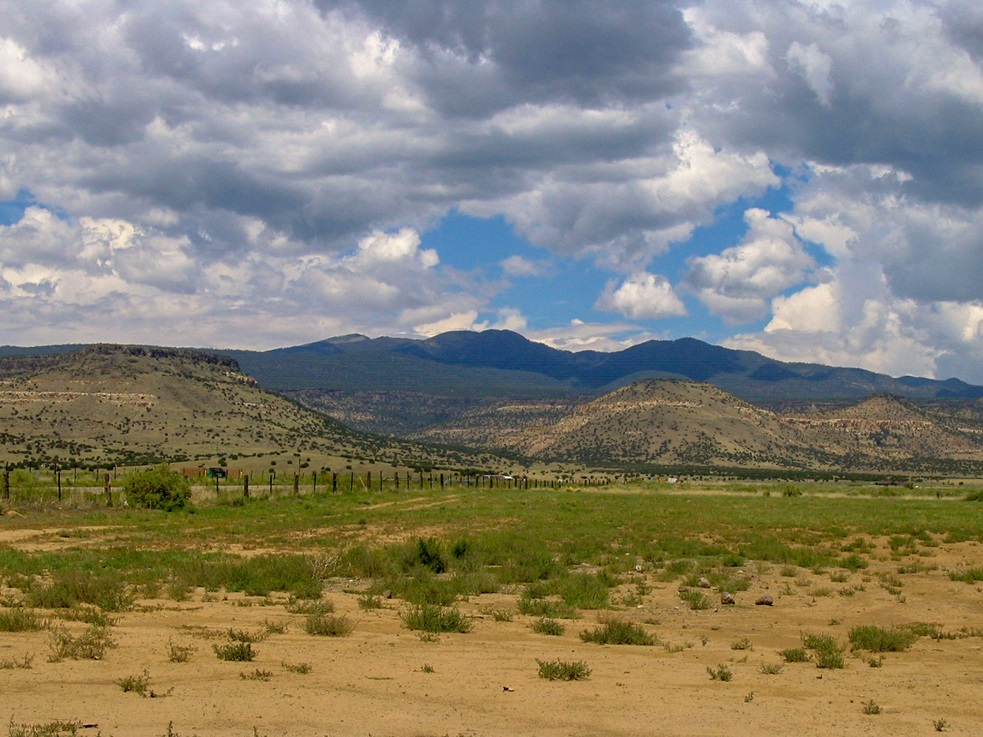
The road ends here, morphing into a footpath. The trail gains the upper ridge and runs behind (relative to Mount Taylor) a sub-peak, then goes through a pass and breaks back into the open, now on the slopes directly below Mount Taylor. The trail makes long switchbacks for the final few hundred feet to the summit. I arrived on top 90 minutes after starting, covering 3 miles and slightly over 2,000 feet of gain to get here, and it was worth every step. The views from up here are stunning, mainly south over the badlands, canyons and volcanic plugs that compose the terrain in this part of the state.
I also inspected an interesting pit dug into the summit. The pit was six feet deep, an honest-to-gosh hole in the ground. I am pretty sure I was the first to summit today, having seen no one coming down nor passed anyone going up, but as I descended, lots of people were on their way up: hikers, joggers, people with kids and dogs. The fine nature of the trail and the generally moderate slopes makes this ascent one of the easiest and most pleasurable in the state for such a large, prominent and significant mountain.
I didn't know it at the time, but a "back way" to the summit can be hiked from the forest roads on the northwest side of the peak, near the Cerros de Alejandro. A road leads to Mosca Peak, the main "second" summit of Mount Taylor, on which sit communications towers. A trail from there leads to Mount Taylor's summit. Actually, I am glad I didn't go that way. This route from the south was just fine the way it was. I was back to my truck by 10 a.m.. I drove from here to hike South Baldy Peak down by Socorro.
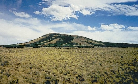
My only regret: I had exactly one image left on my roll of film for this hike and I wasted it on some lame, into-the-sun photo of the trail and ridge, and it came out looking like crap. So I have no photos of my ascent. See kids, back in the olden days of 2000, digital cameras were very expensive and most of us used film cameras. A few years later I stopped by for a better shot of the peak, albeit from a distance, the one you see here.
|

|