The Mountains of New Mexico
www.surgent.net |
| Big Hatchet Peak |
• Highpoint: Big Hatchet Mountains • Hidalgo County ("The Bootheel") |
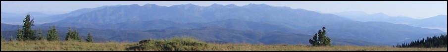
 Big Hatchet Peak is the middle summit, seen at dawn
|
Date: December 20, 2007
• Elevation: 8,356 feet
• Prominence: 3,696 feet
• Distance: 6 miles
• Time: 6 hours
• Gain: 3,125 feet
• Conditions: Clear and sunny
• Teammates: James Wedekind
New Mexico
•
PB
Big Hatchet Peak rises south in the "Bootheel" of New Mexico, the little appendage of the state that juts into old Mexico. Although far from most highways, it's visible from Interstate-10 as a distinctly big-hatchety-shaped peak. On my drives past the interstate, I made a mental note to someday learn of this peak's name and climb it.
For most of 2000 to 2004, I concentrated on New Mexico's county highpoints. The county highpoint of Hidalgo County is Animas Peak, which is just a couple dozen feet higher than Big Hatchet Peak, which is also inside Hidalgo County. However, Animas Peak is on private land with virtually no access allowed. In terms of access, prominence and physical attractiveness, Big Hatchet is much more interesting than Animas. Unless you are dead set on climbing all the New Mexico County highpoints, I'd suggest to ignore Animas Peak and head over to Big Hatchet instead.
For me, the only practical time to climb here would be over my winter break from teaching, as it is too hot otherwise. For this trip, I teamed with James Wedekind, a fellow county highpointer who lives in Las Cruces. The day before, I drove to Lordsburg and stayed in a cheap hotel, eating meatloaf at a local truck stop for dinner. James and I would meet early the next morning.
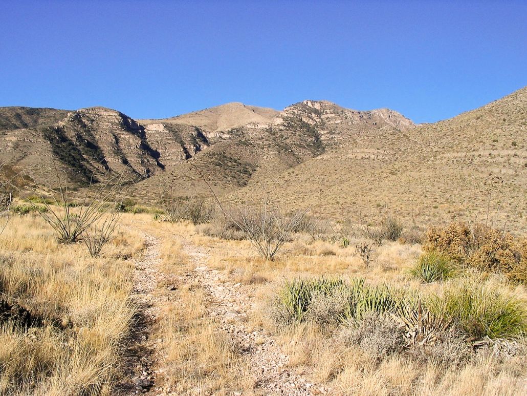
We met before 6 a.m., and I drove us south along state route NM-81 through the small town of Hachita (Spanish for Little Hatchet), then south some more into the broad desert valleys out this way. Ten miles south of Hachita, I made a hard-left onto a dirt road denoted by a "Big Hatchet BLM" sign, then followed dirt roads south and east along the �public lands access� route for 11.2 miles to a spur road to Thompson Canyon, on the range�s east-facing slopes. For the record, the topographical maps (from 1982) are a out of date regarding the roads, but the signs are useful. Google maps may be better.
The only trouble I had was dealing with the sunrise, which blinded me at one point that I had to pull aside a few minutes to let it rise some more to reduce the glare. At the Thompson Canyon spur, I followed the lesser-quality road a few feet to a downed windmill, then up the rocky road (4-wheel drive needed here, definitely) for about two miles to a water tank at the entrance of Thompson Canyon (map). I parked here because there was an open flat space to pull out and turn around. In any case, as we found out a few minutes later, the road is washed out a few yards ahead. By 8:45 a.m., we were starting our hike. The weather was cold in the shadows but sunny, and with indication we were in for a beautiful afternoon.
We walked the road for a mile and a half to its end (map), then found a path that immediately dropped into a ravine, then steeply up the opposite bank and onto a grassy slope. The path was well-defined and we followed it in and out of the ravine a few times until it started up the slopes in earnest. On the map there are two canyons that start at the end of the road. We followed the one that trended more south than west at first.
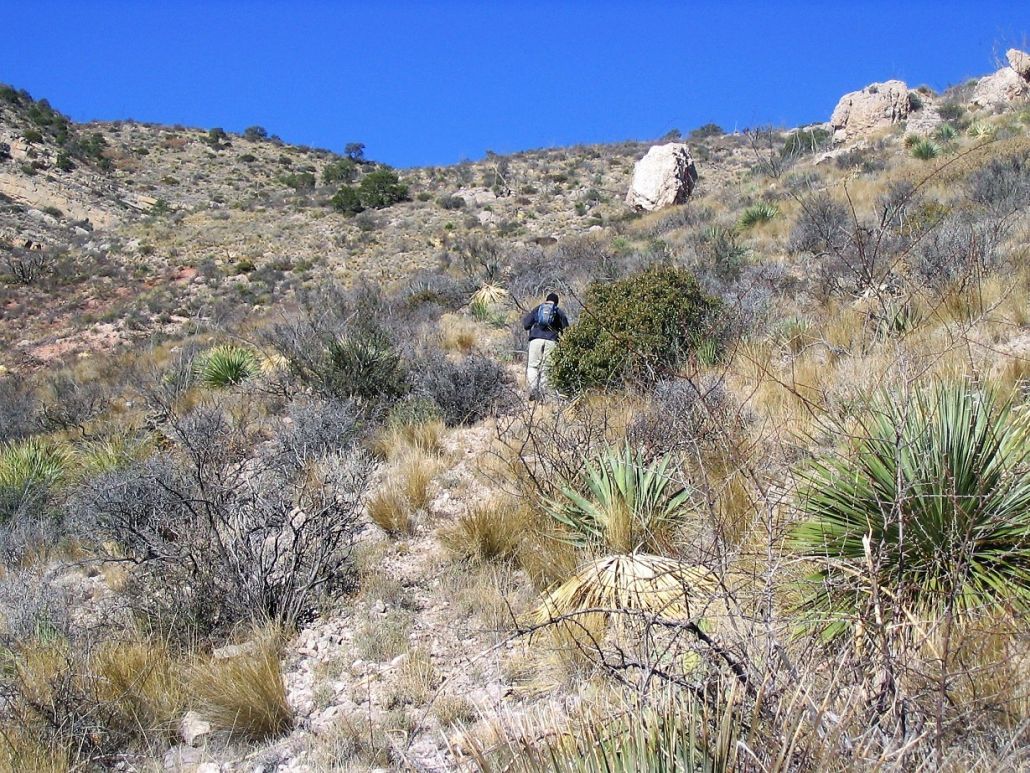
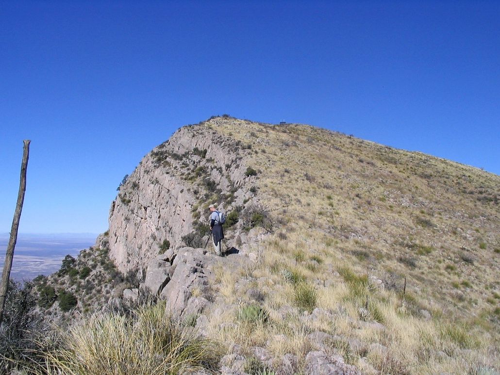
The trail is rocky and loose, but well-defined and easy to follow, lead us up to a small promontory at about elevation 6,430 feet (map). We both took a break here, and check our position on the map. The third photo at left shows James nearing a distinctive leaning boulder on the trail leading to this first rest-stop. As you can see, the slopes are mostly open with lots of grass, some cactus and plenty of agave. Agave rule number one: don't ever fall into or onto an agave.
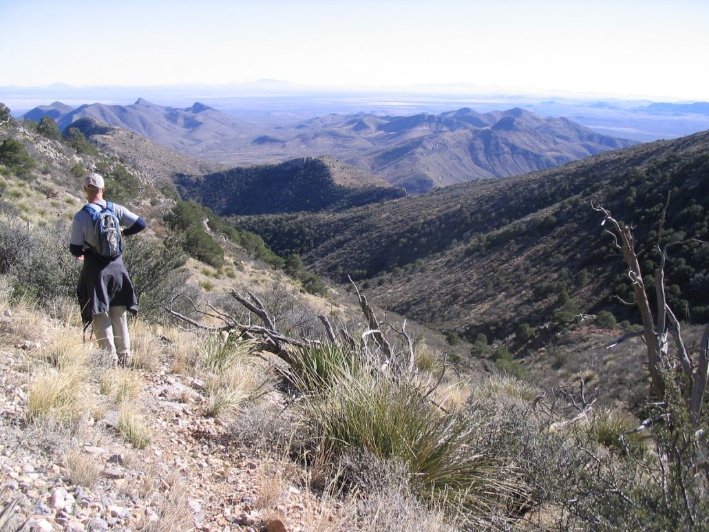
From our rest stop, we continued on the trail which was much better than we were expecting. The trail worked through a little stand of juniper and small fir, and even through lingering snow patches left over from a storm from about 10 days ago. After that, the trail re-emerged back into the open, started up another drainage in a westerly direction. The trail then crossed onto the other slopes about here (map).
From this point to the next major saddle, the trail was easy to follow, but steep. James got ahead of me, but I made good time and we met again at this major saddle, elevation 7,300 feet. We took another break. We were making great time: it wasn't even two hours into the hike. The weather was spectacular. Even at this vantage, we had outstanding views down into the canyon we just came up, plus onto the valleys below to the west.
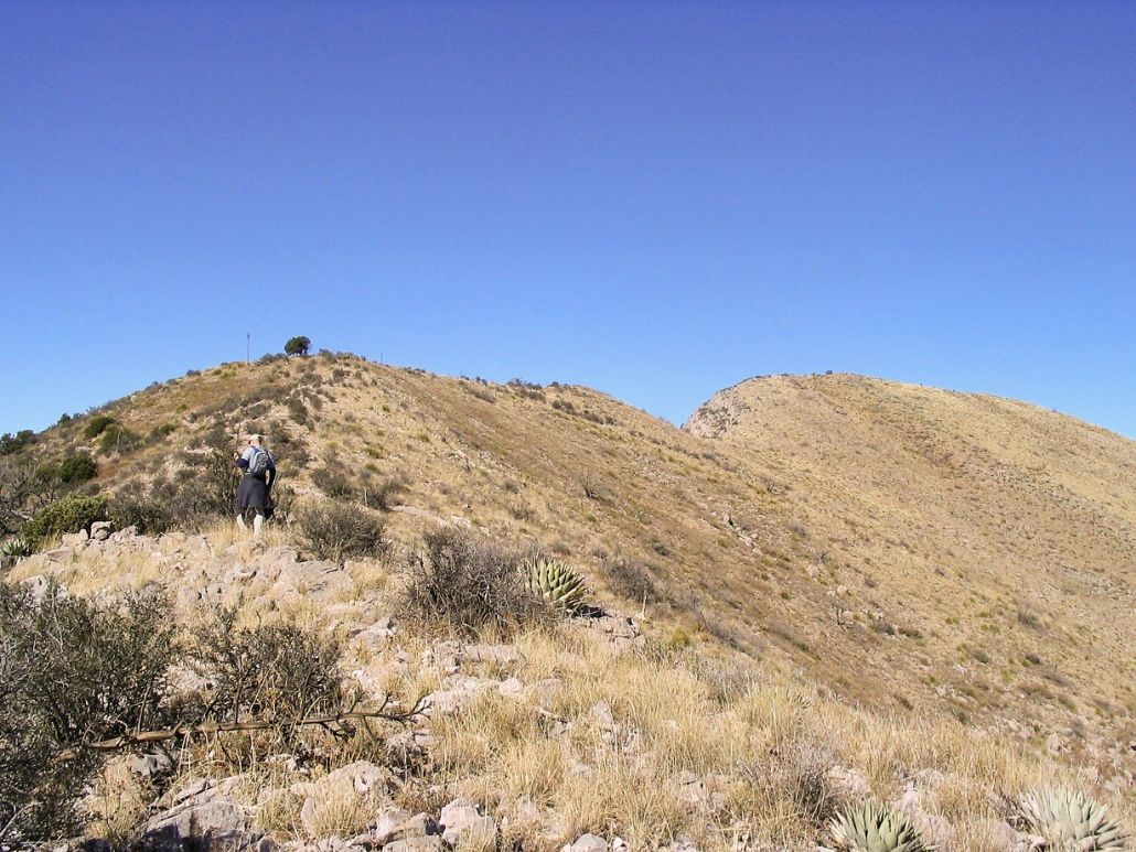
From here to the summit is about a mile and another thousand feet of elevation gain. The trail petered out here, so we had to wing it, which wasn't difficult. The plan was to gain an obvious ridge that angles northwest to southeast on the map, then turn left, walk it up and then on to the top. To get to the ridge, we made our own way through the brush, loose rock and rock bands. This was the slowest part of the hike, but it wasn't difficult. Once we gained this ridge, we hiked it up to an obvious "point in the sky", which corresponds to about here on the map and to about where James is standing in the fourth photo at left.
Finally we had our first views of the summit and the sloping terrain leading up to it, plus the cliffs that drop off to the west. I found that this section went by quickly: I gauged our upward movement by comparing ourselves to a small peak south of the main saddle, which extrapolates to an elevation of 7,500 feet on the map. While the going was sometimes steep and scrambly, every time I looked back at that peak it seemed like we were up another hundred feet.
Once on the main ridge, it was an easy stroll to the summit. We walked up and down intervening knobs, while James also placed a geocache in a nearby tree for future visitors. While he had been ahead of me all day on the hike, I passed him at this point and beat him to the top by a few steps. The summit has a solar-power apparatus on top, while the actual highpoint is marked by a cairn with a register.
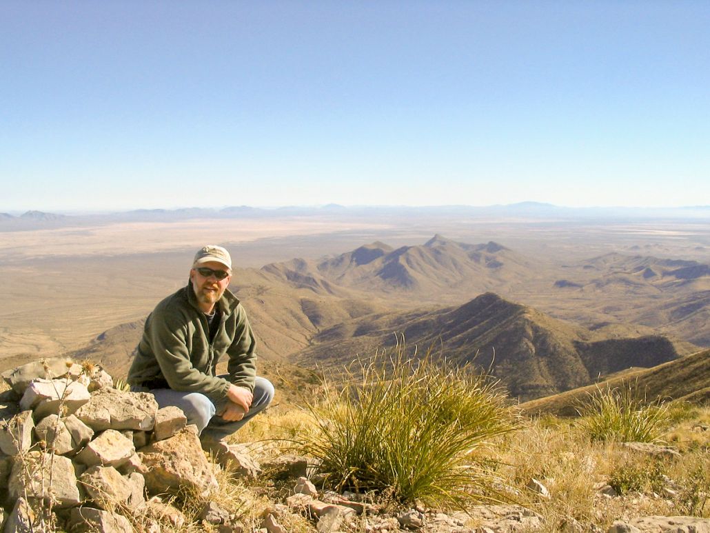
We signed in and read off the names of previous visitors. It seems the peak sees about 20-30 climbers a year. We also took the time to pick out the other peaks in our view. The Alamo Hueco Range was off to our southeast, the last American range before Mexico starts. The clear skies and low humidity allowed for perfect conditions: we could make out ranges as far off as Texas and well into Mexico. The Animas and the Chiricahua Ranges were to the west.
We spent about 15 minutes up top, then began our descent. The downhill went quickly, and the trail on the lower two-thirds really made a difference in our progress. We were out to my truck in less than two hours. The loose rock caused us to slide and stumble but other than that, we had no problems at all. It was just before 3 p.m. when we arrived back to my truck, where we changed into drier clothes and started the drive out back to Lordsburg.
By the time we were back in town and at James' car, it was dusky and getting cold. We loaded up James' stuff and he went on his way to camp for a hike up Burro peak the next day, while I drove my weary bones to the same cheapo motel I stayed at the previous night. The highlight was a dinner at El Charro, a Mexican-food place on the main drag and apart from the gas stations. The locals were all there so I figured it was probably a good place. The food was good and cheaply priced.
The next day a storm front blew in and I had rain and hail/graupel mix while driving through Safford and Globe. I was home by about 4 p.m. in the afternoon. My thanks to James for great camaraderie and trailblazing.
I had one downside: I caught a cold, and had to battle that for a few days afterwards. However, I consider that a decent trade off to be able to have summitted this fine peak.
|

|