
The Mountains of Hawaii
• www.surgent.net
|
| Nonou Mountain • The Sleeping Giant |
• Nonou Ridge • Nonou Forest Reserve • Island of Kauai |
|
Date: July 2, 2006
• Elevation: 1,241 feet
• Prominence: 880 feet
• Distance: 2.5 miles
• Time: 3 hours
• Gain: 1,080 feet
• Conditions: Warm and humid with ocean breezes
Main
•
PB
The Sleeping Giant is a small pointed peak on the east side of Kaua'i Island, overlooking the town of Wailua. Its name is derived from islander mythology, since the profile of the peak suggests that of a sleeping giant. It's official name is Nounou Mountain, or Nonou Mountain, both names appearing equally often.
βð and I were in Hawaii for a week-long trip, hosted by my mother. I had been to Hawai'i once before, in 1985, but just for two days and basically confined to Waikiki, in Honolulu. This would be my first time on Kaua'i. βð had lived in Hawaii as a teenager and visited many times, often on business, but this would be her first time back to Kaua'i in many years. We flew from Phoenix to Los Angeles, then to Honolulu, then to Lihue, all this yesterday. We were staying in Poipu, and looking for something easy to do for today. We had done our homework before leaving, identifying Nounou Mountain as an interesting objective. It was close to Poipu, featured a trail, shouldn't take too long, and had beautiful scenery.
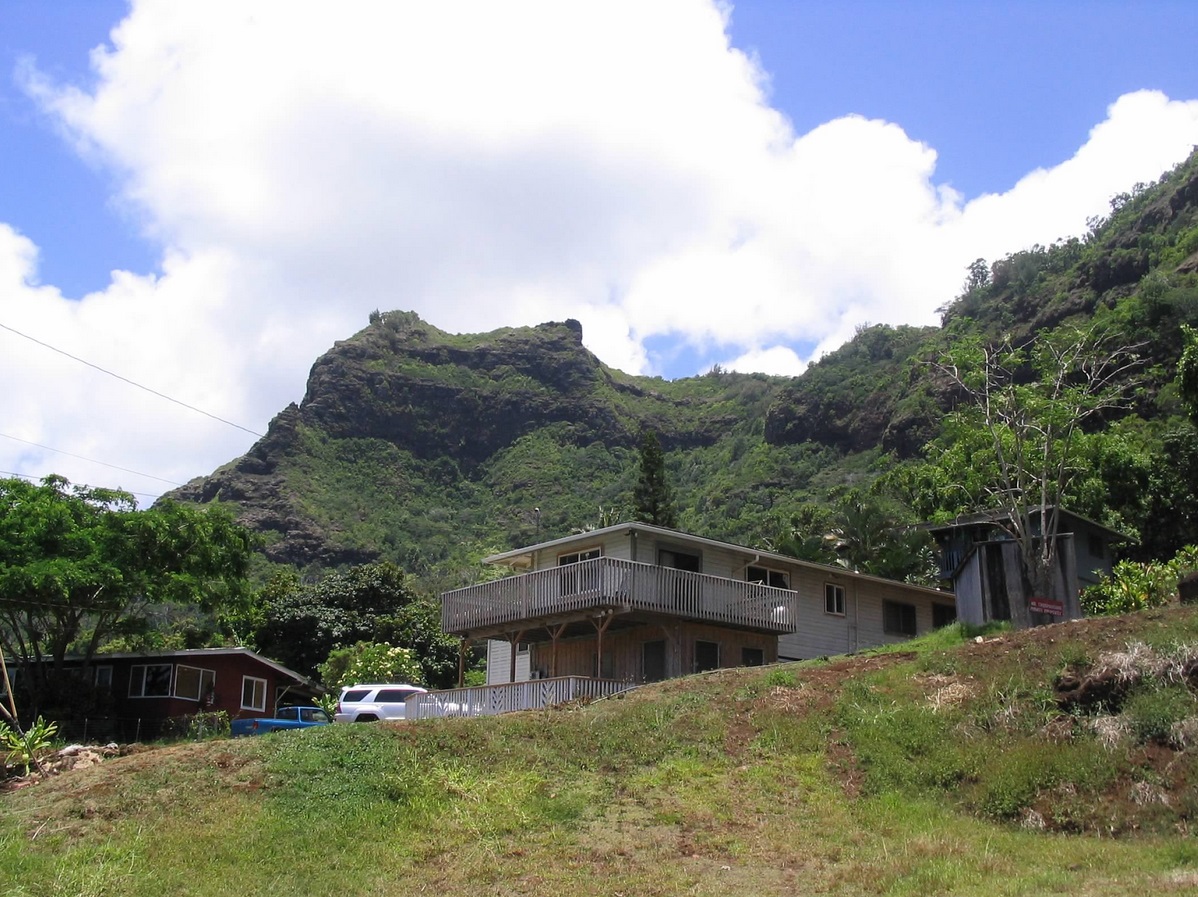
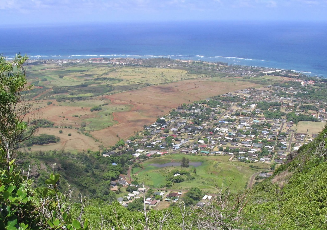
From Poipu, we drove north through Lihue, crossed the Wailua River into the town of Wailua, then through the residential streets to the small parking area, which was full when we arrived. The drive took about an hour, given the traffic, but we enjoyed the slow pace and the sights. We arrived about noon, and scored a parking spot in the small lot. The day was gorgeous! It was warm but breezy, given we were just a mile from the ocean, the air slightly humid.
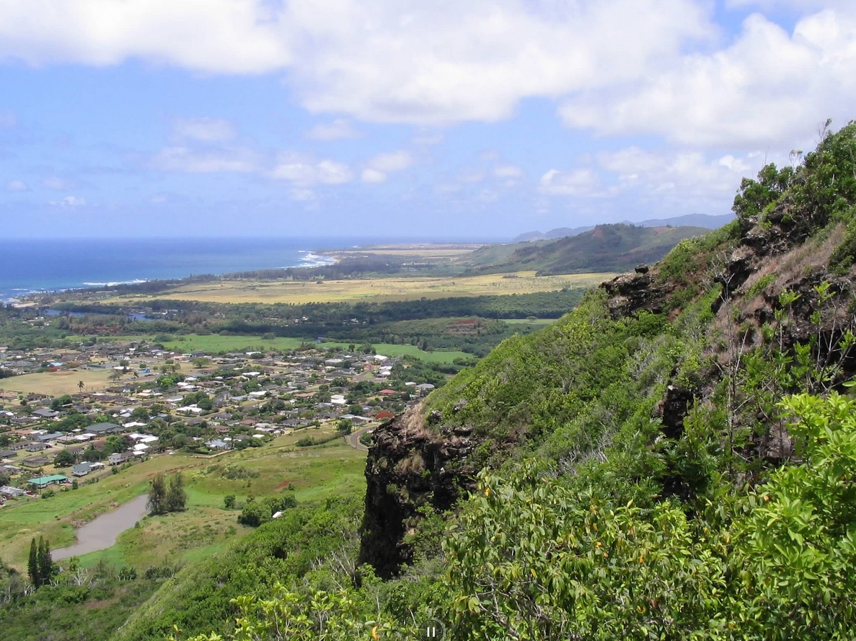
We followed an excellent dirt trail up the mountain's east side. The views alternated between ocean views, some of the town below, and of far-off ridges. Once atop the main ridge, the trail followed the spine through dense forest, composed of all sorts of trees and foliage I had never seen in person before. Shortly, the trail comes to a picnic table and ramada on top of a grassy subpeak. From here, we descended don to a saddle just below the summit.
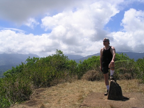
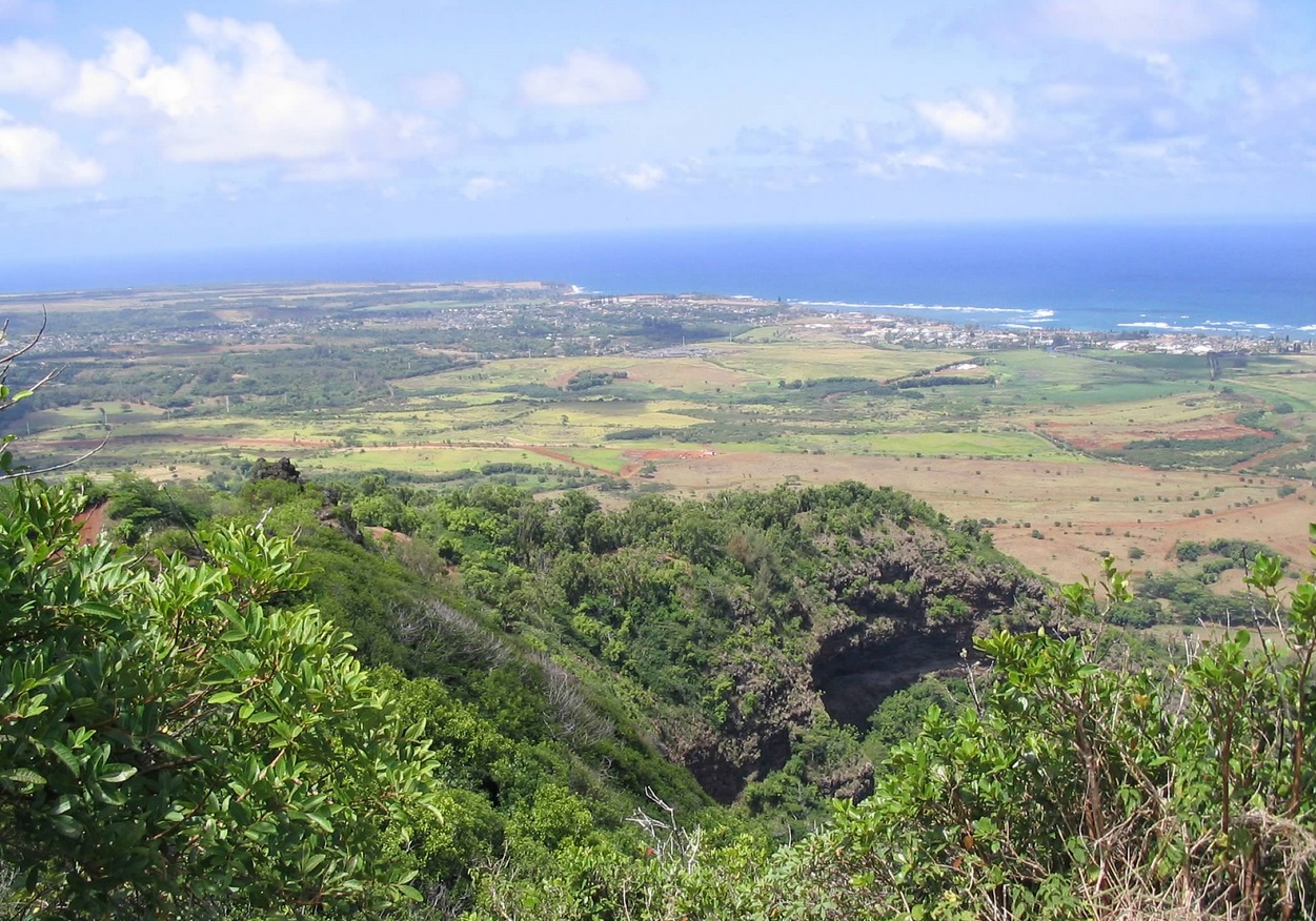
The trail then becomes extremely narrow, with about two feet of wiggle space above the steep slopes. The final section required some scrambling using the hands, and shortly, we were on top. It took us 90 minutes to cover the mile-plus, with just over 1,000 feet of gain. We took our victory photos and had a snack on the summit. The views were beautiful, with the ocean to the north and east, green ridges and hills immediately below us, and cloud-shrouded Kawaikini and Waiale'ale mountains looking west. We spent about thirty minutes up top, having it to ourselves, which was a surprise. It seems that most people stopped at the picnic table and went no farther.
The hike down went well, and we were back to our car after three hours, happy and a little sunburned, too. This little peak was a lot of fun, and a good way to stretch the legs on our first day in Hawaii. It's the only peak on Kaua'i that does not require an all-day grunt through jungles or dealing with nasty steep ridges. For the remaining two days, we drove up Waimea Canyon and out to Barking Sands Beach on one day, and had an incredible trail hike on the Na Pali Coast on our second wedding anniversary, then flew to the Big Island for, among other things, an ascent of Mauna Kea and a day on the lava at Hawaii Volcanoes National Park.
The highpoint of Kaua'i Island is Kawaikini, which is in the center on the island. Once a mighty volcano much like those on the Big Island, Kawaikini is now a nearly inaccessible peak, nearly permanently hidden by clouds, and surrounded by miles of cliffs and knife-edge ridges. The few non-cliff approaches to Kawaikini are high-elevation swamp. A nearby sub-peak, Waiale'ale, is the rainiest spot on the planet, with a yearly average of over 450 inches. I had no intention of trying my luck with Kawaikini.
|
|