
The Mountains of Hawaii
www.surgent.net |
| Haleakalā • Pu'u Ula'ula (Red Hill) |
• Highpoint: Haleakalā Volcano • Highpoint: County and Island of Maui • Highpoint: Haleakalā National Park |
|
Date: July 19, 2013
• Elevation: 10,023 feet
• Prominence: 10,023 feet
• Distance: 1 mile
• Time: 40 minutes (hike)
• Gain: 230 feet
• Conditions: Cold and dark
Main
•
PB
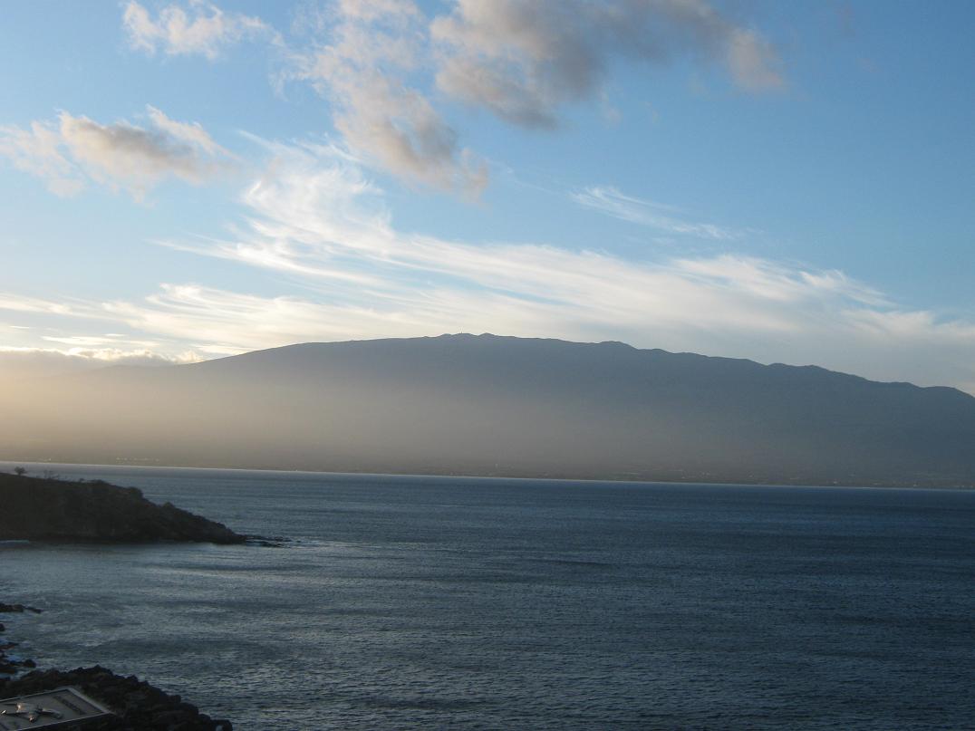
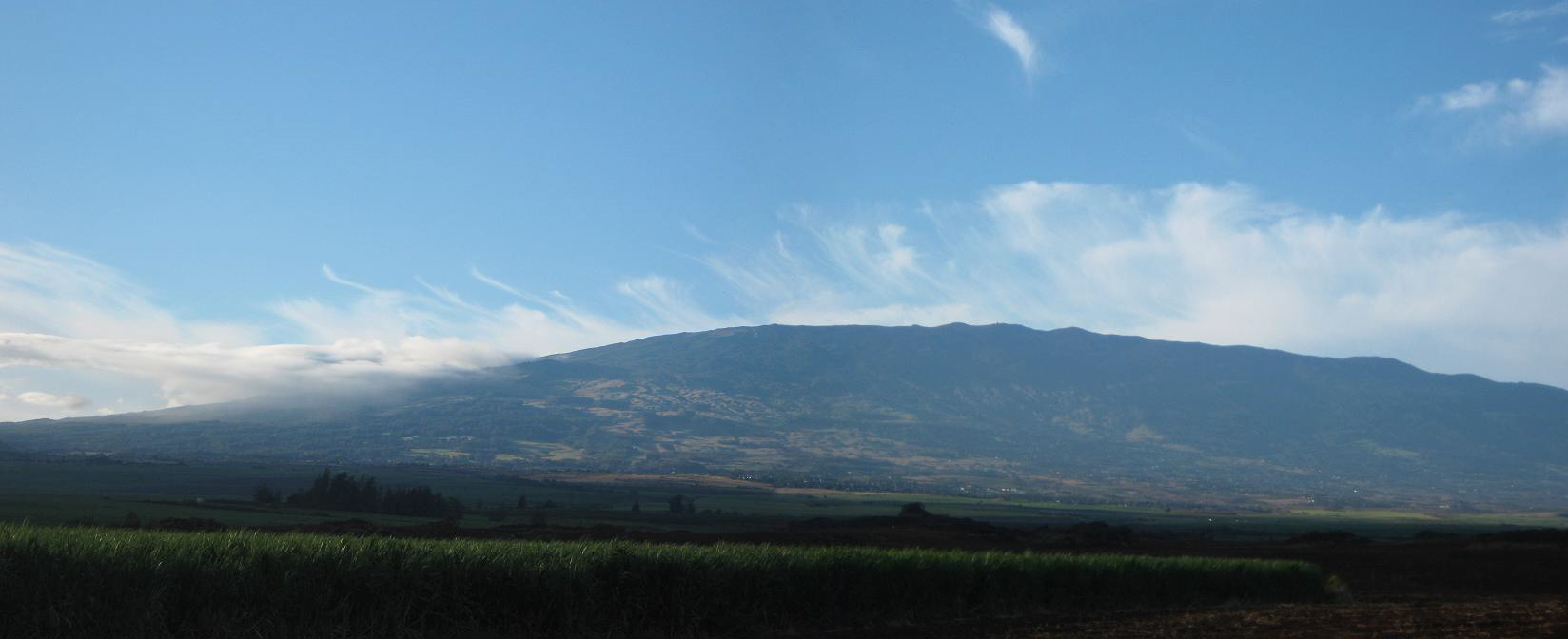
Haleakalā is a magnificent mountain, a dormant shield volcano rising to over 10,000 feet above sea level. It dominates eastern Maui, so uniform its slopes that it appears smaller than it really is. Make no mistake: it is a massive mountain, and it hosts rain forests and jungles on its north and east-facing slopes, range country on its west and south-facing slopes, beautiful waterfalls and deep-cut canyons, much of its grandeur incorporated into the Haleakalā National Park.
Its genesis is the same for all other mountains in Hawaii: a shield volcano that grew over eons before the movement of the plates moved Haleakalā off the so-called "hot spot", which now is generating the lava on the Big Island at Kilauea. Haleakalā is old enough to show signs of its age: it once stood almost 13,000 feet high, but erosion and subsidence has shrunk it by 3,000 vertical feet, with rain and natural events carving huge valleys. But it is young enough that is has had lava flows in past many-hundreds of years, some filling these valleys. It's not extinct, but dormant, and could conceivably ooze lava even today.
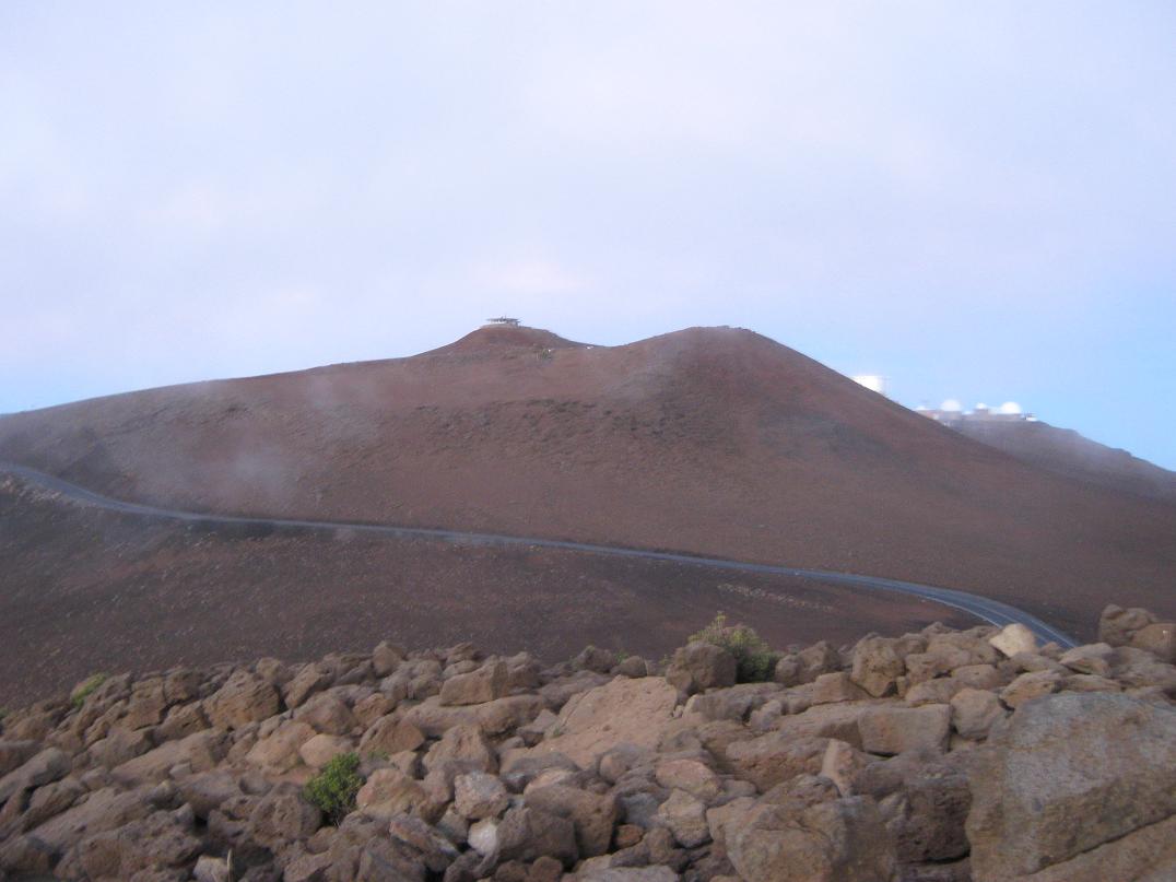
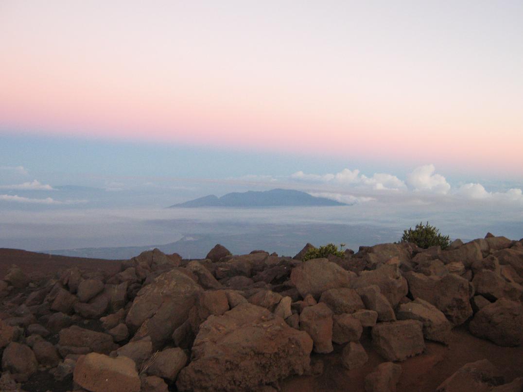
The centerpiece of Haleakalā and of the National Park is the spectacular "crater", which is actually two major eroded valleys, Ko'olau and Kaupo, that run north and east, respectively, from the top. From viewpoints along the rim at over 9,700 feet, the crater is breathtaking, as awe-inspiring as the Grand Canyon. It is a one-of-a-kind place. Not surprisingly, many people want to come here, to hike, or gaze, or witness the sunrise, or bike down the roads. We're no different. My wife had been here before during her working days on Maui, but me, this was my first time ever to Haleakalā, or to Maui for that matter. I had long been fascinated by this place and wanted to visit; it was a "bucket list" destination for me.
βð and I flew to Maui from Phoenix via Los Angeles on the 16th, dealing with delays along the way. We arrived late that day and simply drove to our hotel in Lahaina. The 17th was left open as a rest day, with nothing planned. I spent that day walking up and down the streets in Lahaina, including Front Street, checking out the people and the sights. Our plan was to visit Haleakalā the next day.
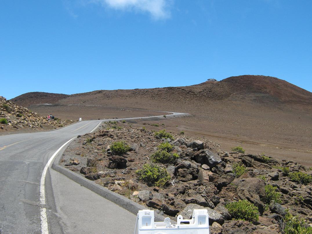
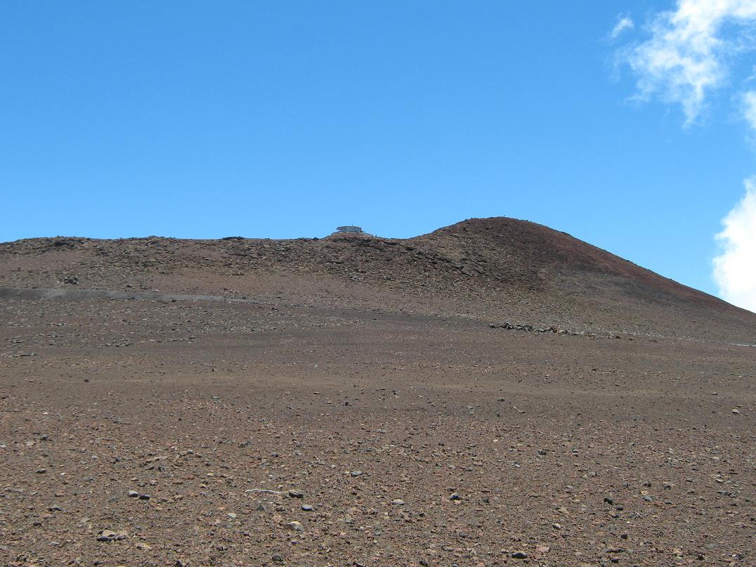
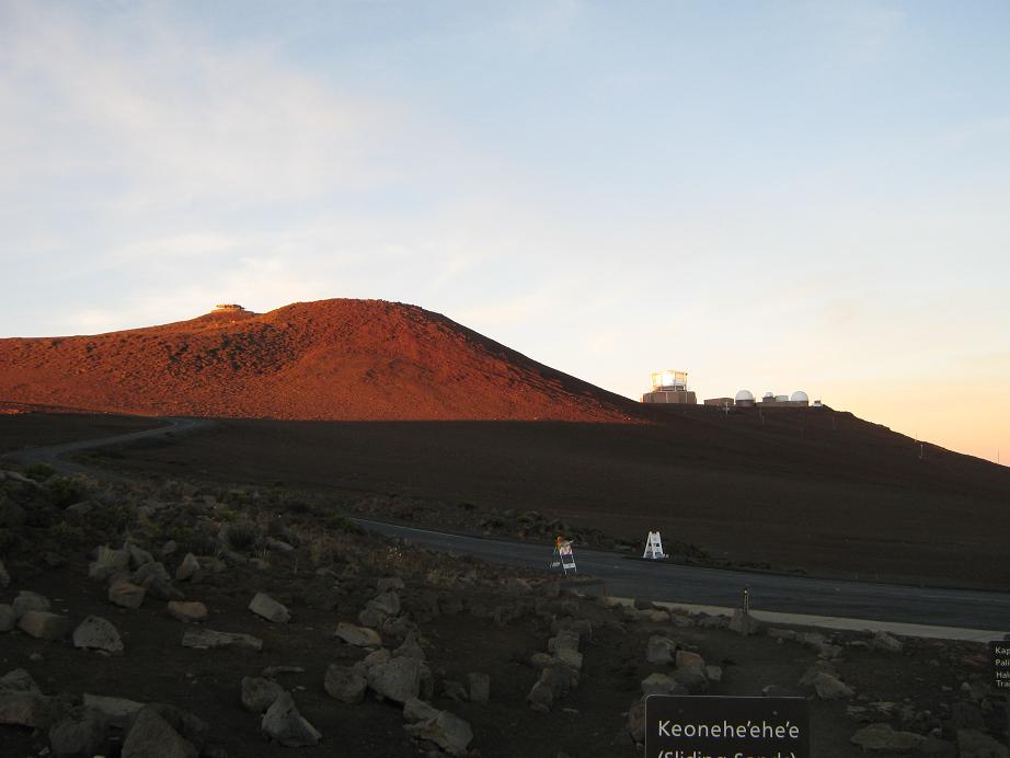
A popular attraction on Haleakalā is to view the sunrise from the summit ridge, then bicycle down the roads back to civilization. We had no desire for the bicycling, and we wanted to avoid the sunrise crowd, so instead, we drove up the roads to the top in the late morning, arriving about noon. Our plan was to hike a little down into the crater along the Sliding Sands trail, then ascend back to the ridge and up the final 250 vertical feet along a road to top out on Red Hill, the highest point on Haleakalā. This would be our "climb" of Haleakalā. Thus, summitting Haleakalā is simple and many thousands of people do it yearly. We had no reason to expect otherwise.
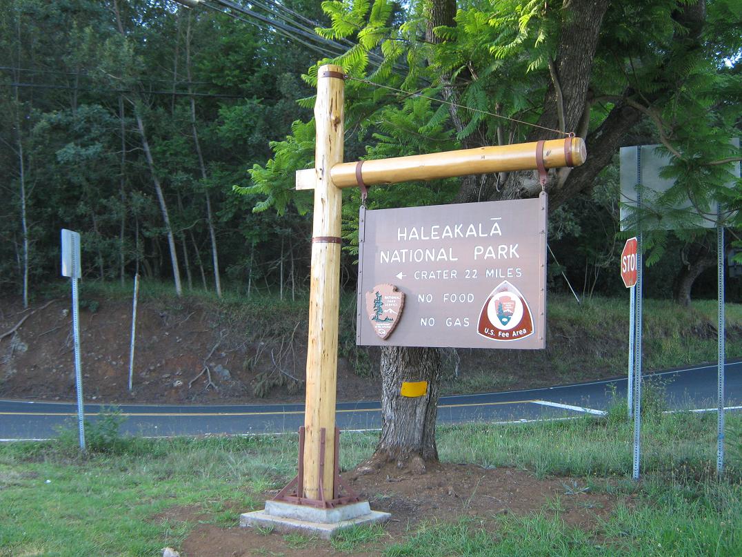
We sensed trouble. The road past the upper visitor's center was gated and closed. A construction guy was manning it, explaining to everyone that the final half-mile road to Red Hill was closed due to repairs on the parking lot. No one was allowed up there, not even foot traffic. Quite a few people, including us, were not pleased with this news. There had been no warning lower down about this. I went into the visitor's center and the young women working there weren't helpful, explaining that I could email a complaint to the Park Superintendent. The closure dates matched exactly with our departure date, so waiting until it re-opened wasn't an option either.
I milled around the area for an hour or so, trying to get a sense of the situation. I spoke to the construction guys. They had no beefs with anyone going up there, but explained it was closed completely for insurance reasons. This was good to know. I asked the ladies in the visitor's center what would happen if we went up there anyway. They said we could be fined up to $5,000. That was good to know too. The construction guys also let it be known their hours up there. This was also useful information to us. Once more with the visitor's center ladies, I asked about notices of this closure lower down, and she said there were two, plus some more taped to the doors at the lower visitor's center near the Park entrance. So we left.
On the drive down, I looked out for these alleged "notices". We found the two she was referring to: they were those electronic mobile construction signs. One, about two miles down, said "Puulaula Parking Lot Closed, July 18-25". The lower one at the park entrance said "May-Sept, Parking Lot Construction". We stopped in to the lower visitor's center and yes, some paper signs were taped to the doors mentioning the Puulaula parking lot closure.
This was as half-ass notification if there ever was one. The lower one was too vague, while the higher one, mentioning Puulaula, was not useful because it uses the parking lot name for this feature, not its more common name, Red Hill, or even a hint that the summit itself was closed, nor was foot traffic barred. βð, who is as vigilant a person I know, had checked the Haleakalā Park website the day before we left (the 15th) and saw no closure notices. Back at the hotel, she checked again and saw one, back-dated to July 8th. Those sneaky SOBs! We had plenty of beefs the way the National Park Service handled this. They are:
1. The notices were vague, and not one of them mentioned that foot traffic was barred.
2. The closure must have come fast because the notice on the website was posted after its supposed date (July 8). Again, had we seen this when we checked the 15th, we could have made alternative plans.
3. Surely the National Park Service knew of this planned closure and could have started notification well in advance. Projects like this take months to sort out, and the dates would have been known probably by last April. We understand last-minute closures due to weather or natural events, but this was a planned construction project, known way in advance.
Given the lackadaisical way the notices were disseminated, especially the back-dated one on the website, we felt we had the moral upper hand to go to the top. Given that none of these notices specifically barred foot traffic, we had a "plausible deniability" argument. Back at our hotel in Lahaina, βð proposed we go back. At night. I agreed quickly.
We got a little sleep, then left Lahaina at 1:00 a.m. and drove up to the summit ridge, arriving at 3:20 a.m.. The drive was actually easy. There was no traffic, the clouds were gone so we had still, calm and dry conditions on the upper mountain, and the road itself is extremely well-marked with those reflective dots so that driving it is like driving a runway. We were the third car to arrive at the upper visitor's center parking lot. The rangers had yet to arrive. We were dressed and ready. We locked the car and started walking.
The hike was simple: we followed the road to the upper parking lot, up the stairs and to the top. I had a cheapy flashlight to help with some tricky parts, but we used it sparingly so as not to attract attention to ourselves. We circled the viewing platform building, then walked out one path and tagged some rocks, and that was that. We started down, by which time more people were rolling into the parking lot, and a couple rangers were there to direct traffic. We surely did not want to be seen by them. We'd been gone about 45 minutes.
We walked down the road, but we were dressed darkly and kept the flashlight off. The rangers probably wouldn't think to look up the road anyway. When we arrived back, we simply greeted them, and they never sensed where we had been. We walked back to our car and sat in it, letting the heater warm us up.
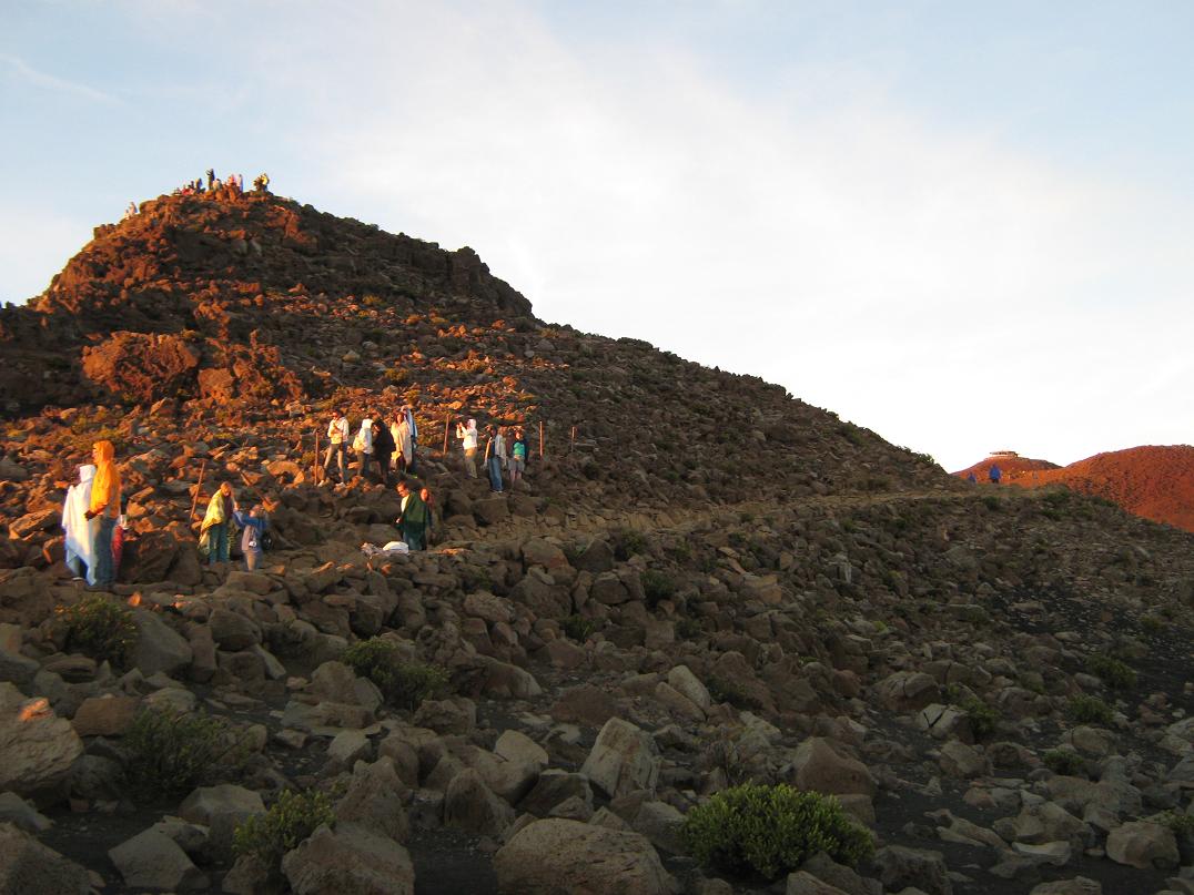
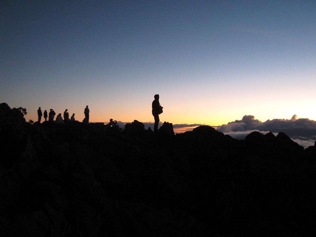
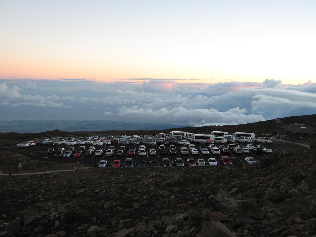
Being close to 4:30 a.m., we stuck around for the sunrise. The cars and busses kept rolling to the point where the lot was filled to capacity. Probably a couple hundred people were milling around, many taking up positions along the rim to get unobstructed views. I climbed the nearby small hill called Pakaoao ("White Hill"), a 140-foot gain, and found a good spot. B. stayed back at the car. There was a steady stream of people coming up this hill.
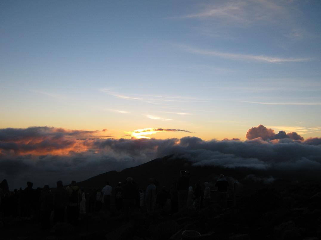
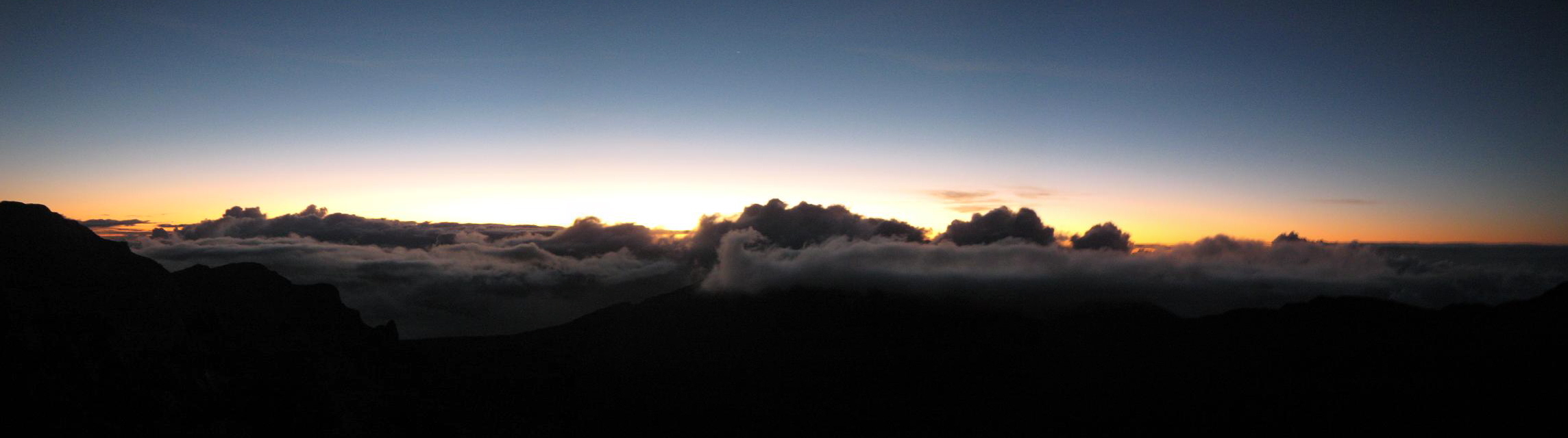
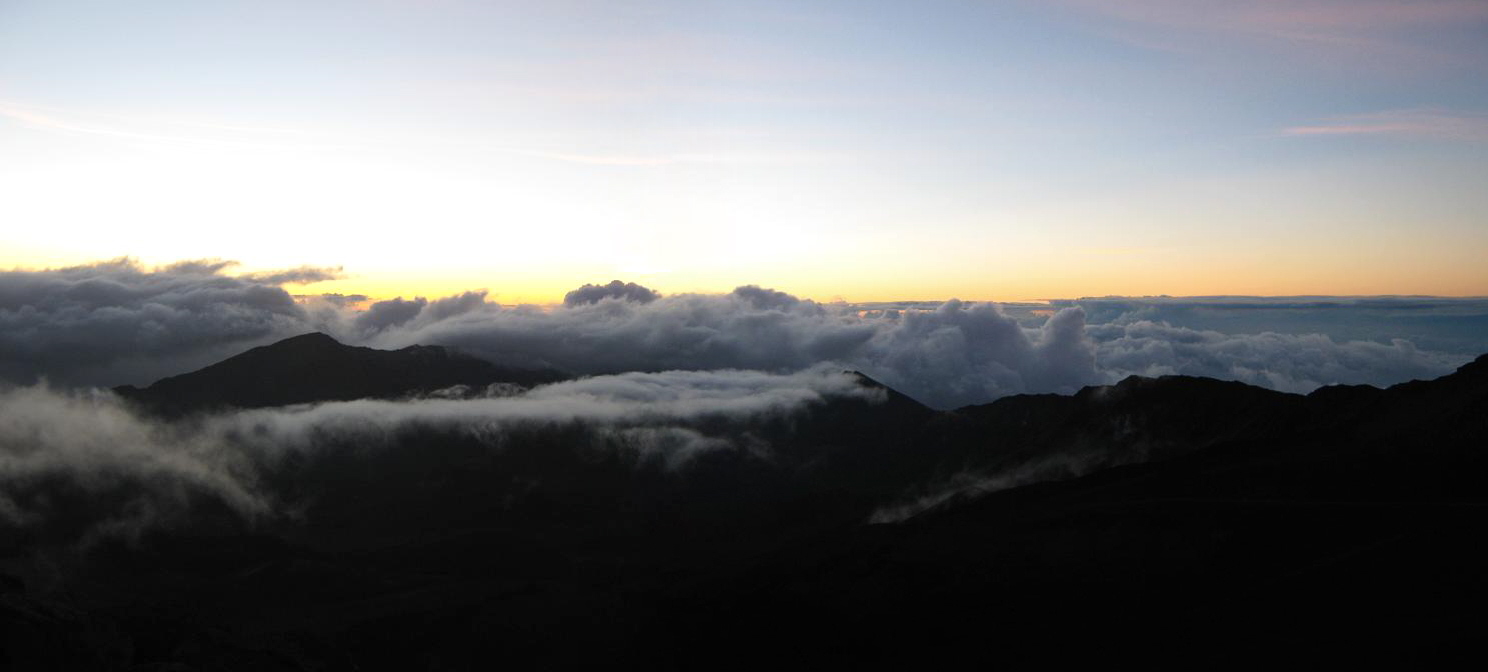
The sunrise event on Haleakalā is astounding. The ever-present clouds usually top out at 8,000 feet, so that the sun rises above the clouds, making for spectacular effects. By 5:00 a.m., the far-eastern skies were shining a pale yellow then blue. The clouds were backlit, and to the southeast I could see the giant masses of Mauna Loa and Mauna Kea on the Big Island. Finally, the sun's rays break out, at first a single point of sunlight, then more and more. It's indescribable. It's also impossible to photograph because it means looking right into the Sun's rays. People clapped and cheered and there were two Hawaiians offering a chant. I daresay I even got a little emotional.
Soon, people started to saunter back to their cars, while the bike riders were getting ready. We could sense a traffic jam in the making, so we started moving quickly, and made the drive down with no troubles at all. We took the time to stop in spots for photographs, trying to capture the scale of Haleakalā and with little success. We were back to Lahaina by 8 a.m., where we relaxed and caught up on our sleep.
Our Haleakalā "summit day" certainly had not gone to plan, and we were amused by the way we turned it into an epic. We were happy to be able to visit it, in spite of the amateur-hour antics of the Haleakalā Superintendent.
|


|