
The Mountains of Colorado
• www.surgent.net
|
(Prowers County)
(Baca County)
(Bent County)
(Otero County)
|
Two Buttes • Carrizo Mountain East Slope I visited these four county highpoints on a week-long driving tour, a big loop from New Mexico into Texas and Oklahoma, then through the Panhandle of Oklahoma back into Colorado. These four counties — Baca, Bent, Otero and Prowers — are the four southeasternmost counties in Colorado. They are in the Plains, but still feature some hills and variable topography rather than just flat monotonous rangeland.
Date: (1) May 29, 2002; (2) September 20, 2002
• Elevation: 4,711 feet
• Prominence: 356 feet
• Distance: 1.6 miles
• Time: an hour or two
• Gain: 330 feet
• Conditions: Nice both times
Main
•
PB
•
LoJ
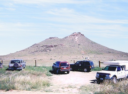
The Two Buttes are a lonesome two-headed knoll rising suddenly from the flat rangelands of southeast Colorado. The bluff is a single hill with two summit caprocks, the southern one being highest. They are visible from many miles away and the hike is a fun diversion while in the area.
I was in Springfield, the main city of the southeast corner of Colorado. I could see the buttes easily, being about 10 miles from town. I needed gas, and also wanted a state atlas to help with the roads out this way. It was late in the day, about 4 p.m., the weather calm and still.
When I asked the counter lady if they sold any state maps or atlases, she looked at me like I was from Mars. She called someone and asked if they sold atlases (she had to ask me to pronounce the word for her). The person on the other end sounded equally confused. The conversation went something like this:
"(Her, to phone) Do we sell (aside to me) what are they called? (me: atlas) (her back to to phone) atlas? A road map ... a road map of the state ... yes, a state atlas ... of Colorado ... an atlas of Colorado ... Colorado ..." (it went on)
Meanwhile, I saunter to their little magazine rack and what's there: a Colorado DeLorme! They had one. So I bought it. She and her phonemate seemed to have not a clue what I was talking about.
With the atlas, I could track the roads better and not run up a dead end. I was able to get to the Two Buttes area with no problem. The hike went quickly and took about 30 minutes round trip. It is a strenuous but short hike, the best you're going to get for a hundred miles in any direction. It is a worthy little peak.
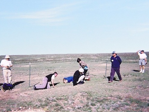
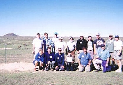
In September, I returned to the area as part of the 2002 Highpointers Convention, in Kenton, Oklahoma, which is about 50 miles from here. A bunch of us convened to hike the county highpoints in the area, including Two Buttes. My photos at left are from this second visit.
All of us took turns on the top and we had a leisurely couple hours in the area. From here, we headed into Kansas for some county highpoints there. I wondered if that lady in Springfield was still on the phone asking about a "road atlas"?
Date: (1) May 30, 2002; (2) September 20, 2002
• Elevation: 5,280 feet
• Prominence: none
• Distance: 0.5 mile
• Time: An hour of moseying
• Gain: 20 feet
• Conditions: Lovely both times
PB
•
LoJ
I bush-camped over night, down within a canyon. It was a quiet and peaceful camp. Today, I would visit three more nearby county highpoints, then make my way west toward Walsenburg for some actual mountains to climb the next day.
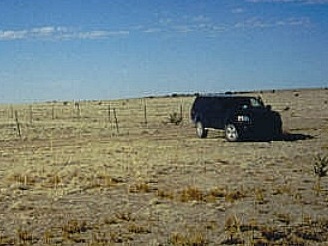
Carrizo Mountain is a hilly plug of a peak, its summit rising in adjoining Las Animas County. The eastern slopes enter into Baca County, the highest point in Baca County somewhere along the county boundary. I found County Road Q and followed it to a track across a pasture and up a mesa, where the road got rough. Once on top the mesa, I drove along an east-west fence line to a gate and a junction with a north-south fence line, which is the Baca-Las Animas County line.
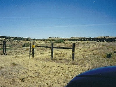
The highest point in Baca County is a single contour of 5,280 feet poking into the county, and the rise and fall of the fence posts made it easy to gauge where it was. I hiked south, then squeezed through the barbed-wire fence into Baca County and paced the highpoint area. Once satisfied, I returned to my truck and was on my way.
I returned again in September as part of the Highpointer's Convention. This time, there were about 15 of us here to visit this peculiar highpoint.
Date: May 30, 2002
• Elevation: 4,855 feet
• Prominence: 315 feet
• Distance: 2 miles
• Time: 60 minutes
• Gain: 350 feet
• Conditions: Lovely
PB
•
LoJ
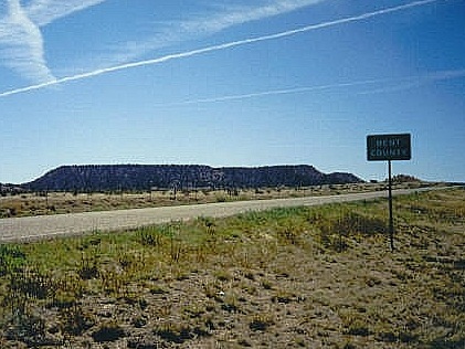
I was now heading west on US-160, then state route CO-109 into the Purgatoire River Valley. The country here was gorgeous, with high-walled mesas lining the valley. The highest point in Bent County is on the San Jose Ranch in the southwest corner of the county. I called the ranch phone number for permission but got no response. I parked along the highway alongside a fence and started the hike.
Hopping the fence, I crossed a pasture, then steeply up the slopes onto the top of this mesa. Brush was moderate and slightly heavy in spots. The day was warm, and snakes were a concern, but I saw none. On top the mesa, I hiked across a narrow neck to get myself onto the higher northern lobe of the mesa, on which the elusive highpoint stood, somewhere. Now to find it.
The brush and trees were enough to shield the views, so I spent awhile walking from one rock mound to another, always scanning the area to see if anything looked higher. The formations up here are very pretty. I eventually tagged about four or five points and felt I gave the highpoint a good once-over. I didn't want to lollygag, so I started down as soon as possible. I was back to my truck in an hour, and on my way.
I learned later that the ranch owner apparently issued a blanket denial to all requests to hike this mesa. He had allowed some visitation but grew weary of the requests. I think this ban was in place when I was there. Not that I tried to be sneaky. I called them and parked my truck along the highway in plain sight. I assumed things were cool so I went in. No one bothered me and it was a few months later that I learned of this policy against hiking here.
(Keep in mind, this was as of 2002)
Date: May 30, 2002
• Elevation: 5,260 feet
• Prominence: none
• Distance: 3 miles
• Time: 60 minutes
• Gain: 200 feet
• Conditions: Lovely
PB
•
LoJ
I drove to the city of La Junta for drinks and gas, then a series of local routes to get on US-350, aiming for the highest point(s) in Otero County, also located in its southwest corner atop the bluffs lining Timpas Creek.
I left the highway at an abandoned railroad siding called Bloom, where I followed a dirt road in a mile, fording a creek with cattle standing in it. Then, I followed a lesser two-track road across the grasslands. I passed through a gate, then slowly made my way toward a reservoir, parking at another gate, with the bluffs now in view. The total mileage from the main highway was about 7 miles.
I hopped the gate and started hiking cross country through open juniper, then out into a meadow, hiking northwest toward the bluffs. I reached the first area after a quick hike up a slope where a small cairn at the fence line "marked" the highpoint. Hiking back, I chose to stay on top the bluffs and hike across three more highpoint areas before descending down into the valley and following a road back to my truck. I ignored one lone eastern area that looked lower to me. The weather was getting hot by now, into the 90s. The hike was about three miles, taking an hour with a total of 300 feet of gain. It was now noon.
I spent the remainder of the day aiming west, eventualy locating myself way up on West Spanish Peak, which I would climb tomorrow.
|


|