The Mountains of California
• www.surgent.net
|
| Blue Ridge & Table Mountain |
• San Gabriel Mountains • Los Angeles County • Wrightwood Area |
|
Date: May 9, 2014
• Elevation: 8,480 feet (Blue Ridge), 7,516 feet (Table Mtn)
• Prominence: 400 feet (Blue), 754 feet (Table)
• Distance: 0.5 mile for both
• Time: 2 hours
• Gain: 125 feet combined
• Conditions: Sunny
• Teammates: Joe Surgent
California
•
Main
•
PB (Blue)
•
PB (Table)
I drove to California for a few days of hiking in the San Gabriel Mountains, arriving at my parents' place in Wrightwood about noon, having left Scottsdale at dawn. My father was at the house, packing and cleaning the place as they plan to sell it soon. This would be my last visit here, assuming it gets sold.
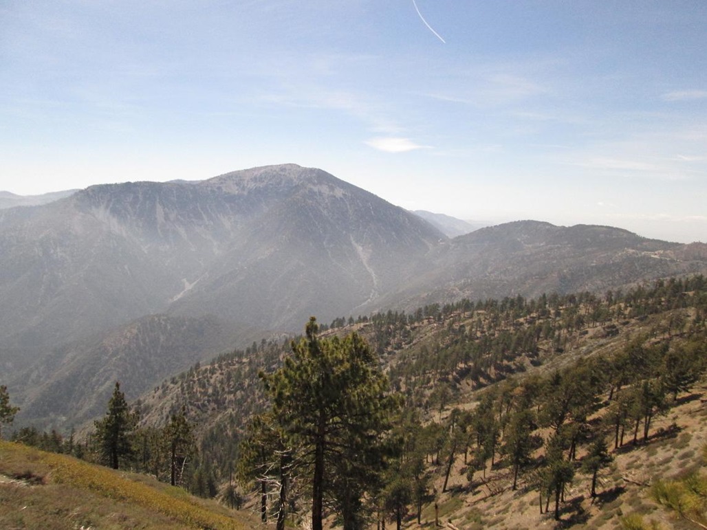
After a nap and lunch, I asked my father if he wanted to join me for a drive up the Blue Ridge Road. This road stays high on the ridges above Wrightwood and the Mountain High Ski Areas, and gets as far as near Wright Mountain, which overlooks Wrightwood. Wright Mountain is notable for a big bare cliff, the result of a giant landslide from the 1940s. It looks as bare now as it probably did then.
We left the house at 4 p.m. and drove about six miles west along Highway-2, the Angeles Crest Highway. Blue Ridge Road starts where the highway crosses the Pacific Crest Trail (PCT). The PCT and Blue Ridge Road then intermingle as essentially one route almost all the way to Wright Mountain, about 8 miles away.
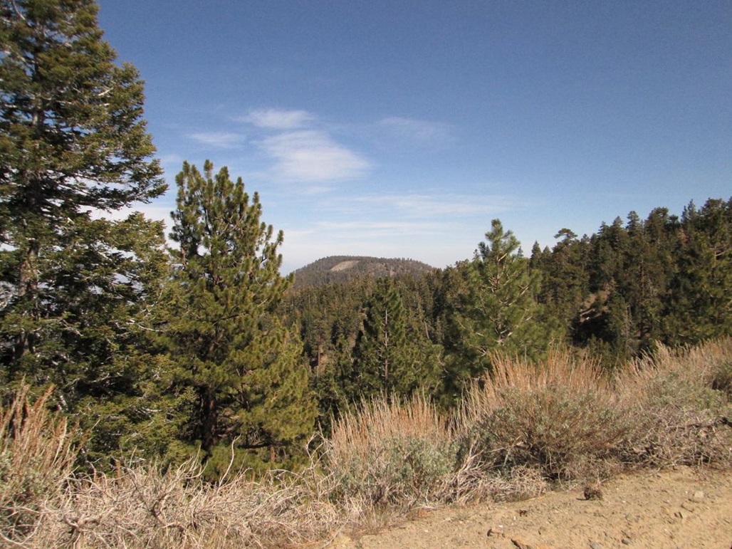
Blue Ridge Road is a good road, but narrow in a few places. It is dirt and sometimes steep, but the surface is smooth and rarely rutted, and I did not need 4-wheel drive. I rumbled forward in second gear, and we stopped often for the scenery. My dad says he had never driven up this road in the years they had their place in Wrightwood.
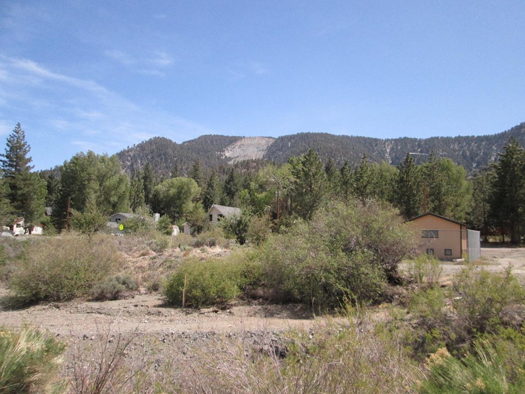
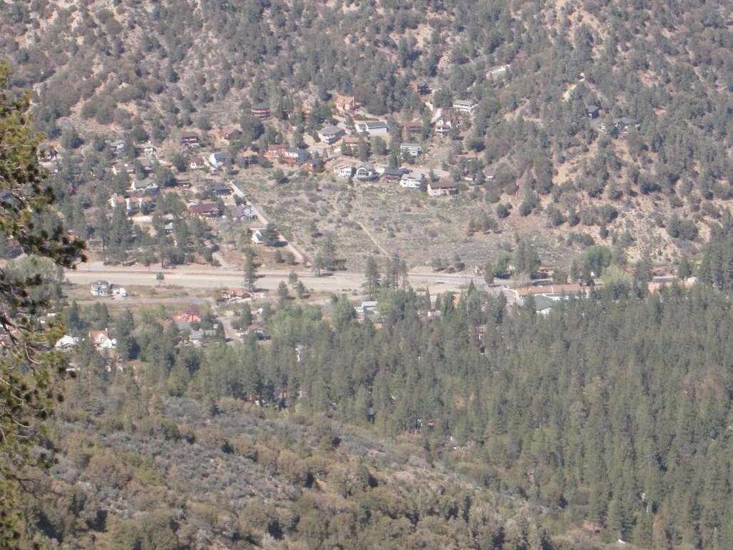
In about a half-hour, I had got as far as the Guffy Campground, about two miles from Wright Mountain. However, the road to Wright Mountain was gated closed. I had hoped to drive closer to it, then hike a short half-mile segment of the PCT to the top. But being this far out, I wasn't up for a longer four-mile round trip at this point, and my dad probably would have got bored waiting for me. Instead, we walked around Guffy Camp and looked down over the town of Wrightwood. I was able to shoot an image of their home using the zoom feature.
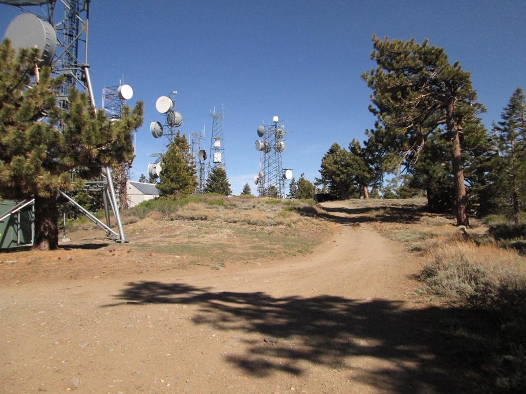
On the drive out, I took a detour road and drove us up to the top of Blue Ridge, where a lot of towers stand. I was looking for the Frost Benchmark, with no luck. We spent about 10 minutes here, then resumed the drive back out to Highway-2. The round-trip drive on Blue Ridge Road took about an hour at an easy pace.
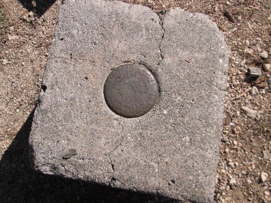
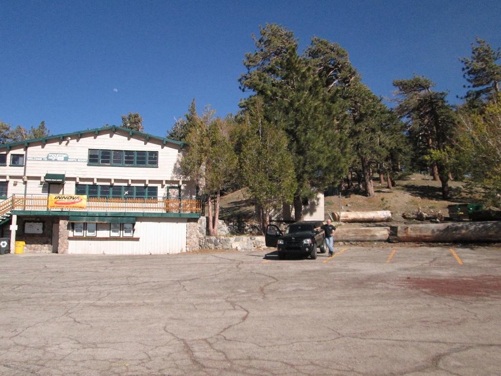
Returning toward Wrightwood, I took another detour up another road, this one paved, to the Mountain High Ski Area's North buildings and parking area. We parked in the gigantic parking lot, us being one of three vehicles there. My goal was the benchmark at the top of Table Mountain. I hiked the road another quarter-mile and about 125 vertical feet of gain to the top, finding the benchmark in a concrete casing in no time. I was back to the truck, the round trip taking about 20 minutes.
We didn't linger long here. The whole place was like a ghost town. Mountain High is probably L.A.'s most popular, accessible ski area, so it's easy to imagine thousands of people here on a winter weekend day. However, when the snow is gone, no one comes here, and everything is in shut-down mode. I am always amused how butt-ugly ski areas are when there is no snow.
We were back to town by 6 p.m. and went out for a dinner. The drive and short hikes were fun and I enjoyed the time with my dad. Although I didn't hike much at all for these two "summits", the walking around did help me acclimate a little better to the elevation change, which would help for tomorrow's big 13-mile hike to Ontario Peak.
|

|