The Mountains of California
• www.surgent.net
|
| Verdugo Mountain & Burbank City HP |
• San Gabriel Mountains • Los Angeles County • Highpoint: City of Burbank |
|
Date: September 19, 2015
• Elevation: 3,120 feet
• Prominence: 1,344 feet
• Distance: 3.5 miles
• Time: 2 hours
• Gain: 1,320 feet
• Conditions: Nice, but getting warm fast
California
•
Main
•
PB
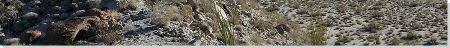
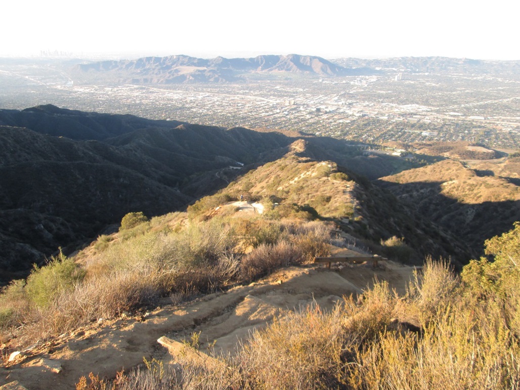
The Verdugo Mountains lie in the San Fernando Valley, in the cities of Burbank and Glendale (and some inside Los Angeles). It's an extension of the San Gabriel Mountains, but lies apart from the main range so that it is essentially its own little range. Roads and trails cross all over the mountain, and there are about a half-dozen ways to get to the summit.
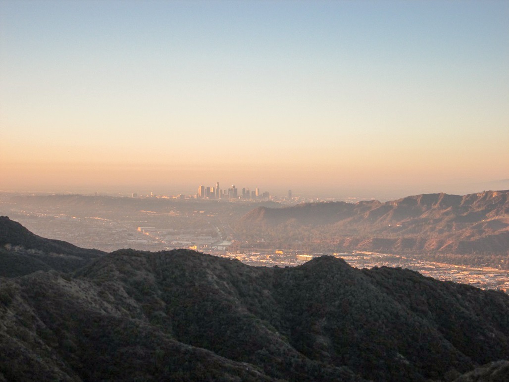
I was here back in May 2014. I had hiked San Gabriel Peak earlier in the day, then drove down Highway CA-2 into the Los Angeles basin. I eventually found my way into Wildwood Canyon Park, and parked at the end of the road. From here to the top would cover about two miles and 1,300 feet of gain. It was about 1 p.m. when I started, and it was very warm.
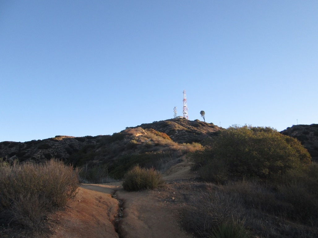
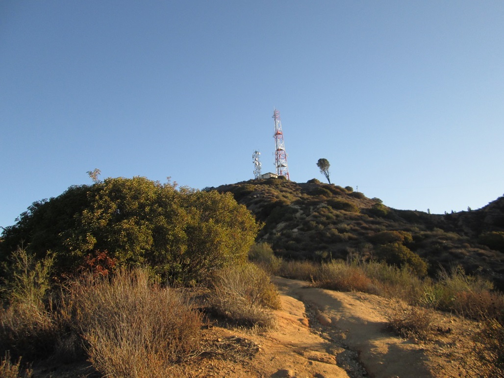
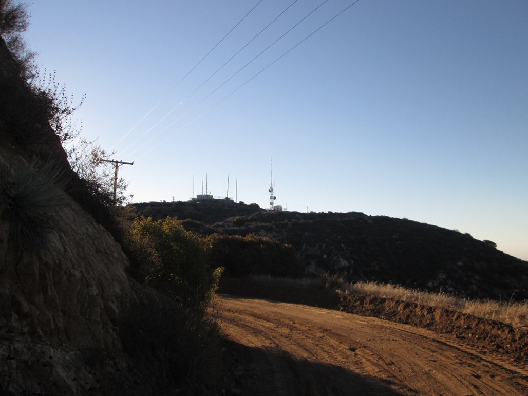
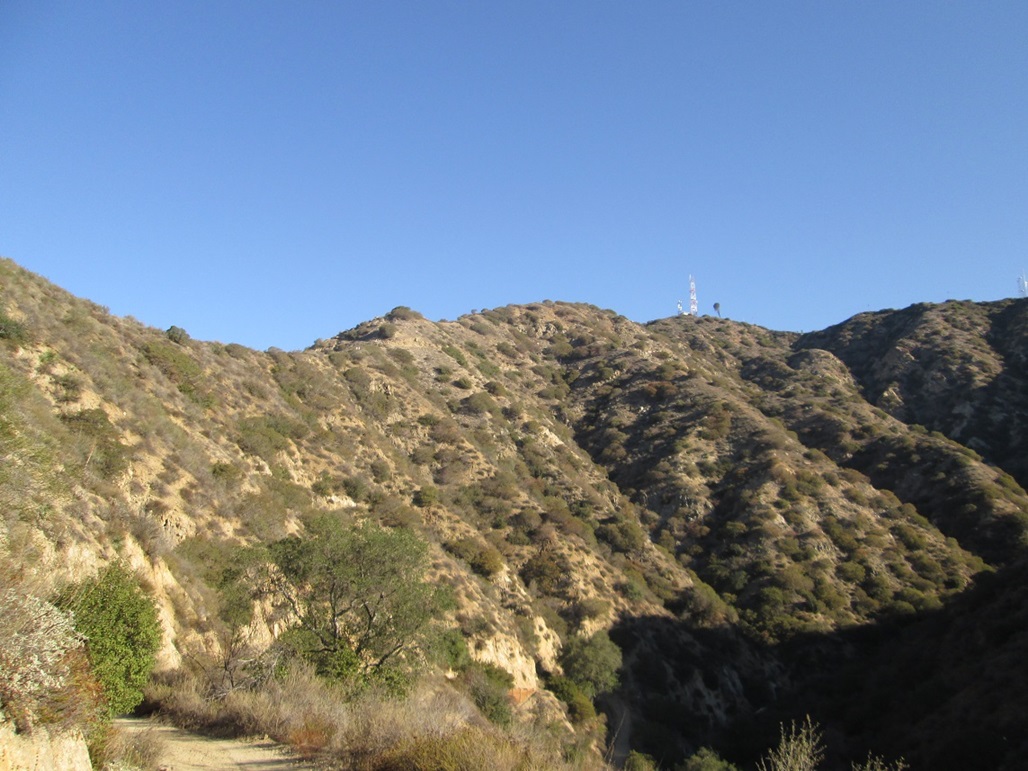
I followed the dirt road past the last turn-around. It gains steeply, making two sharp switchback turns, then levels off at a cleared area where other trails come to meet as well. I made a hard right and scrambled up a lesser path, then found myself on the main trail, directly on an open ridge, aiming for a set of towers directly ahead, lying atop the main summit ridge. The actual summit is about a half-mile east, and I could see its towers too, as I ascended.
All was dandy except that I underestimated the heat. I was only carrying one liter of water, and I was past half-way on it, but still a couple hundred feet below the towers. It was hot, there was no shade, and I was losing interest very fast. I decided to bail, and come back another day.
My next opportunity was not for another 16 months. We drove to Southern California for a short weekend vacation, a chance to do something fun after a whole summer devoted to prepping for, and recuperating from, her major neck surgery. All of our Minnesota travels were not necessarily for pleasure. We decided to get a rental car, too, rather than put the wear on our vehicles.
We left Scottsdale at dusk on Friday and arrived into Pasadena at midnight, the drive uneventful. I slept for a couple hours, but was up early, intending to be at the trailhead as close to dawn as possible. I knew the roads from last year and arrived to the gates of Wildwood Park about 6:45. They were shut, so I pulled into the big lot and started to get my stuff together. Just then, a worker opened the gates. I got back in the car and drove to where I parked last year. I did not feel guilty cutting off about a mile each way of hiking. I didn't have all morning for the hike and hoped to be up and down in less than three hours.
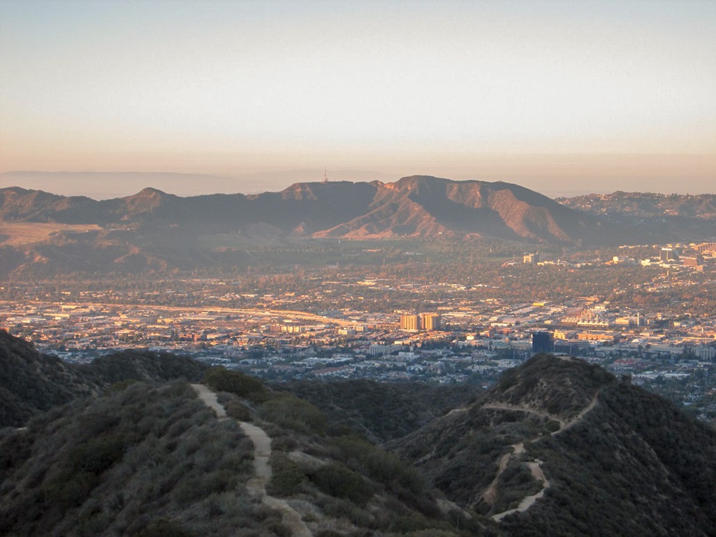
I started walking at 6:55 a.m., the day clear and very still. The air temperature was about 75 degrees, but it felt warm, in that there was no chill from the ocean. It was going to be a warm day (in fact, the high would be about 104 degrees later that day). I followed the exact same route as from a year ago. There were a few hikers already on the trail. Many were jogging it. It appears to be a good workout peak for the locals.
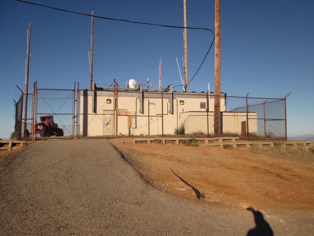
I huffed and puffed up the steep trail to the first set of towers. Going by a sign here, I had covered a little over a mile, and had gained about 1,100 feet. I found the main fire road that runs along the spine of the range and followed it to the summit, making good time. I walked up to the fencing surrounding the buildings and walked the perimeter. The highest point is inside the fencing, but less than a foot higher than the highest spots on the outside. A mountain biker rolled up as I was standing around. I snapped a couple images and started the walk back down. I checked my time and was pleasantly surprised to see it was not yet 8 a.m., meaning I had been hiking for just over an hour. I was making better time than I thought.
I walked briskly back to the first towers and started down the trail. I was moving pretty fast, and after descending about two-thirds the way down, stopped for water and was surprised how jelly-like my legs were. They were shaking. I was probably pushing things and was likely dehydrated. I drank an entire 32-ounce Gatorade in one long gulp, so yes, I probably was dehydrated. At least my legs settled down. I had not done much hiking this summer, so I was a little out of shape. I walked at a more moderate pace back to the car, arriving back at 8:45 a.m., a round trip of 1 hour, 50 minutes, which was great, since I had assumed I would be hiking much longer.
I got into the car, cranked the air-conditioning and returned to our hotel in Pasadena, where I cleaned up. We got our stuff and left, spending the afternoon touring the nice homes in San Marino, killing an hour at the Huntington Library, then meeting with our friend Brian for a three-hour lunch in Arcadia. After that, we drove to Palm Springs where we stayed another night, before driving back to Scottsdale on Sunday afternoon.
For trivia fans, I "discovered" that the highest point in the city of Burbank lies along the ridge, immediately below the first set of towers. The city limits run diagonally here and cross the trail at about 2,980 feet. Thus, just by walking the trail, one passes the Burbank city limits and its highest point. Another small area about 200 feet north may also be as high. The summit of Verdugo Mountain lies inside Glendale city limits, but is not the city's highpoint, since the city has land much higher in the San Gabriels. The highest point in Glendale is near a fire road southwest of Mount Lukens.
This has been a rough summer for me, emotionally. I have had almost no desire to hike or climb anything. On our first trip to Minnesota in June, I got a phone call that another dear friend, Edward Earl, drowned in far-north Alaska while descending a peak in the Brooks Range. This was about five months after Adam Helman had passed. I had reconnected with Edward in February at Adam's memorial, and four months later, he was gone.
βð's neck surgery took center stage for us this summer, and for the many months prior, too. We made two trips to Rochester, Minnesota, one in June, another in July, when she had the actual surgery. The surgery went well, but the emotions before, during and after were quite strong at times. So much hope, some fear, trepidation, good and bad, all mixed into one. Mentally, I never got a break. I love her more than anybody or anything on this planet. Having a successful surgery, and hopefully a lot of benefit from it, is paramount. So hiking went to the back of the line. For the first time in many years, it just did not interest me.
I am still deeply saddened by the loss of two very good pals in such a short period of time. It has taken the air out of my sails. As I write this, September 2015, I feel like I'm lugging around a 50-pound weight. To me, it feels like the end of an era. We were all original members of the County Highpointers Club back in 1999. Even though we may not have seen one another for years at a time, they were kindred spirits to me. I have questioned myself, wondering what the effing point is.
I climb and hike because I enjoy it. I enjoy reading maps and plotting routes. I enjoy reading past trip reports, developing a mind's-eye picture of the journey. I enjoy the challenge, and pushing myself. I enjoy the scenery. I enjoy being on parts of the planet where the weather is raw and could kill you instantly (as it almost did in Utah, 1998). I enjoy the incredible spiritual feeling I get when on the peaks. I am comfortable in this domain. It grounds me and balances out the other aspects of my daily life.
βð was my best and favorite hiking pal when we first met, and she kicked my ass on a couple big summits, before the ravages of arthritis and torticollis started to limit her, to the point where she had to give up hiking altogether around 2008-2009. I have continued to climb since then for the reasons stated above, but it has never been the same without my wife. I am fortunate that I had (and have) many great partners for my hikes, but βð's forced grounding is hard to accept, even many years after the fact.
This surgery was not intended to cure her. There is no cure for torticollis. There are palliative surgeries and other possible cutting-edge treatments. We had the best surgeon for her, and he promised improvement, but warned us against getting our hopes up for a cure. She is recovering nicely, but it will be a long recovery, and as things cool down, we hope to hike a few desert road/trails together, where she can manage the walking well. I am optimistic and have been thoroughly impressed by my wife's continued strength. This has not been easy for her, not by a long shot.
Verdugo Mountain is not a challenging peak to climb. It's dusty and steep, but technically very simple. I put in a couple hours' of effort and got a peak out of the deal. When I descended, I felt good, and happy. This was probably the right kind of peak to get back into the flow again. I was reminded of the stupidly-enjoyable feeling of being covered in sweat and dust, yet elated. Somehow, my wiring likes this. Others may enjoy eighteen beers in a bar, or pondering their gun collection at 3 a.m. Me, I love the summits and the meditative, spiritual, rejuvenative qualities they impart to me.
For my friends Adam and Edward: you were and are very dear friends to me. You were the right kind of mathematically-oriented list-obsessed peakbaggers this bag of doughnuts could have met at that time in my life. I look back on my county highpointing bingeing (1999-2006) with fondness, happy to have hiked a few really cool ones with you two. I am still wrapping my mind around the events of 2015, but I am at peace with this (or getting there).
For βð: you are my hero who reminds me what true strength and courage in the face of adversity really looks like (hint: it's an attractive blonde). You are beautiful and I love you dearly. Your dad would be (and is) proud of you, some of that two-star general seeping into your DNA. We will be on the trails again, after many years of being grounded.
For the peaks: please be nice to me and keep the snakes and bears distracted while I pass through. And thank you!
|


|