The Mountains of California
• www.surgent.net
|
| San Gabriel Peak |
• San Gabriel Mountains • Angeles National Forest • Los Angeles County |
|
Date: May 12, 2014
• Elevation: 6,161 feet
• Prominence: 1,561 feet
• Distance: 4 miles
• Time: 2 hours
• Gain: 1,020 feet
• Conditions: Sunny
California
•
Main
•
PB
San Gabriel Peak is a locally-prominent mountaintop in the San Gabriel Mountains, overlooking Burbank and Glendale in Los Angeles' San Fernando Valley. It's the highest point along a ridge that ends with the towers atop Mount Wilson, and is southeast of Mount Lukens. I was here two years ago and visited the two aforementioned peaks, but for some reason, did not think to visit San Gabriel Peak. I saved it for another trip to the area, such as now.
I was visiting family in Wrightwood and hiking a few peaks in that area, most recently Throop and Lewis Peaks yesterday. I stayed the night in Wrightwood and started my journey there this morning, leaving the house a little before 8 a.m. I planned to drive the length of the Angeles Crest Highway (CA-2) to Red Box Gap, where the road to Mount Wilson starts.
The drive went well and there was zero traffic. I never passed, nor was passed by, anyone in my direction for the 50-plus miles I drove, and only saw one or two vehicles coming the other way. In fact, I saw more Pacific Crest Trail through-hikers (four) than I did cars.
I was in no hurry and I drove somewhat slowly, enjoying the scenery. The weather, which had been extremely windy yesterday, had moderated to calm conditions today, with clear skies and warmer temperatures. I stopped briefly in the Mount Vetter/Mooney Peak area near Charlton Flat, about 40 miles from Wrightwood. Both are short hikes but a burn had severely scarred Mooney Peak, and a gate closed the road to Mount Vetter. I wasn't interested in a four-mile road walk.
I continued to Red Box Gap and pulled into the parking lot. A guy in a "security" jacket was standing around, so I asked him what was up, and he said they were filming a movie today. I asked if I could be in the movie and he said, sure, why not. I had no idea it was that easy to be a Hollywood star. He motioned toward the area they'd be shooting, and it wasn't near my hike, so I politely declined his offer to be in the movie and continued on my way.
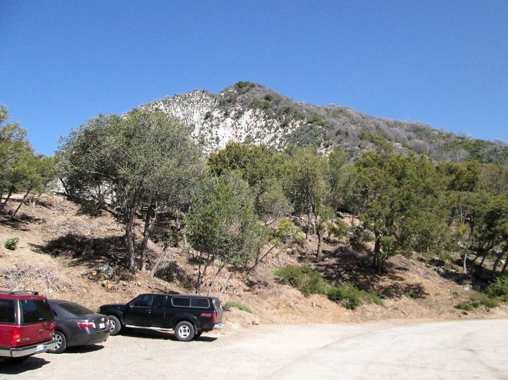
I drove another 2.3 miles along Mount Wilson Road and parked at Eaton Saddle. I was the third car here, and a couple had just rolled in before me, so we talked a little. They were headed to nearby Mount Lowe. I got my stuff in order and started hiking at 9:45 a.m.
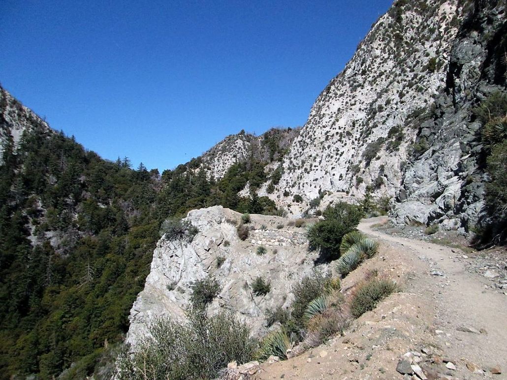
The initial leg of the hike is along an old road called the Mueller Road. It was built in the early 1900s to partly follow a rail line that ferried tourists up from La Cañada below to Mount Lowe. The rail line has long since been removed, and the road has been closed to vehicles probably for as long as I have been alive. For hiking, it was perfect.
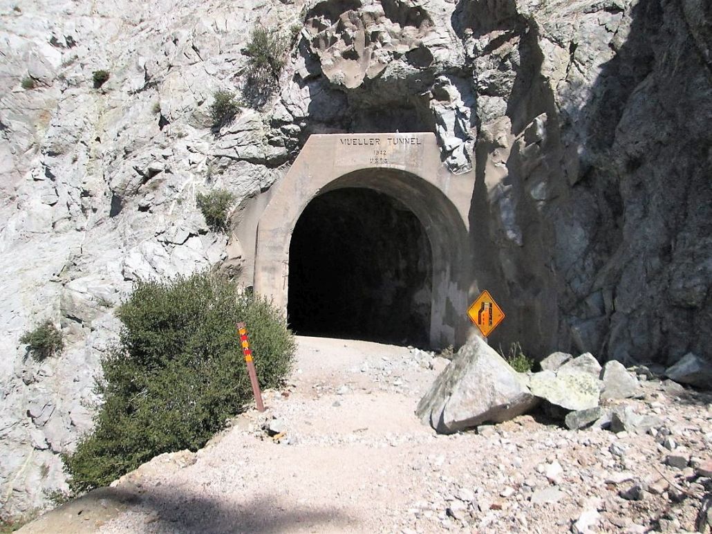
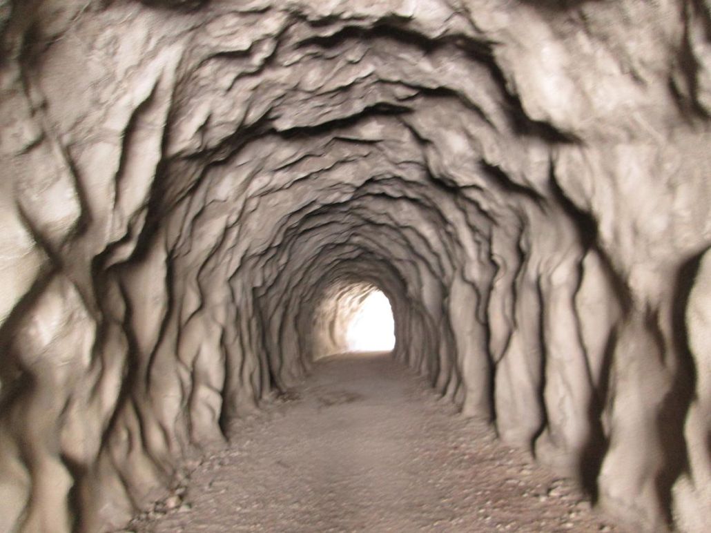
Part of the attraction of this route is the chance to hike through a tunnel, the Mueller Tunnel. It was blasted through one section of cliffs, and runs about 150 feet. Although the road is closed to vehicles, there was still a "lane merging" yellow sign still alongside the road. On the other side of the tunnel, the road is covered over in sandy humps and a stretch of large talus boulders. What's fascinating is the workmanship of the road. Parts are hemmed in by beautiful stone-and-mortar walls, some extending down thirty feet, to create a support ledge for the road. Clearly, the good Lord did not intend for a road to be here, but mankind somehow put one in anyway.
I stayed on this road a few more minutes to a saddle that separated San Gabriel Peak on my right and Mount Markham on my left. The couple that had started before me were taking a break, so we said hi again. I turned right and immediately onto a narrower trail that would lead all the way to the top of San Gabriel Peak.
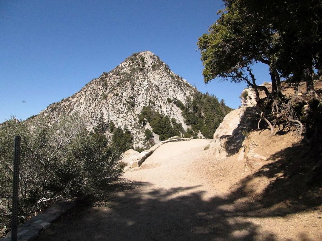
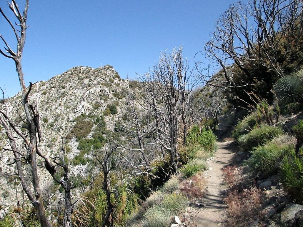
I was feeling energetic so I made good time up the gently-sloped trail. It is rocky with brush that encroaches a little onto the tread. The trail makes about a half-dozen easy switchbacks as it gains the south face of San Gabriel Peak. The south-facing slopes feature no large trees, but an abundance of brush. I seemed to scare up a lizard every five feet. I was mindful of rattlesnakes.
After the switchbacks, the trail then contours west and north, now a little steeper. In places, the trail narrows with steep drops, near cliffs in places. The trail can give a false sense of security so I moved with care in some of these parts. I kept a strong pace, but the sun and the warmth were noticeable.
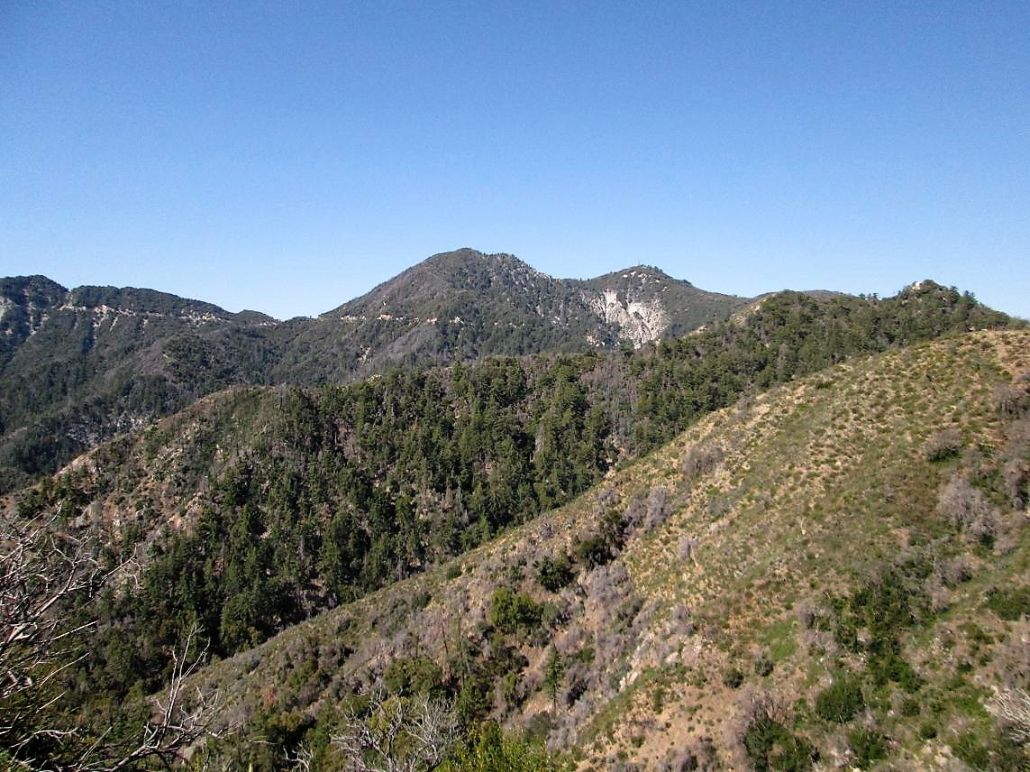
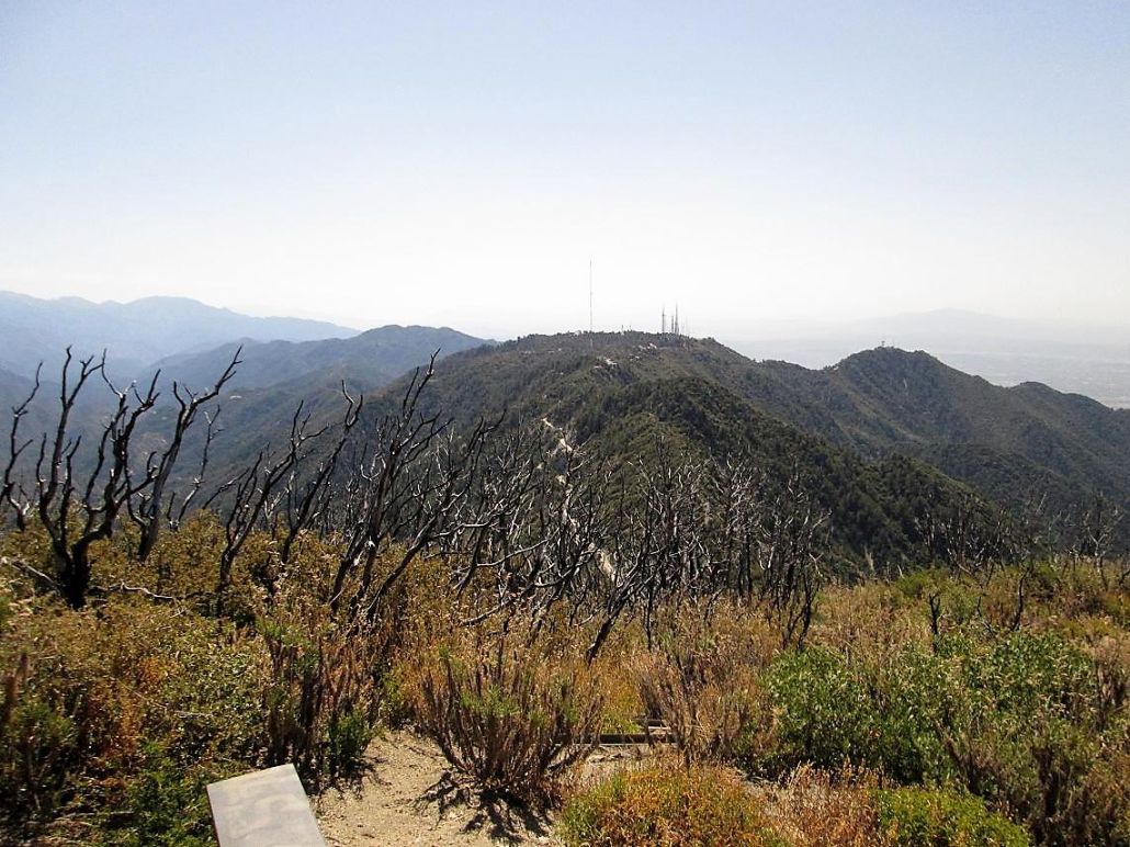
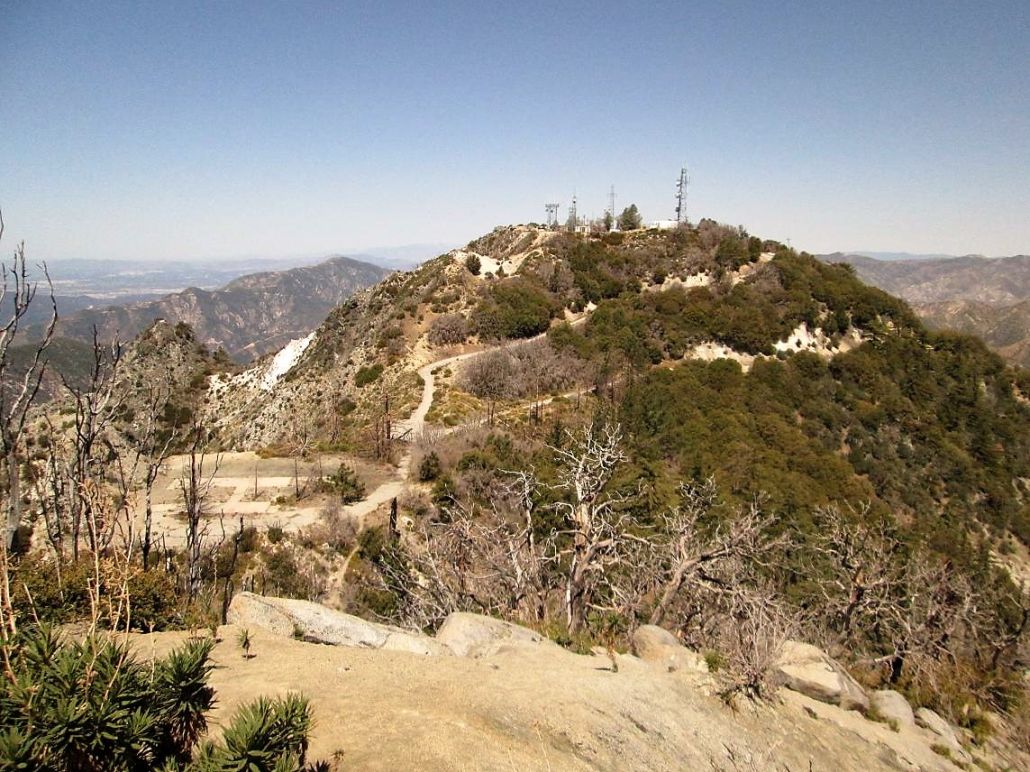
Soon, I was at the saddle connecting Mount Disappointment and San Gabriel Peak. I turned right, and continued upward, following the trail up a handful of switchbacks and a few traverses. From this last saddle, I gained about 400 more feet to finally top out on San Gabriel Peak. The one-way hike covered about 1.5 mile and took me about an hour, with just over a thousand feet of gain.
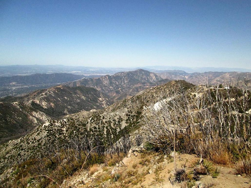
The Santa Ana winds had blown off all the misty muck away, and I had clear views into the Los Angeles basin and the San Fernando Valley. Under these conditions, the views were actually very nice. I took photos in all directions and spent about ten minutes up top, enough time to take a drink break.
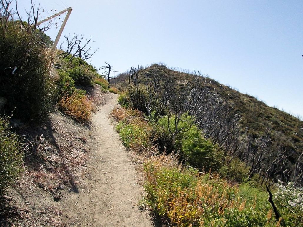
I hiked back the way I came up, and was back to the saddle connecting Mount Markham and San Gabriel Peak in under an hour. I moved quickly but with care. One major problem was the abundance of poodle-dog bush on the slopes. The plant has small purple trumpet-shaped flowers and long stalks with dense, succulent leaves. It's a nice bush to look at, but not to touch. Apparently it is ten times worse than poison ivy. Even a glancing brush can result in blisters, itching and sores. At one point, I glanced it with my palm, and stopped, got a water bottle out and immediately washed the area to remove the resin. Fortunately, I had no symptoms later on.
Back at the saddle, that other couple emerged from their hike up Mount Lowe. We had yet another short chat. The day was still young so I decided to hike the trail toward Mount Lowe myself. I hiked about a half mile to where this trail topped out on a saddle between Mount Markham and Mount Lowe. Actually, I was more interested in Mount Markham. I followed a beaten path about a hundred yards, but it wasn't as well-defined a path as I had hoped, and it was brushy, and warm, and that poodle-dog stuff was growing there, and I had little water. My motivation suddenly disappeared, so I returned to the saddle and consoled myself with more photographs of San Gabriel Peak from this vantage point.
I then hiked back to my truck. The other cars had left so it was just me. I took my time, changed into dry clothes, enjoyed a soda and a snack. Including my extra hike toward Mount Lowe, my total time was about three hours and about four miles of travel.
I started driving again, and continued westbound on CA-2. About a mile later, one of those pull-out lots beside the highway that normally would have maybe one car in it, was completely packed, with about 70 vehicles. A mile later, another of those pull-out lots featured about four or five large tractor-trailers, jammed into the meager space. Clearly, this was all part of that movie shoot. What I wondered was, how were those semis going to get back down? It's not like there's a lot of room to turn, and not like those semis can easily do a three-point u-turn. But then I thought, not my problem. I am sure they're pros at this sort of thing.
The highway drops steeply into La Cañada, passing by some nice homes, then quickly meets with the 210 Freeway. It was about 1:30 p.m. when I dropped into civilization. I had time to kill, so I decided to scout the trailheads for a possible hike up Verdugo Mountain, a low, sprawling peak that sits where Burbank, Glendale and Los Angeles all come together.
I drove on "the" 210 to the La Tuna Canyon exit, then down that into Sunland. There were a couple trailhead let-in points along La Tuna Canyon, but they didn't look very interesting and more importantly, required one to leave their vehicle alongside the road. In Sunland (an integral part of Los Angeles), I worked my way to the south side of Verdugo Mountain and back into the city of Burbank.
My goal was the Wildwood Park, run by the city of Burbank. I drove upward through nice tree-lined streets and well-kept homes, found the entrance and drove steeply to the end of the road (Harvard Road on the map). I parked and that same issue that dogged me a couple days on Ontario Peak happened again: my truck's engine was smoking, burning off extra oil that had got past some seals. I popped the hood and let it air out, and within a minute, it stopped.
It was about 2 p.m., kind of warm (about 85 degrees), and I figured, what the hey, so I got my pack on, my shoes on, and decided to hike to the top of Verdugo Mountain. I followed a dirt road steeply up two switchbacks to a trail, then that trail up some more, gaining about 700 feet in about a mile. The trail was open, dusty and steep, with no shade trees. It was hot and I was lagging so I bailed. I was back to my truck by about 3:30 p.m.. I returned a year later and climbed it while on a quick trip to SoCal with my wife.
I exited the park and followed signs to catch Interstate-5, or "the 5" in SoCal-speak. I followed the 5 to the 134 to where it merged with the 210 eastbound. Traffic was heavy but not ridiculous. I was still ahead of the going-home crunch sure to occur in about an hour. I exited in Monrovia and killed time at a Denny's and at a Target. I even bought oil additive to help against engine smoking.
I had to wait awhile until my chum, Treetops Schneider, got home from his job. We got Yoshinoya and listened to the Kings and Ducks playoff game on the radio. He doesn't have cable, so we listed to it on the radio, like it was the 1980s again.
Early the next morning, I hit the road, following the 210 east to the 10, which I drove all the way into Phoenix and on home to Scottsdale. My truck did well and did not smoke any, and I had another fun, productive trip to SoCal for some peaks and time to clear my head of all the stress from final exams.
|


|