The Mountains of California
www.surgent.net |
| Red Mountain |
• Highpoint: Red Mountains • San Bernardino County |
|
Date: May 23, 2010
• Elevation: 5,261 feet
• Prominence: 2,061 feet
• Distance: 5 miles
• Time: 2 hours and 45 minutes
• Gain: 1,700 feet
• Conditions: Puffy clouds and very windy
California
•
Main
•
PB
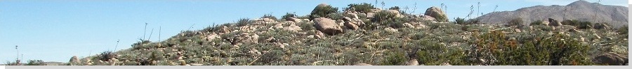
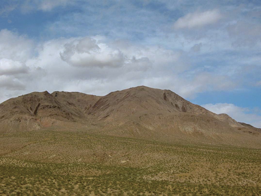
Red Mountain is in the Mojave Desert near the gold-mining towns of Red Mountain and Johannesburg, about 45 miles northwest of Barstow. It has a little over 2,000 feet of prominence, which is why I climbed it. However, it was not my primary goal for this trip. Instead, I wanted to hike to the summit of the Double Mountains in the Tehachapi Mountains.
The day before I left Arizona for California, we had our first 100-degree day, and usually, May features stable, dry weather in the Southwest. However, driving into California along Interstate-10, I battled stiff winds that kicked up dust clouds. My truck shook with the gusts, and bigger trucks would sway and yaw in the winds as I drove up the grade into Banning and Yucaipa. Clearly, a front was moving in. I arrived in Cucamonga to watch my nephew play a Little League game, then celebrate a late birthday with my niece. I spent the night in Wrightwood, where my folks maintain a second home. My mother was also here.
The next morning, I awoke to falling snow. It was heavy enough to collect on my truck and on the ground to about an inch deep, but not heavy enough to clog the roads. I left Wrightwood and descended into the high desert through Phelan and Adelanto, catching US-395 aiming for the Tehachapi Mountains, which were visible on the north horizon. Unfortunately, the clouds had collected over them. Thus, I decided to detour, staying north on US-395 to the Red Mountain-Johannesburg area.
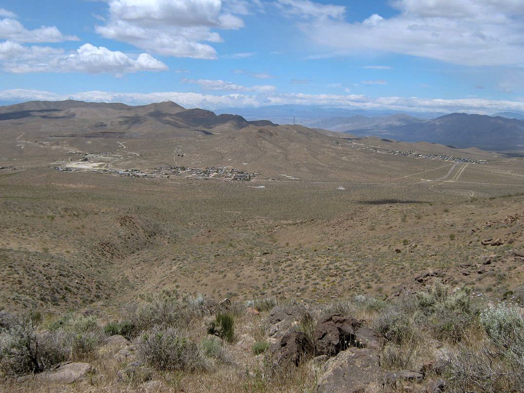
Once in the community of Red Mountain, I went north to the junction with Trona Road, then immediately onto dirt Cuddeback Road, which runs about a mile into the range. I drove in about seven-tenths of a mile, parking at a wide spot in the road, and suited up. It was windy and cool. The peak itself stood high above me to the east. It had a nice shape and friendly-looking slopes. I started the actual hike at noon exactly.
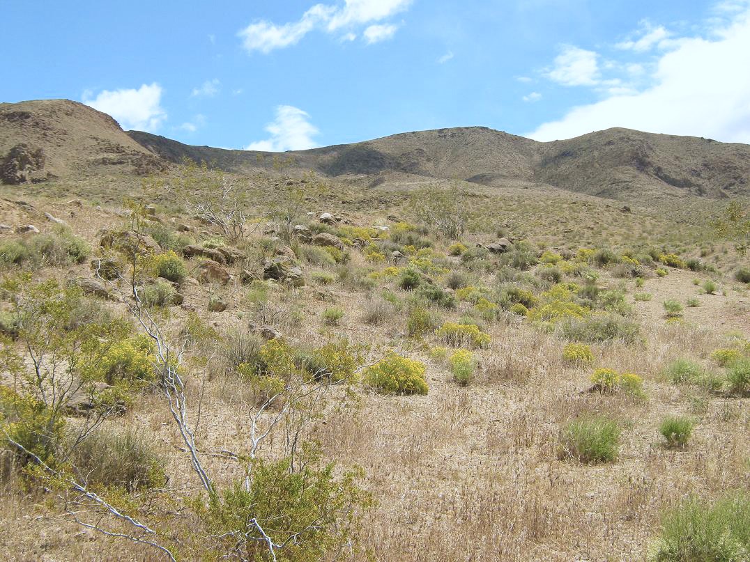
I walked the remainder of Cuddeback Road to its end, then randomly chose a hill to ascend, aiming southeast. The slopes were open, covered in grasses, flowers such as goldenrod and lupine, a few succulents I was unfamiliar with, and russian thistle, better known as tumbleweeds when they die, dry and break loose. I walked up the gentle slopes, heading toward the base of a set of cliffs in front of me. After about a half-mile and 500 feet of gain, the route came onto a broad flat bench covered in large boulders. I took a break on one and eyeballed the next segment.
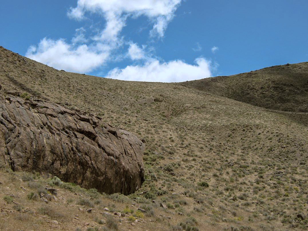
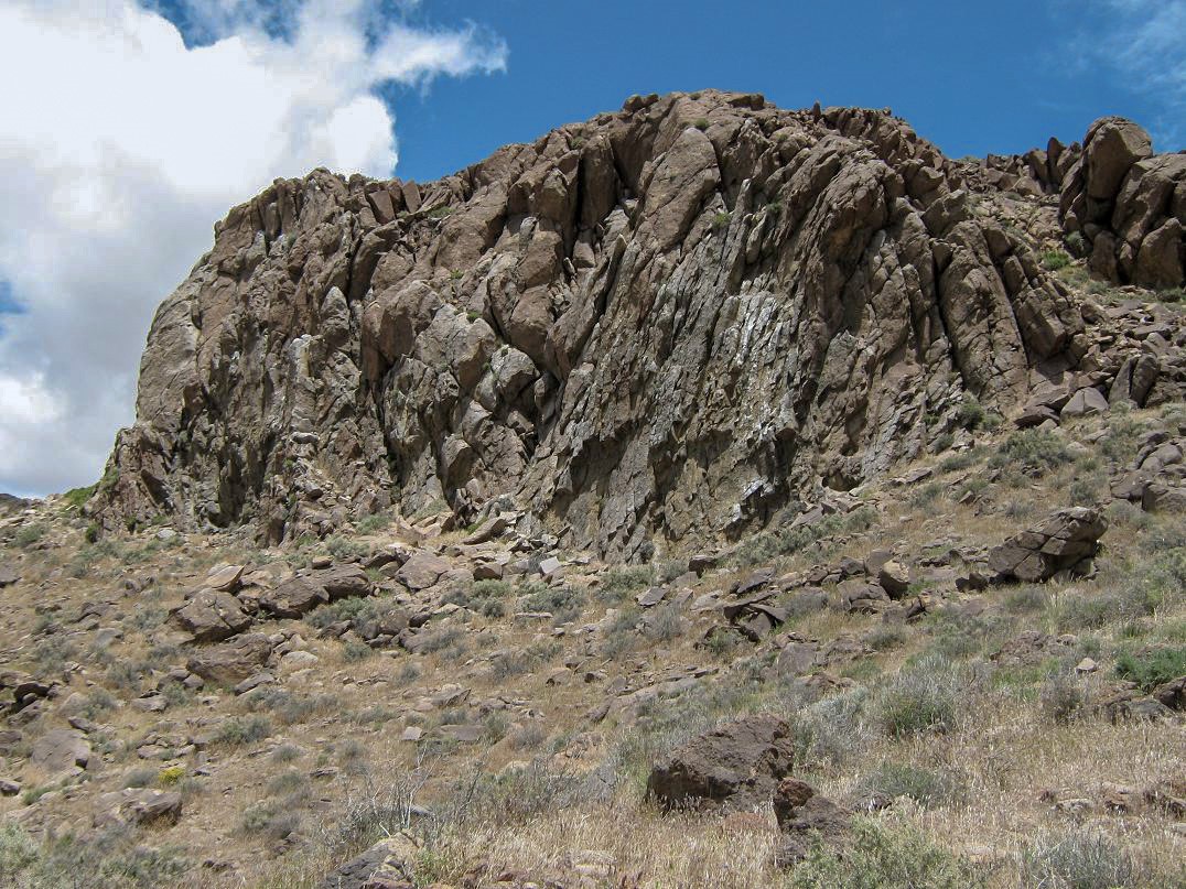
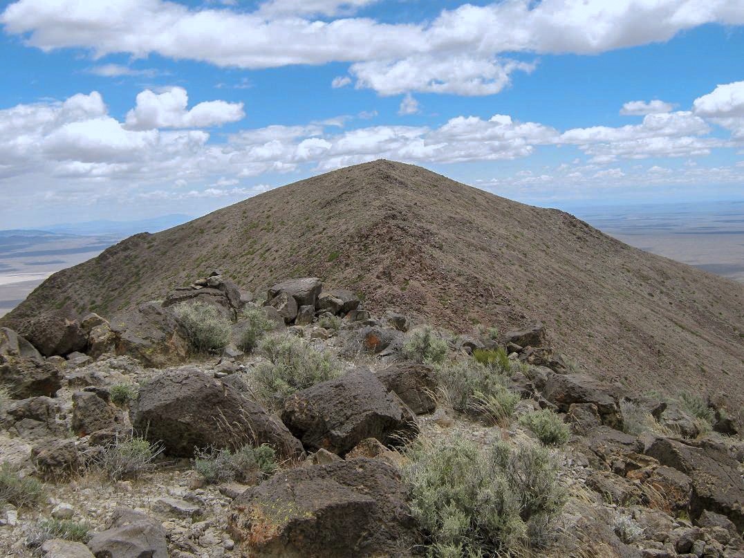
The "crux" of this hike is getting to the main range crest, 600 feet higher. The slopes steepen and in places the rock was loose, but I made slow and steady progress upward, going more up than over to avoid rock gullies. After a half-hour of this, I was now on top the range crest. So far, everything was going well.
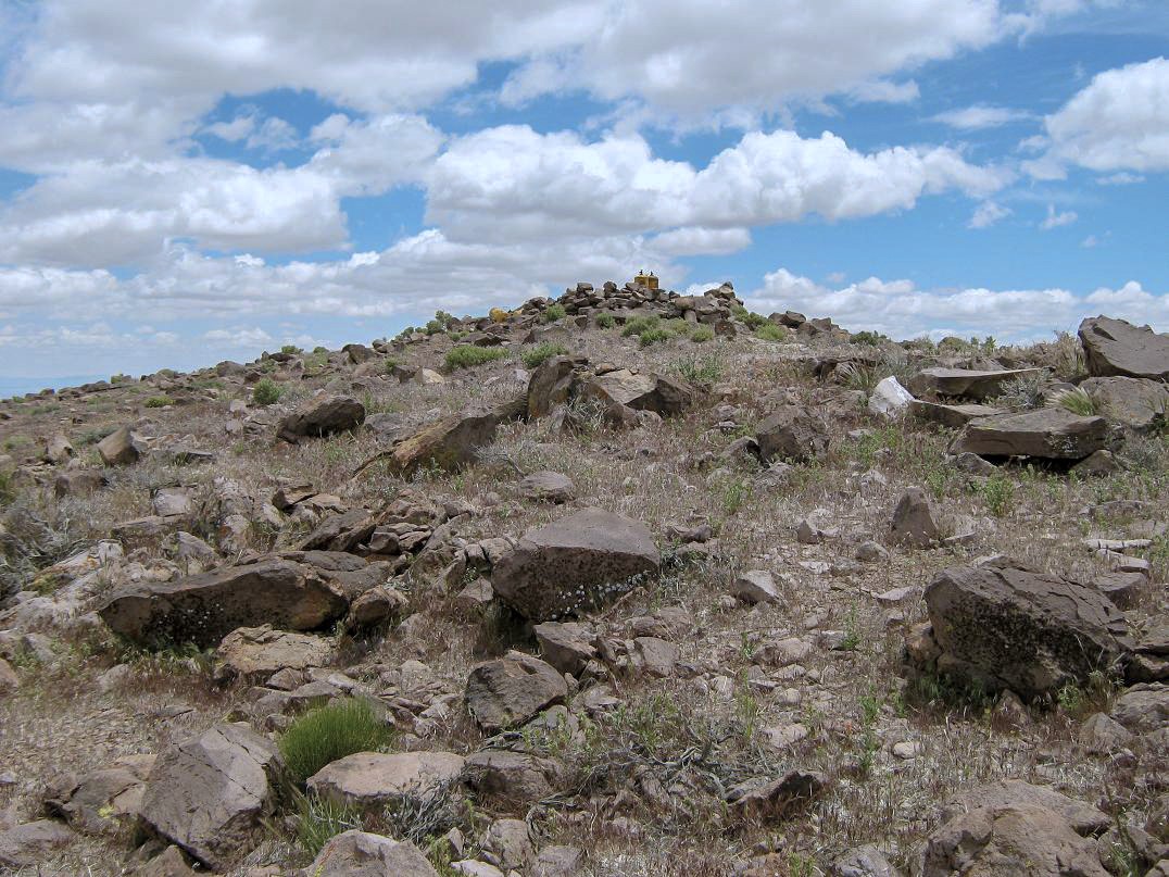
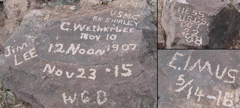
Once on top the range crest, I hiked up the gentle slopes to a false summit, and once atop that, down rockier slopes to a saddle directly below the real summit. I found good foot-paths to follow, occasionally leaving them to scramble over easy rock sections. I arrived to the summit shortly thereafter. The top is marked by a stone windbreak, a number of big air tanks of some sort, and general garbage. Most intriguing were etchings made into the stone from members of the United States Geological Survey and the Marine Corps, from 1907-1916. They took the time to get the letters correctly proportioned and with little serifs. I was "greener" and signed my name into the logbook inside a strong box. The wind, however, was not being kind. I didn't stay long and immediately started my descent.
The hike down went well other than the wind. It was worst as I descended the steep slopes off the range crest. Here, it barreled into me incessantly, cold and sharp, making me uncomfortable. I didn't stop moving until I was below the cliffs, where I finally had a respite from the wind, and where I took another break to enjoy the scenery. The final leg of my hike to my truck went without incident, and I was gently surprised to see I had been gone only 2 hours, 45 minutes. Not too bad for an old slow guy.
I figured I would give Tehachapi another chance. I drove south on US-395, but did not want to take the long way through Kramer Junction and Boron. Instead, I cut a diagonal southwest through the peculiar city of California City. From US-395 in the middle of nowhere, I turned west onto Twenty Mule Team Parkway. It's a sandy and unkempt road for about a mile, but on the map it appeared to be a substantial road, so I drove until I came upon the Kern County line, which is also the city limits for California City. Here, the road "improved" to badly-degraded asphalt.
I rumbled forward along this horrible asphalt path, in places completely rotted back into sand. Every now and then a side road would jut off, a few even signed with street signs, kind of odd for being this far into the desert. After about ten miles of this, the road improved and small hints of civilization would appear. Eventually, I passed through downtown California City, then south to state route CA-58. This was my first, and probably last, time in California City. I left with a general "WTF" feeling.
So I did a little research and discovered that back in the 1960s, developers had the idea to create a new city out of thin air. They plotted the roads and laid out the city, centering it in a huge patch of desert bounded by highways US-395, CA-58, and CA-14. The problem is that none of these highways actually goes through California City (technically, CA-58 nicks its southern edge). The plan was that the workers at Edwards Air Force Base would live in California City, and retirees too. That didn't quite happen. The city is over 200 square miles in area, third largest in the state, but its population is about 13,000, if you trust the signs.
The head-scratchy part about the California City concept is that it still seems like a not-half-bad idea, but why would you center your new town so far off the main highways? Why not plop it along the main highways and that way, get some "pass through" traffic, and create a revenue stream of taxable dollars? Driving through downtown California City was kind of sad. There's no money. Everything looks run down, like everyone just gave up. Weeds grow along sidewalks. I am not exactly sure what the people who live here actually do.
But there is hope: Richard Branson apparently is basing his spaceport either in or nearby the city. That could be a big boon. Maybe I am being too harsh on this place, but it surely did not impress me on my one visit. Anyway, after another hour, I was in Tehachapi.
I ate a meal then got supplies with the intent of camping at Tehachapi Mountain Park and hiking Tehachapi Mountain and the nearby Double Peaks the next day, but the storm had been more energetic than I had planned: the campground was under about 4 inches of snow, which wasn't alarming, but this probably meant 6-8 inches up high, and since a lot of my hike would be cross-country, I sensed that this would be a muddy, snowy, miserable slog. I passed on this hike for now. Since I didn't need to be here anymore, I headed east with plans to hike Clipper Mountain, along Interstate-40 about 100 miles east of Barstow. This one has an old jeep road to the summit, which was good since I had no maps for it otherwise. So eastward I went.
Along the way, I indulged myself in another pursuit, visiting and logging the lat-long confluence at 35 North, 118 West, located about a mile south of Highway CA-58 about 10 miles east of Mojave (the town). That went well. Back on 58, I proceeded east through Barstow and along Interstate-40, pulling off the road at the Hector exit to camp. The night was cool and breezy, and with a mostly-full moon, gorgeous and serene. I slept well in the bed of my truck.
So Monday morning comes and I drive to the Clipper Mountain area. First issue: where does that jeep road start? I can see it from the highway. The only option, it seems, is to park along the interstate. However, this may not be legal and I do not want to leave my truck exposed like that. So I try plan B, which is to come in from the north under the interstate, but without good maps, I really have no idea what I am doing, so I scrap that plan too, and opt for plan C, to come in from the southeast from the little town of Essex. Well, that wasn't too successful either. Again, without good maps showing the roads, I would spend endless time running up dead ends. After about three hours of exploring the road options, I gave up entirely.
I still had another back-up, Spirit Peak in southern Nevada. Same result: without maps I had no idea what I was doing and this one really does need some good maps. Since I was just 60 miles from Henderson, I drove up to visit my dad, who was not expecting me. We had a good time, getting steaks and gambling at the quarter machines, with variable luck.
|

|