The Mountains of California
www.surgent.net |
| Palomar Mountain |
• Highpoint: Palomar Mountains • Cleveland National Forest • San Diego County |
|
Date: August 17, 2008
• Elevation: 6,140 feet
• Prominence: 2,856 feet
• Distance: 3 miles (hiking)
• Time: 4 hours (whole journey)
• Gain: 450 feet
• Conditions: Clear and very warm
California
•
Main
•
PB
Located in northern San Diego County, Palomar Mountain is home to the Palomar Observatories. I visited the telescopes in 1989 with some astronomy-minded college buddies, but it never occurred to us to seek out the summit of the peak, labeled "High Point" on the map. The summit is not that close to the observatory buildings and even requires a little minor trespassing along a closed road to get there. Instead, we poked around the buildings and glommed in with an amateur astronomy group that showed up that night to gaze at the stars through their telescopes.
For this trip, we planned to hike Tahquitz Peak near Idyllwild, and I suggested a side trip to visit Mount Palomar's summit. The plan was to make a half-day hike up to Palomar's summit following roads that come up from other directions, then drive to Idyllwild and hike Tahquitz Peak the following day. Instead, my truck's timing belt broke, stranding us in Idyllwild for three days. I was able to "bag" Palomar Mountain's summit, but losing out on Tahquitz Peak, plus the expense and wait while the truck was repaired, was disappointing. On the upside, Idyllwild is a lovely place to be stranded.
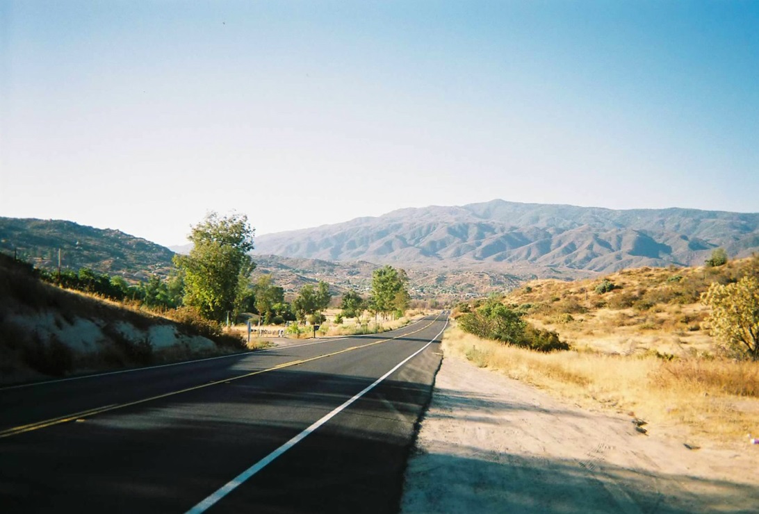
We left home at 2 p.m., the hottest part of the day, and drove into Palm Desert, getting gas and supplies, then drove up the Palms-to-Pines Highway (CA-74) above Palm Desert, rolling into the campground at Pinyon Flat around 8 p.m. We were the only ones here tonight. We had a full moon, a cool breeze and clear weather. The next day (today, Sunday), we continued west on CA-74 to state route CA-371, a back way toward Palomar Mountain. Highway CA-371 is scenic, rolling through high desert and rocky countryside. It ends 20 miles later at state route CA-79, in the small town of Aguanga, in San Diego County.
One of three roads that lead to (near) the summit starts immediately east of Aguanga. We found this road, and noted the abundance of "No Trespassing" signs. They were everywhere, sometimes two or three in a twenty-foot stretch. Maybe they were really trying to get their point across, or just got a quantity discount deal. In any case, we got the message, and moved on. Plan A was a failure.
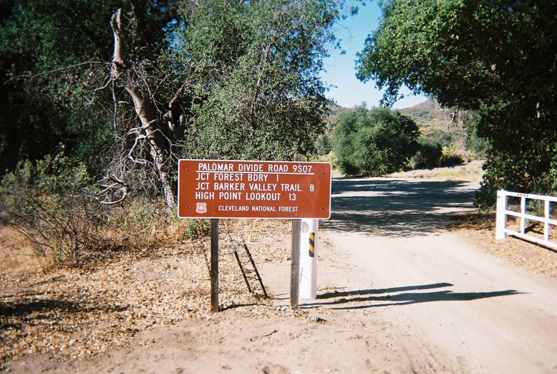
East of Aguanga, in the community of Oak Grove, we found another road that goes to the top (says the map), but this road was gated at its base, and we got nowhere. I don't even call this an attempt. So we continued east along CA-79. The land here is pretty valleys hemmed in by the mountains, with old-growth trees and small ranches and rustic villages. We took the drive slowly, but even then, we nearly drove past another possible access road, called Palomar Divide Road (Forest Road 9-S-07). It was well-hidden behind the trees. A sign along the road mentioned the summit being 13 miles ahead, so we knew we had a promising route. Plus, there weren't a whole bunch of no-trespass signs everywhere.
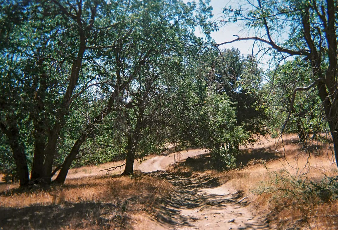
The first mile and a half was typical dirt road. It was moderately bumpy, rutted in spots, rocks here and there, and so on. Driving 13 miles of this seemed unattractive, but we were willing to give it a try. Anyway, after the first mile and a half, the road was now paved. In fact, it was paved for the next six miles. It was not paved up to the standards of a normal road. It was just a layer of asphalt laid directly on the road, which by now was a true mountain road, a narrow shelf road with no shoulders or turn-around room, with steep drops and no guardrails. The pavement is presumably there to guard against erosion, but it does not make the road any easier to drive. I still drove the road slowly and deliberately.
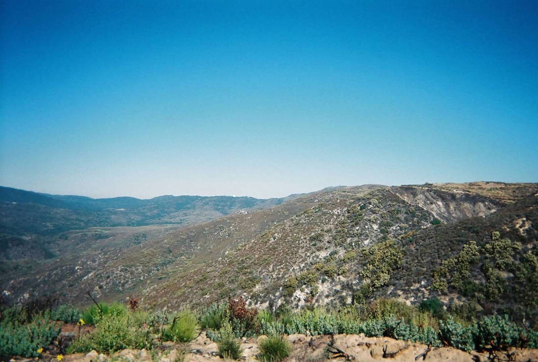
The road eventually surmounts the highlands of Palomar Mountain, where the gradients aren't so steep. The pavement ends near the ruins of an old building, and Palomar Mountain's summit, with its tall lookout tower, comes into view, still a long distance to the west. The road up here was a little better and we drove another couple miles to a junction of roads. I went right, and the road now was much rockier, including one icky segment where a large rock sat in the road, forcing me to drive it by letting the right tires up onto the rock, making us lean about 25 degrees to the left. We got past that, then rumbled another mile or two to a shady glen of trees, still a couple miles short of the summit.
I decided to park in this glen for a couple reasons. I was getting tired of the drive, the road to the top might get worse, and the trees were pretty and offered shade. The day was warm but not unpleasant. However, the bugs were abundant. We rested here awhile, and she decided to wait back at the truck in the shade while I ran off to hike to the top. I took a light pack and started the hike around 10 a.m.
I followed the road to a fork and went right, losing about 60 feet to another junction, the right road being the one up from Oak Grove. Here, I went left and stayed on the road through the shady forest, passing an old concrete foundation of uncertain provenance. The road then curls to the west-facing slopes. Here, I had views of the big observatories a couple miles away, while the summit was just up the road I was on. From the observatories, it would be a simple matter to hike the dirt access road to the top, but why they forbid this, I don't know. Maybe they don't want the extra traffic.
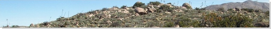
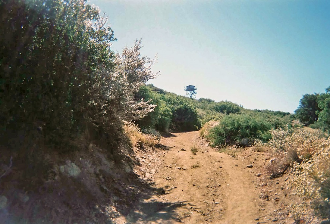
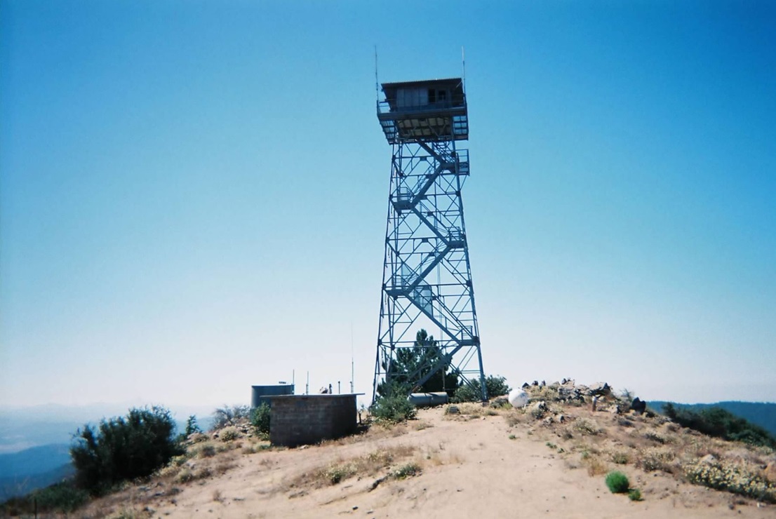
In any case, I came to a fork, the left branch being gated, but leading up to the top. There was no restriction against hiking, so I walked up this final segment and momentarily, I was on the summit, a 25-minute hike for me. The tower was unmanned and the top was scraggly, the very summit marked by a rock outcrop. Given the warmth, I was mindful of snakes. I tagged the highest point, looked around, but didn't stay long. Lake Hinshaw was below us, with Cuyamaca and Hot Springs Mountains in the near distance. However, the day was hazy, and I was being bombarded by bugs, so I got moving fast. Did I mention the bugs?
The hike back went quickly, and I shaved some distance following a shortcut along an abandoned road segment that I didn't see coming up. I was gone less than an hour. I changed quickly, and soon, we were moving downward. I was pleased to have hiked Palomar Mountain, but now it was time to move onto our next objective, Idyllwild and Tahquitz Peak. The drive down was uneventful, and we were back to the highway (CA-79) around noon.
From here, we retraced our route back to state route CA-74 and then to Idyllwild, where we camped at a campground in town that night. We spent the remainder of the day relaxing in the cool air and trees. We slept well that night, then awoke early to get moving to the trailhead for our hike. Halfway there, my truck died on me. When I tried to turn the ignition, it would catch, then quickly die. I knew what it probably was, but we tried other things first, like roll-starting it on a slope, but nothing worked. I got a tow into town, where the mechanic confirmed the bad news: a busted timing belt. They would have to ship the parts in from San Diego and it would take a couple days.
We had no choice. We found a place in town to stay, and left the truck at the mechanics. The Bluebird Cottages offered little cabins and were on the edge of town, about a mile out. One of the mechanics gave us a lift so we could get our stuff there. For the next couple of days, we cooled our heels here. I'd walk into town once or twice a day for drinks and food, and for the exercise. It was all very pleasant. Finally, the truck was ready. By now, we had to be moving back to Arizona, so we drove down and back across the hot desert that afternoon and evening. To add insult, my air conditioning started to falter. What a way to end the trip.
In events like this, we try to look at the bright side. First, the timing belt didn't break while we were on Palomar Divide Road. I don't want to imagine what that would have been like. Second, our stay in Idyllwild was very relaxing aside from the truck issue. The proprietors at the Cottages were cool and understood our plight. Thus, I wanted to mention them by name and put in a good word for them.
|


|