The Mountains of California
www.surgent.net |
| Orocopia Mountain |
• Highpoint: Orocopia Mountains • Chuckwalla National Monument • San Andreas Rift Zone • Riverside County |
|
Date: January 8, 2008
• Elevation: 3,815 feet
• Prominence: 2,095 feet
• Distance: 6 miles
• Time: 3 hours
• Gain: 1,500 feet
• Conditions: Cold but clear
California
•
Main
•
PB
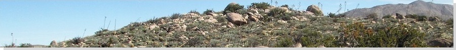
The Orocopia Mountains are astride the San Andreas fault ("Rift Zone") in south-central Riverside County, 25 miles southeast of Indio and about the same distance northeast of the Salton Sea. The range has a deceptively low appearance to it as viewed from Interstate-10, but it does in fact supercede that magical 2,000-foot prominence threshold. It is a popular peak for desert hikers and people chasing the Sierra Club's Desert Peaks Section list.
The range's spread-out appearance contrasts sharply with the more pronounced ranges that surround it, such as the Eagle Mountains to the north and the Chuckwallas to the east. However, when viewed from the shoreline along the Salton Sea, Orocopia Mountain rises over 4,000 vertical feet, a neat trick considering the summit is just 3,815 feet above sea level. The shoreline at the Salton Sea is 230 feet below sea level.
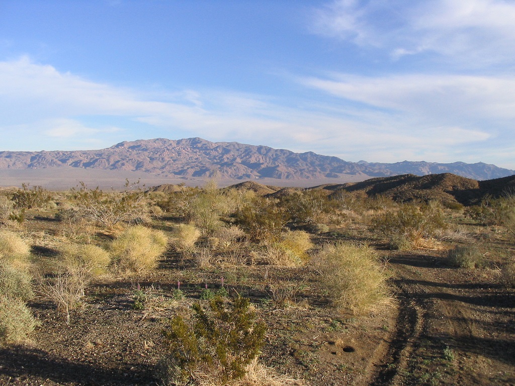
I was driving to California over my winter break to visit family and friends, so I broke the drive into two days, planning to camp and hike this peak before resuming my journey west. A major winter storm had moved through the southwest over the previous couple days. All of Southern California and Arizona got soaked. When I left home on the 7th, it was raining heavily in Phoenix, but as I drove west, and the storm trended east, I eventually encountered calmer weather around Quartzsite.
I planned to camp at the Cottonwood Campground at the south end of Joshua Tree National Park, but instead, I camped along an access road at the base of the Eagle Mountains, about two miles north of the Interstate. This road apparently belongs to the Metropolitan Water District, with signs saying one could "enter at your own risk". So at my own risk, I drove to a clearing near a lone tree and had a pleasant, if cold, night. The passing clouds resulted in a spectacular sunset, and the night was cold enough to leave frost everywhere.
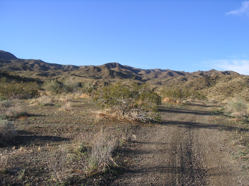
The next morning, I returned to the overpass at the Interstate, southwest along the Box Canyon Road (the road that eventually leads to Mecca), then quickly, a sharp left onto old Pinto Road, which I suspect may have been part of old US-60, the precursor to Interstate-10. Less than a mile later, I went south on a good dirt road, then three more miles south and southeast to the foothills of the Orocopias. I parked at a clearing below a steep, eroded section of the road, but I was only 0.4 mile from the wilderness boundary, so this was a good place to start. I started walking at 8:30, the weather cool and hazy, the effects of the storm still evident. The ground was muddy, but not severely so.
I walked the road 0.4 mile to the Orocopia Mountains Wilderness boundary, just two plastic signs set on both sides of the road, which itself continues into the range for another half mile. There is no gate, and tire tracks of past ATV visitors suggested that although motorized traffic isn't allowed, the rule is apparently ignored. I continued south to where the road dips into a gully and up the other side, turning left at this point and now paralleling a huge wash on the wash's east bank.
The road parallels the wash until it (the road) climbs up onto a short but prominent rock outcrop, about 20 feet high. I scampered up this outcrop and got a good overview of what was ahead of me. The summit was now visible, a flattish top sloping to one side with a small point visible. This was the cairn atop the summit. Now having a clearer idea of where to go, I went on my way, and promptly walked up a dead end.
I knew to drop into the wash and to follow it into the range, but for some reason I thought I should climb up the other side of the wash and follow that route, but within minutes I realized I was too high and had blocked myself by cliffs. I returned to the wash and dropped in, then started hiking up the wash, which quickly narrowed into a lovely canyon about 6 to 10 feet wide and walls about 10 to 30 feet high. This part was fun. The brush was minimal and there were a few dryfalls to clamber over.
I stayed in the canyon for about a half mile and 15 minutes until coming upon a junction where another canyon met up with the one I was in. This was my clue to leave the canyons and start up a steep slope to gain a ridge of land hemmed in by these two little canyons. Now I was on the right path. I had been hiking less than an hour and everything was going well so far.
From here to the summit, I followed a series of ridges and subpeaks, always hiking toward the nearest higher land. Many times the summit would come into view then disappear again behind one of the ridges. To my surprise I found paths that seemed to be human-made, and since they seemed to go where I was heading, I would follow them. When I topped out on the first subsummit, I had a good view of the remaining hiking I needed to do. I stayed high, opting to go up and down instead of bypassing the subsummits on their sides, although in a few cases I had no choice.
In time I was on the last saddle below the summit. From here to the top was the only steep part of the climb, but even then it went well with no trouble. Actually, I thought I was lower than I was and when I topped out over a rise, I was surprised to see the summit cairn right there — I was on top!
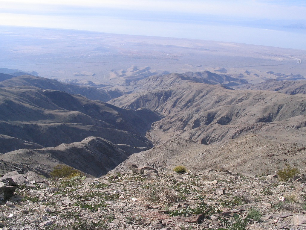
The summit cairn stands four feet high with a stick on its top. The register was in the rocks and I signed in, the first (probably) for 2008. The weather was breezy but the sun was out, and I had tremendous views in all directions. The best views were to the southwest looking down onto the Salton Sea. To the west the snow-clad summits of Mounts San Jacinto and Gorgonio stood above the cloudy haze like islands in the sky. Given the storms had just passed within the last day, both peaks were snow white and beautiful. I could see the trucks on Interstate-10 to the north, and countless desert ranges in all other directions. It took me two hours to get here, and I stayed up top for about 15 minutes. The steady breeze, though, gave me a chill. I figured it was time to get moving down.
I figured the descent would go very quickly, and it did. I was back down into the canyon within 30 minutes, and back to my truck in less than an hour, for a hike of three hours exactly. Back down to my truck I brought out my campchair, changed into dry clothes and enjoyed the warm sun (everything was relative: the temperature was only in the high 50s, and I had to stay out of the breeze).
I had time to kill so I relaxed here for about an hour. The drive out to the highway went well, although I got confused on one turn and took a slightly more "scenic" route, although as long as I was heading downhill toward the powerlines, all was well. I drove into the San Bernardino-Fontana area and visited my old buddy "Treetops" Schneider at his job, then drove to my brother's place with late Christmas gifts for the little ones.
|


|