The Mountains of California
www.surgent.net |
| Mount Jurupa |
• Highpoint: Jurupa Mountains • Highpoint: City of Jurupa Valley • Riverside County |
|
Date: May 14, 2012
• Elevation: 2,217 feet
• Prominence: 1,167 feet
• Distance: 3 miles
• Time: 2 hours
• Gain: 1,200 feet
• Conditions: Warm, hazy, partly snakey with occasional bees
• Wildlife: a snake and a bee
California
•
Main
•
PB
I was heading home after a weekend in Southern California visiting family and celebrating birthdays. I had worked in a few peaks to hike and saved Mount Jurupa, located between Fontana and Riverside, for the drive out. The hike follows a trail and did not figure to take long.
Mount Jurupa is one of those peaks I ignored in all my years living in Riverside and in my trips back to California since then. The peak is the highpoint of the small Jurupa Mountains, which extend just a few miles east to west. The summit is just a shade above 2,200 feet, but the peak does have about 1,150 feet of prominence. I didn't feel like doing any bushwhacking, so knowing there is a trail to the top sealed the deal. The one-way hike covers a mile and a half with 1,200 feet of gain, so it's a hefty little workout. This would be a good way to work off the tamales and enchiladas from yesterday's celebrations.
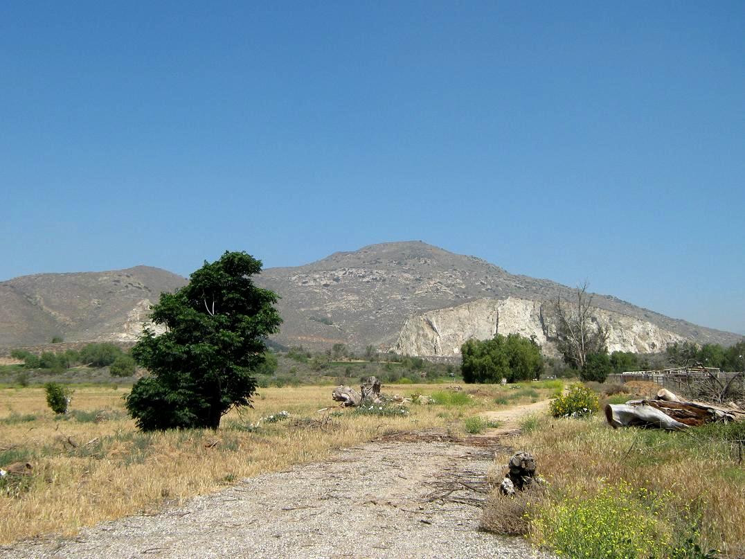
Leaving Wrightwood, I dropped my sister off at the Ontario Airport, then drove a few miles east into Fontana, exiting at Sierra Drive, stopping at a Circle-K for drinks. Mount Jurupa was just another mile south. Looking at it, it has a nice hump-shaped profile, and is not a bad-looking mountain. It just hides in plain sight, or, more often the case, hides in the gray muck that they call air in this part of the country.
I drove another mile south on Sierra to the Martin Tudor city park at the base of the peak. They were doing a lot of renovation, construction and destruction, although the parking lot was still accessible. I pulled in and found a shady spot to park, away from all the work trucks. Apparently at one time the park had a big water slide. I saw nothing like that today. There are about a couple acres of grassy lawns and big shade trees, and a small stream of hikers and joggers who obviously use Mount Jurupa to keep fit. The area was nicer than I was expecting.
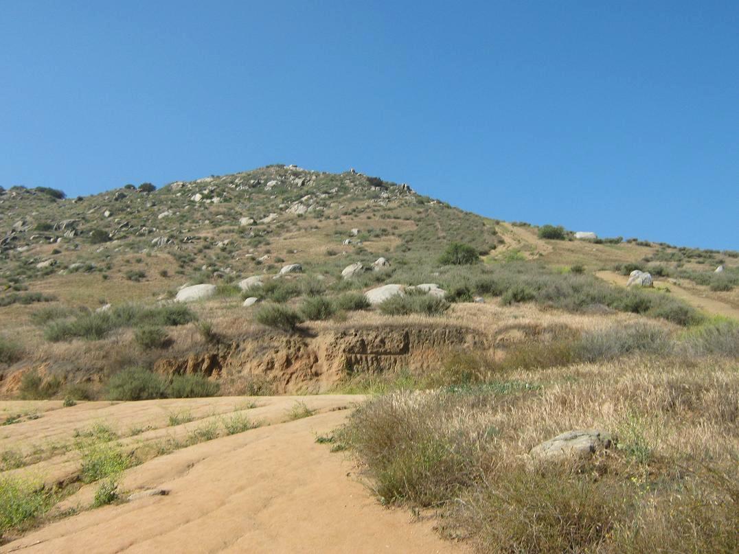
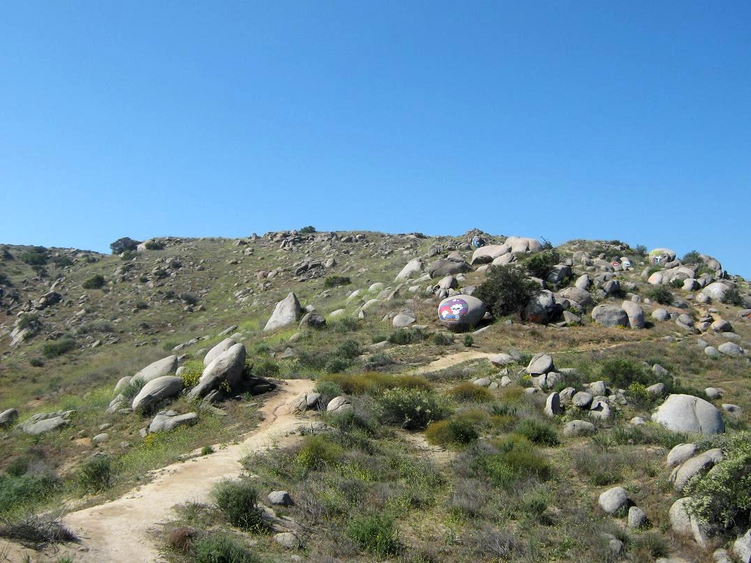
It was 10 a.m. when I rolled in, got my shoes on and my stuff together. Given the short nature of the route, I didn't bring a pack. I carried my walking staff ("Stick Scott"), my camera and a Gatorade. I walked up a grassy slope to a cell-phone tower decked out in fake pine tree branches, which is kind of odd since there are no pine trees here for it to blend in with. Past the cell-phone tower, the trail starts directly up-slope. The first couple hundred feet is wide, loose and eroded. It badly needs attention and perhaps some trailbuilders to add in a few switchbacks here. Part of the "trail" was a two-foot deep erosion gully.
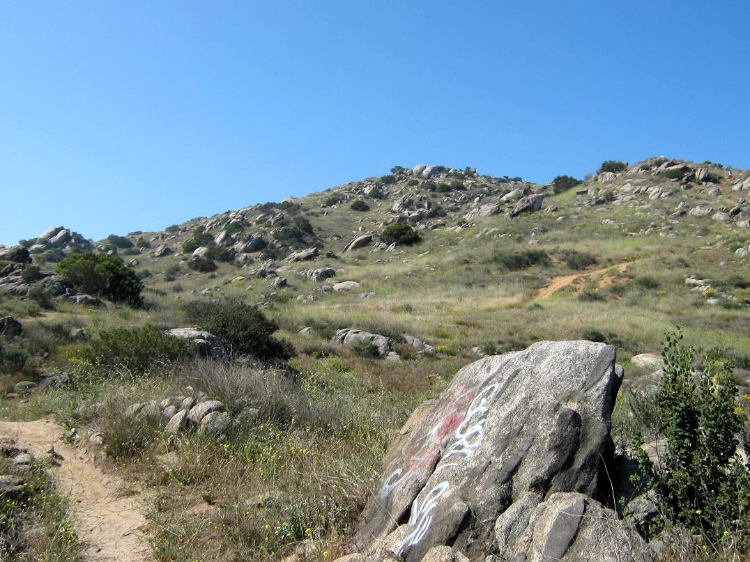
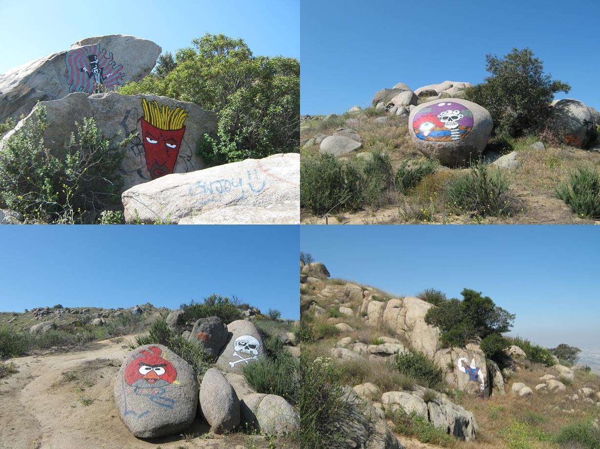
This section ends at a rock band, where the brush also closes in slightly. From here to the top the trail runs in and out of the rocks and amid open slopes, with grass and flowering plants. The rocks themselves are covered in graffiti of various quality. Some were murals, competently-rendered paintings of pop-culture themes such as Frylock from the Aqua Teen Hunger Force, a Grateful Dead-inspired skeleton, an angry bird, and so on.
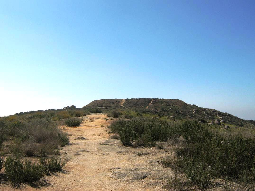
It was kind of warm already. A few people were hiking, most heading down, and a few joggers on the trail. Everyone was friendly. Certainly, if I lived close by, I'd be on it weekly for my exercise. I kept a good pace and just went from rock-pile to rock-pile until the trail gained the highest ground, leading to the flat summit. I was surprised to see such a flat top about a half-acre in size, and covered in thick knee-high woody scrub. Was there something up here ages ago? I have no idea.
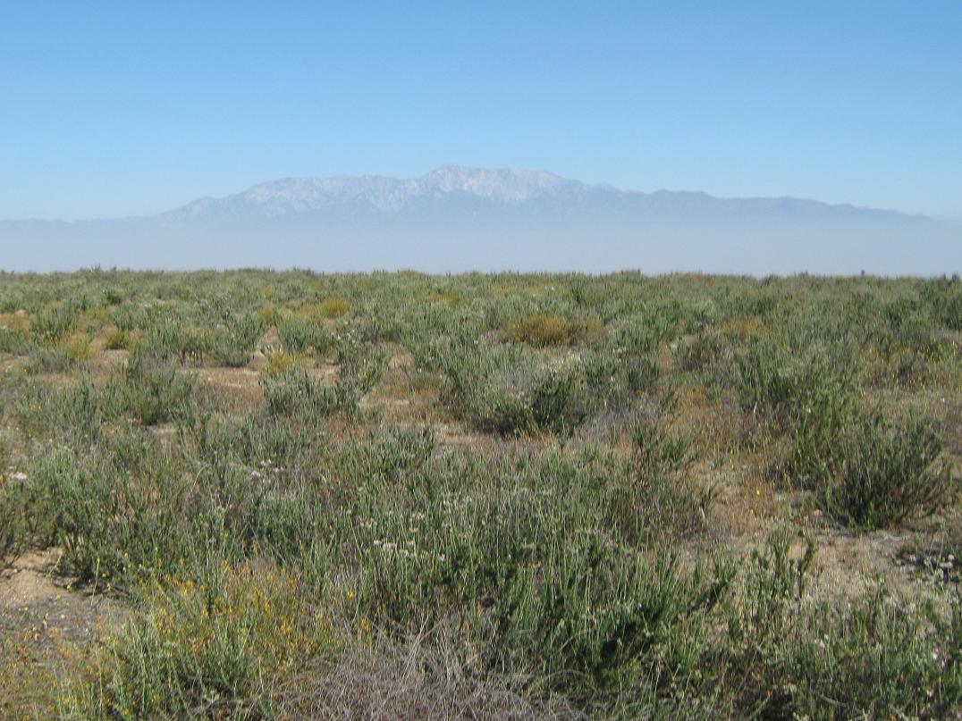
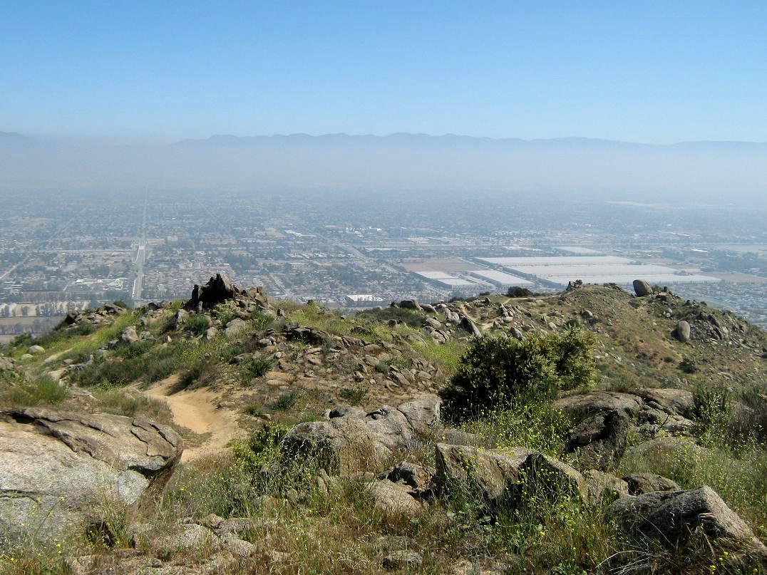
I spent about 10 minutes touring the top, walking a path that cuts directly across, then another that runs around the perimeter. The views down were hazy and unimpressive. Looking south into Riverside, I could see nothing except a light-brown haze. The views north into the Fontana-San Bernardino area was a little better, but still hazy. I had a nice view of big Mount San Antonio (Mount Baldy) across the way. As for the highest point: I tagged any rock that seemed like the highest point. My senses tell me the highpoint is toward the southwest rim, but on my short walks I tagged or kicked anything that looked good.
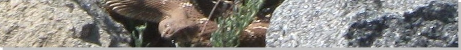
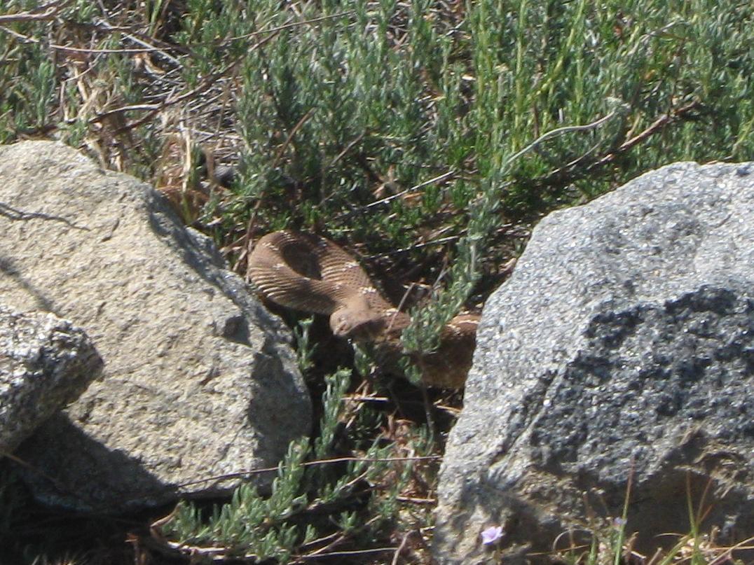
I was back to the point where I had come up, and was getting ready to give a three-rock cairn one last kick when I spooked a big rattlesnake, who hissed, shook his rattle and coiled at me, ready to bite my sorry ass. I jumped about 8 feet back, then took a zoom-image photo of him. In viewing the photo later, it came out well and he was bigger than I first thought. He was in no mood for games and probably would have bit me in no time. Man, that gave me a fright!
So now I'm thinking there are snakes everywhere, and I'm wearing shorts and low-top shoes. The trail was wide so that I could see well, but in a few spots I had to walk through low scrub or rocky sections, where snakes like to hang out. I used my staff to beat the rocks and brush ahead of me, and tried to move through these sections quickly but attentively.
About halfway down, I felt a sharp pain on my right shoulder and realized a stupid bee just stung me. I reached back and yanked my shirt to remove the stinger, then hoped I wasn't going to have an allergic reaction. I don't remember the last time I was stung, and sometimes people can suffer severe reactions even if they've been stung before without incident. I was down to my truck after a few minutes, a total time for the hike about 90 minutes. I seemed to be okay allergy-wise (especially my breathing). I changed and got things packed, then started the long drive home to Arizona.
From Sierra Road, I went south over the pass and down into the new city of Jurupa Valley, which incorporated in late 2011. It is the communities of Rubidoux, Pedley, Mira Loma and Jurupa all combined into one entity. The city limits sign on the freeway had the population at just under 100,000 people. I mention all this because (a) I'm a nerd and dig it when new cities incorporate and (b) the summit of Mount Jurupa lies barely within the city limits, which goes up to the Riverside-San Bernardino county line. Mount Jurupa is therefore the highpoint of the city of Jurupa Valley.
I gassed and got drinks, plus a couple Benadryls in case I needed to stave off any histamine attacks from the bee sting. It was noon when I finally got moving east, along US-60 through Riverside and Moreno Valley, catching Interstate-10 in Beaumont. The day was hot and my truck has no functioning air conditioning. It was very uncomfortable all the way to Blythe and the Arizona state line, then the heat seemed to moderate a small amount into Phoenix. Still, the temperatures were about 105 the whole way in. I was ripe when I got home about 5 that afternoon, but happy to be back home. The trip west had gone well and I nabbed three decent peaks along the journey.
|
|