|
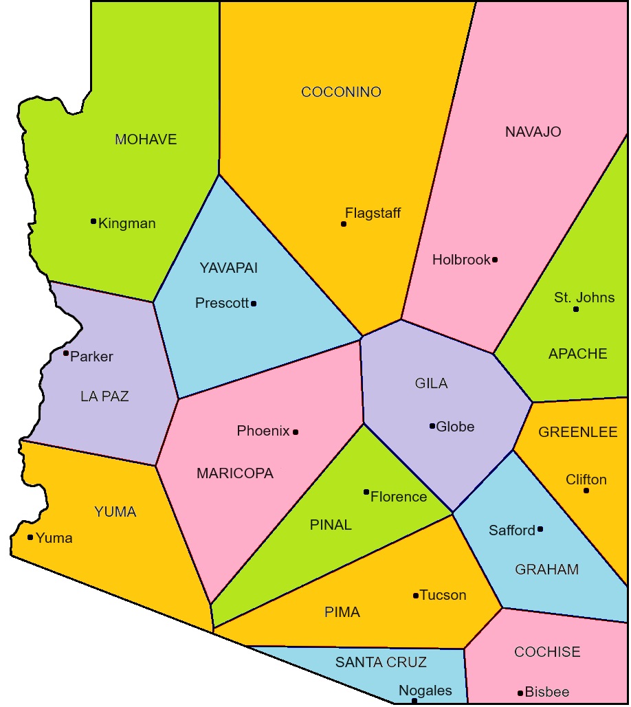
The Arizona counties are reconfigured below, as a Voronoi Map.
Each county consists of all the points closest to the corresponding county seat. For example, every point in Pima county is closest to Tucson. Points on a boundary are equidistant to the two county seats of the bounding counties. Points at a tricorner are equidistant to the three county seats of the three bounding counties.
One way to visuallize a Voronoi Map is to envision circles emanating outward from each county seat. When the circles meet, they then form a line, and when three meet, they form a corner, like soap bubbles do when they conjoin.
To create the map, I used this site: cfbrasz.github.io/Voronoi.html, then did the map tweaking myself.
|