Blue Ridge
|
• Highpoint: Jefferson County
|
Date: August 2, 2005 • Elevation: 1,713 feet • Prominence: 638 feet • Distance: 5 miles • Time: 4 hours • Gain: 600 feet • Conditions: Sunny and nice
Main
•
PB
The Blue Mountains straddle the easternmost West Virginia-Virginia boundary. The Appalachian Trail passes through the range, and the ridge itself is the actual state boundary, although in places the ridge is so broad and ill-defined that identifying the "exact" state line in places is difficult. The highest point in Jefferson County (WV) is a 1,713-foot hilltop, a short off-trail bush-whack through forest and brush.
From Millwood (VA), we followed routes US-340 and VA-7 to Round Hill, and a series of lesser roads to a day-use parking area and let-in point to the Appalachian Trail. In fact, for our whole journey, we would be inside Virginia, except when we actually tagged the highpoint, at which time we'd be "in" West Virginia.
We arrived at 8 a.m. at the Blackburn Visitors Center. We were the only people here. The weather was pleasantly cool, and we had a lot of shade with a soft breeze. After a few minutes of getting ready, we walked up the road to the Blackburn Center and found the spur trail to the Appalachian Trail behind the buildings. We hiked a half-mile, gaining 240 feet, to attain the Appalachian Trail, where we turned south. For the first mile, the trail was mostly level, covered over by a thick canopy of trees proving welcome shade.
Along the way, we came upon a group of about 10 young people, ages about 11 to 14, just standing around. One girl had sat on a hornet's nest and got stung a few times, her arms and neck covered in welts. They were waiting for their leaders to show up. We quizzed them to make sure everyone was alright. Even though my EMT status had lapsed a year ago, we decided to stay with them to ensure she wouldn't have any undue reactions (like anaphylaxis) from the bee stings. They had daubed her skin with Calamine, but carried no medication. The leaders apparently carried an epinephrine pen in their med-stash, but they were behind for some reason. In a few minutes the leaders showed up, the eldest about 19. They helped the young lady, and we left once we were satisfied the whole situation was under control.
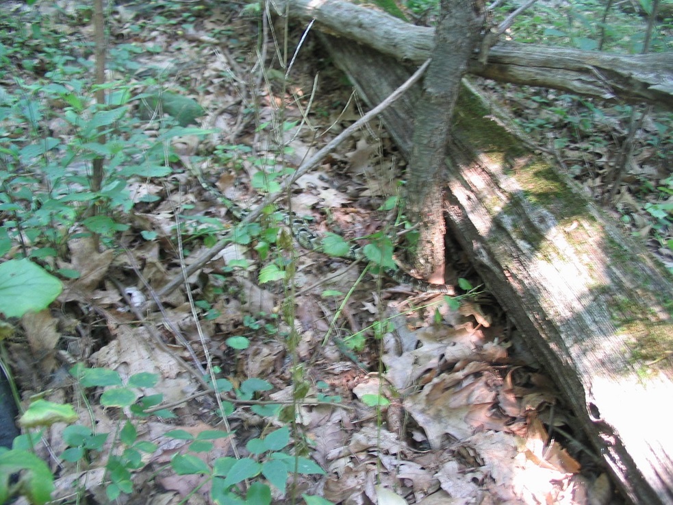
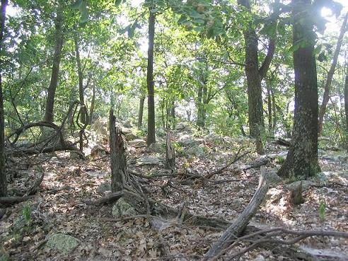
We continued south, the trail starting a long, gentle descent into Wilson Gap, a low point along the ridge. Afterwards, the trail started another gentle uphill to put us back at our original elevation. Now it was time to seek out the highpoint. With some trip reports in hand and my own maps and GPS, we identified the correct ridge that held the highpoint for Jefferson County. We'd have to leave the trail and hike a short way up a slope, then walk the ridge to seek the top. The off trail portion was mainly a bed of leaves and light underbrush, plus fallen logs and rocky outcrops.
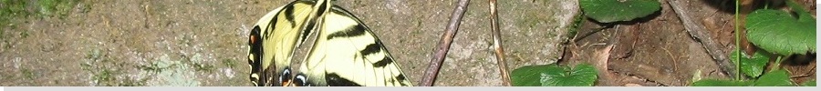
At one point I was helping βð walk across a log when she started to go "oooh ... oooh ... snake ... snake!" I started to get concerned because I couldn't see it. We backed up a bit and she pointed it to me: a slender, pointy-headed serpent with distinct diamond-back pattern. Eastern Diamondback, we thought. Looking in on some webpages it may have been a copperhead snake, and maybe a young one at that. See the photo at left and tell us what you think. We took no chances and backed up, and took another route to the top.
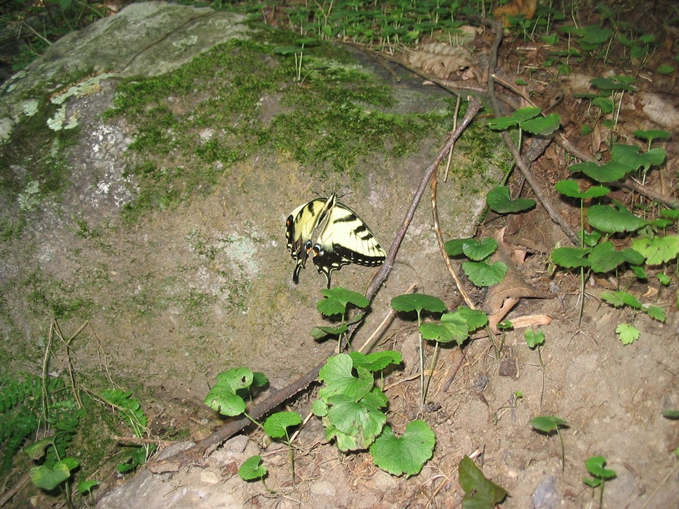
Once on the ridge, we sought the highest point. The ridge was broad, so seeking the highest point would take some detective work. we needed to tag about three piles of rocks that might tie for the honors. But spooked by the snake, we took our steps very slowly and deliberately. The undergrowth was very light, but those little bastards blend in so well you can be right on top of one and not know it. We tagged the rock piles then beelined back to the trail.
The highpoint done, we hiked leisurely back to the Blackburn Center and our car, a total of five miles covered in four hours. We did not see the kids in the other hiking group, and no one else for that matter.

Shanghai Benchmark
|
• Highpoint: Berkeley County
• Highpoint: Third Hill Mountain
|
Date: August 3, 2005 • Elevation: 2,172 feet • Prominence: 1,122 feet • Distance: 2 miles • Time: 1 hour • Gain: 380 feet • Conditions: humid
PB
Today, we planned to drive to the town of Berkeley Springs in West Virginia, site of one of the oldest developed hot springs resorts in the United States. Berkeley Springs is about a 60-mile drive northwest of Millwood, Virginia, but we chose (as usual) to take a scenic route, the plan to hike an easy highpoint along the way.
The objective was the top of Third Hill Mountain, marked by the "Shanghai" benchmark. From Millwood, we traveled north through Berryville toward Charles Town, West Virginia, then west through smaller communities (Glengary and Shanghai) until we got onto a local road called Hampshire Grade Road (County Road 7-13). It was a straightforward drive to the trailhead, which was easy to miss ... and I did, but I backed up to it without incident.
I promised not to be long, and went on my way, while she stayed back at the car. A jeep road and foot path meander about a mile to the top from the main road. The Jeep road is no longer jeep-worthy and is only open to foot traffic. The condition of the trail started out poorly, with deadfall and a heavy mat of forest crud on the ground. I took it slow, mainly to watch for snakes, but soon conditions improved, the trail grew wider and more exposed, and I made much better time. The trail goes directly to the top, gaining about 380 feet at a lenient grade.
The top "features" a derelict tower with a flapping American flag. Some rocks behind the tower seem to jut higher, but then so did parts of the trail, so I stepped on anything that looked high. Three other areas lie nearby, and the trail goes to them, so I quickly visited these, then started the hike out. The thick forest blocked any views of the countryside, and I didn't trust the tower enough to climb it. I was back to the car, gone less than an hour.
From here, we descended through interesting West Virginia backroads that eventually put us onto US-551 about 3 miles south of Berkeley Springs. We spent a few hours touring the little town and taking in some of the amenities. Apparently George Washington soothed his sore muscles here back in his time. Later in the day, we visited the nearby Morgan County highpoint on Cacapon Mountain.
Ridge Benchmark
|
• Highpoint: Morgan County
• Cacapon Mountain
|
Date: August 3, 2005 • Elevation: 2,320 feet • Prominence: none • Distance: a few dozen feet • Time: 10 minutes • Gain: 10 feet • Conditions: Cloudy and nice
PB
From Berkeley Springs, we drove south on US-551 and in twenty minutes, entered into the Cacapon Mountains State Park. The highpoint of Morgan County is nearby the road that starts here in the state park, leading to a lookout tower and platform. I got turned around on the maze of roads, eventually finding the main Visitor's Center, where they gave me directions to the desired road.
We followed the decent dirt road south as it gained elevation, sometimes steeply. After a few miles, the road bends north at some radio towers and goes another half-mile to a large parking area and the lookout deck. We spent a few minutes at the lookout, being the only ones there. On the drive out, we sought the highpoint of Morgan County. The highpoint is a benchmark set into a rock outcrop just 20 feet off the road.
This benchmark, called "Ridge", is at the southeast corner of Morgan County and is also a corner of the state of Virginia, where it tucks into West Virginia at its eastern panhandle. We had to keep an eye out, but soon we found the right rock outcrops and in short order found the benchmark. We gingerly stepped into the brush and leaf bed, keeping an eye out for the snakes, which we were sure were here by the hundreds. We walked to the benchmark, which is in a cairn of white rocks.
After the tagging, we walked the 20 feet to our car. We also chatted with some others driving up, trying to explain what we were doing. Views at the highpoint are of just the rocks and forest, but views back at the lookout and on the drive up are expansive, the whole valley in view.
|