
Peaks & Highpoints of Virginia
www.surgent.net |
| Hawksbill |
• Highpoint: Shenandoah National Park • Highpoint: Page & Madison Counties • Blue Ridge Mountains |
 Misty
|
Date: November 28, 2003
• Elevation: 4,051 feet
• Prominence: 2,148 feet
• Distance: 2.1 miles
• Time: 45 minutes
• Gain: 420 feet
• Conditions: Cold, misty and drizzly
Main
•
PB
Hawksbill (just the singular name) is the highest peak in Shenandoah National Park, and of both Page and Madison counties. We were driving the northern segment of the Park, a day after Thanksgiving. Today was cold and rainy, and we had already hiked a peak, Hogback Mountain a few miles to the north.
When we pulled into the parking lot for Hawksbill, we got a little lucky, as the rain let up, and all we had was the cold and mist. Not surprisingly, we were the only people here. It was about 2:30 p.m. when we started hiking. Fortunately, it's not a long hike and it's all along a trail.
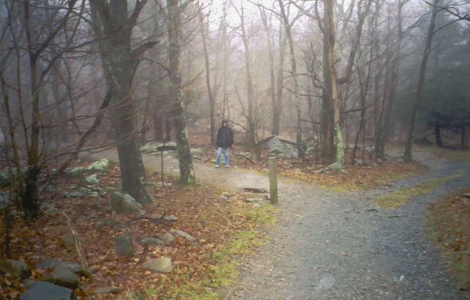
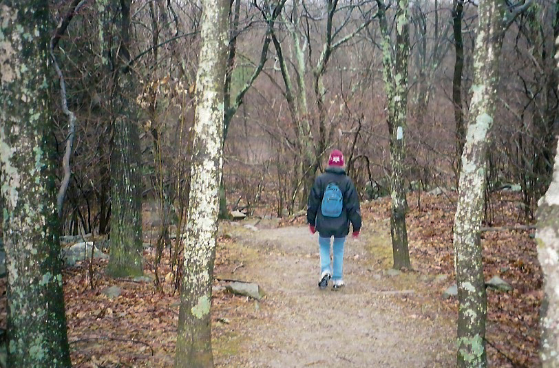
We bundled up and started walking into the forest. Normally this would be a profusion of green, with leaves, trees, undergrowth, brambles and so forth, but on this cold, blustery November day, everything had closed up for the winter. Combined with general fog and winds, we had a spooky, interesting little stroll.
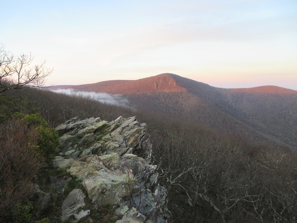
The trail gains 200 feet in 0.6 mile, then levels and drops slightly to where it meets a fire-access road. The remainder of the hike is up this road, where it ends at a shelter called the Byrds Nest #2. It took us about 20 minutes to get here. The summit is another 50 feet or so along the trail past the shelter and up to a viewing platform. Today, all we could see was gray. We snapped photos of the area and the shelter, and sought out the top "natural" rock before heading down. We were back to the car quickly, a round trip of 45 minutes.
From here, we started heading back north along the Skyline Drive. About 4 miles north of Hawksbill is an old resort called Skyland that was built about 100 years ago and pre-dates the National Park. While it no longer is a private resort, the Park maintains it, with a restaurant, gift shop and an attractive lobby with a large fireplace. In the surrounding areas are camping areas, stables, and Park offices. We stopped here to do a little souvenir shopping and to dry out. The rain had really picked up and was coming down hard.
On the drive out, we stopped for one more hike, to "The Pinnacle" in Rappahannock County. By this time, the rain was falling steadily and was cold and biting. That hike was short, and we hurried our backsides down off the mountain before things got too wet and nasty up high. Despite the wet and gloomy weather, we had a lot of fun, and we have returned to drive parts of the Blue Ridge Parkway in nicer weather.
|


|