
Peaks & Highpoints of Virginia
www.surgent.net |
| Elliott Knob |
• Highpoint: Great Northern Mountain • Highpoint: Augusta County • George Washington National Forest |
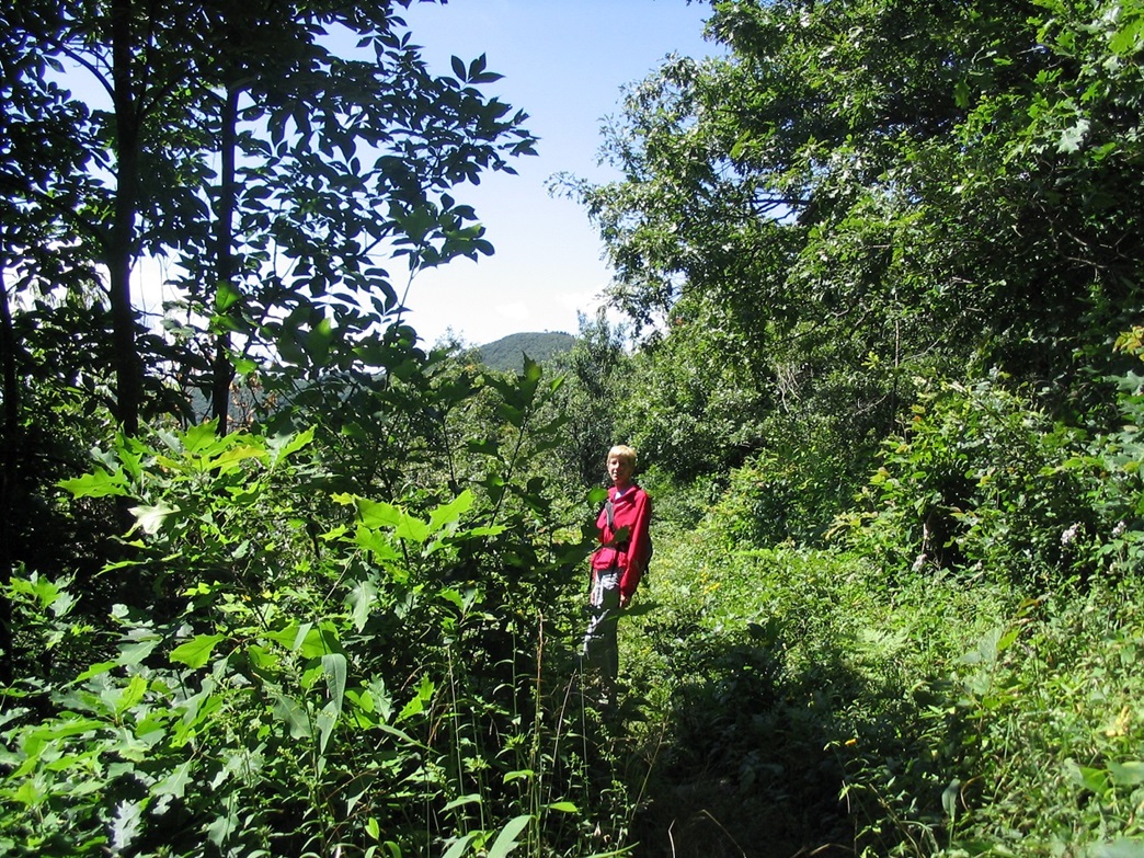 Elliott Knob's summit ahead
|
Date: August 7, 2004
• Elevation: 4,463 feet
• Prominence: 2,423 feet
• Distance: 14 miles
• Time: 8 hours
• Gain: 2,800 feet
• Conditions: Mild, warm but not that humid
• Wildlife: A huge timber rattlesnake
Main
•
PB
Elliott Knob, which tops Great Northern Mountain, was our big hike for our 2004 Virginia vacation. The peak has about four or five possible access points, ranging from a service road to a handful of trails. The shortest (yet still a long hike) would be the service road, which comes up from the southeast via state route VA-42 about three miles southwest of the town of Buffalo Gap. We chose to follow the Elliott Knob Trail, which starts from the north at Dry Branch Gap, elevation 2,581 feet.
We were staying in Staunton. From there, we went west on US-250 and south on VA-42 to Buffalo Gap. We then drove State Road 688, which leaves Buffalo Gap at a white church heading west. The plan was to drive four miles to where the road tops out at Dry Branch Gap. From here, the summit is 4 miles to the southwest, with 1,870 feet of gain.
As we turned off VA-42 onto road 688, a sign said the road was closed 2.5 miles ahead. We drove in anyway, and sure enough, 2.5 miles later, we came to barricades. An older gentleman out for a walk came by, and we asked him if he knew any details of the closure. He said there were big earth-movers up ahead completely blocking the road, but that the trailhead was still open another 1.5 miles farther, except that one had to drive all the way around to get to it. We thanked him, then left.
We drove back to the white church in Buffalo Gap and debated our options. We decided to make the 25-mile drive up and around to the other side. So, a half-hour later we make our way all the way around and roll up to the trailhead at Dry Branch Gap. Much to our surprise, there was the old man! He broke out laughing and was clearly surprised to see us again. We started hiking at 10 a.m..
The hike started well. We followed the trail up a short distance, then into a drainage, then up and up as it gained at a pleasant gradient. The forest was thick and green, and views were limited to the nearby trees. About a mile and a half in, we caught up to some other hikers, a couple out with their tiny Pekingese dog. We kept moving until we got high enough to where the tree cover lessened, allowing for nice views to the valleys to the west.
For the first two miles, the trail was wide and open, the brush keeping a respectful distance to the sides. But soon, the brush became thicker and encroached onto and over the trail, obscuring the trail in segments. I hoped it was just a temporary thing. I grabbed a stick and used it to beat the brush ahead of me to scare off any snakes. We could see the top up ahead.
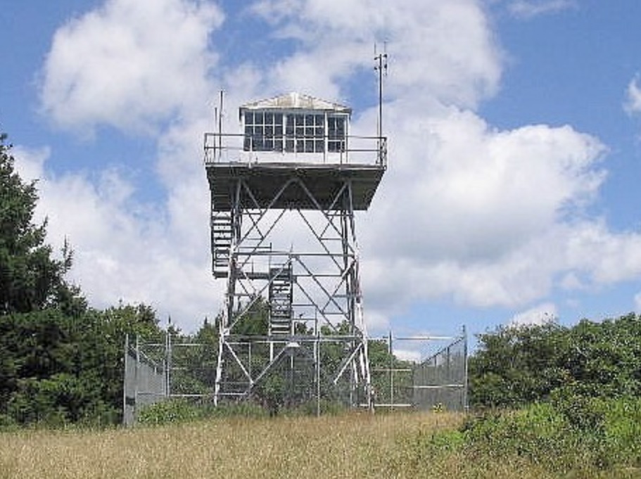
We were still over a mile away. In sections, the trail was just a faint path in knee-high grasses, with bushes and tree limbs in our way. We went slowly and carefully, stomping whenever possible and finally, we came back out to more open trail. We followed the trail until it intersected the service road, which we followed to a turnabout. From there, we followed a faint secondary road to the top, marked by a large steel lookout tower. It had taken us two hours to get here. There was a guy here, having come up from another direction. He was checking off wildflowers from a list. We chatted, and he kindly took our photo. He then sat and ate his lunch while we walked to the summit rocks, a small pile about four feet high marked by a pole and a waist-high cairn.
At the cairn, I pulled out a strongbox and noted it was full of random crap. Then I offered to take βð's photo, so I walked back a few paces. As I did so, one rock moved. Then a rattle. Not a sustained rattle but a short one, then another. βð saw the snake first and said "there's one big-ass rattler!". I ran a few feet away amid the jumbly rocks, turned, and watched the biggest freaking rattlesnake I have ever seen uncoil from his place of repose and slither away. This guy was easily 3 feet and as big around as my arm (keeping in mind I work out a lot). We watched him disappear, then attempted to do our own disappearing act as well.
I had cornered myself on the rocks, surrounded by thick brush. With adrenaline pumping and assuming there were probably a hundred more snakes ready to strike nearby, I made two big leaps and got myself off the rocks and onto open grass. We walked over to where the other guy was enjoying his lunch and told him about the snake. He actually seemed like he wanted to go and find him, but then thought better of it. The three of us sat around and had lunch. Soon, he was off and we remained to finish eating and let the adrenaline wear off.
After finishing lunch, we debated our options again. Going back the way we came seemed to be less attractive to us after seeing that big snake, but it was the most direct route back to the car. I was willing to go that way anyway, grab a branch and beat the brush as we walked through it. The only alternative was to hike the service road back down to the highway. After some discussion and ensuring we had enough water for the extra mileage, we chose to do this, knowing it would mean many extra miles of hiking: two and a half miles back to the highway, three to Buffalo Gap, and another four to our car.
The service road was steep and full of loose rock, but it went fast and we were down to the highway in exactly an hour, dropping 2,200 vertical feet. Now, we had to walk three miles to Buffalo Gap. This went quick, too, taking about an hour and fifteen minutes. The highway didn't have much of a shoulder, so we had to be careful when cars came whizzing by, and we hoped the drivers were paying attention as they passed us.
Once back in town, we walked to the white church at the corner of VA-42 and Road 688, and took a long rest on the lawn. We started moving again and in 90 minutes had walked the four miles, crossing through the barricades and the big work equipment, to our car. Just as we got to our car, we heard two loud gunshots coming from the trees nearby. It sounded like a shotgun, and it did not sound like it was coming our way. We surmised it was probably some local kids trying to combat boredom. Nevertheless, we immediately exited the area, stopping at a small country store in East Augusta for much-needed drinks. From here we drove back to Lexington, staying at the Natural Bridge resort a few miles south out of town.
The detour added about six miles to our hike, turning an 8-mile half-day hike into a 14-mile epic. We were both exhausted when we finished, but enjoyed ourselves. I think we could have done without all the extra drama and monster rattlesnakes. Aside from these factors, the mountain is beautiful and green and lush, and I enjoyed the hike very much.
|
|