
Peaks & Highpoints of Virginia
www.surgent.net |
| Apple Orchard Mountain |
• Highpoint: Northern Blue Ridge • Highpoint: Bedford & Botetourt Counties • Jefferson National Forest • Most Prominent Mountain in Virginia |
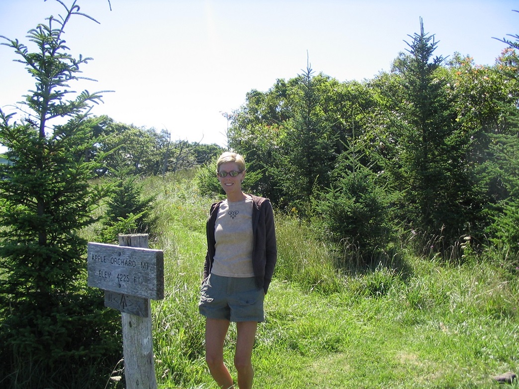 Near a sign |
Date: August 8, 2004
• Elevation: 4,225 feet
• Prominence: 2,825 feet
• Distance: 1 mile
• Time: 1 hour
• Gain: 300 feet
• Conditions: Beautiful
Main
•
PB
Apple Orchard Mountain has the highest prominence of all mountains in Virginia. However, prominence doesn't dictate effort, and in this case, this peak's summit is easily reached from the Blue Ridge Parkway, with access to or from the Appalachian Trail, or a service road that goes to the top.
We were staying in Natural Bridge and it was a 20-mile drive to get to the Blue Ridge Parkway access onramp, then another 15 miles south to the Apple Orchard Mountain area. The weather was behaving wonderfully and we had clear, dry conditions. The views from the Blue Ridge Parkway were magnificent.
We chose to hike the service road to the top instead of taking a segment of the Appalachian Trail. The Appalachian Trail can be reached about a mile north of the peak, requiring about 500 feet of gain. I'm sure it's a lovely hike, but we were both scratched up from yesterday's 14-mile epic on Elliott Knob. We found the road without a problem, and parked north of it in a pullout near an information sign. The hike went fast, gaining about 300 feet in a half-mile. The top is home to an FAA radar dome.
We walked past the complex, noted the gate was open and there was a truck there, and walked onto a grassy area. Someone, maybe the FAA guys, had mowed paths into the grass. One path led to the Appalachian Trail and a small sign marking the summit. Actually, the summit was hidden in trees and consisted of a pile of big rocks. Still skittish from yesterday's snake encounter, we gingerly stepped into the brush, which wasn't too thick. The highest rock had some sort of metal guy-wire anchor drilled into it. Shortly we walked back onto the grass, shot some photos and took in the lovely scenery.
As we hiked down the road, the worker came rumbling down in his truck and we had a short chat near the gate at the bottom. He said people walk up the road all the time and they have no trouble with that. The FAA site has all the usual signs about long prison sentences for tampering and that sort of thing. The worker was a pretty cool guy. We also met a motorcyclist at our pullout and had a chat with him too. We spent the rest of the day poking about Lexington.
|
|