The Mountains of Utah
• www.surgent.net
|
| Signal Peak |
• Highpoint: Washington County • Highpoint: Pine Valley Mountains • Dixie National Forest |
 As I drive in
|
Date: June 24, 2001
• Elevation: 10,365 feet
• Prominence: 4,485 feet
• Distance: 10 miles
• Time: 7 hours
• Gain: 3,805 feet
• Conditions: Clear
Utah
•
PB
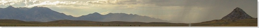
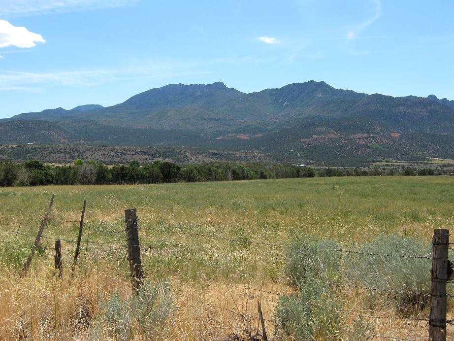
Signal Peak is the highest peak of the Pine Valley Mountain Range, which dominates the skyline north of St. George, Utah. The crest stays consistently high, while cliffs guard the base of the range. It is a very pretty range in a very pretty part of Utah. I planned to hike this peak a year ago but something more important came up: the birth of my niece. Thus, here I am now, a year later.
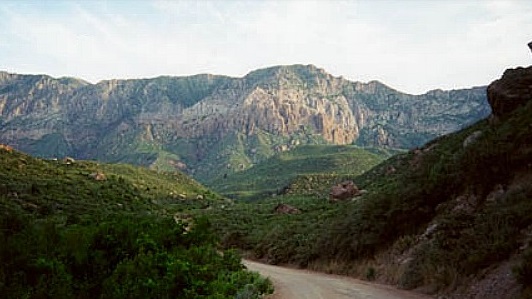
I left Phoenix on Friday the 22nd, spent a day in Henderson, Nevada, with my parents, then left early the 24th for the 170-mile drive to the trailhead in the Oak Grove Campground. I left Interstate-15 in the town of Leeds and took Silver Reef Road west fo about nine miles to the campground. The road is well maintained, but narrow in places with blind curves. I arrived at the campground at 6 a.m., the quiet ruined by the buzz of a generator at a nearby Boy Scout camp. I started hiking at 6:20 a.m., elevation approximately 6,560 feet.
From the trailhead, the trail gains moderately for 500 feet, making one turn, before coming to the Pine Valley Wilderness Sign at elevation 7,061 feet. The undergrowth is heavy, although the trail is well-defined. At the wilderness sign, I turned right and started a very long, steep grind to the top of the range following a ridge. This long ridge I was on seemed to break into four parts. The first, from the wilderness sign, gained with few switchbacks up the west side of the ridge. Early in the morning, this portion was shaded, which was nice. The second portion stayed on the west side of this ridge too, but had more switchbacks while the undergrowth lessened. This part topped out at a rock knob at 8,100 feet.
The third portion featured the steepest series of switchbacks, from the knob at 8,100 feet up to about 8,800 feet, where the fourth section started. I entered into forest and the trail now worked its way through large pines and blocks of talus. I followed more switchbacks, gaining the main range crest at elevation 9,800 feet. From the trailhead to this point was about 3.5 miles and 3,300 feet of gain in just under three hours. I stopped to rest and admire the views. The uniquely-shaped mountains that lead to Zion National Park were visible behind a foreground range. This would be my best views for the day, as the summit is wooded.
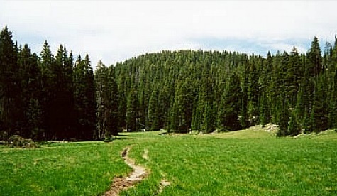
From here, I descended a hundred feet in a quarter mile to a trail junction. I was in heavy forest, and tiny snow patches (in June?) still survived in the shaded areas. At this trail junction, I turned west, gained a saddle and crossed Deer Flat Meadow. The trail is faint but still evident, but a few rock cairns helped, too. The trail then re-entered the forest, gained to another saddle, then dropped down to a spring called Further Water, about elevation 9,800 feet.
Here, I crossed the stream, gained the trail again, and crossed another long meadow, slowly gaining about 200 feet. Signal Peak was finally in view, directly ahead of me. I re-entered the forest, then left the trail and headed up a drainage through the forest. There is no trail to the summit, but the route is common sense, and the forest cover is not so thick as to hide everything. I finally emerged onto the summit and walked along the series of knobs to the western-most block, topped by a cairn. I arrived here at 10:30 a.m., and I stuck around for about a half-hour, eating lunch. There are limited views through the trees at the top. Nevertheless, I was quite happy to be here, and enjoyed my time up top.
The hike down was straightforward. I retraced my route, coming back to the main range crest at about noon, where again I stopped and admired the views. The hike down the switchbacks was tedious, and I stopped often wherever shade was available. The heat was noticeable. The final portion, basically the lowest part that was under heavy undergrowth, was the slowest as I had to step carefully so as to avoid unseen rocks, roots and other things that could (and did) trip me. I must have kicked about 3 dozen rocks. My toes weren't too pleased.
I arrived at my truck at 1:45 p.m. The gain for the hike was about 3,800 feet, but with the drops and gains up high, the gross might be slightly more than 4,000 feet. Either way, this was a good leg-stretcher. I got into my truck, turned on the refrigerated air, and started the drive back to Henderson. That evening was spent with my folks and family friends, all of whom lived near one another when my dad was stationed at White Sands Missile Range, New Mexico, in 1969-1970.
|
|