The Mountains of Utah
• www.surgent.net
|
| Mount Peale |
• Highpoint: La Sal Mountains • Highpoint: San Juan County • Manti-LaSal National Forest |
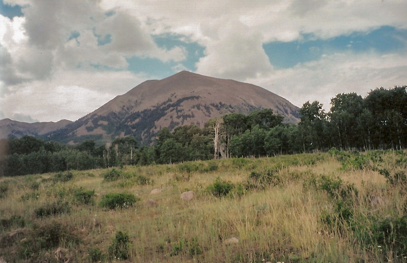
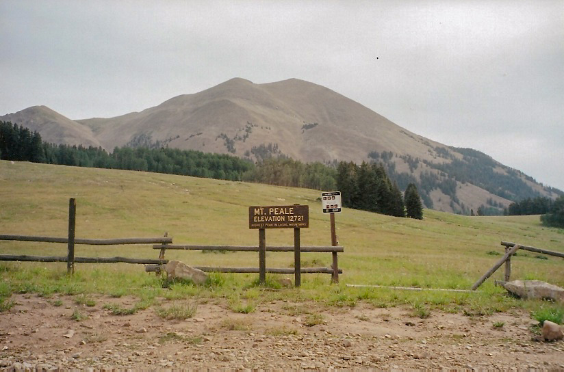 Mount Peale from the La Sal Pass parking area
|
Date: July 31, 2003
• Elevation: 12,721 feet
• Prominence: 6,161 feet
• Distance: 5.5 miles
• Time: 5.75 hours
• Gain: 2,800 feet
• Conditions: Unsettled, then storms late in the day
Utah
•
PB
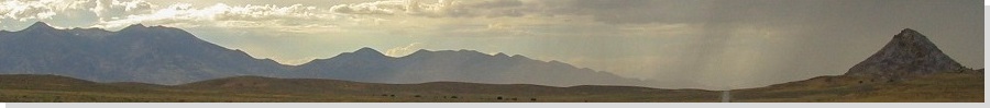
Mount Peale is the highest point of the La Sal Mountains in southeastern Utah, towering over the canyons, arches and deserts near Moab. The range gets its name for its snowy peaks, which are high enough to retain its snow into summer. Early explorers assumed the snow to be salt, hence the name "La Sal". Why they assumed it would be salt is a good question.
βð and I planned a journey to Moab and its surrounding attractions as a getaway. Originally, we planned to hike Mount Peale at the end of the trip, but a brief dry spell suggested we take advantage of the opportunity now, so we hiked it first thing after arriving in Moab.
We coordinated our schedules from work so that we had five days open. We split the journey into segments, driving to Flagstaff for a night, then the 350-mile leg to Moab with a side trip to the famous Monument Valley on the Navajo Nation. We arrived in Moab in the mid-afternoon and spent the day playing tourist, visiting shops and walking the main street. What a beautiful place.
The following morning, we got an early start and drove forty miles via US-191, UT-46 and FR-073 to get ourselves to La Sal Pass, south of Mount Peale. The sky was clear with a high clouds and haze, but humid. We hiked up the grassy slopes from the parking area. We followed faint paths and old eroded ruts and soon, entered the forest, hiking north. We came out into the open again, then re-entered the trees, where I found a path that we followed briefly into the open again. We surmounted a small hilltop, spot elevation 10,428 feet. We took a rest and assessed our route.
The usual route up Mount Peale is to hike up a talus gully on the peak's west slopes, about a mile from our position. From atop our perch on Hill 10,428, we could see a road that heads north into the trees toward the gully. We hiked down to it, then follow this road north. We stayed on the road as it entered back into the trees, then followed lesser tracks through the thinning trees, where we came upon the base of the gully, leaving the last of the forest behind us.
Hiking in the gully now, we followed a path through wildflowers, soft dirt and rocks. Soon, we were hiking on bigger blocks of talus. While it was steep, and some slabs were loose, it was safe, the gradient no steeper than 20% and often not that steep at all. But it was tedious. Most of the talus ranged from football sized rocks to the size of a small vehicle. After a half-hour in which we gained 700 feet, we took another break.
Ominously, I noted that the clouds were starting to get puffier. However, Mount Peale was still clear, with clear skies to the south and a strong southerly wind. I felt we were safe for now, but that our window of opportunity was closing. We had about a mile to go and just a few hundred feet to gain. I figured another hour. I found a use-trail that leaves the gully and starts directly up the rocky and grassy slopes. This use-trail appeared to cut off distance and put us on the ridge not far from the summit, so we followed it.
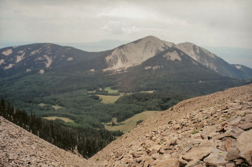
The use-trail degenerated quickly into a loose path in the scree, so we abandoned it and hiked up the slopes to the main ridge. The footing was not the greatest. Nevertheless we reached the main ridge, where we were met by a hiker who was traversing from nearby Tukuhnikivatz to Mount Peale. We could also see the clouds building, although Mount Peale and our approach ridge was still clear. I told Beth we had to hustle. We followed a path on the ridge past two outcrops and finally, the summit.
Our stay was short. That other hiker was there, sunning himself. As soon as we dropped into the windbreak, we heard thunder. We snapped a couple photos and then started down, no time to waste. We didn't spend more than 90 seconds at the top.
I was spooked by the thunder and amassing clouds, and wanted off the ridge as soon as possible. Beth and I, along with the other hiker, walked "with purpose" down the ridge to where we had met it coming up. Our plan, weather permitting, was to stay on the ridge and meet the gully a little farther west where the slopes weren't so loose and steep, but the worsening weather prompted us to take the short-cut path we had taken coming up. I didn't like it and Beth thoroughly hated it, but it descended fast and that's what was important now. Soon (or not soon enough), we were back into the talus gully. The thunder was still distant, but that means little. A strike could happen anywhere, at any moment. The more we descended, the smaller our chances of being hit, although we were always at risk.
We retraced our route until we came to the road. We followed it out to the main road, which put us about three-quarters of a mile east of where we parked. We walked back to the truck, arriving at 3 p.m., a total of five hours and forty-five minutes for the hike, no doubt a lesser figure "helped" by the motivating thunder. Despite the conditions, we had a great time and were happy to have had a successful, exciting hike. From here, we drove back to Moab, showered and spent the rest of the day resting.
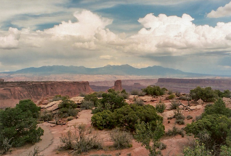
We spent the remainder of our two days exploring Arches National Park, a visit out to Deadhorse State Park (which is often used by film crews as a "stand in" for the Grand Canyon), and a day in Canyonlands National Park, in which the road (UT-211) washed out after a flash flood while we were in the park. We made a wise decision to hike Mount Peale when we did, as the storms were bad the remainder of our time, with the La Sals being socked in by storm clouds essentially 24 hours a day.
|

|