The Mountains of Utah
• www.surgent.net
|
| Navajo Mountain |
• Highpoint: Navajo Indian Reservation • Colorado Plateau • San Juan County |
 Navajo Mountain
|
Date: July 6, 2009
• Elevation: 10,346 feet
• Prominence: 4,226 feet
• Distance: 9 miles
• Time: 7.5 hours
• Gain: 3,300 feet
• Conditions: Clear, warm in the sun
Utah
•
PB
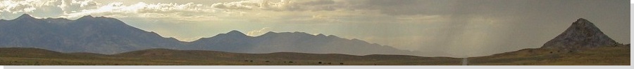
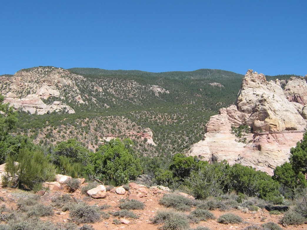
Navajo Mountain lords above the badlands and canyons where Arizona and Utah come together, east of the Colorado River. The summit lies inside Utah, but the mountain mass straddles both states. The peak is a laccolith, meaning it was a blob of ancient magma that rose, cooled, and was left behind after the softer layers eroded away. There are few foothills, and the peak rises about 4,500 feet above the countryside.
Most of the time, Navajo Mountain is nothing more than a shadow on the distant horizon. It's in a remote corner of what is already a remote part of the country. It lies on the Navajo Indian Reservation and is normally off-limits to outsiders. The Navajo consider this mountain sacred, its name being Naatsis'aan, "Head of the Earth" (source), part of a larger complex called Tadidi'iin Dzil, or "Pollen Mountain". Older maps from the 19th century call the range "Sierra Panoche", and there is still trace evidence of the earliest Anasazi peoples to be found within the mountain's surrounding canyons.
The mountain is surrounded by highly convoluted canyons, so much so that it was one of the last regions in the United States to be fully explored and mapped. The canyons offered an excellent "hide out" for many people: Indians escaping the forced evacuations to distant reservations, Mormons evading the government, and bad guys evading the law. There's a real timelessness to this area. It's only been within the past 20 years that the roads toward the mountain have been improved. Still, no one gets here by accident. On a more practical matter, Navajo Mountain catches a lot of winter snow and summer thunderstorm rains, spawning a number of springs that water this arid landscape.
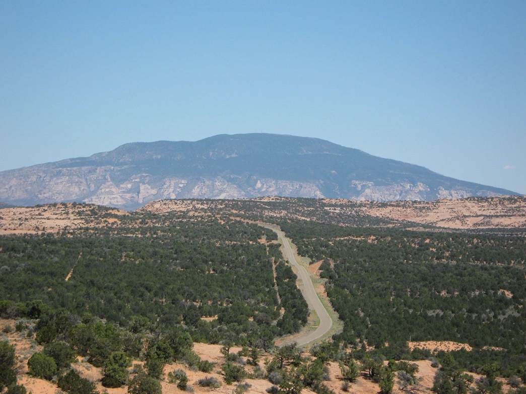
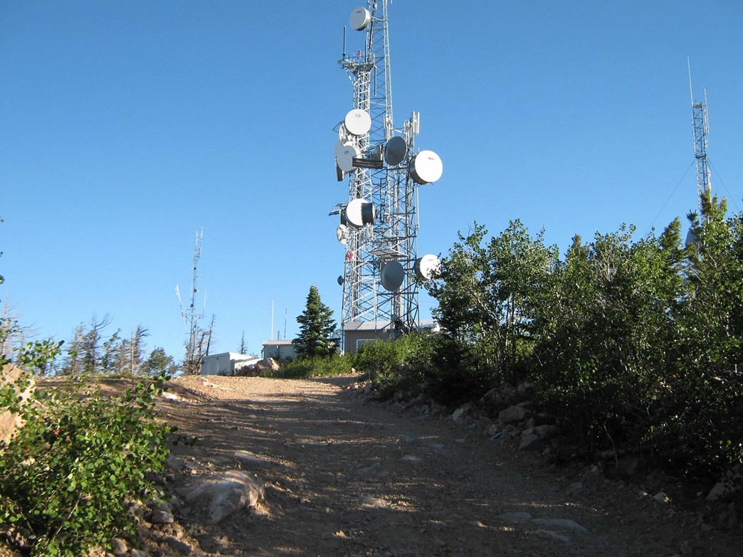
Until I actually made an effort to climb Navajo Mountain, I had never been closer than 40 miles to the peak. I was aware of its remoteness, supposedly bad roads, and the usual rule against outsiders accessing lands on the Navajo Nation not specifically designated for recreation. These facts conspired to dampen any motivation to drive all that way for a hike. However, I recently learned that the main route to the peak, Indian Route 16, is now paved to the state line. Also, there is a dirt service road to the summit, which is covered in communications towers, which (to me) partially negates the sacred aspect of the peak. Learning all this, I felt it might be worth the trouble to make the long drive to Navajo Mountain and hike the peak. I made two concessions: I would not leave the road the entire journey, and once I found the summit rocks, would not actually tag the highest of them. I figured this was a reasonable compromise.
I chose to visit Navajo Mountain over the 4th of July weekend. βð and I celebrated our wedding anniversary (also the 4th of July) at home, while I would take off on the 5th for the long drive, then hike it on the 6th. βð was content to stay home, looking after our new brood of kittens, now about 3 months old. My plan was to make this a 24-hour journey: drive there, camp that night, hike the peak and come home. I had not done much hiking at all in the last month and was looking forward to a big road hike, a chance to get my legs and lungs back into shape all at once.
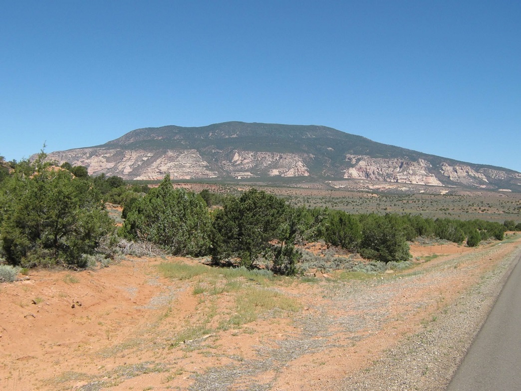
I left home on the 5th around 1 p.m., making the 5-hour, 320-mile journey with no trouble other than one part where my truck lugged funny on an uphill grade on Interstate-17. Other than that, it ran fine with no issues. I later discovered that the air intake hose had come partially detached from the main block. I solved this with lots of black electrical tape. I bought groceries in Flagstaff, topped the gas in Tuba City, then followed US-160 for 40 miles to AZ-98, then 12 miles along AZ-98 to the IR-16 turnoff. From here, it is another 36 miles to the Utah state line. The land up here is cut by large cliffs and deep canyons, most notably the canyon housing the Inscription House, one of the larger and better-preserved cliff dwellings in the state (although closed to the public likely forever). Navajo Mountain starts to become visible while still on US-160, getting steadily larger the closer I got to it.
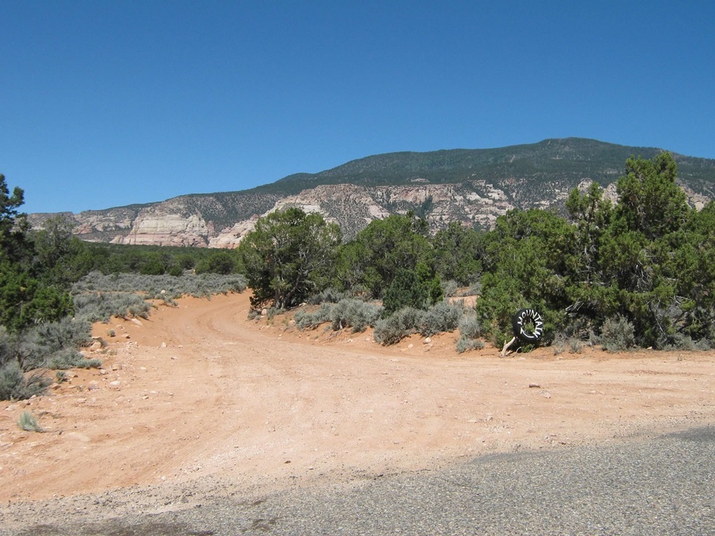
There are no signs here mentioning the state boundaries, the only hint being a hand-painted sign mentioning I was now in the town of Navajo Mountain, Utah, and a sudden decrease in the quality of the pavement. What I though was the turn off for the service road toward the peak was gated and seemingly closed, and I feared I had just driven 320 miles for nothing. But I went north another mile and found the proper road. I drove this road about 2.5 miles, paralleling some power lines. It was sandy at first, then rocky, but never too bad. I used 4-wheel drive for the sandy stretches. The road turns north onto a sloping ramp that leads through a break in the cliffs. I drove to about 7,000 feet elevation and parked in a nifty pull-out. The ground here was flat and there was a fire ring. I decided to camp here for the night.
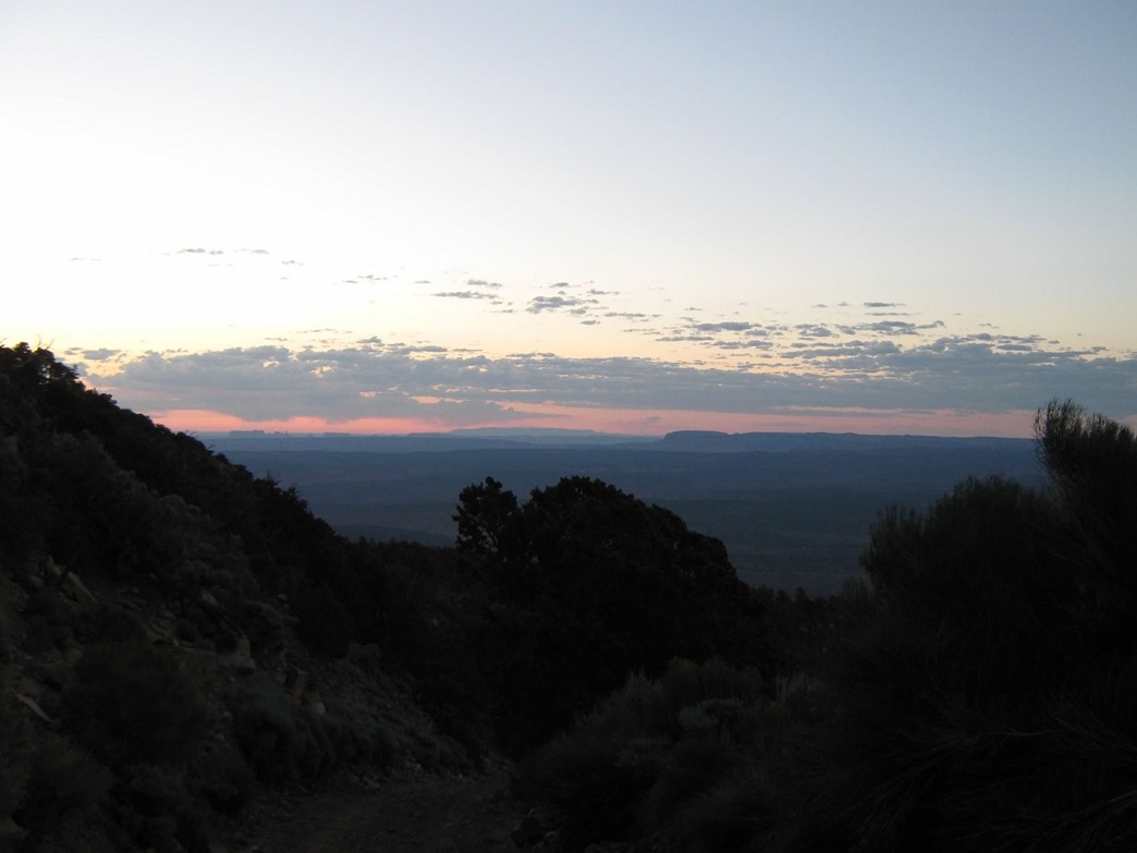
I arrived at my camp space around 7 p.m., the weather warm and breezy. The monsoon was quiet today so there was no chance of storms, and the moon would be mostly full tonight (the actual full moon came a night later). As the sun set, the light from the moon was bright enough so that I could see all around my area without a flashlight. It was utterly gorgeous, and dare I say, spiritual. I was about a thousand feet above the plains. A few homestead lights were visible, and on occasion I could see the lights of a vehicle driving IR-16. I enjoyed the quietness, solitude and moon-lit darkness, setting up my camp chair on a small knoll to take in the view. There was also a practical aspect of the full moon as well: knowing I was in for a big hike, and that it gets hot even up at these elevations, and that it had been particularly hot everywhere the past few days, I planned a night-time start to my hike to mitigate the need to be hiking during the mid-day. I slept in the bed of my truck.
I had pre-packed everything the night before so all I needed to do when I awoke was eat something, make sure everything was locked up, and start moving. The moon was now slightly past its zenith but high enough to light everything up very nicely. I started hiking at 2:15 a.m., walking up the road, and immediately needing to stop and catch my breath. I got into a rhythm and made steady progress up this road. By now the moon was starting to dip behind some ridges and I hiked in the moon-shadows, but there was enough ambient light so that I could make out the terrain, and I used the flashlight sparingly. In time, the road comes to a set of switchbacks, and after about seven or eight of these, tops out onto a bench on Navajo Mountain's south face. To here I had covered over a mile and about 1,100 feet of gain. The moon was behind the ridges and I had some light to follow, but I used my flashlight more often during this segment. I took a long break here to rest and drink.
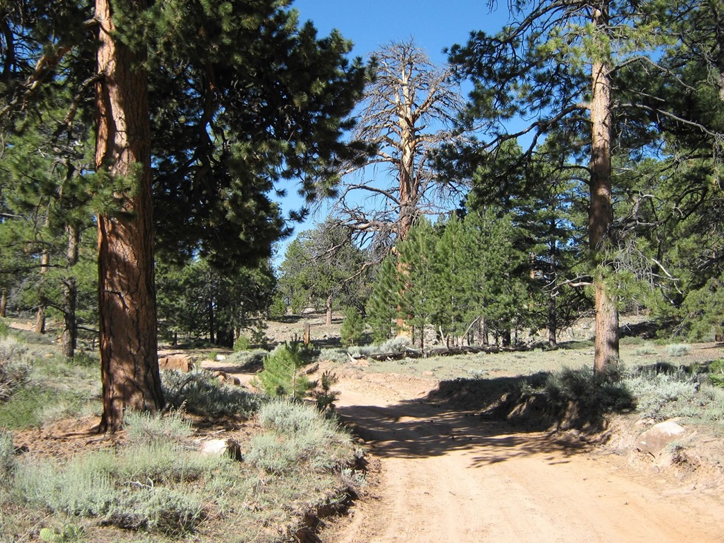
The next segment of road went west for a mile, across the forested bench, gaining about 600 feet before losing 200 feet to bottom out in a small depression. I hiked this mainly in the dark, spooking some deer along the way. I couldn't see much, so I just concentrated on walking. With much more moderate slopes, I made good time on this stretch. I came to the low-point (elevation 8,510 feet) and rested again, actually getting a text message from my wife, cheering me on! It was about 4:15 a.m. now. I felt good, but I certainly wasn't setting any speed records.
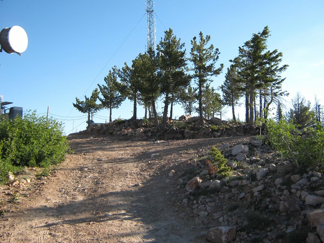
The final segment gains the final 1,800 feet in about 1.5 miles to the summit. The initial 500 feet follows a steep series of exposed switchbacks. The sun was starting to rise while I was on these switchbacks, providing me a beautiful dawn to hike by. At about 9,200 feet, the grade starts to moderate and stays this way the rest of the way to the top. Even at close to 10,000 feet at 6 a.m., the temperatures were very gentle, mid 50s at the coolest. The final half-mile seemed to take forever as the road bends through the tree cover. You think you're "there" but there's always one more bend, one more slight uphill to go. But in time I came upon the top, and its many sacred towers, arriving about 6:45 a.m.
I found the summit rocks, hiked up to these and once I determined which were the highest, I made good on my promise to not touch them, although I stood beside them, my head higher by a couple feet. I also hiked north another few hundred feet to inspect a couple more hills along this broad summit region to be sure I had found "the summit". After inspecting these other points, I felt pretty strongly the rocks nearby the buildings and towers are the highest point. The forest cover limits views from the actual summit area. I didn't stay long, maybe 10 minutes. The hike was a success, so far, but I had a lot of hiking to get down and I wanted to get moving quickly.
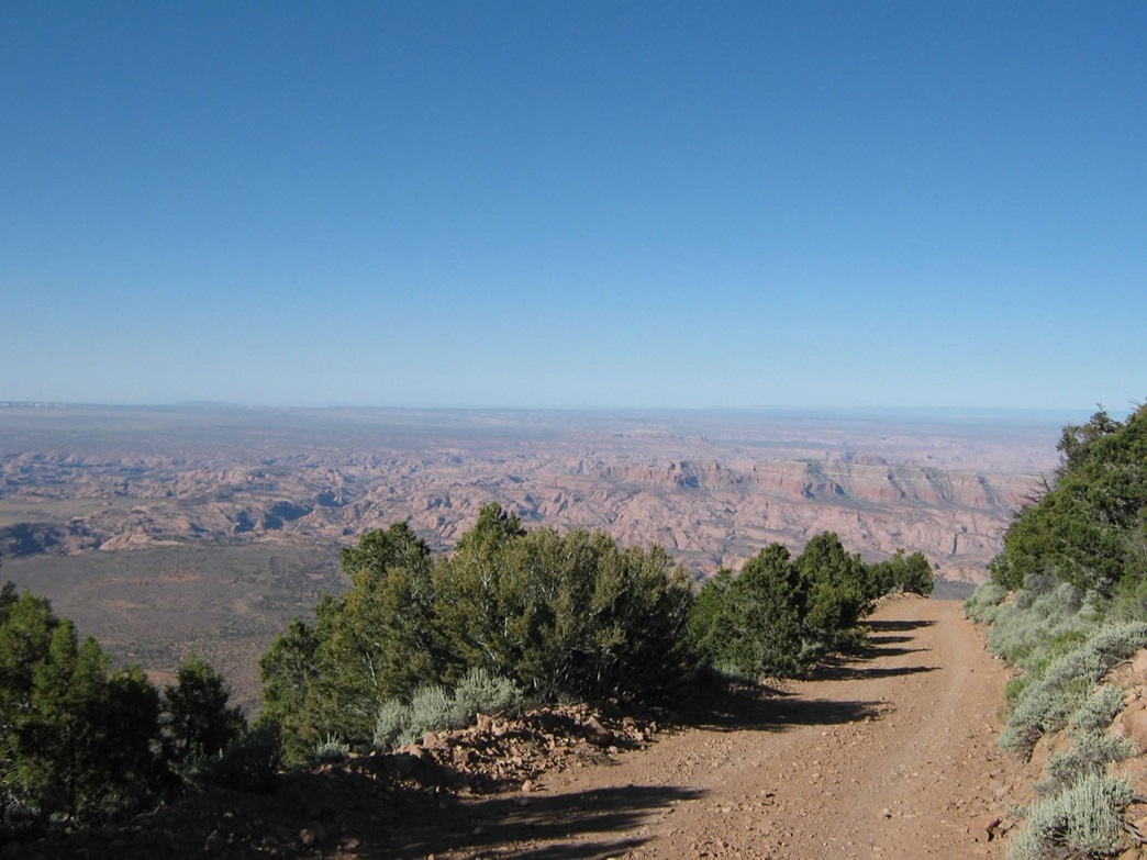
The real treat of this hike was the views on the descent. By now, I had daylight, and especially where the road was exposed, I had hundred-mile views of the deserts, cliffs and canyons down below. I was now hiking out the sections I had come up in the dark, and now I could appreciate the scenery. The slopes near the War God Spring were especially nice, with a nice mix of trees and open meadow. Finally I was back at the top of the switchbacks, the last segment before my truck. Coming down this stretch, I turned my left ankle, giving myself a sprain of my Achilles tendon and probably the muscle that comes across the top of the foot as well. I didn't fall, but it was close. What this meant was the final mile down to my truck took 45 minutes longer than it should have, as I had to take each step very slow. I hobbled back to my truck, got changed, and taped up my ankle, then started the drive out. The descent hike took 3 hours exactly, meaning a 7.5-hour day, and yes, it was getting pretty warm down toward the bottom. The night-time start was a good call.
Of concern was my foot, and if I could use it to press the clutch while driving. I didn't have much of a choice. As long as I kept my foot firmly planted on the floorboards the pain mitigated and my muscles didn't want to contract. I made the drive out and got some first aid and wraps in Tuba City, which helped. After a lunch in Flagstaff, I was home by 5 p.m., back to my lovely wife, wonderful cats and kittens, and the 110-degree heat. I enjoyed my hike up Navajo Mountain, although I think it exacted its revenge on me coming down.
My regret was I did not hike farther northwest from the summit to check out Rainbow Bridge and the views into Lake Powell. My whole time here, I was aware I was here without a permit and did not want to be gone longer than I had to be. Officially, access to this peak is not allowed. In 2011, some friends of mine were able to get permits to hike Navajo Mountain. Maybe the person issuing the permits didn't know any better. The summitpost page has more updated information and links. It would appear to still be closed "officially".
Truthfully, I have no idea. I'd err on the side of caution and assumed it's closed, but it can't hurt to ask. For other areas on the Navajo Nation not normally designated for public recreation, we have been able to get permits (for example, North Rim of the Black Mesa and the Carrizo Range). We just tell them where we're going and they seem cool with that. There are a few clearly-stated areas that are always closed, so we don't go there. The rest of the Navajo Nation that isn't clearly closed nor clearly open for recreation seems to be in a gray area: you can ask and see what happens.
|

|