The Mountains of Utah
• www.surgent.net
|
| Kings Peak |
• Highpoint: State of Utah
& Duchesne County • Highpoint: Uintah Mountains & High Uinta Wilderness • Most Prominent Mountain in Utah |
 Kings Peak dead center
|
Date: August 9-11, 1998
• Elevation: 13,528 feet
• Prominence: 6,348 feet
• Distance: 25 miles
• Time: 9 hours (summit day only)
• Gain: 4,400 feet
• Conditions: Mixed, with periods of sun and then heavy storms, lightning and hail
Utah
•
PB
Prologue
Utah has its share of beautiful, rugged and remote peaks, and Kings Peak ranks among the best that the state has to offer. It is the state's highest peak, which that alone prompts hundreds of people a year to attempt it. Rising in the Uintah Mountains near the Wyoming border, it is a rocky summit, above treeline, in a region remote from roads. The only people who get back in this far do so after a long hiking approach, likely including an overnight somewhere along the way.
I was pecking away at the state highpoints and had learned all I could about Kings Peak, this being in the dark ages when the internet was still a toy but not much of a resource. I had to do it the old fashioned way: books, and more books. All indicated that the main challenge is just the long approach hike, the climb itself not being technical. The weather is also highly erratic. Climbers need to haul in a large pack if doing it as an overnighter, and to be ready for sudden lightning and hailstorms.
Trailhead and approach hike
I finished my summer teaching duties and had about a two week window of freedom before the Fall classes started up. I had planned this hike all summer --- this was going to be my big one of 1998. I was doing this solo, by design. I wanted the experience of hauling everything by myself and being entirely self sufficient. I had never done anything like this before in my life, and I was eager to find out how I would do.
I covered the 950 miles to the trailhead in two days, spending one night in Henderson, Nevada, with my parents, then a long 600-mile push up and through Utah into Wyoming, then back south into Utah to the Henry's Fork Trailhead at dusk. I slept in my biv-sack beside my car in the parking lot that night, a light rain falling at one point.
The next morning, I got everything packed, the car locked, and threw it all on my back and started in. My pack weighed about 50 pounds: sleeping bag, tent, food, cold-weather clothing, and so on.
The hike is along an excellent trail that barely slopes upward. My destination was Dollar Lake, about eight miles in and a thousand feet higher in elevation. The day started clear and mellow. They always do, then around 2 p.m. the storms build and all hell breaks loose. I wanted to be at Dollar Lake by noon, safely tucked into my bag in my tent.
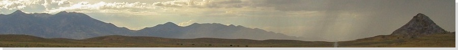
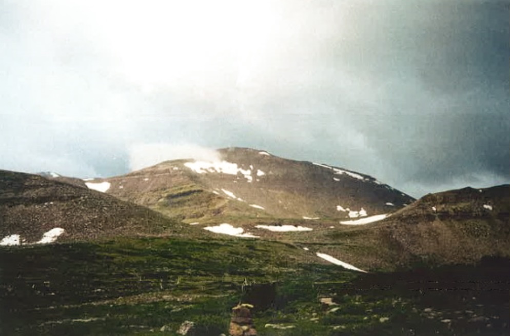
A few open meadows allowed me to see Kings Peak for the first time, a beautiful pyramid of a peak, rising behind a foreground ridge of peaks, still about ten miles distant. About halfway in, I had to cross a creek along a "bridge" made of three logs lashed together. The creek was running heavy with steep embankments. If I fell in, I'd be in real trouble. Needless to say, I walked across those logs very carefully.
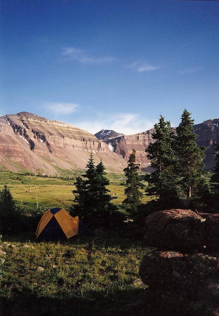
As I neared Dollar Lake, I was surprised to see about a dozen people coming out, what appeared to be one big family. One woman was holding a tiny baby. I wasn't sure what to make of that. Otherwise, I had seen no one. I arrived at Dollar Lake around noon as planned. I got the tent erected, stashed my food in a container well apart from my tent (this being bear country), and walked around the area. It was just me. Dollar Lake was lush with grasses and some trees but nothing too tall. I wandered around with no plan other than enjoy the scenery and solitude. As expected, an afternoon thunderstorm confined me to my tent for a few hours, and mosquitoes kept me in most of the evening.
The Climb
I awoke at 3 a.m. and popped my head out of the tent. A mostly-full moon lit up the area, but all the high peaks were socked in with clouds. I slept in and tried again at 5 a.m.. This time, all was clear. It was still dark but dawn would not be long. After breakfast, I got busy walking on the trail at 6 a.m..
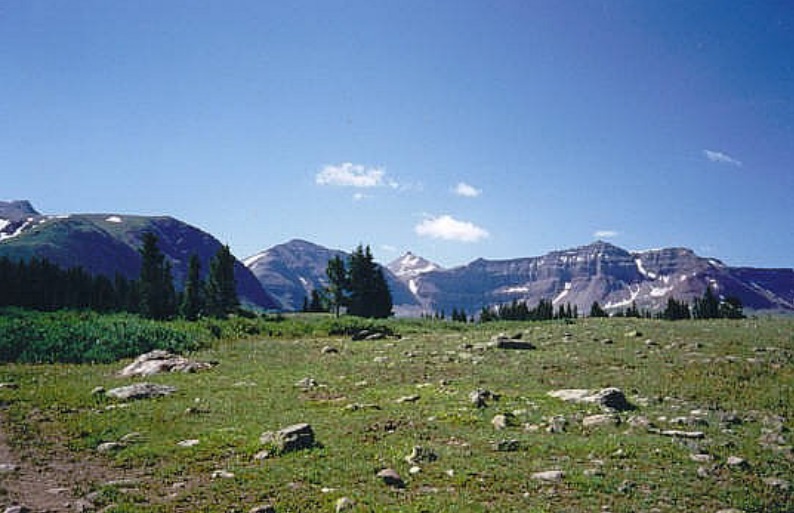
The first segment is a 700-foot gain toward Gunsight Pass in about a mile. On the other side, I lost all the elevation descending into Painter Basin. I was now on the backside of the foreground peaks and now could see Kings Peak in its fullest form: a gigantic pile of talus rising to a point, all this still a few miles distant.
The trail grew weak here, but a sign pointed toward Anderson Pass, which is north of Kings Peak. The usual route is to hike to this pass, then bust up the long rocky ridge to the summit. I had good conditions for now: sunny with a few clouds, calm and pleasant. I moved quickly.
Toward the pass, the path loses distinction in the grassy marshes below Anderson Pass. I essentially hopped from rock to rock to avoid getting wet. Rather than go all the way to the pass, I started on a beeline toward the peak itself, anxious to get on these rocks and starting upward.
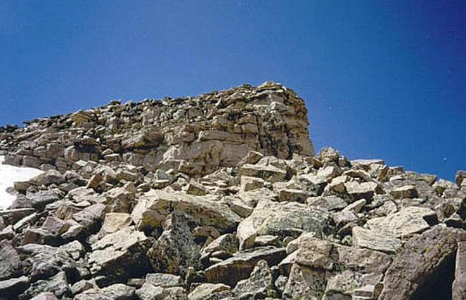
I had a couple thousand feet of elevation to gain, all of it on these rocky blocks which ranged in size from a small suitcase to bigger than a house, all heaped in every possible way. There was always a stair-steppy light-scramble option to get around any barriers. I was moving as fast as I could, but in this kind of terrain, it is impossible to be speedy.
Lightning!
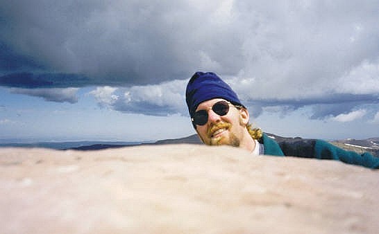
I kept at this tedious task for over an hour until I sensed I was running out of rocks to climb, the summit prow now visible ahead. After almost 5 hours from my tent, I summitted Kings Peak at 11 a.m., the top being a mundane rock pile, but the views all around, stupendous. I was elated to have made the summit! I did not tarry, though. I knew the storms would be building. Above me it was sunny, but clouds were collecting on the surrounding mountains.
I did not spend much time at all on top of Kings, just enough to get a couple quick images. I knew I needed to be starting down, the sooner the better. I started hopping from rock to rock. The sun started to dim as clouds built and hugged the summit. A light rain started to fall. Me, I just kept moving, trying to get down as soon as possible.
I felt a sizzle and a snap, then a loud crack and a stupendous thunder. It felt like someone had slapped the top of my head with a whip! It hurt but was not debilitating. I immediately curled into a ball, footsoles on the rock, my head between my knees and my hands above my neck.
I knew exactly what just happened but I did not have time to process the emotional aspect. I gave myself a once-over. No burns, no damage. I had been hit by lightning but clearly not a direct hit. Was I scared? Hell yes. But weirdly, I wasn't panicky. I just knew I had to haul my butt off this rock pile. Then maybe later I could be scared. But all my energy was now devoted to getting off the peak as soon as humanly possible.
The next half hour or so I was in "the zone". I was on autopilot. I just hopped from rock to rock, block to block. The route opened up as I went along and I never stopped to debate a move. I was mindful of the slick rocks and not to slip. I had descended far enough down to be out of the cloud itself and now below it to where I could see things again. The rain fell steadily and then turned into hail.
Hail and the hike out
Curiously, other than the one big strike that zapped me, there wasn't much more lightning afterwards, which was fine with me. But I knew I wasn't out of danger by any stretch. All I could do now is play the probabilities. The lower I got, and the less exposed I was on the high ridge, the lesser likelihood of getting hit by lightning. But it was still a possibility.
I was able to get down into Painter Basin, by which time the hail had collected to about 6 inches deep. I felt a little safer, but kept moving nonetheless. The hail covered the trails, but I could see Gunsight Pass higher up, and simply trudged through the hail to get to it. My parka was wonderful. It kept me dry. The hail was about pea-sized so it did not hurt when it hit me, but I was getting barraged by the pellets.
I was moving efficiently now. All things considered, the conditions had not deteriorated much beyond what it was now: cold hail and low clouds in and around Kings Peak. Temperature was about 40°. It occured to me I was the only person probably in a ten-mile radius, and I liked that. I knew as I closed in on Gunsight Pass I was going to be just fine and have a heck of a story to tell.
Once at Gunsight Pass, the storm simply ended. The boundary was that sudden. I went from cold, gray clouds and hail to sunny and calm conditions literally in fifty feet. The walk back to Dollar Lake went well and I was back into my tent at 3 p.m., a nine-hour hike. I was exhausted, so I crawled inside and took a nap. At dusk, I emerged and sat atop a rockpile, looking out at the ridges and mountains around me. I was still by myself, no evidence anyone had been here today. The mosquitoes were not a problem and I sat in quiet reverence to the mountains. What a day. I had nearly been killed, and yet, I was completely in the moment and about as happy as I could be, truly at peace.
Epilogue: the hike out
I had a peaceful night's sleep, tired from the day's activities. I was up before dawn the next morning and got everything packed and on my back at 5 a.m.. The 8-mile outbound trek took just 4 hours and I was back to my car at 9 a.m., the end of a 25-mile, 48-hour, 4,500-foot elevation gain, 1-lightning strike trek. I was pleased and grateful to be successful and to be back out.
I piled into my car and exited back out of the mountains and into Wyoming, catching Interstate-80 and backtracking into Utah, then the long drive back to Henderson. Later in the week, my brother would be getting married. My cousings from back east were visiting, and we spent the time exploring Las Vegas (they'd never been) plus heading to California for the wedding.
I came within a hair of being killed atop the peak and, frankly, it was just dumb luck and random chance I survived. I was well aware of the storm patterns and had taken steps to mitigate my exposure such as dawn starts, and even atop the summit, had sunny conditions. One of the photos though, shows the developing storm in the background, something I did not really notice until I had the film developed (for anyone born after 2000, don't ask. That's just what we did in the 1900s).
Ever since then, I have a very healthy respect for storms clouds and thunderheads. I do get anxious when I see puffy clouds develop above me on a climb. I never chance it, and start back down at the first hint of stormy weather. I've hiked with people who don't seem to share my hesitancy when the puffy cloulds start to build. I know they know better, but until you actually get hit, the true enormity of what it feels like just can't be explained in words.
|
|