The Mountains of Utah
• www.surgent.net
|
| Abajo Peak |
• San Juan County • Highpoint: Abajo Mountains • Manti-LaSal National Forest |
|
Date: July 10, 2010
• Elevation: 11,360 feet
• Prominence: 4,550 feet
• Distance: 1 mile run
• Time: 20 minutes (run), 2.5 hours total
• Gain: 190 feet
• Conditions: Thunderstormy
• Teammates: Scott Casterlin, Scott Peavy & Chris Gilsdorf
Utah
•
PB
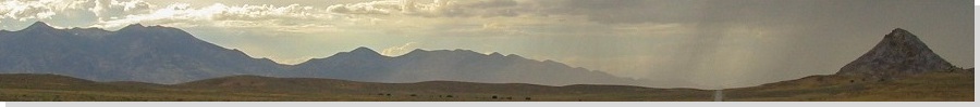
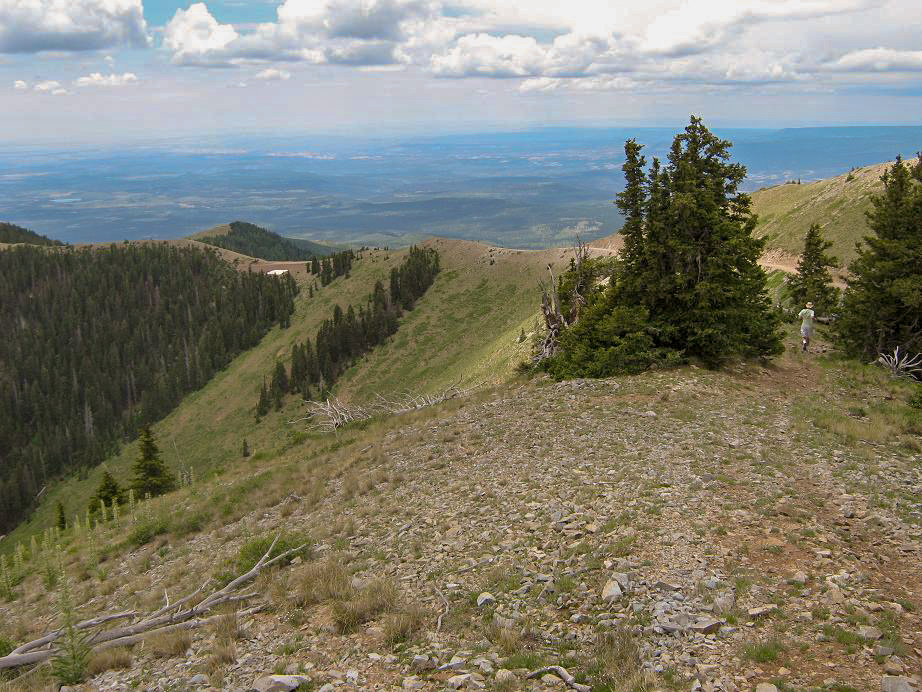
Abajo Peak is a huge mountain in southeastern Utah, looming above the deserts and canyons of this amazing part of the world. The summit is almost 11,400 feet, and the mountain has over 4,500 feet of prominence. The Abajo Range is near the city of Monticello, but is visible from as far south as the Navajo Nation in northern Arizona.
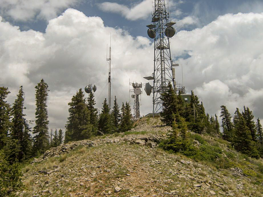
Its great size and prominence (and gentle slopes) means that Abajo Peak was sacrificed to modern technology: a good road goes to the summit, on which sit communication towers. While there are hiking options, they'll all feed you onto the road for at least the final portion. I was one of a group of four (Scott Casterlin, Scott Peavy and Chris Gilsdorf) visiting the peaks near the Four Corners for this weekend. Originally, Abajo Peak was not on our agenda, but I suspected we might have the time if our other plans went well, so I brought along a basic description of the peak and after about 30 seconds of arm-twisting, got the other three guys interested in it too. The road to the top at least gave us flexibility on our time as we were not necessarily locked into a half-day hike.
We has just come off of Pastora Peak in Arizona earlier this morning. We were back onto pavement by 8:30 a.m. and Abajo Peak was about 100 miles away, so we went for it. We took highway US-191 into Utah through the cities of Bluff and Blanding, where we stopped to get a map of the Abajos and talk with the visitor center lady, who'd driven her ATV up there just a couple weeks ago. Then from Blanding we rolled into Monticello, and went west toward the Abajo Range, all the while studying the cloud build-up, hoping it would stall enough to allow us safe passage up and back.
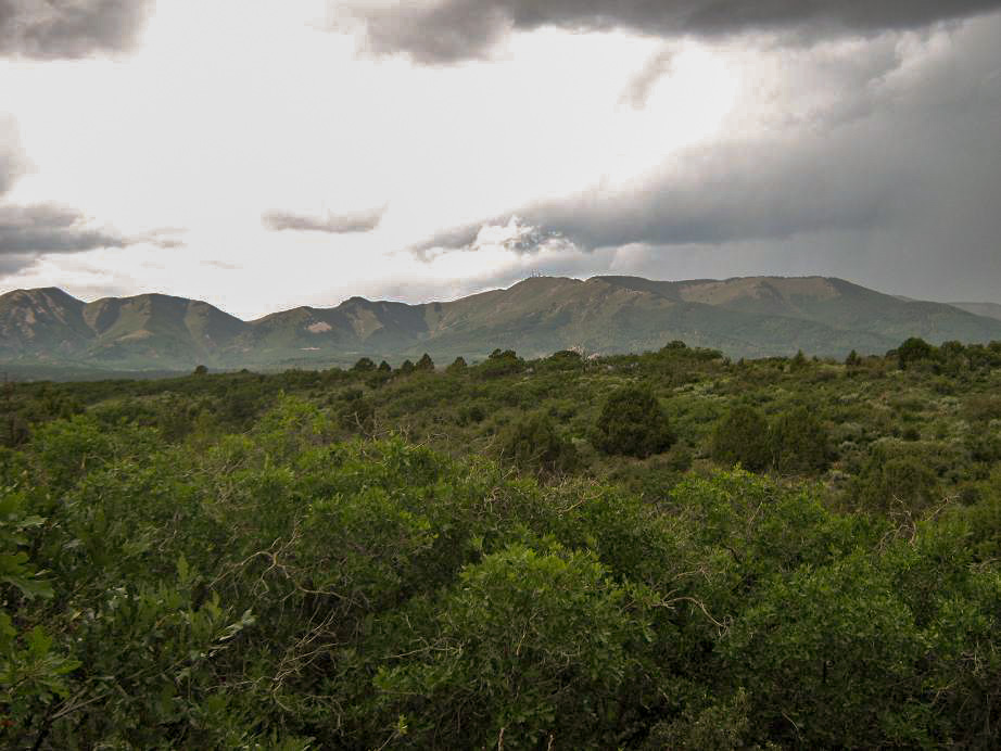
From Monticello, we went west on Avenue 200 South, hanging a left onto Forest Road 87, signed for Loyd Lake. The road is paved as it passes Loyd Lake, then becomes fine dirt and gravel as it meanders toward the range. We passed through forests of pine and aspen, getting high enough so that the road was hugging the steep slopes, which were mostly open, with low scrub and grass.
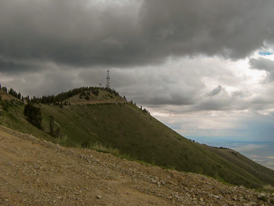
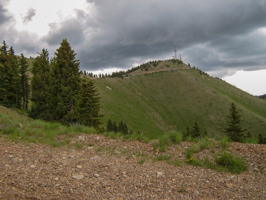
After rounding a bend, we could see the upper summit ridge, and after another couple miles, the summit itself. We parked south of the peak, in a clearing at the last saddle below the top. From here the hike would be short, a half-mile one way with 150 feet of gain. But the clouds were building fast and there were lightning bolts off in the distance, so we didn't delay one bit.
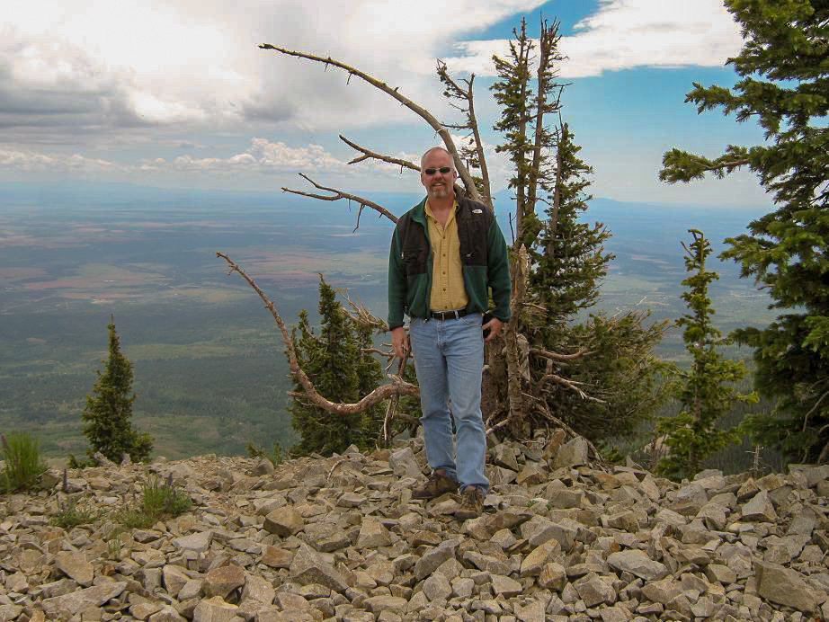
The hike was easy, as we followed tracks up the south slope to the top, running as best we could to beat the storms. Going from 6,000 feet to 11,200 feet, then trying to run, made me feel light-headed enough I thought I may faint. After catching my breath, I "jog-hiked" to the top. Chris was already there, the other Scotts immediately behind me. We took a few photos, looked at the towers and at all the dark clouds. I didn't want to stay any longer than necessary. After a minute or two, we all ran down the slope back to the vehicle. We had considered parking earlier for a couple miles hike, but the weather cancelled those plans. We were happy to be able to hike it as we did, considering the circumstances.
The drive back into Monticello went well, but we got a flat as we neared Loyd Lake. We were able to get the car into a tire shop where they patched it, while we ate tacos at a nearby fast-food stop. The rain was steady while we were in town, but our total delay was a mere 40 minutes. We exited Monticello by heading east on US-491 (old US-666) into Colorado, then into New Mexico and then Arizona for a late-day visit to Roof Butte, in the Chuska Mountains of northeastern Arizona.
So, we didn't so much climb Abajo as drive it, and then run the last portion, but we were all happy to get this peak in. It's remote enough so that none of us get up here often, so we took advantage of the opportunity. The storm clouds gave us excitement, for sure. Perhaps one day I'll do the short hike from the north, but there's no urgency. What views we had were stunning.
The remainder of our trip went well. At Roof Butte, Peavy and Gilsdorf hiked to the top while Casterlin and I rested back at the car, both of us already having hiked this peak in the past. We had enough daylight after Roof Butte to drive up the sketchy dirt roads from Sanostee (NM) to the base of Beautiful Mountain in New Mexico, where the tale continues.
|

|