The County Highpoints of Texas
www.surgent.net |
| No Man's Land |
• Highpoint: Hartley County • Raton Mesas |
 I'm a long way from home |
Date: September 22, 2002
• Elevation: 4,465 feet
• Prominence: 20 feet
• Distance: 1.5 miles
• Time: 45 minutes
• Gain: 50 feet
• Conditions: Warm
• Teammate: Roy Wallen & Bob Packard
Texas
•
PB
I visited these two Texas County highpoints as an addendum to a fun three-day weekend at the National Highpointer's Convention in Oklahoma. I was joined by Roy Wallen and Bob Packard.
Both Hartley County and Randall County are flat desert and rangeland counties in northwest Texas. Their respective highpoints don't require much uphill hiking, but getting to them involves a little patience. I was interested because I had failed on both counties on earlier attempts.
Hartley County came first. Roy, Bob and I convoyed together about a hundred miles to a highway junction at FM-296 and TX-102, about a stone's throw inside Texas from the New Mexico border. We had parked off the roads and were looking over our maps when a local rolled up in his truck.
The local asked if we needed help, and we told him what we wanted to do. He told us the road we wanted went past his home, which was a couple miles south of where we three (now four) stood. The man was nice and knowledgable. He gave us a little bit of interesting history of the immediate area.
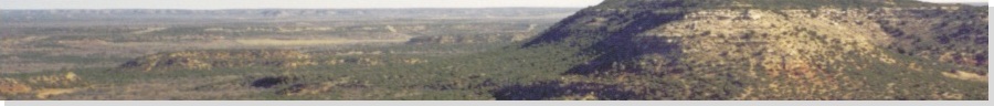
If you look at a map of New Mexico and Texas, you'll note that the border jogs a little west from where New Mexico and Oklahoma border one another. This narrow strip of land technically belonged to no state for a brief time because both Texas and New Mexico claimed it (it had to do with erroneous mapping and surveying). The land was awarded to Texas. The man called the whole area "No Man's Land" because that's what it was for awhile, and now, is a descriptive name for the surrounding region. It really is a lonely, vacant land.
We thanks this gentleman and soon started on our way. We piled into Roy's vehicle. Roy handled the sandy roads well, and we got within a mile of the highpoint. The surrounding land was flat with low sandy dunes covered in shin-high scrub. The man called it all "blowsand". The three of us walked south. Bob and I angled about 30 feet west, following a road within New Mexico, while Roy kept to a fence line, on the state line itself.
Our walk was not without excitement. Roy nearly jumped out of his skin when he came upon a coiled rattlesnake. We could hear the rattle from the road. Wisely, Roy joined us on the road. In time, we angled east back into Texas near a stock pond. The highpoint was a small but noticeable "blowsand" hill nearby, and we walked to it with no issues ... and no snakes.
Satisfied, we exited the way we came, and drove back out to where Bob and I had parked our cars. From here, Roy went on his way while Bob and I drove south to Randall County.
Elevation: 3,890 feet
• Prominence: negligible
• Distance: 1.5 miles
• Time: 30 minutes
• Gain: 10 feet
• Conditions: Warm
• Teammate: Bob Packard
PB
Bob and I stopped in Dalhart for a lunch, then drove 90 miles south along US-385 through the towns of Channing and Vega, and into Hereford. The drive was pretty, as we passed through the rolling hills and breaks of the Canadian River. More toward Hereford, the land became flatter and featureless.
We arrived in Hereford about 3 p.m. and followed FM-1259 southeast, then local roads to a point south of the Randall County highpoint. The land is flat, so we had to judge its location using fence lines, windmills, the topographical map, and old-fashioned compass and dead-reckoning. Fortunately, a fence line lies along the west county line, and the windmills shown on the map agreed with what we saw, so gauging the highpoint region was not that difficult.
We hopped a fence and started walking north. We were apparently on the Happy-Hereford Ranch. In 2000, I was here but did not visit the highpoint due to cattle milling in the area. Today, there were no cattle. We walked a half-mile to a windmill, spot elevation 3,888 feet, said the map.
The terrain was flat hard-pack dirt. We dodged piles of cow poop, occasional bones, little cacti, and vermin holes. There was no scrub. Anything more than an inch high gets eaten or trampled. From this first windmill, we proceeded at a north-northwest bearing for a quarter mile to get within the lone 3,890-foot contour that pokes into Randall county from neighboring Deaf Smith county. Bob took bearings from our first windmill, now to the south-southeast, and another windmill at elevation 3,879 feet to the north-northeast, and verified we were within the desired contour. Bob celebrated with a short wind sprint. We didn't linger and walked back out to our vehicles.
Back at the road we parted ways: Bob east a little more to Swisher County's highpoint, and me back to Amarillo to clean up and fly home, a culmination to a great weekend of highpointing, driving and meeting tons of new people. I put 1,031 miles on my rental Ford Ranger truck. it had had 3 miles on it when I picked it up.
|

|