The County Highpoints of Texas
www.surgent.net |
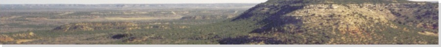
| Moro Mountain |
• Highpoint: Runnels County |
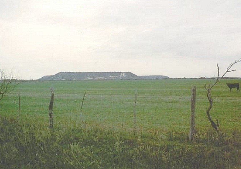 Moro Mountain from a distance
|
Date: March 17, 2003
• Elevation: 2,310 feet
• Prominence: 370 feet
• Distance: 3 miles
• Time: 90 minutes
• Gain: 410 feet
• Conditions: Cool
Texas
•
PB
I spent the night in Ballinger, within easy driving distance of Moro Mountain, a lone mesa in north Runnels County that is the county highpoint. It was first on the day's agenda and I was moving at dawn. I started by trying roads from the north.
First, driving US-83 past Winters and into the community of Bradshaw, I followed county roads two miles to a locked gate, three miles north of the mesa. That stopped me. I returned to US-83, went back to Winters, then east on FM-1770 about 5.5 miles to county road 171, across from the junction with FM-2647. I went north two miles to CR-172, right briefly, then left onto CR-173, heading north. The road turned east again then came to another gate after three miles. There were no posted notices on the gate. I parked my truck, got suited up, put a note in my truck's window, and started walking. I was at spot elevation 2,029 feet, about one mile southwest of the top.
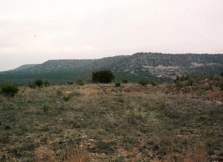
I walked north along the road for a half mile, then east into a large draw, losing about 60 feet. Soon, the road came to another gate. I hopped this gate and entered into the trees. At first, it was sporadic trees with lots of low grasses and cactus, and cow paths helped me wind through the brush. Shortly, I entered into thicker "forest" and the grasses gave away to bare soils and rock. And it got steep, too. The actual climb up the mesa is short and quick.
I picked my way up the steepening hillside, periodically battling low brush, until I reached the caprock at the mesa's rim. Finding a place to gain the rim was challenging, as the caprock was 6 to 8 feet high all around. I found a brushy cleft with big blocks that made it relatively easy for me to scale the caprock. Once on top, I strolled toward the obvious highpoint. I found what appeared to be an old cairn, but the rocks had been spread apart.
It had taken me 45 minutes to reach the top. I stayed long enough to snap a photo or two, then started down. I found a better place to descend the caprock, then re-entered the trees down low as I made my way to the main road. I was back to my truck at 8:30 a.m., a total of 90 minutes of hiking covering 3 miles round trip, and a gross elevation change of about 410 feet, including the 60 feet I dropped and regained.
The only downer was that somewhere along the line I lost my good sunglasses. They must have fallen off of me on one of my many slips, slides and butt-landings while descending the rubbly slope. As for the hike, no one bothered me, and I saw no one, although I can't vouch for certain that this peak has public access. But I did get the impression the top has been visited before.
|
|