The Mountains of West Texas
www.surgent.net |
| Mount Livermore • Baldy Peak |
• Highpoint: Davis Mountains • Highpoint: Jeff Davis County |
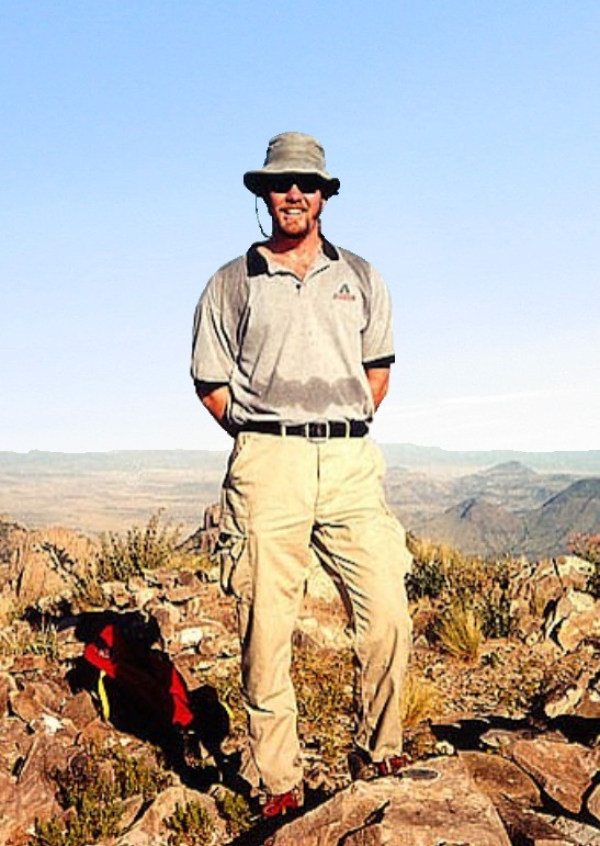 Me on the top
|
Date: August 19, 2000
• Elevation: 8,378 feet
• Prominence: 3,918 feet
• Distance: 2 miles
• Time: 3 hours hike
• Gain: 1,000 feet
• Conditions: Hazy skies but pleasant
• Teammates: About 20 others
Texas
•
PB
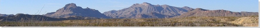
The Davis Mountains lie centered in the West Texas Panhandle, about 200 miles southeast of El Paso. The summit, Mount Livermore, is the highest point of the Davis Mountains and of Jeff Davis County. The summit appears from below as a tooth-shaped fin of rock jutting above the high ridgeline, visible from most vantage points around the range (if sufficiently far away).
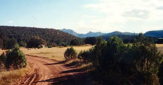
In early 2000, I drove through the region thinking I could just show up and climb it, but learned quickly that most everything in Texas is on private property, behind fences and locked gates. There was no easy access to this peak. I explored the areas around Fort Davis, the county seat of Jeff Davis County, and some surrounding areas. The mountains and the surrounding foothills are more lush and green, with grassy scrub below, as compared to the other ranges in West Texas, which tend to be more desert-like.
I also learned that the Nature Conservancy owned the land on the peak's east side, including the peak itself. It was part of the U-Up-U-Down Ranch. Periodically, the Nature Conservancy opened the ranch and the mountains for people to camp and explore. I also learned that one such open date was in August, so I made sure to be here on that date.
When that weekend came about, I flew to El Paso a few days early to hike Sierra Blanca in New Mexico first. A hurricane had barrelled through south Texas a few days earlier and its remnants were still active in the mountains of New Mexico. I stayed the night in Ruidoso. Early the following morning, the fog and storms were so thick that I immediately cancelled my plans for Sierra Blanca, and instead enjoyed a leisurely sight-seeing drive south through Carlsbad, the Guadalupe Mountains, and Fort Davis.
I arrived at the U-Up-U-Down Ranch about 3 in the afternoon. Many people were there, numbering about 60. The Nature Conservancy had a few docents there and they were leading casual walking tours of the grounds, plus walks for birders. Birding is a popular pastime in Texas and some of these people take it very seriously. I went on one short walk and hung in the back. That evening, I slept in the open under a large tree. Conditions were pleasant and I slept soundly.
Early the next morning, I met with the others interested in the Livermore hike at the main ranch complex. Our group numbered about 20 people. We piled into three big SUVs, each driven by a guide, as we lumbered slowly up the rough tracks into Madera Canyon toward Livermore Peak. The drive covered about 7 miles and gained 1,500 feet as best as I recall. It was steep with rough sections and stream crossings, and the drivers did well. We parked at an opening on Bridge Gap east of the peak.
The initial segment of the hike was along a steep track, but easy to follow. The guides were locals and knew a lot about the region, and they talked about about everything that we passed. As it was, we moved slowly and had to stop often to listen to the talks and let the slow-pokes catch up. We were in no hurry so this wasn't a problem. Another guy with scraggly hair and beard was also in the lead. He was cool and we'd often sit up a few yards ahead while the group convened and the guides pointed at things.
In 90 minutes, we reached the end of the road, where it curls around the north side of Livermore's summit, its bare rock forming a small but impressive palisade of cliffs on all sides. From the end of the road, the final vertical hundred feet involves scrambling up a loose talus slope to get to the cliffs, then a short rock-climb (Class 3 at worst) to the top. While the climb was blessed with solid rock all the way up, it was exposed and a few people decided to stay back.
In short order, about a dozen of us had convened on top. The summit is an elongated platform of bare rock, with small repeater boxes. There was a depression filled with thousands of old arrowheads and shards, a remarkable archeological artifact with a great story attached, I am sure.
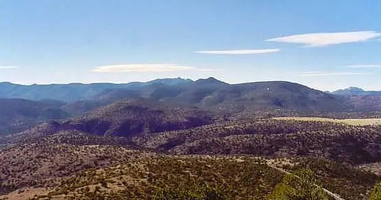
The guides told us about everything, and I had fun picking out peaks all around me. The Guadalupes were visible to the north, and the Eagles off to the west. The day was slightly humid and hazy, so far-off peaks were obscured. We stayed on top for 15 minutes before clambering our way down to firmer ground. Hiking down, we followed an old trail instead of the road, which was much more interesting and lead us right back to the cars. Our total time: three hours.
Once all heads were accounted for, we got back in the vehicles for the slow drive out. I didn't stick around much afterwards, as I had to be in El Paso that evening for my flight home, and needed a place to clean up. I got moving, found a truck stop near El Paso to shower, and flew home that night. The next day classes started at ASU and I needed to be ready to go.
The trip went well and with nearly no logistical issues. I wish to thank the Nature Conservancy as well as the guides for the hike. They all did a top-rate job and I had a great time. The Davis Mountains are beautiful and I have been back since a couple times, once to bring my wife and do some sight-seeing at the observatory and around the lonely highways.
|
|