The Mountains of West Texas
www.surgent.net |
| Eagle Peak & Peak 7282 |
• Highpoint: Hudspeth County • Highpoint: Eagle Mountains |
 The sign into the ranch
|
Date: October 1, 2005
• Elevation: 7,484 feet
• Prominence: 3,114 feet
• Distance: 5 miles (4.4 to Eagle, 0.6 to Peak 7282)
• Time: 6 hours
• Gain: 1,743 feet (1,443 to Eagle, 300 to Peak 7282)
• Conditions: Clear, dry and warm
• Teammates: Bob Martin
Texas
•
PB
•
FAA Radome Site
•
Jason Penney's Snakes of Hudspeth County
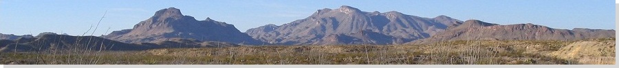
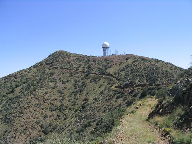
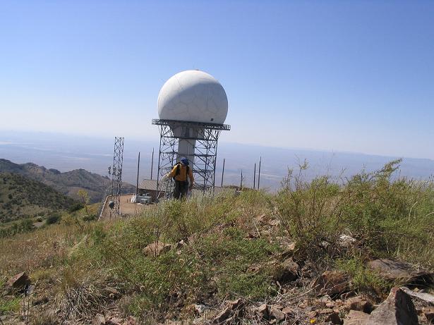
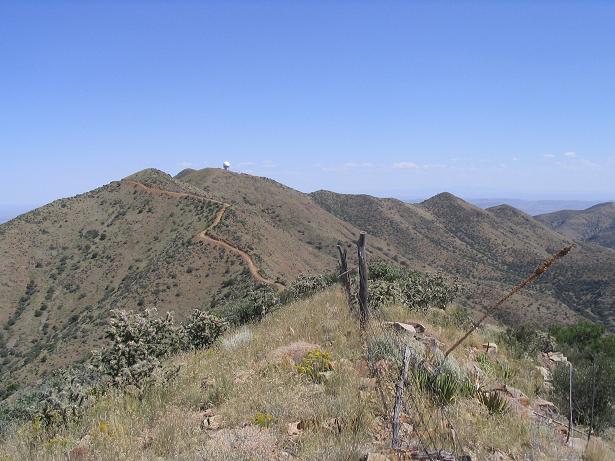
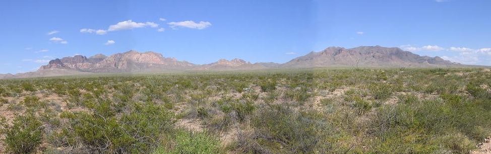
The Eagle Mountains are in West Texas, south of Interstate-10 about 30 miles southeast of the community of Sierra Blanca and about three hours from El Paso. The mountains rise high above the desert flats, and are the fourth-most prominent mountain range in Texas. The Eagle Mountains are surrounded by private property, so there is no public access. The most notable landmark is a geodesic FAA radar-dome near the summit of Eagle Peak, the range highpoint. This dome is visible from the Interstate, but getting to it is essentially impossible without someone granting permission to enter into the range.
For me, this was one peak that had been on my short list for a long time, ever since I "discovered" it in 1999 when compiling information about the various West Texas county highpoints. I was in the area during the 1999-2000 rollover, but quickly discovered that this peak, like so many in Texas, was off limits. So I put it off for many years while I figured out a way to possibly climb it on some future date.
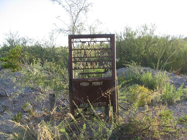
Between 2000 to 2003, I made yearly hiking and exploration trips into Texas. Occasionally, when passing the Hot Springs-Allamoore exit on Interstate-10, I would exit and follow the dirt road south about five miles to a railroad crossing. Passing over the tracks, the road comes to some beat-up ranches and an imposing gate with a more imposing sign about toying with FAA radar-domes. A few times I just sat there and hoped some workers would show up and allow me to drive to the top, but no one ever did.
Passing through in 2002, I got a lead from a guy in Sierra Blanca who runs "ranch tours". This guy owned a hotel in town and I asked him about these ranch tours, asking him about being allowed up to Eagle Peak. Why sure, he said, I can get you there. This was fantastic news, but each time I would call him to follow up, he was evasive and I eventually gave up on him as a viable lead. So back to square one. By 2004, I had given up any hope of climbing Eagle and figured it was just one I wouldn't get.
In early 2005, some friends of mine got access into the Eagle Mountains and actually climbed the peak. They forwarded me the landowner's name and contact information. I wrote him a letter and in a few weeks, got a reply that we were welcome to hike the peak. For this trip, I invited the venerable Bob Martin, who had accompanied me on so many trips to Texas and who had won us permission on so many properties. To be able to do this for him in return was an honor. We set an October date for the hike, figuring it would be cooler but not yet real cold.
The day before, I drove to Sierra Blanca, arriving in the evening and staying at the hotel owned by the "ranch tours" guy. I ate at a local diner and the people there were cool. The town is tiny, about 700 people, but it is the county seat of Hudspeth County, so it has the buildings you would expect, like a courthouse, jail and other "official" buildings, then a few marts, gas stations and that's about it. The town sits below a peak called Sierra Blanca, so named for its whitish appearance. The whole area is undeveloped and very remote.
Bob and I met early the next morning on the south side of Interstate-10 at a gas station. He rode with me as we rumbled along southeast along an extension of highway RM-1111 for about 30 miles to the landowner's residence, which was another few miles up a dirt road tucked into a canyon. The landowner, whose name I won't print here, is a long-time west Texas resident whose family goes back many generations, who owns significant portions of the surrounding areas, and who have strong political connections. He is as old-time as one can get, a truly authentic character. He has a high profile in Hudspeth County, and later I learned that he and the "ranch tours" guy had a falling out a few years back which explains why I couldn't get onto Eagle Peak with the other guy.
The landowner was super nice and interested in our excursion. He said he gets a few visitors a year, mainly scout troops, birders and the occasional hikers. He was more fascinated by Bob, who was older than him by a good 10 years. I think that impressed him. I had brought along a small token gift from my wife and I as appreciation for his generosity. We got the nickel tour of his ranch spread, then after a few minutes of chit-chat, he let us go off "to climb our mountain."
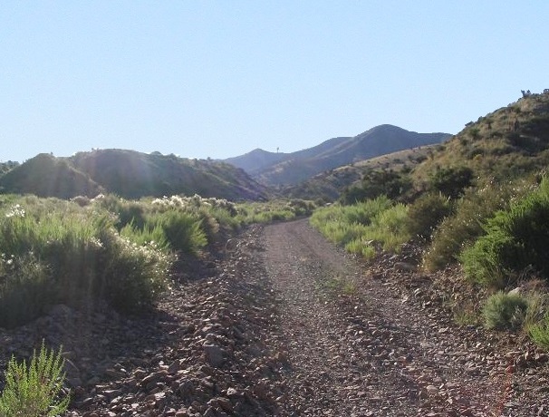
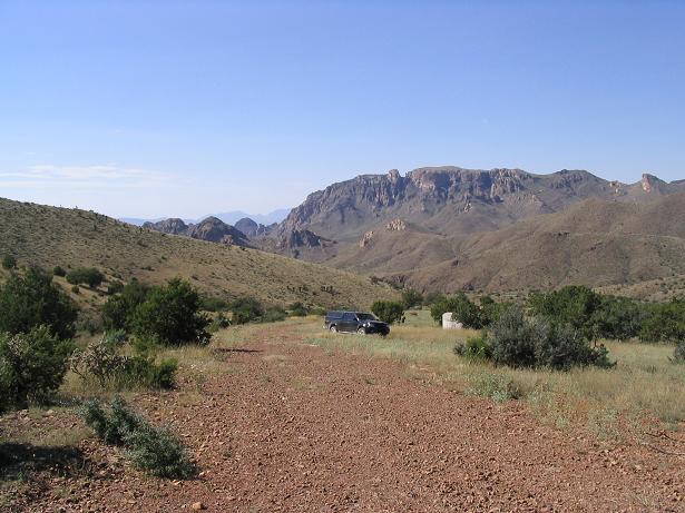
From the ranch home, we drove a dirt road a small distance into Frenchman Canyon, parking at a stock tank at elevation 6,041 feet. The road goes farther, all the way to the top in fact, but it becomes extremely steep and beat-up, something only a Jeep or ATV could handle. We were perfectly happy to hike the rest of it. We were hiking by 9:30 a.m. in cool, sunny conditions, some moisture in the air creating a little haze to the east.
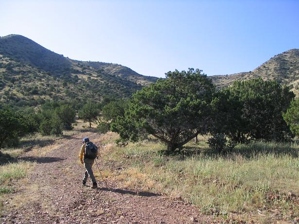
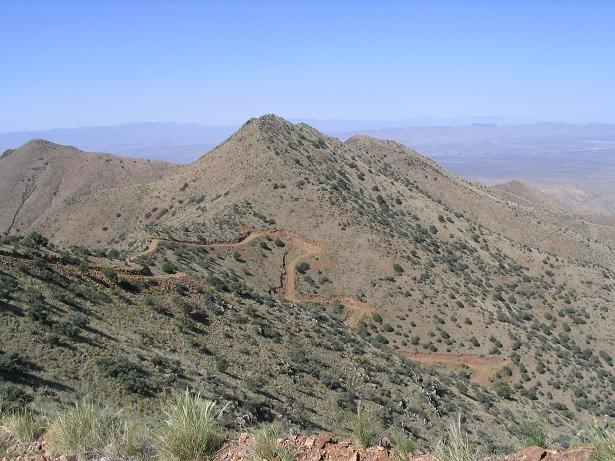
The first quarter-mile past my truck was easy, and the road was pretty good. Soon, though, the road makes very steep switchbacks up the slope, putting us onto the main range crest just below 7,000 feet elevation and below peak 7,282, about a mile west of Eagle Peak's summit. We took a break here to drink and relax. The land is open up here with a few pinon and a lot of low grass and scrub, with tremendous views across the canyons and the desert flats out beyond.
From our rest stop, we continued east along the road and the spine of the range. I always marvel at how precarious some of these jeep roads are. This one is strung high on the range crest, with outward leans and bad exposure. One can imagine the bull-dozer guy blading it in back in the olden days, probably scared nuts to look down. For walking, it's great. We went up and down some bumps and descended to a saddle below Eagle Peak's summit. From here we walked up the last of the road, then left it as we went directly for the summit.
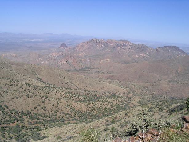
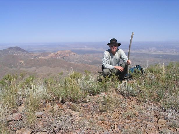
The top is a flat patch of land covered in grass and scrub. The actual FAA tower is a few hundred feet to the south, not physically on the summit. No one was home apparently, and we could see the paved road below us on the other side. After all those years of waiting to hike to this summit, this felt especially good. It had taken us two hours at a slow pace to get here. We congratulated one another and took a few photos, but didn't delay much. Technically, "our" landowner's land boundary ran right across the summit. We figured it would be wise to drop back down to the road, back on to safer territory, for our lunch break. Even from a lower position, we had amazing views at the remote West Texas landscape. The day was warm and we were being bombarded by insects. We didn't spend much time on our lunch break because of the bugs.
We walked back to near Peak 7,282. Bob was interested in hiking to its top since it meets his 300-foot rule. So we did, and the side-hike took about 20 minutes round-trip. The top was grassy and rocky, but it did provide a good vantage point for a photo of Eagle Peak. We then descended back to the road and from there, back to my truck, taking a slow, even pace. We had been gone 6 hours, and it was warm when we returned.
We drove down back to the ranch house. Some ranch hands, not knowing we were up in the canyon, had laid out giant bales of hay in the road, blocking us. They were too big to move and I didn't want to push them with my truck because they could have toppled onto us. I was able to ease the truck onto the rocky berms and carefully get around these barriers. We did, and when we got back to the ranch house, no one was there, so we just went on our way, driving back to the gas station in Sierra Blanca.
Here, Bob and I congratulated one another and parted ways. Bob headed back to Arizona while I stayed in town a little longer to look around. I decided to take the scenic route back toward El Paso, going north up RM-1111 and catching highway US-62/180 across the salt flats into El Paso. I stayed the night in Lordsburg, New Mexico, then drove home the next day. I put 1,100 miles on my truck in 48 hours, but it was worth it to climb the peak.
Post-script: Bob passed away in late 2008 at the age of 88. He was a remarkable man, and as time has passed, it turns out this peak is the last Texas highpoint that I have done, and probably it for awhile since I am no longer making trips into the state to visit its other highpoints. I am nearly certain this was Bob's last too, and it was an honor to be able to gain the access for this peak and have Bob come along since he had done so much the same for me on other peaks and highpoints. This was a particularly nice peak on which to "end" our Texas journeys, although at the time we certainly had no idea it would be our last. Bob was so fit and spry for a man in his 80s, I just assumed he'd be hiking for another 15 years. Rest easy, friend.
|

|