FM-170: The Texas River Road
Brewster & Presidio Counties, Texas • Jan. 2004 & Dec. 2005 |
|
The Texas River Road (Farm-to-Market 170) is a scenic route that parallels the Rio Grande for 120 miles, starting in Terlingua, then passing north through Presidio and technically ending in Ruidosa. A county road then runs another dozen miles to the settlement of Candelaria. The road is scenic and remote, seemingly here for our touring pleasure as opposed to hauling stock to market. We have driven it twice, in January 2004 and again in December 2005.
The road starts in the Terlingua-Study Butte area, branching off of Texas highway TX-118 west of Big Bend National Park. The first few miles is a mash-up of hotels, businesses and homes, all serving the tourists who come to the Big Bend. On our first visit, we took time to visit the ghost town of Terlingua, which was (at its prime in the 1940s) a quicksilver mining town during World War II. Its population numbered about 2,000 people, but at the war's end, the mines closed and the population shrunk to nearly nothing. Today, Terlingua-Study Butte has about 300 people. Getting technical here, Study Butte is the area at the TX-118/FM-170 junction, while Terlingua is about 5 miles west along FM-170. But there is no demarcation between the two places and even the signs list both names. The "Study" in Study Butte is pronounced "Stoo-dy".
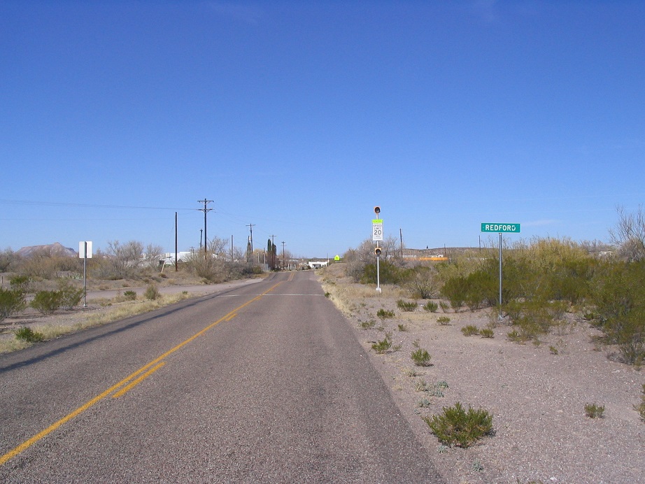
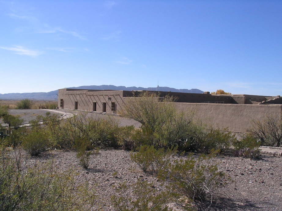
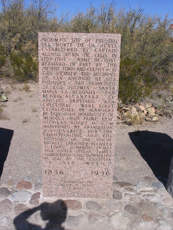
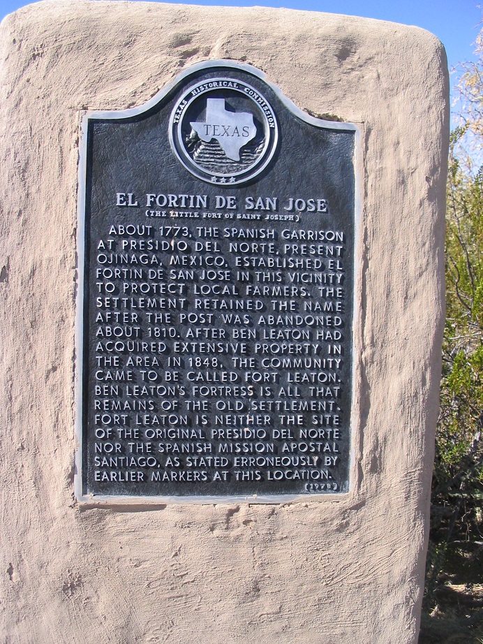
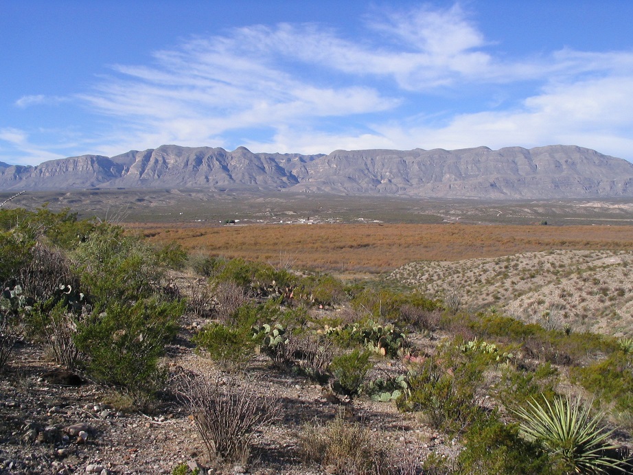
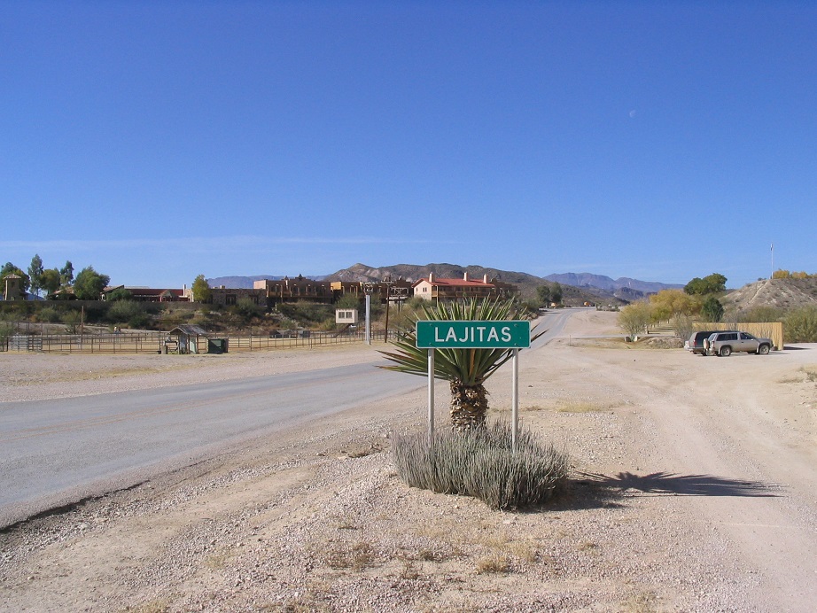 You are now entering Lajitas. Eighteen miles later, the road enters into the town of Lajitas. The place was dead and devoid of character. Someone developed the place into a higher-end resort (with golfing and shops). Anything authentically old and shabby was removed and replaced with a phony version thereof. You can't fake things like this, but the people who run Lajitas sure have tried. The only positive thing about the town is that it's home to the Burton Warnock Visitor Center for the Big Bend Ranch State Park, just over the Presidio County line to the north. We stopped in and checked out the sights and spoke with the rangers. Big Bend Ranch State Park The next 40 miles past Lajitas is the realm of the Big Bend Ranch State Park (BBRSP), a state park addendum to the National Park. This is a newer park and is still mostly closed to tourists, although they are slowly adding trails and infrastructure. The road is spectacular here, twisting and winding up and down the mountainsides. In 2004, we made one stop to hike Closed Canyon, a slot canyon whose waters dump into the Rio Grande. In 2005 we just drove it, enjoying the secenery and steep grades. At the north end of the park we passed through the little village of Redford. We are kind enough to show you a photo of its sign. We also visited Fort Leaton and noted the amusing signage, in which the two monuments seem to have issue with one another.
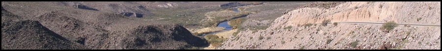
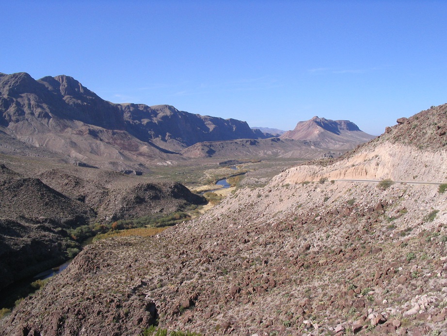 The Rio Grande from the Big Bend Ranch State Park.
The Dueling Signs of Fort Leaton
Presidio Presidio is about 55 miles from Lajitas, and the main city along the River Road. It looks and feels like Mexico. In the old days it was a part of the city of Ojinaga, Mexico. Then the Rio Grande became the international border, and the parts north of the river became the city of Presidio, now in the United States. Ojinaga still exists south of the river and the two cities together are culturally one big city. We didn't venture into Ojinaga but we did stop for one of the best Mexican meals we've ever had at The Patio Restaurant along the business district in Presidio. We also walked around the shops in the immediate area.
 The home-made Presidio Welcome sign.
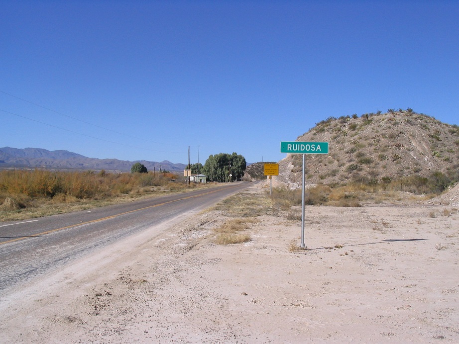
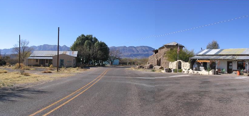
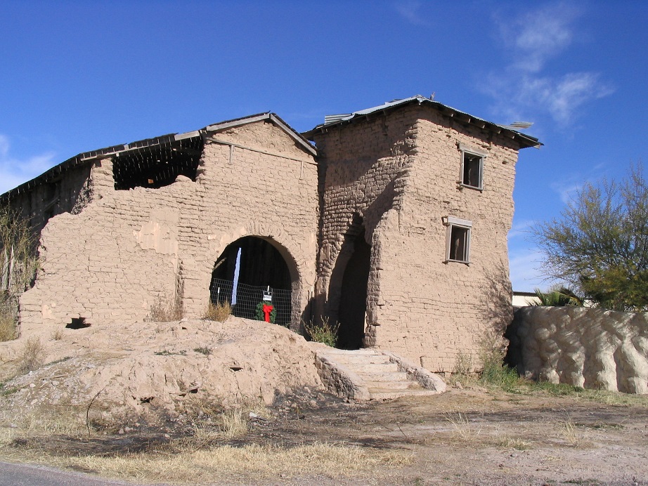
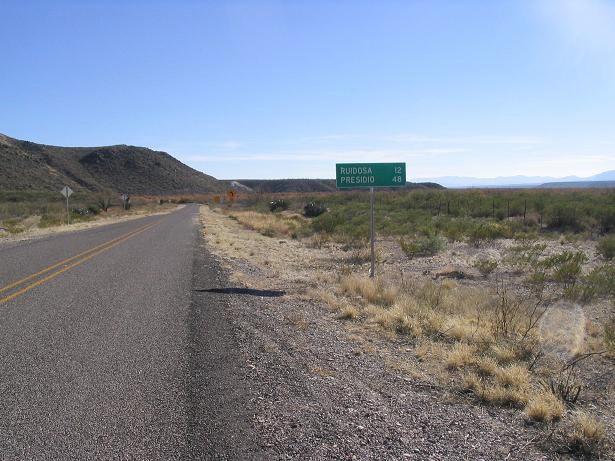
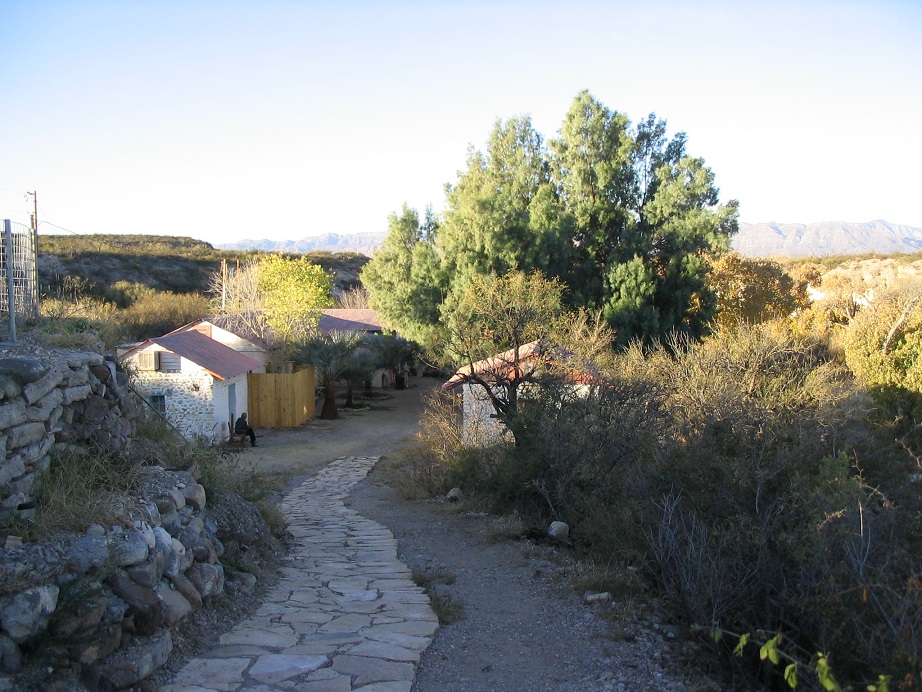
Ruidosa Forty more miles up FM-170 brings us to Ruidosa, a tiny town tucked into a small section of flat space between the mountains and the river. On our first visit in 2004, no one was home, but we did get barked at by two dogs who came running at us. We bent down and offered them ear-rubs and they quickly rolled onto their backs. The attractions in Ruidosa is an old adobe church, the La Junta General Store, and the start (or end) of the Pinto Canyon Road. The Chinati Hot Springs are a great place to soak in the natural hot waters, located 7 miles out of Ruidosa along good graded dirt road. We visited there on both our visits, and we highly recommend it.
 Chinati Hot Springs.
On our second visit in 2005 we had an enjoyable talk with Ms. Celia Hill, the proprietress who runs the La Junta General Store. She's a retired school teacher who bought and renovated the store about 10 years ago. A wonderful woman with lots of stories to tell, she is Ruidosa's unofficial historian. She informed us that Ruidosa'a population is "17, when everyone's home". She also told us about this cool website that had photos of the ferocious guard dogs of Ruidosa ... hey - that's my website! Great lady, truly a friendly woman and worth the time to chat.
Candelaria FM-170 (or its County equivalent) continues another 12 miles before dead-ending in the community of Candelaria, one of the more remote towns in the entire United States. There's a town in Mexico just over the border. We were told that while it's okay for Americans to walk over the footbridge, it's technically illegal to come back that way as it's not an official border checkpoint. We were also told that the locals will look out for you and let you know when the Border Patrol isn't around, so getting back and forth is not as troublesome as it seems. Nevertheless, we didn't want to chance it ... our goal was just to drive to Candelaria just to say we've been there. Does the highway really end? Yes, the paved FM-170 ends, but a continuation road called Chispa Road goes on from here. Where does it go, I wondered. We didn't drive it, but the guys at Chinati Hot Springs tell us it eventually worms its way north and east a bit to come out on some FM roads southwest of Van Horn, about 70 miles in all. He told us he's never driven it but says he's heard it's usually passable by most 4wd vehicles. So there you have it: good 4th-hand information! He says there are a few big ranch spreads and not much else. The B.P. patrols it. (Update 12/10/08) The following information was provided to me by Travis Hicks, who worked on one of these remote ranches north of Candelaria: "This Fall (2008), I worked cattle on two ranches past the end of the road. The larger ranch is 110 sections, starting 19 miles down the unpaved road. The land out there is amazing and untouched for the most part. Here is the address of a website about the area: www.circledug.com".
 Candelaria is the last town north along FM-170.
Pinto Canyon Road, Chinati Peak and FM-2810 From Ruidosa, the Pinto Canyon Road leads to some of the most beautiful desert-canyon countryside in the state. It's an unpaved road for the first 22 miles, and steep in places, but only one small section was nasty enough for us to use 4wd. A small passenger car would not make this road. The road eventually crests onto the higher plateau ranchlands and meets up with paved FM-2810, which travels another 32 miles before coming back into the city of Marfa. In 2005, slightly concerned about a slow leak in one of my tires, we passed on driving this road and went out along US-67 from Presidio to Marfa, which was pretty and scenic, with good eastern views of the Chinatis. We also took in the Marfa Lights that night. We saw some that to me might have been the real deal. I remain mostly skeptical, however.
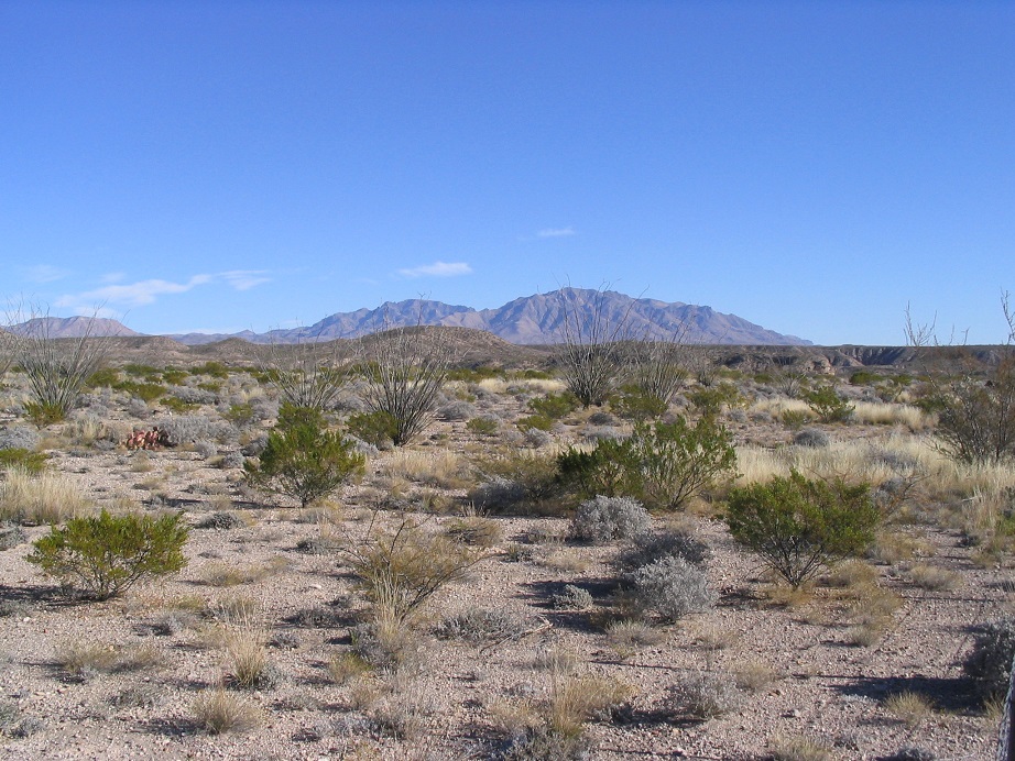 Chinati Peak from FM-170 (the summit is to the left).
(c) 2004-2021 Scott Surgent. For entertainment purposes only. |